Contact | RSS | EN | DE | EL | ES | FR | IT | RU

Agung Volcano Volcanic Ash Advisory: DISCRETE VA TO FL300 MOV SW AND VA TO FL180 MOV W AT 15KT. to 18000 ft (5500 m)

Thu, 13 Jun 2019, 00:15 | BY: VN
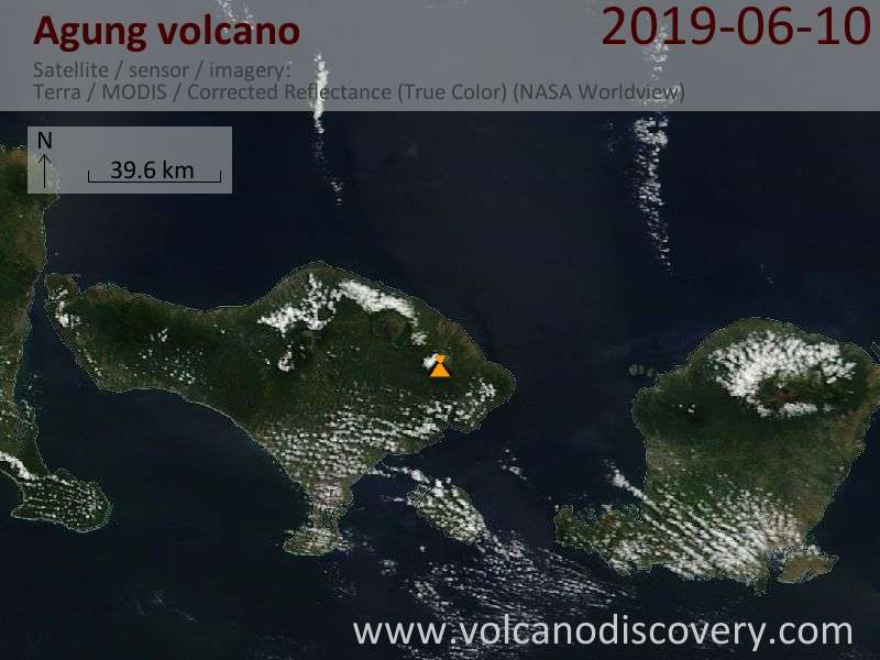
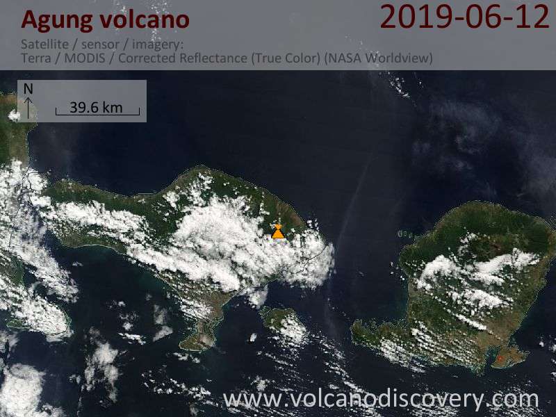
Satellite image of Agung volcano on 13 Jun 2019
Explosive activity continues. Volcanic Ash Advisory Center (VAAC) Darwin warned about a volcanic ash plume that rose up to estimated 18000 ft (5500 m) altitude or flight level 180 .
The full report is as follows:

FVAU02 at 00:00 UTC, 13/06/19 from ADRM
VA ADVISORY
DTG: 20190613/0000Z
VAAC: DARWIN
VOLCANO: AGUNG 264020
PSN: S0821 E11530
AREA: INDONESIA
SUMMIT ELEV: 3142M
ADVISORY NR: 2019/103
INFO SOURCE: HIMAWARI-8, CVGHM, WEBCAM
AVIATION COLOUR CODE: RED
ERUPTION DETAILS: DISCRETE VA TO FL300 MOV SW AND VA TO
FL180 MOV W AT 15KT.
OBS VA DTG: 13/0000Z
OBS VA CLD: SFC/FL180 S0902 E11400 - S0832 E11324 - S0810
E11317 - S0812 E11344 MOV W 15KT SFC/FL300 S0908 E11430 -
S0922 E11412 - S1018 E11446 - S0946 E11530 MOV SW 35KT
FCST VA CLD +6 HR: 13/0600Z SFC/FL300 S0954 E11330 - S1053
E11506 - S1145 E11425 - S1024 E11206
FCST VA CLD +12 HR: 13/1200Z SFC/FL180 S1136 E11443 - S1038
E11139 - S1115 E11106 - S1154 E11252
FCST VA CLD +18 HR: 13/1800Z NO VA EXP
RMK: VA DETACHED FROM THE VOLCANO AND CONTINUE MOVING
WESTWARD AWAY FROM THE DENPASSAR AIRPORT. VA TO FL300 MOV SW
IS ABOUT 50NM S/SW AND SECONDARY VA TO FL180 MOV W IS ABOUT
60NM W OF DENPASSAR AIRPORT. VA TO FL180 IS EXPECTED TO
DISSIPATE WITHIN 6 HOURS. FORECAST BASED ON HIMAWARI-8
IMAGERY AND HYSPLIT GUIDANCE.
NXT ADVISORY: NO LATER THAN 20190613/0100Z

Previous news

Wed, 12 Jun 2019, 06:00

Agung volcano (Bali, Indonesia) - Smithsonian / USGS Weekly Volcanic Activity Report for 12 June-18 June 2019 (Continuing Activity)

PVMBG reported that an eruption at Agung, recorded by the seismic network at 0138 on 13 June, ejected incandescent material onto the flanks. The Darwin VAAC stated that ash plumes rose to altitudes of 5.5 and 9.1 km (18,000 and 30,000 ft) a.s.l. and drifted W and SW, respectively, based on webcam views and satellite data. ... Read all
Show more
Hazard map of Agung volcano (Sep 2017)
Hazard map of Agung volcano (PVMBG)
Agung volcano
Stratovolcano 3142 m (10,308 ft)
Bali (Indonesia), -8.34°S / 115.51°E
Current status: normal or dormant (1 out of 5) Agung volcano eruptions:
1808, 1821(?), 1843, 1963-64 (large Plinian eruption on March 16, 1963), 2017-ongoing
Typical eruption style
Highly explosive.
Try our free app!
Volcanoes & Earthquakes - new app for Android
Android | iOS version

More on VolcanoDiscovery

Why is there advertising on this site?

Support us - Help us upgrade our services!

We truly love working to bring you the latest volcano and earthquake data from around the world. Maintaining our website and our free apps does require, however, considerable time and resources.
We need financing to increase hard- and software capacity as well as support our editor team. We're aiming to achieve uninterrupted service wherever an earthquake or volcano eruption unfolds, and your donations can make it happen! Every donation will be highly appreciated. If you find the information useful and would like to support our team in integrating further features, write great content, and in upgrading our soft- and hardware, please make a donation (PayPal or Online credit card payment).

Planned features:Thanks to your past donations, these features have been added recently:
Download and Upgrade the Volcanoes & Earthquakes app to get one of the fastest seismic and volcano alerts online:
Android | IOS
Thank you!
Sources: VolcanoDiscovery / VolcanoAdventures and other sources as noted.
Use of material: Most text and images on our websites are owned by us. Re-use is generally not permitted without authorization. Contact us for licensing rights.
Volcanoes & Earthquakes
VolcanoDiscovery Home
Volcanoes | Earthquakes | Photos | Volcano News | App
Adventure & Study Travel
Tours to Volcanoes and Volcanic Areas: walking tours, photo tours, study tours
Tours & Dates | FAQ | About us
Get our newsletter!
Company info
Contact | Legal info | Terms & conditions
Follow us
Follow us on facebook Follow us on Instagram Follow us on Twitter Visit our Youtube channel
EN | DE | EL | ES | FR | IT | RU
VolcanoDiscovery GmbH, Germany, Reg. nr.: HRB 103744, EU Tax Id: DE 297 465 123 owned and created by
Dr. Tom Pfeiffer, volcanologist, volcano photographer, tour organizer member of
IAVCEI
IAVCEI
Vulkanologische Gesellschaft
Volcanological Society
Ecotourism Greece
Ecotourism Greece
RUV insurance
Insured by R+V
VolcanoDiscovery © 2004- All Rights Reserved | Privacy - Cookie Settings