Ararat Volcano
Updated: Apr 19, 2024 05:35 GMT -
stratovolcano 5165 m
Turkey, 39.7°N / 44.3°E
Current status: normal or dormant (1 out of 5)
Turkey, 39.7°N / 44.3°E
Current status: normal or dormant (1 out of 5)
The 5165-m-high, double-peaked stratovolcano Mount Ararat, also known as Agri Dagi, is Turkey's highest, largest volume, and easternmost volcano.
[smaller] [larger]
Ararat volcano eruptions: 1840 AD
Latest nearby earthquakes
| Time | Mag. / Depth | Distance / Location | |||
Background
Glacier-clad Ararat, along with its twin volcano, 3925-m-high Kucuk Ararat (or Lesser Ararat), covers an area of 1000 sq km at the eastern end of a SSW-ESE line of volcanoes extending from Nemrut Dagi. Construction of the Greater and Lesser Ararat volcanoes was followed by a period of extensive flank eruptions, many erupted along N-S-trending fissures. The initial stage of flank eruptions produced a cluster of cinder cones and dacitic-rhyolitic lava domes surrounding Greater Ararat and a series of pyroclastic cones and domes on the western flank of Lesser Ararat. Late-stage activity formed large pyroclastic cones lower on the flanks of the two volcanoes. Ararat appears to have been active during the 3rd millennium BC; pyroclastic-flow deposits overlie early Bronze Age artifacts and human remains. Karakhanian et al. (2002) reported historical evidence for a phreatic eruption and pyroclastic flow at the time of a July 1840 earthquake and landslide.Ararat Volcano Photos
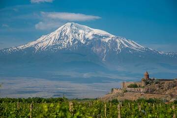
Khor Virap monastery with the backdrop of Ararat volcano. (Photo: Tom Pfeiffer)
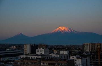
Sunrise over Yerevan, view from our hotel: the first sunrays are touching the summit of Ararat volcano behind the Turkish border to the west. (Photo: Tom Pfeiffer)
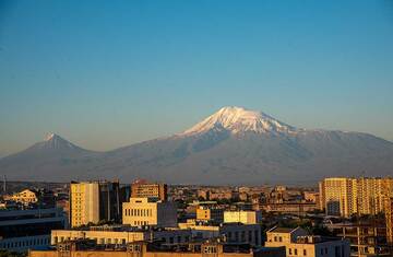
Sunrise has arrived in Yerevan and kisses the eastern facades of its buildings. On a clear morning, the slopes and valleys of Ararat volcano are well visible. (Photo: Tom...
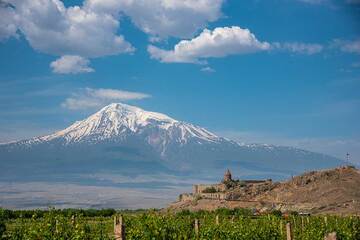
Khor Virap monastery with the backdrop of Ararat volcano. (Photo: Tom Pfeiffer)
Latest satellite images