Contact | RSS | EN | DE | EL | ES | FR | IT | RU

Bagana volcano Volcanic Ash Advisory: CONTINUOUS VA TO FL080 EXT W LAST OBS AT 29/2310Z

Fri, 30 Sep 2016, 16:15 |
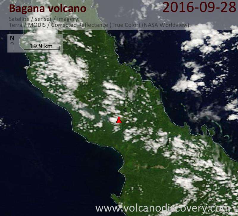
Satellite image of Bagana volcano on 30 Sep 2016
Volcanic Ash Advisory Center Darwin (VAAC) issued the following report:

FVAU0300 at 15:57 UTC, 30/09/16 from ADRM
VA ADVISORY
DTG: 20160930/1600Z
VAAC: DARWIN
VOLCANO: BAGANA 255020
PSN: S0608 E15512
AREA: PAPUA NEW GUINEA
SUMMIT ELEV: 1855M
ADVISORY NR: 2016/275
INFO SOURCE: HIMAWARI-8
AVIATION COLOUR CODE: ORANGE
ERUPTION DETAILS: CONTINUOUS VA TO FL080 EXT W LAST OBS AT
29/2310Z
OBS VA DTG: 30/1600Z
OBS VA CLD: SFC/FL080 S0550 E15431 - S0620 E15429 - S0610
E15513 - S0606 E15513 MOV W 15KT
FCST VA CLD +6 HR: 30/2200Z SFC/FL080 S0550 E15431 - S0620
E15429 - S0610 E15513 - S0606 E15513
FCST VA CLD +12 HR: 01/0400Z SFC/FL080 S0545 E15435 - S0614
E15428 - S0610 E15513 - S0606 E15514
FCST VA CLD +18 HR: 01/1000Z SFC/FL080 S0545 E15435 - S0614
E15428 - S0610 E15513 - S0606 E15514
RMK: VA CURRENTLY NOT IDENTIFIABLE DUE TO MET CLOUD AND
DARKNESS. HOWEVER, ASH STILL EXPECTED IN AREA. VA HEIGHT AND
FORCAST MOVEMENT BASED ON HIMAWARI-8 IMAGERY AND MODEL
GUIDANCE.
NXT ADVISORY: NO LATER THAN 20160930/2200Z

Previous news

Show more
Bagana volcano
lava cone (stratovolcano) 1750 m / 5,741 ft
Bougainville Island, Papua New Guinea, -6.14°S / 155.2°E
Current status: minor activity or eruption warning (3 out of 5) Bagana volcano eruptions:
2012, 1972-2011, 1970-71, 1968, 1966-67, 1964-65, 1962-63, 1961, 1959(?)-60, 1953, 1952, 1948-51, 1945-47, 1943, 1939, 1938, 1937, 1909(?), 1908, 1899, 1897, 1894-95, 1883, 1865-83, 1842
Typical eruption style
explosive
Try our free app!
Volcanoes & Earthquakes - new app for Android
Android | iOS version

More on VolcanoDiscovery

Why is there advertising on this site?

Support us - Help us upgrade our services!

We truly love working to bring you the latest volcano and earthquake data from around the world. Maintaining our website and our free apps does require, however, considerable time and resources.
We need financing to increase hard- and software capacity as well as support our editor team. We're aiming to achieve uninterrupted service wherever an earthquake or volcano eruption unfolds, and your donations can make it happen! Every donation will be highly appreciated. If you find the information useful and would like to support our team in integrating further features, write great content, and in upgrading our soft- and hardware, please make a donation (PayPal or Online credit card payment).

Planned features:Thanks to your past donations, these features have been added recently:
Download and Upgrade the Volcanoes & Earthquakes app to get one of the fastest seismic and volcano alerts online:
Android | IOS
Thank you!
Sources: VolcanoDiscovery / VolcanoAdventures and other sources as noted.
Use of material: Most text and images on our websites are owned by us. Re-use is generally not permitted without authorization. Contact us for licensing rights.
Volcanoes & Earthquakes
VolcanoDiscovery Home
Volcanoes | Earthquakes | Photos | Volcano News | App
Adventure & Study Travel
Tours to Volcanoes and Volcanic Areas: walking tours, photo tours, study tours
Tours & Dates | FAQ | About us
Get our newsletter!
Company info
Contact | Legal info | Terms & conditions
Follow us
Follow us on facebook Follow us on Instagram Follow us on Twitter Visit our Youtube channel
EN | DE | EL | ES | FR | IT | RU
VolcanoDiscovery GmbH, Germany, Reg. nr.: HRB 103744, EU Tax Id: DE 297 465 123 owned and created by
Dr. Tom Pfeiffer, volcanologist, volcano photographer, tour organizer member of
IAVCEI
IAVCEI
Vulkanologische Gesellschaft
Volcanological Society
Ecotourism Greece
Ecotourism Greece
RUV insurance
Insured by R+V
VolcanoDiscovery © 2004- All Rights Reserved | Privacy - Cookie Settings