Camiguin de Babuyanes Volcano
Updated: Apr 25, 2024 04:21 GMT -
stratovolcano 712 m / 2,336 ft
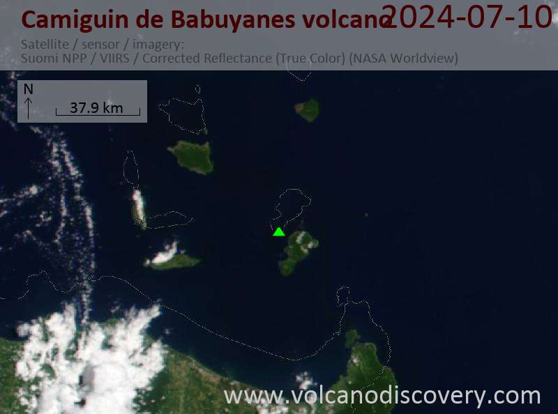
North of Luzon (Philippines), 18.83°N / 121.86°E
Current status: normal or dormant (1 out of 5)
North of Luzon (Philippines), 18.83°N / 121.86°E
Current status: normal or dormant (1 out of 5)
Camiguin de Babuyanes volcano is a small stratovolcano on the SW tip of the 22 km long Camiguin Island in the Babuyan archipelago, 35 km off the north tip of Luzon Island.
Note: A volcanic island called Camiguin is located off the north coast of Mindanao Island.
[smaller] [larger]
Camiguin de Babuyanes volcano eruptions: 1857
Latest nearby earthquakes
| Time | Mag. / Depth | Distance / Location | |||
| Apr 14, 05:28 am (Manila) | 2.6 1 km | 4.2 km (2.6 mi) to the W | Info | ||
| Apr 14, 05:17 am (Manila) | 2.8 91 km | 7.6 km (4.8 mi) to the SW | Info | ||
Background
The andesitic Camiguin volcano is forested and has 2 prominent flank cones relatively far from the main summit vent, Minabul to the north and Caanoan to the east, both on the northern part of the island.The southern part of Camiguin Island has 3 volcanic centers aligned SSE-NNW, Mount Camiguin stratovolcano itself and the young andesitic lava domes of Mt. Malabsing and Pamoctan.
A phreatic eruption, possibly in part submarine, happened around 1857. At present, there are fumaroles on the SW, W and E flanks of the volcano and a hot boiling water spring near sea level on the W flank.
(Source: GVP volcano information)
Latest satellite images