Our expert volcanologists and photographers offer unique travel experiences:
volcano expeditions, photo tours, and relaxed walking & study tours.
Guaranteed tours
= spaces available = guaranteed = few spaces left = booked out
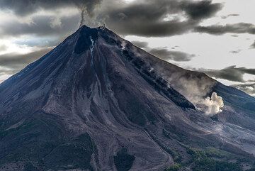
Colima volcano (Mexico) July 2015: aerials
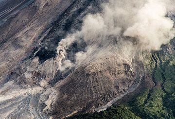
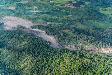
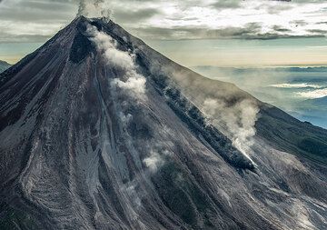
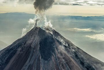
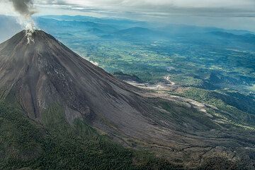
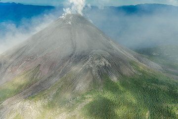
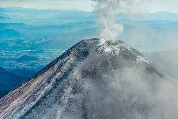
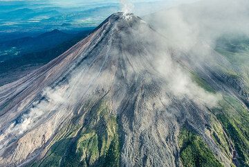
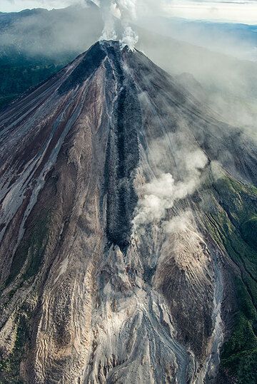
Pictures taken during an overflight on 16 July 2015. They show the active lava flow, the path of the recent pyroclastic flows, in particular the 10 km long one from 11 July, rockfalls, and the new crater configuration after the (pre-11 July) dome had collapsed, giving way to the new lava flow on the southern flank.
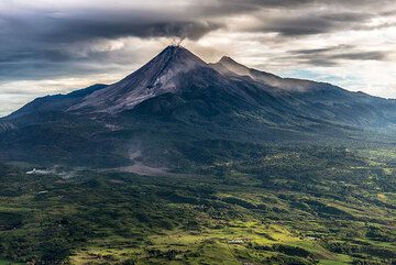
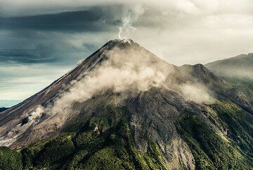
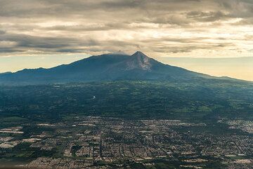
View of Colima from the SSE while approaching from airport. (Photo: Tom Pfeiffer) [
info]
(572 Hits)
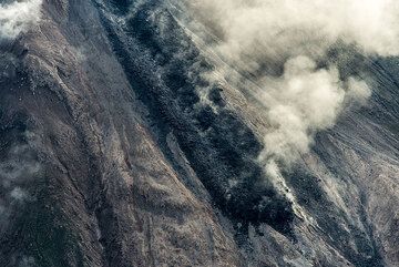
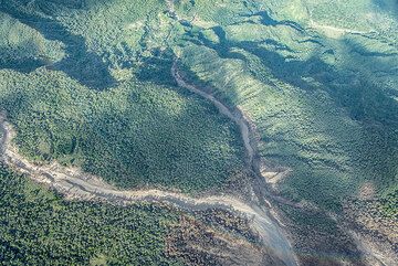
The gray 11 July pyroclastic flow deposit can be seen following a narrow gully and then widening in ... [
info]
(557 Hits)

The delta of the pyroclastic flow deposit near Montitlan. (Photo: Tom Pfeiffer) [
info]
(527 Hits)
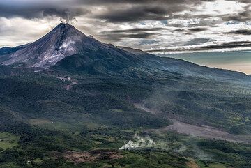
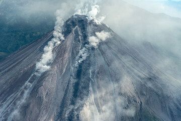
View of the volcano from the south, with the active lava flow (black) and another pyroclastic flow d... [
info]
(738 Hits)
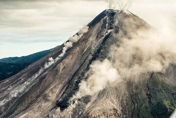
View from the SW with the active lava flow. (Photo: Tom Pfeiffer) [
info]
(561 Hits)
Near vertical view of the lava flow front. (Photo: Tom Pfeiffer) [
info]
(550 Hits)
View back onto the 11 July pyroclastic flow deposit. (Photo: Tom Pfeiffer) [
info]
(379 Hits)
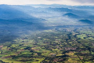
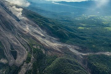
View over the plain SE of the volcano and the hills and mountains in the distance. (Photo: Tom Pfeif... [
info]
(372 Hits)
View of Colima from the SE. (Photo: Tom Pfeiffer) [
info]
(447 Hits)
A small rockfall leaves a dust trail on the SW side (left in image). (Photo: Tom Pfeiffer) [
info]
(375 Hits)

View of the lava flow on the southern flank of Colima. A small rockfall on the SW flank. (Photo: Tom... [
info]
(479 Hits)
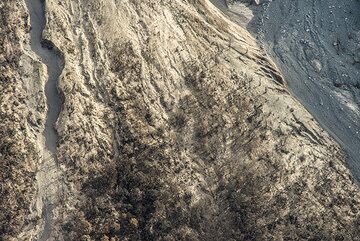
Vertical view onto a zone at the foot of the volcano devastated by pyroclastic flows (unrooted and s... [
info]
(349 Hits)
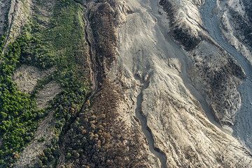
Area at the SW base of Colima with 3 different zones: left, still intact vegetated areas; middle: bu... [
info]
(396 Hits)
Lower part of the lava flow seen from SW. (Photo: Tom Pfeiffer) [
info]
(325 Hits)
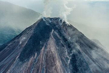
View of the cone from the SW. (Photo: Tom Pfeiffer) [
info]
(317 Hits)
Upper portion of the path of the 11 July pyroclastic flow, seen from SW. (Photo: Tom Pfeiffer) [
info]
(353 Hits)
View of the crater from the west; a prominent lava tongue, forming a dark path, but no more alimente... [
info]
(404 Hits)

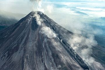
With each lava flow like this, the cone of Colima becomes a little bigger. (Photo: Tom Pfeiffer) [
info]
(388 Hits)
View of Colima from the NW. (Photo: Tom Pfeiffer) [
info]
(347 Hits)
View from the east as we fly through the ash plume... (Photo: Tom Pfeiffer) [
info]
(293 Hits)
View from SE of the upper part of the summit cone. (Photo: Tom Pfeiffer) [
info]
(293 Hits)
View from SE of the larger part of the summit cone. (Photo: Tom Pfeiffer) [
info]
(309 Hits)
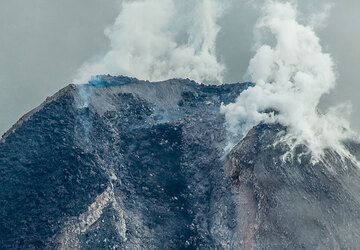
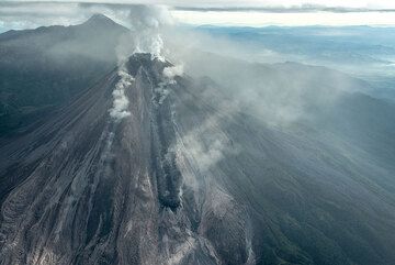
Zoom onto the crater breached by the lava flow to the south. The dome that had existed until 11 July... [
info]
(374 Hits)
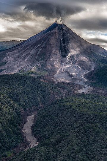
Portrait view of the mountain with its active lava flow on the southern flank. (Photo: Tom Pfeiffer) [
info]
(473 Hits)
View from SW with the southwestern lava tongue (left). (Photo: Tom Pfeiffer) [
info]
(270 Hits)
Steaming and the distant mountains to the east. (Photo: Tom Pfeiffer) [
info]
(235 Hits)

The lower portion of the 11 July pyroclastic flow. It is interesting to note how well the flow follo... [
info]
(268 Hits)
Pyroclastic flows entered two gullies on the southern flank: the one to the left (most of the flow w... [
info]
(283 Hits)
View onto the summit area from the south. (Photo: Tom Pfeiffer) [
info]
(254 Hits)
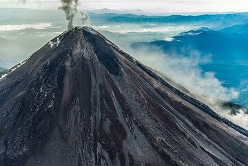
Wide angle view from the south with the peak of Nevado de Colima volcano in the background. (Photo: ... [
info]
(335 Hits)
Last view of the volcano from the SW. (Photo: Tom Pfeiffer) [
info]
(271 Hits)
View over Colima town with Colima volcano in the background. (Photo: Tom Pfeiffer) [
info]
(375 Hits)