Kontakt | RSS | EN | DE | EL | ES | FR | IT | RU

Reykjanes Volcano

Updated: 6. Mai 2024 21:12 GMT -
Crater rows 230 m / 755 ft
Reykjanes peninsula (SW Iceland), 63.89°N / -22.52°W
Aktueller Status: Ausbruch (4 von 5)
Last update: 3 Mai 2024 (pressure in magma chamber continues to be elevated, new eruption is not ruled out)

Reykjanes volcano on the peninsula of the same name is a vast fissure system in SW Iceland. It is located where the Mid Atlantic Ridge emerges onto land.
It forms a vast area with many eruptive fissures, lava fields, hot springs and mud pools. In 2000, a large earthquake lowered the water level in Lake Kleifarvatn by 5 metres, but has gradually returned to normal since then.

[smaller] [larger]
Typische Aktivität: effusive (lava flows)
Ausbrüche des Reykjanes: 1211, 1226, 2023 (Dec), 2024 (Jan), 2024 (Feb), 2024 (Mar)

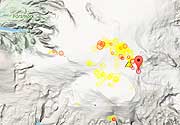
Letzte Erdbeben in der Nähe

UhrzeitMag. / TiefeEntfernung / Ort
6. Mai. 20:34 (Reykjavik)
2.7

5.4 km
24 km östlich 5.9 km N of Krýsuvík  I FELT IT
Info
6. Mai. 17:43 (Reykjavik)
3.3

5.6 km
24 km östlich 6.0 km N of Krýsuvík  I FELT IT - 4 BerichteInfo
Sonntag, 5. Mai 2024 GMT (4 Beben)
5. Mai. 23:00 (Reykjavik)
2.5

6 km
Iceland: 1.0 km NW of Eldeyjardrangur
Info
5. Mai. 22:54 (Reykjavik)
2.5

8.2 km
Iceland: 2.1 km NNW of Eldeyjardrangur
Info
5. Mai. 22:53 (Reykjavik)
2.5

15 km
Iceland: 0.9 km NNW of Eldey
Info
5. Mai. 21:02 (Reykjavik)
2.6

8.9 km
Iceland: 1.7 km NW of Eldeyjardrangur  I FELT IT
Info

Beschreibung

The Reykjanes volcanic system at the SW tip of the Reykjanes Peninsula, where the Mid Atlantic Ridge rises above sea level, comprises a broad area of postglacial basaltic crater rows and small shield volcanoes.
The Reykjanes volcanic system is the westernmost of a series of four closely-spaced fissure systems that extend diagonally across the Reykjanes Peninsula. Most of the volcanic system is covered by Holocene lavas and eruptions have occurred in historical time during the 13th century at several locations on the NE-SW-trending fissure system.
---
Source: GVP, Smithsonian Institute

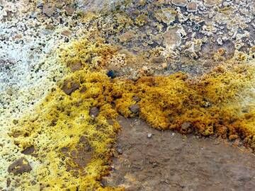
Reykjanes Volcano Photos

Latest satellite images

Reykjanes satellite image sat1Reykjanes satellite image sat2
Fr, 3. Mai 2024, 03:21

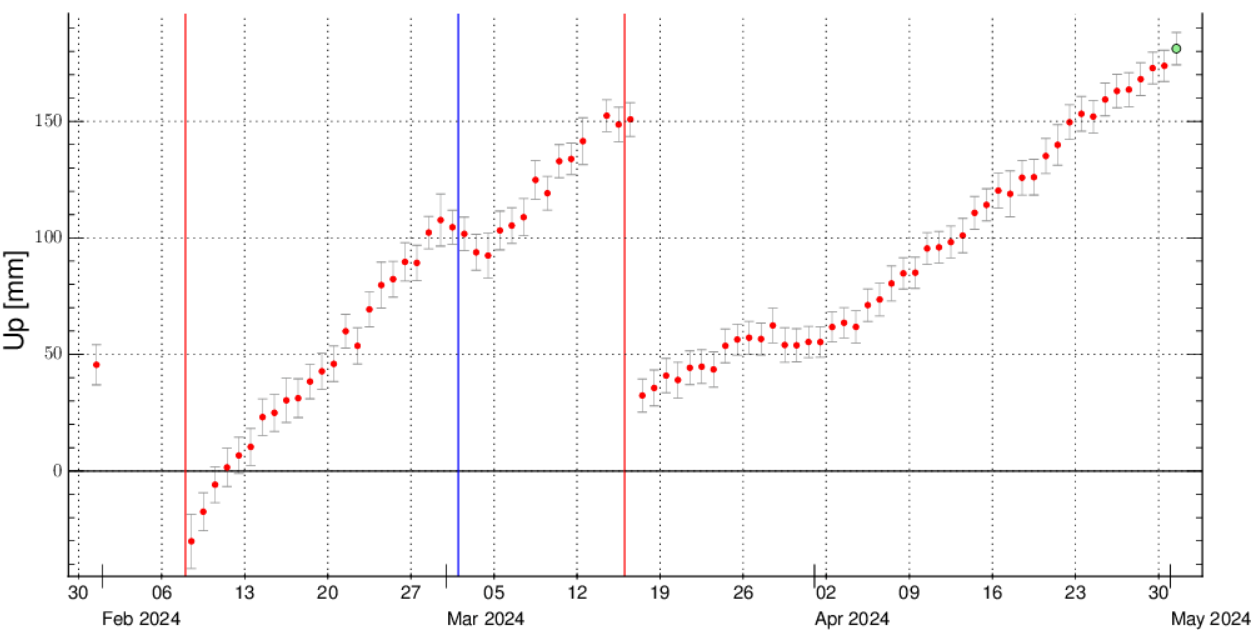
Reykjanes volcano update: pressure in magma chamber continues to be elevated, new eruption is not ruled out

The graph displays the vertical displacement of the GPS station SKSH located in the Svartsengi (image: IMO)
The ground deformation at the Svartsengi continues. ... Read all
Mi, 1. Mai 2024, 14:00

Reykjanes volcano (Reykjanes Peninsula) - Smithsonian / USGS Weekly Volcanic Activity Report for 24 April-30 April 2024 (Continuing Activity)

IMO reported that the cone just E of Sundhnúk and along the fissure within the Reykanes volcanic system continued to erupt lava. The average effusion rate was 0.9 (± 0.4) cubic meters per second during 15-25 April, whereas during the first half of April the rate was an estimated 3-4 cubic meters per second. By 25 April the lava-flow field was an estimated 6.16 square kilometers with an approximate volume of 34 (± 1.9) million cubic meters. ... Read all

Auf dieser Seite:

App herunterladen
Volcanoes & Earthquakes - new app for Android
Android | iOS-Version

Mehr auf VolcanoDiscovery

Warum gibt es Werbung auf dieser Seite?

Unterstützen Sie unsere Arbeit!

Diese Webseite und die dazugehörigen Apps und Tools instandzuhalten und kostenlos Nachrichten zu Vulkanen, Erdbeben und anderen Themen bereitzustellen, verschlingt enorm viel Zeit und auch Geld.
Wenn Sie die Infos mögen und uns in der Arbeit dazu unterstützen wollen, würden wir uns über eine Spende (über PayPal oder mit Kreditkarte) sehr freuen.
Online Zahlung (Kreditkarte)
Damit können wir Ihnen auch in Zukunft neue Features entwickeln und Bestehende laufend verbessern.Vielen Dank!
Sources: VolcanoDiscovery / VolcanoAdventures and other sources as noted.
Use of material: Most text and images on our websites are owned by us. Re-use is generally not permitted without authorization. Contact us for licensing rights.
Volcanoes & Earthquakes
VolcanoDiscovery Home
Vulkane | Erdbeben | Fotos | News | App
Adventure & Study Travel
Reisen zu Vulkanen und Vulkangebieten: Wanderreisen, Studienreisen, Fotoreisen
Tours & Dates | FAQ | About us
Get our newsletter!
Company info
Kontakt | Impressum | AGB
Follow us
Follow us on facebook Follow us on Instagram Follow us on Twitter Visit our Youtube channel
EN | DE | EL | ES | FR | IT | RU
VolcanoDiscovery GmbH, Germany, Reg. nr.: HRB 103744, EU Tax Id: DE 297 465 123 owned and created by
Dr. Tom Pfeiffer, volcanologist, volcano photographer, tour organizer member of
IAVCEI
IAVCEI
Vulkanologische Gesellschaft
Volcanological Society
Ecotourism Greece
Ecotourism Greece
RUV insurance
Insured by R+V
VolcanoDiscovery © 2004- All Rights Reserved | Datenschutz - Cookie Einstellungen