Doro Lambuwu Volcano
Updated: Apr 24, 2024 06:18 GMT -
Stratovolcano 1602 m / 5256 ft
Indonesia, -8.36°S / 118.5°E
Current status: (probably) extinct (0 out of 5)
Indonesia, -8.36°S / 118.5°E
Current status: (probably) extinct (0 out of 5)
[smaller] [larger]
Doro Lambuwu volcano eruptions: None during the past 10,000 years
Less than few million years ago (Pleistocene)
Latest nearby earthquakes
| Time | Mag. / Depth | Distance / Location | |||
| Apr 23, 09:47 am (Makassar) | 3.5 114 km | 21 km (13 mi) to the SW | Info | ||
Background
Doro Lambuwu (or Lambuwa) is a broad Quaternary volcanic zone west of Bima Bay with a caldera open to the NE (Ratman and Yasin 1978). IAVCEI (1973) lists a Doro Oromboha volcano in this area. The area, about 30 km across, was mapped by Garvin (2002, shown in Khant et al., 2013) as early Pleistocene. The Garvin (2002) map also identified volcanic features named Doro Matua and Doro Pokah, but clearly identifying specific peaks in this heavily eroded region is difficult.---
Source: Smithsonian / GVP volcano information
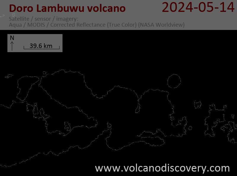
Latest satellite images