Volcano earthquake report for Monday, 22 Feb 2021
Mon, 22 Feb 2021, 23:50 | BY: EARTHQUAKEMONITOR
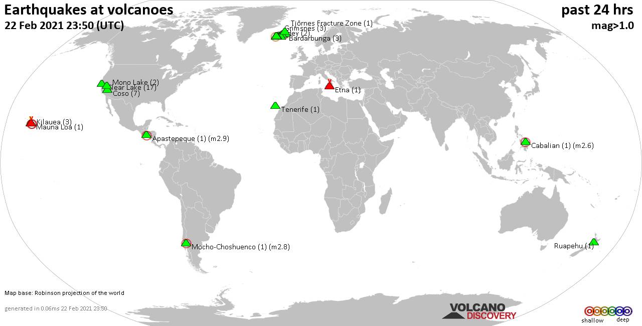
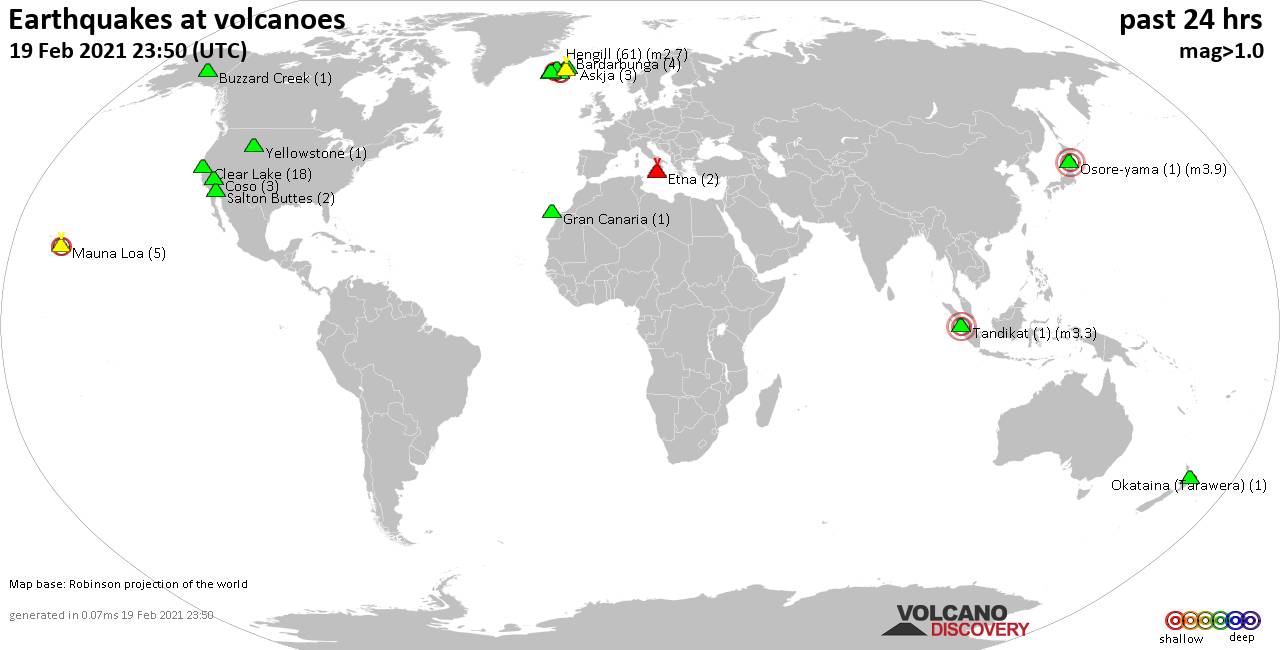
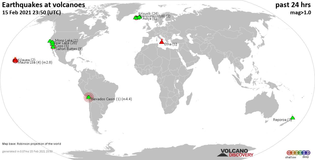
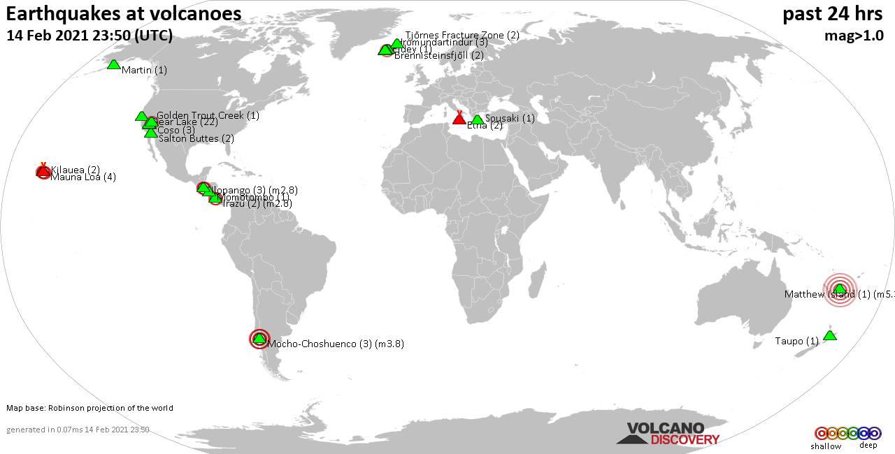
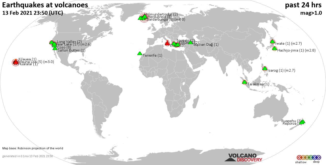
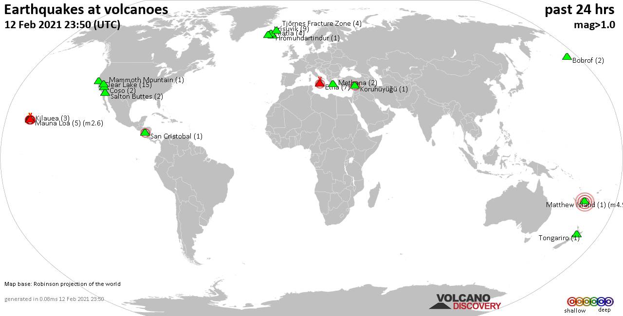
World map showing volcanoes with shallow (less than 20 km) earthquakes within 20 km radius during the past 24 hours on 22 Feb 2021 Number in brackets indicate nr of quakes.
Etna (1 quake mag 1.6), Grímsnes (3 quakes between mag 0.5-1.0), Hekla (2 quakes between mag 0.4-1.1), Herdubreid (5 quakes between mag 0.5-1.3), Hofsjökull volcano (1 quake mag 1.7), Katla (1 quake mag 1.3), Kilauea (3 quakes between mag 1.8-2.5), Krísuvík (3 quakes between mag 0.2-1.1), Mauna Loa (1 quake mag 1.8), Mocho-Choshuenco (1 quake mag 2.8), Mono Lake (2 quakes between mag 1.1-1.4), Reykjanes (18 quakes between mag 0.1-1.3), Ruapehu (1 quake mag 1.0), Tenerife (1 quake mag 1.0), Tjörnes Fracture Zone (1 quake mag 1.0) (updated 23h50)
Note: Earthquakes within 20 km from and at depths less than 20 km under active volcanoes are reported. The list is not complete because many volcanoes are not monitored and/or seismic data in high resolution is not available publicly.
Volcanoes with recent earthquakes above magnitude 2 or more than 10 quakes are listed below:
Apastepeque volcano (El Salvador): magnitude 2.9 earthquake
A magnitude 2.9 earthquake occurred at the volcano 3 hours ago. The quake, which might be volcanic in origin, was located at a depth of 5.0 km depth at 16 km distance SE from the volcano.Earthquake details:
2.9 quake 14 km east of San Vicente, El Salvador, 22 Feb 2021 3:15 pm (GMT -6) (16 km SE)
All earthquakes at Apastepeque
Cabalian volcano (Central Philippines): magnitude 2.6 earthquake
A magnitude 2.6 earthquake occurred at the volcano 9 hours ago. The quake, which might be volcanic in origin, was located at a depth of 4.0 km depth at 13 km distance W from the volcano.Earthquake details:
2.6 quake 33 km northeast of Maasin, Southern Leyte, Eastern Visayas, Philippines, 22 Feb 2021 10:52 pm (GMT +8) (13 km W)
All earthquakes at Cabalian
Clear Lake volcano (California): 17 earthquakes up to magnitude 1.4
Possible earthquake swarm: 17 earthquakes occurred near (under) the volcano during 18 hours, the last being recorded quake 6 hours ago. Hypocenter depths ranged between 3.4 and 0.7 km.Earthquake details: (only 5 largest)
1.4 quake 5km WNW of Cobb, CA, USA, 22 Feb 2021 5:38 am (GMT -8) (15 km S)
1.3 quake 8km NW of The Geysers, CA, USA, 21 Feb 2021 8:19 pm (GMT -8) (16 km SSW)
1.0 quake 7km NW of The Geysers, CA, USA, 21 Feb 2021 10:44 pm (GMT -8) (18 km SSW)
0.9 quake 7km WNW of The Geysers, CA, USA, 21 Feb 2021 9:58 pm (GMT -8) (18 km SSW)
0.9 quake 7km NW of The Geysers, CA, USA, 21 Feb 2021 11:59 pm (GMT -8) (17 km S)
All earthquakes at Clear Lake
Eldey volcano (Iceland): 2 earthquakes up to magnitude 2.1
2 earthquakes occurred near (under) the volcano during 1 hour 56 minutes, the last being recorded quake 10 hours ago. Hypocenter depths ranged between 15.0 and 5.5 km.Earthquake details:
2.1 quake 4.8 Km SW of Geirfugladrangur, Iceland, 22 Feb 2021 11:56 am (GMT +0) (19 km WSW)
1.6 quake 10.2 Km S of Eldeyjardrangur, Iceland, 22 Feb 2021 1:52 pm (GMT +0) (10 km S)
All earthquakes at Eldey
Eldey is located at the beginning of the Reykjanes Ridge off the SW tip of Iceland. Its highest elevation is the top of Eldey Island, but most of the volcanic edifice is submerged.
Several eruptions occurred in historic times, last in 1926.
Kilauea volcano (Hawai'i (Big Island)): 3 earthquakes up to magnitude 2.5
3 earthquakes occurred near (under) the volcano during 1 hour 2 minutes, the last being recorded quake 13 hours ago. Hypocenter depths ranged between 6.3 and 1.5 km.Earthquake details:
2.5 quake 14 Km S of Fern Forest, Hawaii, USA, 22 Feb 2021 1:10 am (GMT -10) (18 km ESE)
2.0 quake 14 Km S of Fern Forest, Hawaii, USA, 22 Feb 2021 12:08 am (GMT -10) (17 km ESE)
1.8 quake 13 Km S of Fern Forest, Hawaii, USA, 22 Feb 2021 12:09 am (GMT -10) (16 km ESE)
All earthquakes at Kilauea
Mocho-Choshuenco volcano (Central Chile and Argentina): magnitude 2.8 earthquake
A magnitude 2.8 earthquake occurred at the volcano 12 hours ago. The quake, which might be volcanic in origin, was located at a depth of 8.0 km depth at 16 km distance NNE from the volcano.Earthquake details:
2.8 quake 38 km southeast of Panguipulli, Provincia de Valdivia, Los Rios Region, Chile, 22 Feb 2021 9:03 am (GMT -3) (16 km NNE)
All earthquakes at Mocho-Choshuenco
Reykjanes volcano (Iceland): 18 earthquakes up to magnitude 1.3
Possible earthquake swarm: 18 earthquakes occurred near (under) the volcano during 17 hours, the last being recorded quake 5 hours ago. Hypocenter depths ranged between 6.2 and 0.1 km.Earthquake details: (only 5 largest)
1.3 quake 2.7 Km ENE of Grindavík, Iceland, 22 February 2021 04:23 GMT (8 km SE)
1.1 quake 2.6 Km SW of Fagradalsfjall, Iceland, 22 February 2021 11:38 GMT (10 km E)
1.0 quake 3.7 Km WSW of Grindavík, Iceland, 22 February 2021 04:08 GMT (8 km S)
1.0 quake 2.2 Km WSW of Fagradalsfjall, Iceland, 22 Feb 2021 7:12 pm (GMT +0) (10 km E)
0.9 quake 2.2 Km SW of Fagradalsfjall, Iceland, 22 February 2021 02:06 GMT (10 km E)
All earthquakes at Reykjanes
Previous news
Sun, 21 Feb 2021, 23:50
Volcano earthquake report for Sunday, 21 Feb 2021
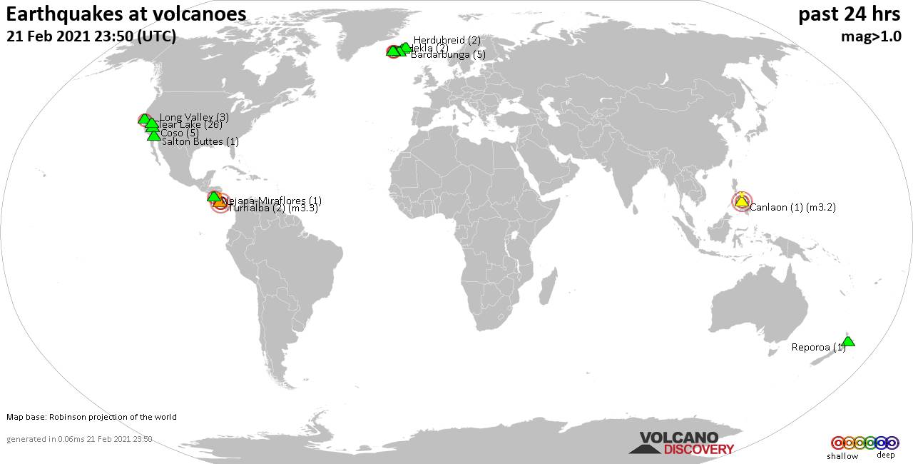
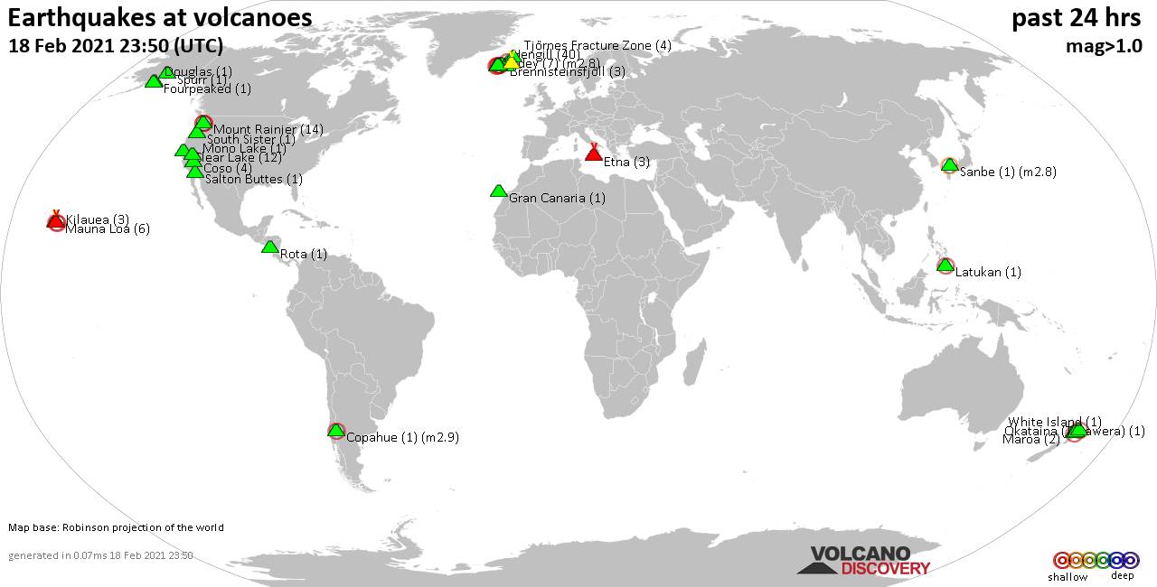
Quakes detected near: Bardarbunga (5 quakes between mag 0.4-1.1), Canlaon (1 quake mag 3.2), Clear Lake (26 quakes between mag 0.3-2.3), Coso (5 quakes between mag 0.9-1.8), Hekla (2 quakes between mag 0.5-1.2), Herdubreid (2 quakes between mag 0.6-1.0) ... Read all
Sat, 20 Feb 2021, 23:50
Volcano earthquake report for Saturday, 20 Feb 2021
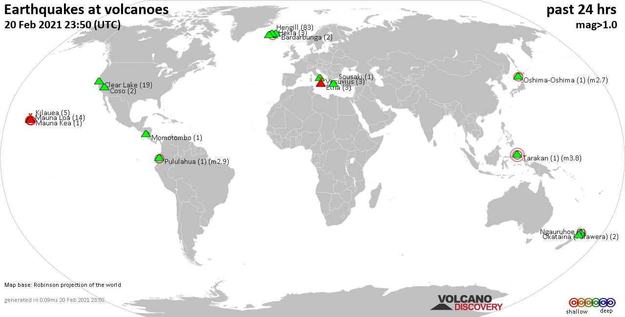
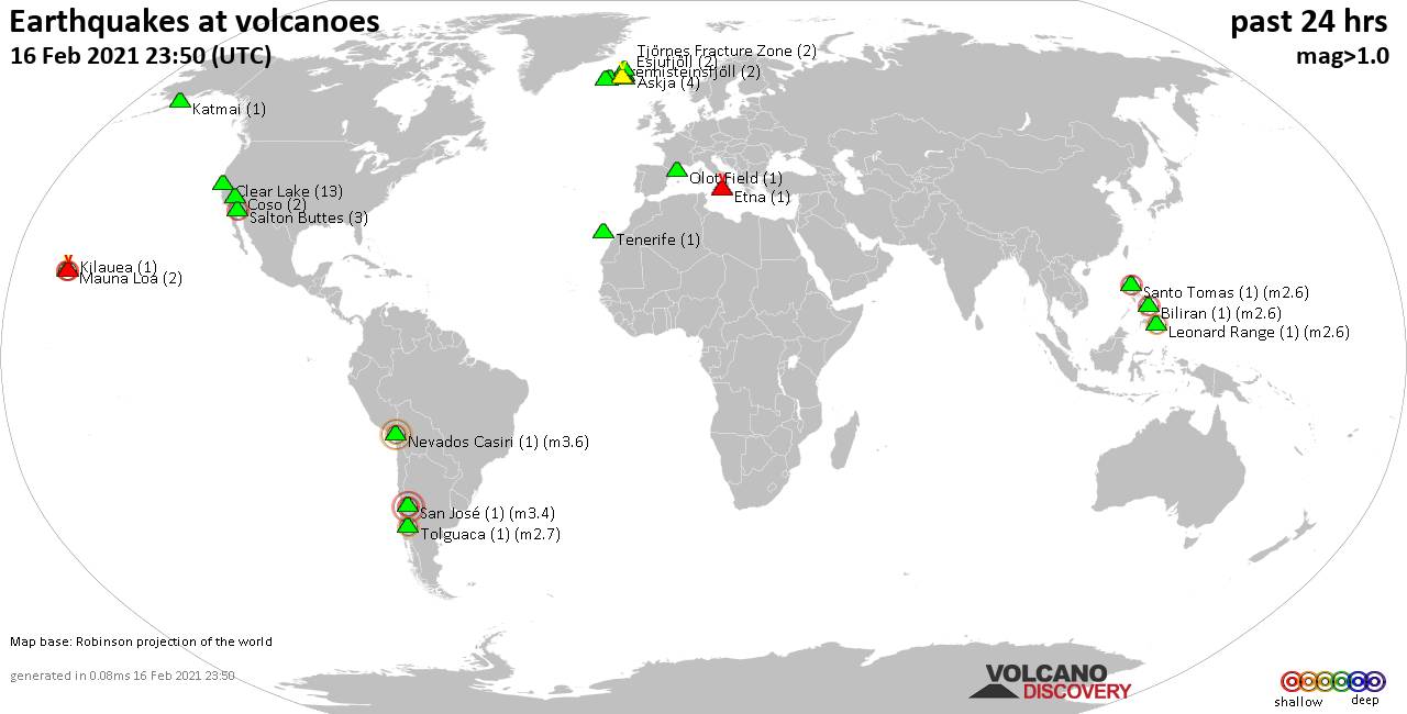
Quakes detected near: Bardarbunga (2 quakes between mag 0.6-1.2), Clear Lake (19 quakes between mag 0.1-1.1), Coso (2 quakes between mag 1.1-1.9), Etna (3 quakes between mag 1.1-1.3), Hekla (3 quakes between mag 0.8-2.4), Hengill (83 quakes between mag 0.1-1.9) ... Read all
Show more