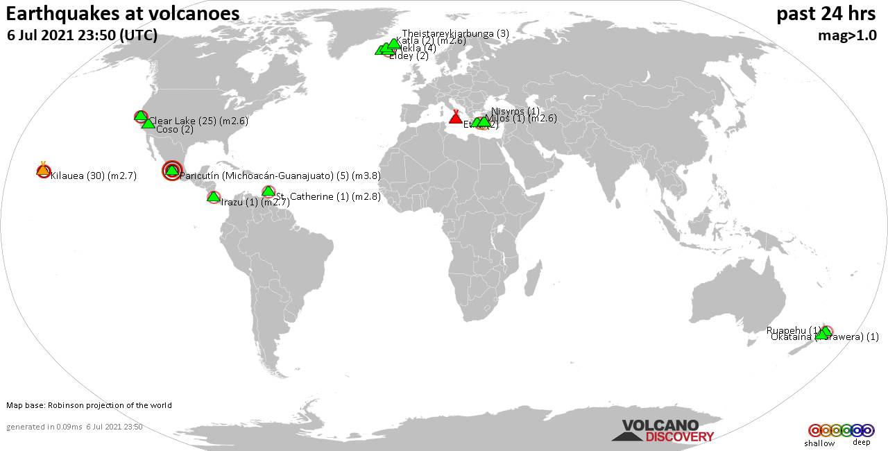
Volcano earthquake report for Tuesday, 13 Jul 2021
Tue, 13 Jul 2021, 23:50 | BY: EARTHQUAKEMONITOR
World map showing volcanoes with shallow (less than 20 km) earthquakes within 20 km radius during the past 24 hours on 13 Jul 2021 Number in brackets indicate nr of quakes.
Fagradalsfjall (3 quakes between mag 0.2-1.0), Fourpeaked (7 quakes between mag 0.7-1.6), Katla (5 quakes between mag 0.7-1.7), Kilauea (2 quakes between mag 1.9-1.9), Lassen (1 quake mag 1.7), Mount Baker (1 quake mag 1.5), Ngauruhoe (2 quakes between mag 0.4-1.3), Novarupta (1 quake mag 1.0), Paricutín (Michoacán-Guanajuato) (1 quake mag 3.7), Salton Buttes (2 quakes between mag 1.0-1.3), Takawangha (5 quakes between mag 0.2-1.3), Tindfjallajökull (1 quake mag 1.6) (updated 23h50)
Note: Earthquakes within 20 km from and at depths less than 20 km under active volcanoes are reported. The list is not complete because many volcanoes are not monitored and/or seismic data in high resolution is not available publicly.
Volcanoes with recent earthquakes above magnitude 2 or more than 10 quakes are listed below:
Cabalian volcano (Central Philippines): magnitude 3.2 earthquake
A magnitude 3.2 earthquake occurred at the volcano 13 hours ago. The quake, which might be volcanic in origin, was located at a depth of 1.0 km depth at 8 km distance NNE from the volcano.Earthquake details:
3.2 quake 0.9 km north of Hinundayan, Southern Leyte, Eastern Visayas, Philippines, 13 July 2021 - 06:51 PM (PST) (8 km NNE)
All earthquakes at Cabalian
Clear Lake volcano (California): 14 earthquakes up to magnitude 1.2
Possible earthquake swarm: 14 earthquakes occurred near (under) the volcano during 17 hours, the last being recorded quake 3 hours ago. Hypocenter depths ranged between 3.9 and 1.4 km.Earthquake details: (only 5 largest)
1.2 quake 8km W of Cobb, CA, 13 July 2021 08:28 GMT (15 km SSW)
1.2 quake 8km NW of The Geysers, CA, 13 July 2021 09:03 GMT (16 km SSW)
1.0 quake 6km NW of The Geysers, CA, 13 July 2021 13:49 GMT (17 km S)
1.0 quake 6km NW of The Geysers, CA, 13 July 2021 12:33 GMT (18 km SSW)
0.9 quake 3km NNW of The Geysers, CA, 13 July 2021 20:34 GMT (19 km S)
All earthquakes at Clear Lake
Paricutín (Michoacán-Guanajuato) volcano (Western & Central Mexico): magnitude 3.7 earthquake
A magnitude 3.7 earthquake occurred at the volcano 15 hours ago. The quake, which might be volcanic in origin, was located at a depth of 8.0 km depth at 17 km distance S from the volcano.Earthquake details:
3.7 quake Nuevo Parangaricutiro, 19 km southwest of Uruapan, Michoacan, Mexico, 2021-07-13 03:28:45 (Hora de México) (17 km S)
All earthquakes at Paricutín (Michoacán-Guanajuato)
Unnamed 24.00°N/121.83°E volcano (Taiwan): 2 earthquakes up to magnitude 4.7
2 earthquakes occurred near (under) the volcano during 15 minutes, the last being recorded quake 36 minutes ago. Hypocenter depths ranged between 10.0 and 8.0 km.Earthquake details:
4.7 quake Philippines Sea, 18 km east of Hualien City, Taiwan, 14 Jul 6:59 am (GMT +8) (10 km WSW)
4.3 quake 7.7 km southeast of Hualien City, Taiwan, 14 Jul 7:14 am (GMT +8) (19 km WSW)
All earthquakes at Unnamed 24.00°N/121.83°E
Previous news
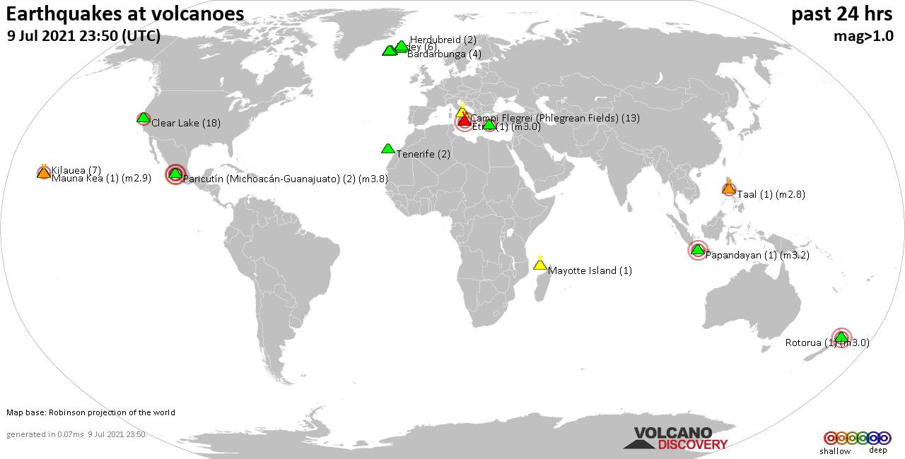
Mon, 12 Jul 2021, 23:50
Volcano earthquake report for Monday, 12 Jul 2021
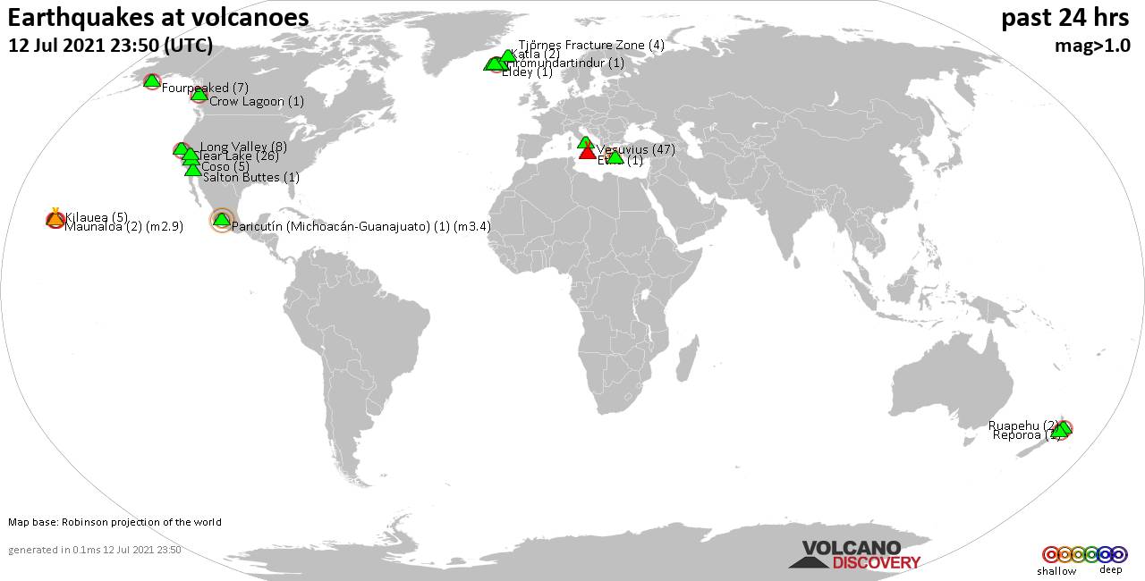
Quakes detected near: Brennisteinsfjöll (2 quakes between mag 0.1-1.0), Clear Lake (26 quakes between mag 0.3-2.1), Coso (5 quakes between mag 0.8-1.2), Crow Lagoon (1 quake mag 2.4), Eldey (1 quake mag 1.7), Etna (1 quake mag 1.0) ... Read all
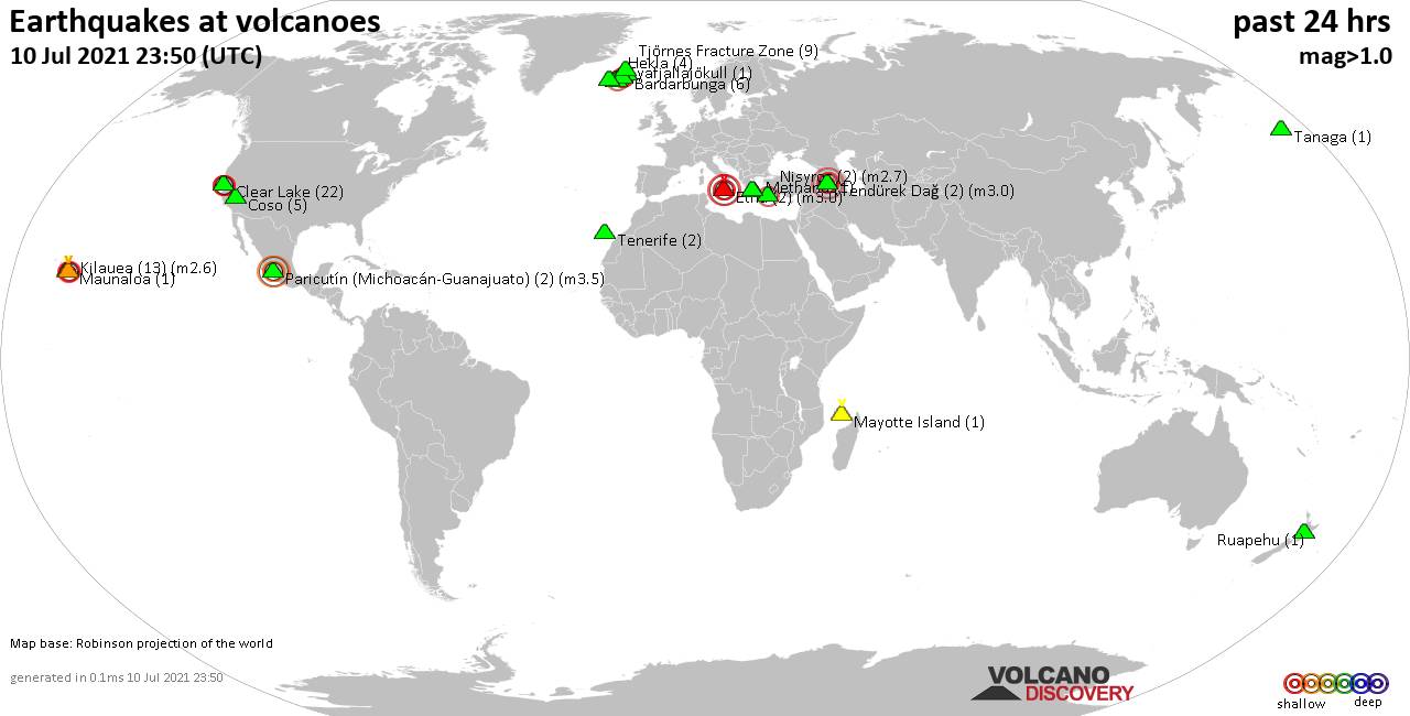
Sun, 11 Jul 2021, 23:50
Volcano earthquake report for Sunday, 11 Jul 2021
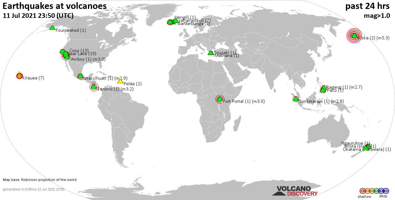
Quakes detected near: Amboy (1 quake mag 3.0), Bardarbunga (3 quakes between mag 0.6-1.3), Clear Lake (19 quakes between mag 0.4-2.4), Coso (13 quakes between mag 0.1-2.5), Eyafjallajökull (2 quakes between mag 1.5-1.7), Fort Portal (1 quake mag 3.0) ... Read all
Show more