Volcano earthquake report for Monday, 8 Jul 2019
Mon, 8 Jul 2019, 23:50 | BY: EARTHQUAKEMONITOR

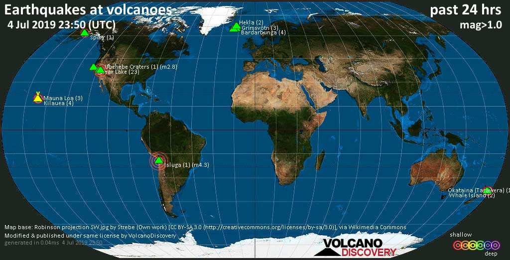
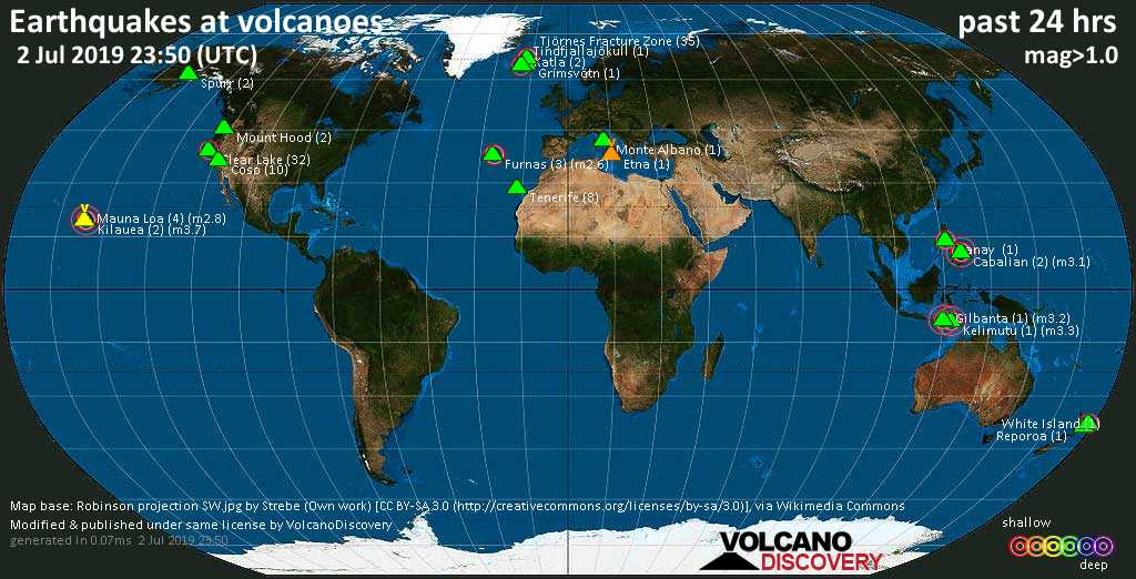
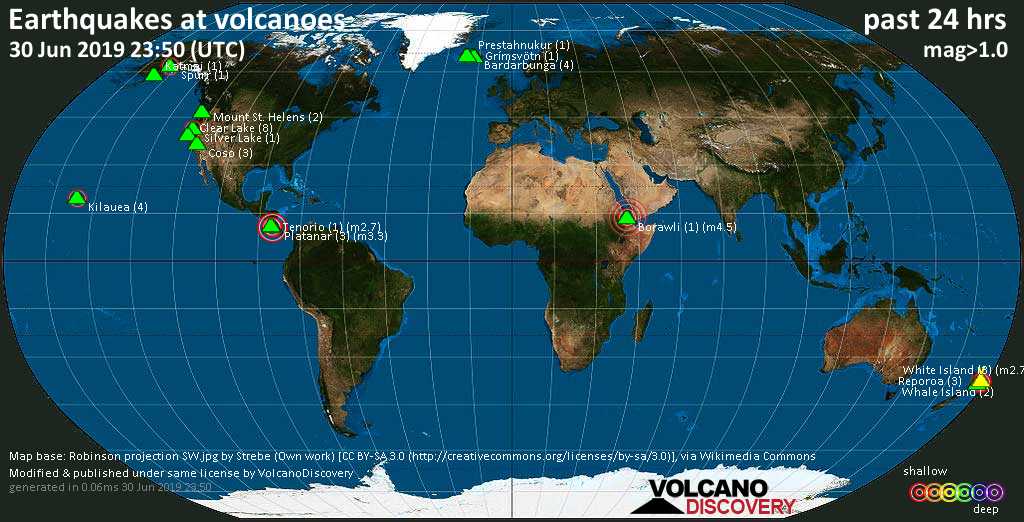
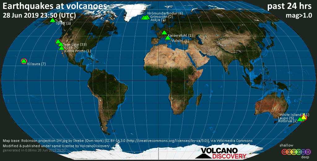
World map showing volcanoes with shallow (less than 20 km) earthquakes within 20 km radius during the past 24 hours on 8 Jul 2019 Number in brackets indicate nr of quakes.
Grímsvötn (3 quakes between mag 0.8-1.2), Katla (6 quakes between mag 0.3-1.8), Monte Albano (3 quakes between mag 1.8-2.0), Mount Hood (18 quakes between mag 0.2-1.6), Okataina (Tarawera) (2 quakes between mag 1.8-1.9), Ruapehu (4 quakes between mag 0.1-1.7), Spurr (4 quakes between mag 1.2-1.5), Taupo (5 quakes between mag 1.1-1.6), Tjörnes Fracture Zone (16 quakes between mag 0.4-1.6), Whale Island (1 quake mag 2.9), White Island (1 quake mag 2.2) (updated 23h50)
Note: Earthquakes within 20 km from and at depths less than 20 km under active volcanoes are reported. The list is not complete because many volcanoes are not monitored and/or seismic data in high resolution is not available publicly.
Volcanoes with recent earthquakes above magnitude 2 or more than 10 quakes are listed below:
Cancanajag volcano (Central Philippines): magnitude 2.2 earthquake
A magnitude 2.2 earthquake occurred at the volcano 3 hours ago. The quake, which might be volcanic in origin, was located at a depth of 8.0 km depth at 17 km distance N from the volcano.Earthquake details:
M 2.2 quake: 009 km N 79° W of Jaro (Leyte) (Philippines) on Mon, 8 Jul 21h13 (17 km N)
All earthquakes at Cancanajag
Clear Lake volcano (California): 18 earthquakes up to magnitude 1.3
Possible earthquake swarm: 18 earthquakes occurred near (under) the volcano during 20 hours, the last being recorded quake 23 minutes ago. Hypocenter depths ranged between 3.7 and 0.8 km.Earthquake details: (only 5 largest)
M 1.3 quake: 6km NNW of The Geysers, CA (USA) on Mon, 8 Jul 13h10 (16 km S)
M 1.3 quake: 7km NW of The Geysers, CA (USA) on Mon, 8 Jul 10h11 (17 km S)
M 1.1 quake: 6km W of Cobb, CA (USA) on Mon, 8 Jul 19h50 (16 km S)
M 1.0 quake: 6km WNW of The Geysers, CA (USA) on Mon, 8 Jul 11h20 (19 km S)
M 0.9 quake: 8km WNW of Cobb, CA (USA) on Mon, 8 Jul 16h41 (13 km S)
All earthquakes at Clear Lake
Coso volcano (California): 313 earthquakes up to magnitude 3.8
Possible earthquake swarm: 313 earthquakes occurred near (under) the volcano during 24 hours, the last being recorded quake 16 minutes ago. Hypocenter depths ranged between 15.7 and 0.0 km.Earthquake details: (only 5 largest)
M 3.8 quake: 10km NE of Coso Junction, CA (USA) on Mon, 8 Jul 01h36 (11 km N)
M 3.5 quake: 14km NNE of Coso Junction, CA (USA) on Mon, 8 Jul 07h31 (15 km N)
M 3.5 quake: 9km E of Coso Junction, CA (USA) on Mon, 8 Jul 22h57 (3 km N)
M 3.2 quake: 17km E of Little Lake, CA (USA) on Mon, 8 Jul 05h24 (13 km SSE)
M 3.2 quake: 16km E of Little Lake, CA (USA) on Mon, 8 Jul 19h45 (13 km S)
All earthquakes at Coso
Don Joao de Castro Bank volcano (Azores): magnitude 2.3 earthquake
A magnitude 2.3 earthquake occurred at the volcano 19 hours ago. The quake, which might be volcanic in origin, was located at a depth of 0 km depth at 11 km distance SSW from the volcano.Earthquake details:
M 2.3 quake: Fossa Hirondelle (Portugal) on Mon, 8 Jul 04h51 (11 km SSW)
All earthquakes at Don Joao de Castro Bank
Etna volcano (Italy): 2 earthquakes up to magnitude 3.9
2 earthquakes occurred near (under) the volcano during 12 hours, the last being recorded quake 7 hours ago. Hypocenter depths ranged between 13.0 and 5.0 km.Earthquake details:
M 3.9 quake: 3.9 Sicily, Italy on Mon, 8 Jul 04h38 (12 km ESE)
M 3.5 quake: 3.5 Sicily, Italy on Mon, 8 Jul 16h48 (15 km SE)
All earthquakes at Etna
Grensdalur volcano (Iceland): 26 earthquakes up to magnitude 1.1
Possible earthquake swarm: 26 earthquakes occurred near (under) the volcano during 6 hours, the last being recorded quake 17 hours ago. Hypocenter depths ranged between 11.8 and 3.8 km.Earthquake details: (only 5 largest)
M 1.1 quake: 4.6 km E of Raufarhólshellir (Iceland) on Mon, 8 Jul 00h53 (10 km SE)
M 0.7 quake: 5.1 km SSE of Skálafell (Iceland) on Mon, 8 Jul 00h42 (10 km SE)
M 0.7 quake: 5.2 km SSE of Skálafell (Iceland) on Mon, 8 Jul 01h25 (10 km SE)
M 0.5 quake: 5.0 km E of Raufarhólshellir (Iceland) on Mon, 8 Jul 01h25 (10 km SE)
M 0.5 quake: 5.1 km SSE of Skálafell (Iceland) on Mon, 8 Jul 00h57 (10 km SE)
All earthquakes at Grensdalur
Mount Hood volcano (Oregon): 18 earthquakes up to magnitude 1.6
Possible earthquake swarm: 18 earthquakes occurred near (under) the volcano during 11 hours, the last being recorded quake 11 hours ago. Hypocenter depths ranged between 4.1 and 0.1 km.Earthquake details: (only 5 largest)
M 1.6 quake: 19km ESE of Mount Hood Village, Oregon (USA) on Mon, 8 Jul 13h02 (7 km S)
M 1.2 quake: 21km ESE of Mount Hood Village, Oregon (USA) on Mon, 8 Jul 08h08 (6 km S)
M 1.2 quake: 20km ESE of Mount Hood Village, Oregon (USA) on Mon, 8 Jul 12h24 (7 km S)
M 1.2 quake: 20km ESE of Mount Hood Village, Oregon (USA) on Mon, 8 Jul 12h06 (8 km S)
M 1.1 quake: 20km ESE of Mount Hood Village, Oregon (USA) on Mon, 8 Jul 02h00 (7 km S)
All earthquakes at Mount Hood
Tjörnes Fracture Zone volcano (Iceland): 16 earthquakes up to magnitude 1.6
Possible earthquake swarm: 16 earthquakes occurred near (under) the volcano during 19 hours, the last being recorded quake 5 hours ago. Hypocenter depths ranged between 11.8 and 0.4 km.Earthquake details: (only 5 largest)
M 1.6 quake: 31.5 km WNW of Kópasker (Iceland) on Mon, 8 Jul 03h04 (12 km N)
M 1.3 quake: 24.6 km W of Kópasker (Iceland) on Mon, 8 Jul 18h40 (5 km ESE)
M 1.3 quake: 26.9 km W of Kópasker (Iceland) on Mon, 8 Jul 01h12 (4 km SE)
M 1.2 quake: 26.5 km W of Kópasker (Iceland) on Mon, 8 Jul 09h05 (3 km ESE)
M 1.1 quake: 25.0 km W of Kópasker (Iceland) on Mon, 8 Jul 18h13 (5 km ESE)
All earthquakes at Tjörnes Fracture Zone
Whale Island volcano (New Zealand): magnitude 2.9 earthquake
A magnitude 2.9 earthquake occurred at the volcano 15 hours ago. The quake, which might be volcanic in origin, was located at a depth of 5.0 km depth at 14 km distance ENE from the volcano.Earthquake details:
M 2.9 quake: New Zealand on Mon, 8 Jul 08h26 (14 km ENE)
All earthquakes at Whale Island
White Island volcano (New Zealand): magnitude 2.2 earthquake
A magnitude 2.2 earthquake occurred at the volcano 9 hours ago. The quake, which might be volcanic in origin, was located at a depth of 2.8 km depth at 2 km distance SSE from the volcano.Earthquake details:
M 2.2 quake: New Zealand on Mon, 8 Jul 14h26 (2 km SSE)
All earthquakes at White Island
Previous news
Sun, 7 Jul 2019, 23:50
Volcano earthquake report for Sunday, 7 Jul 2019
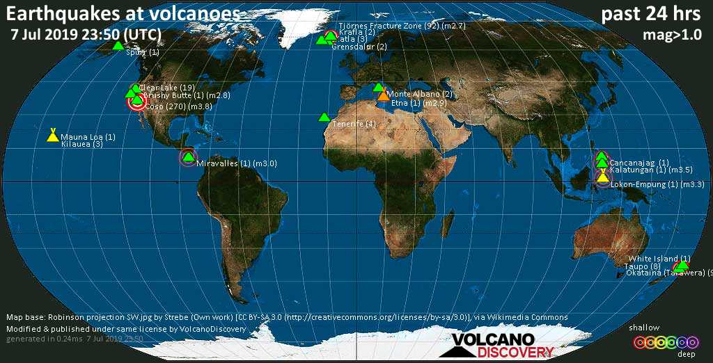
Quakes detected near: Brushy Butte (1 quake mag 2.8), Cancanajag (1 quake mag 2.4), Clear Lake (19 quakes between mag 0.3-1.6), Coso (270 quakes between mag 0.9-3.8), Etna (1 quake mag 2.9), Grensdalur (2 quakes between mag 1.3-1.5) ... Read all

Show more