Contact | RSS | EN | DE | EL | ES | FR | IT | RU

Strong mag. 6.2 earthquake - Mindanao, Philippines on Saturday, 8 September 2018 - information

Very strong mag. 6.2 Earthquake - Mindanao, Philippines, on Saturday, Sep 8, 2018, at 03:16 pm (Manila time)

A very strong magnitude 6.2 earthquake hit 5.2 km (3.3 mi) away from Manay, Davao,  Philippines, in the early afternoon of Saturday, Sep 8, 2018 at 3.16 pm local time (Asia/Manila GMT +8). The quake had a very shallow depth of 10 km (6 mi) and was felt over a large region. The shallow depth of the quake caused it to be felt more strongly near the epicenter than a deeper quake of similar magnitude would.

Very strong mag. 6.2 Earthquake - Mindanao, Philippines, on Saturday, Sep 8, 2018, at 03:16 pm (Manila time) Very strong mag. 6.2 Earthquake - Mindanao, Philippines, on Saturday, Sep 8, 2018, at 03:16 pm (Manila time)
Very strong magnitude 6.2 earthquake at 10 km depth
8 Sep 07:23 UTC: First to report: GFZ after 7 minutes.
Sep 8 07:24: Magnitude recalculated from 6.3 to 6.2.

Earthquake details

Date & timeSep 8, 2018 07:16:50 UTC
Local time at epicenterSaturday, Sep 8, 2018, at 03:16 pm (Asia/Manila GMT +8)
StatusPreliminary (automatic detection)
Magnitude6.2
Depth10 km
Epicenter latitude / longitude7.24°N / 126.58°E Davao Oriental, Davao, Philippines
Seismic antipode7.24°S / 53.42°W Brazil
Shaking intensityVII Very strong shaking near epicenter
Felt139 reports
Primary data sourceGFZ (German Research Centre for Geosciences)
Nearest volcanoLeonard Range (61 km / 38 mi)
Estimated seismic energy released1.3 x 1014 joules (35 gigawatt hours, equivalent to 30089 tons of TNT or 1.9 atomic bombs!) | about seismic energy
[smaller] [bigger]

Ground shaking from this quake

shake map
Map of estimated ground shaking (source:USGS)

Nearby places

The closest larger town where the quake might have been felt is Magugpo Poblacion, a city with more than 230,000 inhabitants in the Philippines, in 89 km (55 mi) distance west of the epicenter. People likely experienced moderate shaking there. Several smaller towns and villages are located closer to the epicenter and might have experienced stronger shaking.
The following table shows some of the places that might have been affected (or not) by the shaking.
Distance Place Max. shaking intensity(*) Region Country
5 km (3 mi)
SW of epicenter
Manay
(pop: 20,300)
VI: Strong
Davao Oriental, Davao
51 km (32 mi)
SW of epicenter
Mati
(pop: 105,900)
V: Moderate
Davao Oriental, Davao
72 km (45 mi)
NW of epicenter
Compostela
(pop: 42,600)
V: Moderate
Davao de Oro, Davao
74 km (46 mi)
SW of epicenter
Lupon
(pop: 27,200)
V: Moderate
Davao Oriental, Davao
86 km (54 mi)
NW of epicenter
Monkayo
(pop: 51,400)
V: Moderate
Davao de Oro, Davao
89 km (55 mi)
W of epicenter
Magugpo Poblacion
(pop: 233,300)
V: Moderate
Davao, Davao
98 km (61 mi)
W of epicenter
Samal
(pop: 43,500)
V: Moderate
Davao, Davao
99 km (62 mi)
W of epicenter
Panabo
(pop: 84,700)
V: Moderate
Davao, Davao
108 km (67 mi)
W of epicenter
Davao
(pop: 1,212,500)
IV: Light
Davao
200 km (124 mi)
SW of epicenter
General Santos City
(pop: 679,600)
IV: Light
South Cotabato, Soccsksargen
Notes:
(*) Shaking intensity according to the Modified Mercalli Intensity Scale (MMI) and estimated using seismic models.

User-reports for this quake (152)

We received 140 reports for this quake.
User reports estimate the perceived ground shaking intensity according to the MMI (Modified Mercalli Intensity) scale.
Contribute:
Leave a comment if you find a particular report interesting or want to add to it.
Flag as inappropriate.
Mark as helpful or interesting.
Send your own user report!
Translate
davao city / Very strong shaking (MMI VII)
Kipp / Very weak shaking (MMI II) : I  
Pantukan / Strong shaking (MMI VI) : I was lying in bed watching TV when I feel dizzy. I already thought that there was an earthquake  
sm city ecoland davao city / Strong shaking (MMI VI) : I and my family together with my friends were inside sm city ecoland specifically at 3rd flr inside davao light office, we were swaying together the hanging lights, we were just calming ourselves sitting while waiting for the personnel to guide  
Davao city / Light shaking (MMI IV)
Davao City / Moderate shaking (MMI V)
Samal islanf davao del norte / Strong shaking (MMI VI) : Everything was moving inside the house. Even me and my kids was shocked  
Davao city / Light shaking (MMI IV)
Davao city / Very strong shaking (MMI VII)
Davao Doc Quirino Avenue D.C / Strong shaking (MMI VI) : Ang traffic light at ang poste ng kuryente po sumasayaw sa lakas ng lindol.  
MATI CITY, DAVAO ORIENTAL / Strong shaking (MMI VI) : i'm in the office during the earthquake. i was stuck in my chair and don't know what to do because i felt so nervous and, i was panicking at the same time. But thank God, nothing seriously happened and we're all safe. God Bless us All.  
Davao / Light shaking (MMI IV)
sm city ecoland davao city / Strong shaking (MMI VI) : my family an  
Jumao-as St., Brgy. Zone 1, Digos City, Davao del / Moderate shaking (MMI V)
kabacan, cotabato / Very weak shaking (MMI II)
Tagum city / Light shaking (MMI IV) : I was in the mall during the earthquake, we felt the shaking of the ground thank God we are all safe, earthquake drill is really helpful to educate everybody.  
tagum city / Moderate shaking (MMI V) : we all felt the intensity of the earthquake while were in the 5th floor of the school building. I felt nervous while steping down through the downfloor.  
Brgy Riverside, Calinan, Davao City / Strong shaking (MMI VI)
Mintal Davao City / Strong shaking (MMI VI)
Panabo City / Light shaking (MMI IV)
Cabadbaran City, Agusan del Norte / Light shaking (MMI IV)
Maa Davao City / Moderate shaking (MMI V) : I was sleeping at that time then I felt my bed shaking, it wakes me up and saw our things being out place.  
davao city / Very strong shaking (MMI VII)
Davao city / Strong shaking (MMI VI)
tagum / Moderate shaking (MMI V)
University of the Immaculate Conception - Bonifaci / Strong shaking (MMI VI)
Agusan del Sur / Weak shaking (MMI III)
Davao city / Strong shaking (MMI VI)
davao city / Very strong shaking (MMI VII)
Panabo / Very strong shaking (MMI VII) : Nakaupo lang aq pero sumakit nahilo aq.  
tagum city,davao del norte / Strong shaking (MMI VI)
Davao City / Strong shaking (MMI VI)   
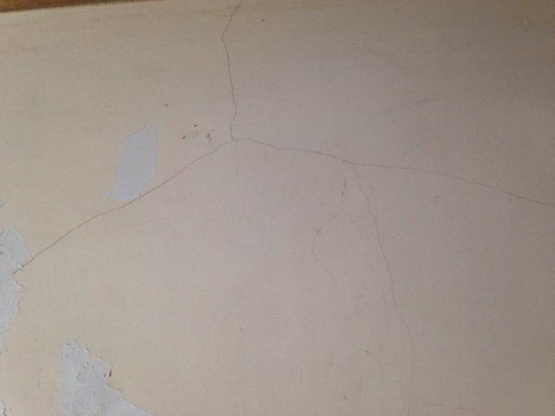
image.jpg... .jpg (public domain)
Show more
Show more

What is Intensity and the Mercalli Intensity Scale?


The amount of shaking that occurs on the surface due to an earthquake is called the intensity. It is commonly measured on the so-called Modified Mercalli Intensity Scale (MMI) ranging from 1 (not felt) to 10 (extreme shaking), and given in Roman numerals as I,II,...IX, X, and often displayed with color codes ranging from light blue to dark red.
Earthquake intensity depends mainly on the magnitude and depth of the quake as well as the distance from the epicenter: The further away, the less shaking intensity occurs.
Read more about the MMI scale!

Compare Quake Data

Data for the same earthquake as reported by different agencies

The more agencies report about the same quake and post similar data, the more confidence you can have in the data. It takes normally up to a few hours until earthquake parameters are calculated with near-optimum precision.
Mag Depth Time GMT
2018-09-8
Epicenter Agency
6.2 10 km
6.2 mi
(*)
07:16:50 Mindanao, Philippines GFZ (German Research Centre for Geosciences)
6.1 10 km
6.2 mi
(*)
07:16:49 MINDANAO, PHILIPPINES
3.5 km (2.2 mi) epicenter difference with GFZ
EMSC (European-Mediterranean Seismological Centre)
6.1 10 km
6.2 mi
(*)
07:16:49 - 9km WNW of Manay, Philippines
13 km (8.1 mi) epicenter difference with GFZ
USGS (United States Geological Survey)
6.1 20 km
12 mi
07:16:50 Philippines [Sea]
10.4 km (6.4 mi) epicenter difference with GFZ
INGV (Istituto Nazionale di Geofisica e Vulcanologia)
6.0 42 km
26 mi
07:16:53 Mindanao, Philippines
6 km (3.7 mi) epicenter difference with GFZ
GeoAu (Geoscience Australia )
6.1 20 km
12 mi
07:16:49 菲律宾棉兰老岛
8.9 km (5.5 mi) epicenter difference with GFZ
CEIC (China Earthquake Networks Center)
Notes:
(*) A depth given as 10 km often means that the the depth of the quake could not determined with sufficient accuracy.

Seismograms

Seismic station: Davao, Philippines (DAV/IU network) | Distance from quake: 112 km / 70 mi | Show on map | Station Info
Seismic station Davao, Philippines: vertical movement plot around time of quake (source: IRIS/BUD)
Seismogram (vertical component) around time of quake. Thin dotted red line indicates time of quake. Seismic waves arrive some time later, depending on distance. Bandpass filter applied: 0.1-10.0 Hz. Source: IRIS Buffer of Uniform Data (BUD) webtool
Show more

14 aftershocks for this quake

For this strong earthquake, 14 aftershocks have been detected so far. The strongest was a magnitude 3.7 quake that hit 2 hours and 1 minutes after the mainshock in 11.2 km (7 mi) distance, in 009 km S 24° E of Manay (Davao Oriental) on Saturday, Sep 8, 2018 on 05:18 pm (Manila local time GMT +8).
The most recent aftershock occurred 6 years ago 017 km S 29° W of Caraga (Davao Oriental) and had a magnitude of 2.1.

What are aftershocks?


Larger earthquakes (above magnitude 5 or so) such as this one are usually followed by smaller ones known as aftershocks that occur in the same area during the days, weeks, months or even years after the main shock.
[More info]

What about this quake?


Based on its magnitude, the fault that was active during the quake likely ruptured beneath a surface of approx. 158 km2 (=61 sqare miles) as a first-order estimate. The length of the rupture zone thus was probably around 22 km (14 mi).
[More info]


Recorded aftershocks, latest first (14 quakes)

Date and Time GMTMag
Depth
DistanceRegionDetails
Nov 4, 2018 05:19 am (Manila)
5 years ago
8 weeks after main shock
2.1

127 km
11 km (7.1 mi)
SW of main shock
6.2 km SW of Manay, Davao Oriental, Davao, PhilippinesMore
Nov 2, 2018 01:17 am (Manila)
5 years ago
8 weeks after main shock
2.0

31 km
9.5 km (5.9 mi)
SW of main shock
004 km S 55° W of Manay (Davao Oriental)More
Oct 26, 2018 03:41 am (Manila)
6 years ago
7 weeks after main shock
2.6

31 km
9.4 km (5.9 mi)
W of main shock
004 km S 80° W of Manay (Davao Oriental)More
Oct 26, 2018 03:37 am (Manila)
6 years ago
7 weeks after main shock
2.6

32 km
6.3 km (3.9 mi)
SW of main shock
001 km S 14° W of Manay (Davao Oriental)More
Oct 17, 2018 02:37 pm (GMT +0)
6 years ago
6 weeks after main shock
3.1

23 km
15 km (9.4 mi)
S of main shock
015 km S 38° E of Manay (Davao Oriental)More
Oct 14, 2018 01:58 pm (Manila)
6 years ago
5 weeks after main shock
2.8

31 km
5.5 km (3.4 mi)
E of main shock
012 km S 36° E of Caraga (Davao Oriental)More
Oct 2, 2018 03:45 pm (Manila)
6 years ago
3 weeks after main shock
2.5

15 km
27 km (17 mi)
N of main shock
004 km N 43° E of Baculin (Davao Oriental)More
Sep 27, 2018 01:19 am (Manila)
6 years ago
3 weeks after main shock
2.8

23 km
2.5 km (1.5 mi)
NW of main shock
006 km N 33° E of Manay (Davao Oriental)More
Sep 11, 2018 10:29 am (Manila)
6 years ago
3 days after main shock
2.6

8 km
11 km (7 mi)
S of main shock
009 km S 17° E of Manay (Davao Oriental)More
Sep 9, 2018 01:15 am (Manila)
6 years ago
10 hours after main shock
3.3

15 km
12 km (7.2 mi)
S of main shock
011 km S 41° E of Manay (Davao Oriental)More
Sep 8, 2018 09:52 pm (Manila)
6 years ago
7 hours after main shock
3.1

8 km
19 km (12 mi)
S of main shock
016 km S 01° E of Manay (Davao Oriental)More
Sep 8, 2018 06:53 pm (Manila)
6 years ago
4 hours after main shock
2.1

11 km
17 km (10.7 mi)
SW of main shock
012 km S 67° W of Manay (Davao Oriental)More
Sep 8, 2018 05:48 pm (Manila)
6 years ago
2 hours and 31 minutes after main shock
3.1

123 km
14 km (9 mi)
N of main shock
018 km N 14° E of Manay (Davao Oriental)More
Sep 8, 2018 05:18 pm (Manila)
6 years ago
2 hours and 1 minutes after main shock
3.7

10 km
11 km (6.9 mi)
S of main shock
009 km S 24° E of Manay (Davao Oriental)More
Sep 8, 2018 03:16 pm (Manila)
6 years ago - felt
6.2

10 km
0 km - This quake5.2 km NE of Manay, Davao Oriental, Davao, Philippines
Main Shock (this quake)
More

Map of aftershocks

Earthquake statistics

Average number of earthquakes

Based on data from the past 14 years and our earthquake archive back to 1900, there are about 751 quakes on average per year in the area near the epicenter of this quake (within 100 km/61 mi):
  • Mag. 8 or higher: 0.02 quakes per year (or 1 quake every 62.5 years)
  • Mag. 7 or higher: 0.1 quakes per year (or 1 quake every 10.4 years)
  • Mag. 6 or higher: 0.43 quakes per year (or 1 quake every 2.3 years)
  • Mag. 5 or higher: 5 quakes per year
  • Mag. 4 or higher: 38.1 quakes per year (or 3.2 quakes per month)
  • Mag. 3 or higher: 194 quakes per year (or 16.2 quakes per month)
  • Mag. 2 or higher: 640 quakes per year (or 53 quakes per month)
  • Mag. 1 or higher: 747 quakes per year (or 62 quakes per month)
The area where this quake occurred has a very high level of seismic activity. It has had at least 2 quakes above magnitude 8 since 1900, which suggests that larger earthquakes of this size occur infrequently, probably on average approximately every 60 to 65 years.

Number of quakes per year

Previous quakes in the same area of this earthquake

Map of earlier quakes in the area of this quake

[smaller] [bigger]

Map to embed or share

Try our free app!
Volcanoes & Earthquakes - new app for Android
Android | iOS version
Why is there advertising on this site?

Support us - Help us upgrade our services!

We truly love working to bring you the latest volcano and earthquake data from around the world. Maintaining our website and our free apps does require, however, considerable time and resources.
We need financing to increase hard- and software capacity as well as support our editor team. We're aiming to achieve uninterrupted service wherever an earthquake or volcano eruption unfolds, and your donations can make it happen! Every donation will be highly appreciated. If you find the information useful and would like to support our team in integrating further features, write great content, and in upgrading our soft- and hardware, please make a donation (PayPal or Online credit card payment).

Planned features:Thanks to your past donations, these features have been added recently:
Download and Upgrade the Volcanoes & Earthquakes app to get one of the fastest seismic and volcano alerts online:
Android | IOS
Thank you!
Sources: VolcanoDiscovery / VolcanoAdventures and other sources as noted.
Use of material: Most text and images on our websites are owned by us. Re-use is generally not permitted without authorization. Contact us for licensing rights.
Volcanoes & Earthquakes
VolcanoDiscovery Home
Volcanoes | Earthquakes | Photos | Volcano News | App
Adventure & Study Travel
Tours to Volcanoes and Volcanic Areas: walking tours, photo tours, study tours
Tours & Dates | FAQ | About us
Get our newsletter!
Company info
Contact | Legal info | Terms & conditions
Follow us
Follow us on facebook Follow us on Instagram Follow us on Twitter Visit our Youtube channel
EN | DE | EL | ES | FR | IT | RU
VolcanoDiscovery GmbH, Germany, Reg. nr.: HRB 103744, EU Tax Id: DE 297 465 123 owned and created by
Dr. Tom Pfeiffer, volcanologist, volcano photographer, tour organizer member of
IAVCEI
IAVCEI
Vulkanologische Gesellschaft
Volcanological Society
Ecotourism Greece
Ecotourism Greece
RUV insurance
Insured by R+V
VolcanoDiscovery © 2004- All Rights Reserved | Privacy - Cookie Settings