Contact | RSS | EN | DE | EL | ES | FR | IT | RU

Strong mag. 6.0 earthquake - S. Chile-Argentina Border Region on Thursday, 26 September 2019

Strong mag. 6.0 Earthquake - S. Chile-Argentina Border Region on Thursday, Sep 26, 2019, at 01:36 pm (Santiago time)

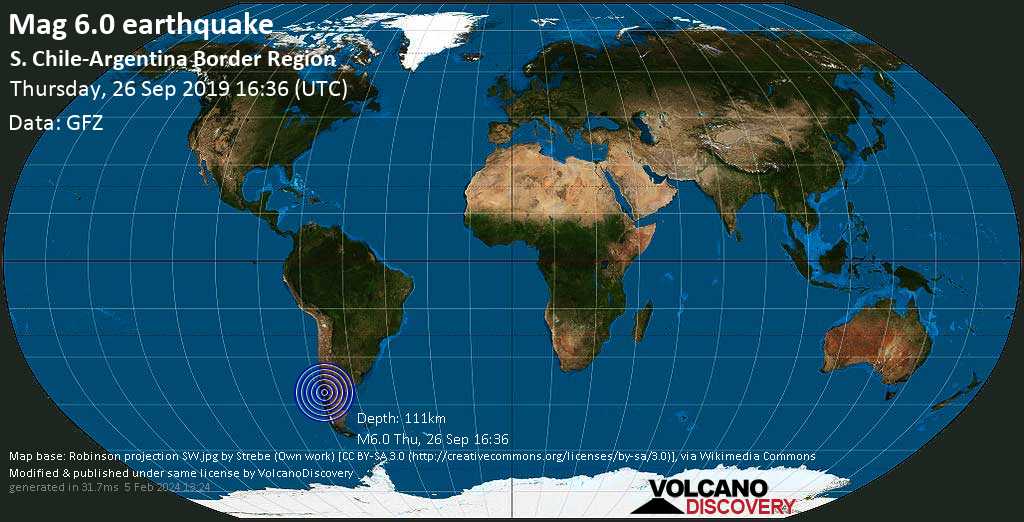
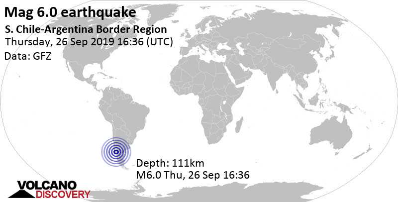
A very strong magnitude 6.0 earthquake hit 99 km (61 mi) away from Osorno, Los Lagos,  Chile, around noon of Thursday, Sep 26, 2019 at 1.36 pm local time (America/Santiago GMT -3). The quake had a moderate depth of 111 km (69 mi) and was felt widely in the area.

Fatalities and economic damage

The earthquake caused some fatalities (1 in total) and injuries, while damage to buildings and infrastructure was insignificant in the areas near the epicenter.
Damage categoryNumber / Order of magnitude
People killed1
Source: NOAA National Centers for Environmental Information (NCEI), Global Significant Earthquake Database. doi:10.7289/V5TD9V7K
Strong mag. 6.0 Earthquake - S. Chile-Argentina Border Region on Thursday, Sep 26, 2019, at 01:36 pm (Santiago time) Strong mag. 6.0 Earthquake - S. Chile-Argentina Border Region on Thursday, Sep 26, 2019, at 01:36 pm (Santiago time)
Strong magnitude 6.0 earthquake at 111 km depth
26 Sep 16:40 UTC: First to report: GFZ after 4 minutes.
Sep 26 16:42: Magnitude recalculated from 6.2 to 6.0.
Hypocenter depth recalculated from 124.0 to 112.0 km.
Hypocenter depth recalculated from 112.0 to 111.0 km.

Earthquake details

Date & timeSep 26, 2019 16:36:17 UTC
Local time at epicenterThursday, Sep 26, 2019, at 01:36 pm (America/Santiago GMT -3)
StatusPreliminary (automatic detection)
Magnitude6.0
Depth111 km
Epicenter latitude / longitude40.68°S / 71.97°W Osorno, Los Lagos, Chile
Also near: Argentina 4 km (2 mi) away
Seismic antipode40.68°N / 108.03°E China
Shaking intensityIV Light shaking near epicenter
Felt27 reports
Primary data sourceGFZ (German Research Centre for Geosciences)
Nearest volcanoCerro Pantoja (10 km / 6 mi)
Estimated seismic energy released6.3 x 1013 joules (17.5 gigawatt hours, equivalent to 15080 tons of TNT or 0.9 atomic bombs!) | about seismic energy
[smaller] [bigger]

Additional info

A shellfish diver died while performing clam extraction work in the town of Carelmapu, in the commune of Maullin, during the earthquake that occurred in the south central area of ​​the country. The 24-year-old, identified as Pablo Huenante Maldonado, was found inside a boat. According to Sago radio, the deputy commissioner of the PDI Homicide Brigade, Paula Orellana, presumed that as a result of the quake, the victim suffered a decompression, which would have caused death. (reference #12520)

Cited references

  • #1053 National Earthquake Information Center (NEIC) (1971 to 2013):

    Preliminary Determination of Epicenters (PDE), a weekly and monthly publication, National Earthquake Information Center, U.S. Geological Survey, Golden, Colorado, 1971 to 2013.

  • #12520 National Television of Chile (2019): Buzo mariscador murio mientras realizaba labores de extraccion durante el sismo de este jueves. Published 27 September 2019. Link
Source: NOAA National Centers for Environmental Information (NCEI), Global Significant Earthquake Database. doi:10.7289/V5TD9V7K

Nearby places

The closest larger town where the quake might have been felt is Osorno, a city with more than 140,000 inhabitants in Chile, in 99 km (61 mi) distance west of the epicenter. People likely experienced light shaking there. Several smaller towns and villages are located closer to the epicenter and might have experienced stronger shaking. In the capital of  Chile, Santiago de Chile, 812 km (504 mi) away from the epicenter, the earthquake was probably felt as very weak shaking.
The following table shows some of the places that might have been affected (or not) by the shaking.
Distance Place Max. shaking intensity(*) Region Country
29 km (18 mi)
E of epicenter
Villa La Angostura
(pop: 7,530)
IV: Light
Los Lagos, Neuquen
53 km (33 mi)
W of epicenter
Puyehue
(pop: 3,930)
IV: Light
Ranco, Los Rios
76 km (47 mi)
SE of epicenter
San Carlos de Bariloche
(pop: 95,400)
IV: Light
Bariloche, Rio Negro
78 km (49 mi)
NE of epicenter
San Martin de Los Andes
(pop: 23,500)
IV: Light
Lacar, Neuquen
92 km (57 mi)
NW of epicenter
Rio Bueno
(pop: 15,500)
IV: Light
Ranco, Los Rios
99 km (61 mi)
W of epicenter
Osorno
(pop: 135,800)
IV: Light
Los Lagos
120 km (74 mi)
SW of epicenter
Puerto Montt
(pop: 160,100)
IV: Light
Llanquihue, Los Lagos
222 km (138 mi)
N of epicenter
Temuco
(pop: 238,100)
III: Weak
Cautin, Araucania
812 km (504 mi)
N of epicenter
Santiago de Chile
(pop: 4,837,300)
II: Very weak
Santiago, Santiago
Notes:
(*) Shaking intensity according to the Modified Mercalli Intensity Scale (MMI) and estimated using seismic models.

User-reports for this quake (42)

We received 28 reports for this quake.
User reports estimate the perceived ground shaking intensity according to the MMI (Modified Mercalli Intensity) scale.
Contribute:
Leave a comment if you find a particular report interesting or want to add to it.
Flag as inappropriate.
Mark as helpful or interesting.
Send your own user report!
Translate
Santiago / Light shaking (MMI IV)
Osorno / Moderate shaking (MMI V)
Chillán / Weak shaking (MMI III)
Vina del Mar / Very strong shaking (MMI VII) : I was on a 15th floor and the building begin to move sideways. I wasn't afraid because through out my entire life I survived 4 strong earthquakes. The last one on September 2015 that one was an 8.8 the strongest one ever !!!  
Warren / Very weak shaking (MMI II)
Santiago airport / Weak shaking (MMI III)
La Vara / Light shaking (MMI IV) : Lamps moving 10cm and the floor moving up and Down.  
puerto montt, chile / Light shaking (MMI IV) : was in a very large concrete hospital and the building could be flt rumbling like heavy object dropped and it lasted couple of seconds maybe 3 or 4  
Valdivia / Moderate shaking (MMI V)
Santiago downtown metro / Light shaking (MMI IV) : Lasted for about 10 seconds  
Talcahuano, Chile. / Very weak shaking (MMI II) : Me encontraba en el segundo nivel de un edificio de tres.  
Russia. Sankt-Peterburg.not felt. / not felt : Без тряски и какой либо вибрации, не почувствовал и не ощущал, был дома, ужинал, всё тихо и спокойно, висяч  
PUERTO MONTT / Moderate shaking (MMI V) : HOLA SENTI EL TEMBLOR EN FORMA MODERADA NO FUE COMO PARA ASUSTARSE, YO ESTABA EN UN 2 PISO SE MOVIÓ TODO, PERO PENSE QUE ERA UN MAREO AL PRINCIPIO.  
Puerto Montt / Moderate shaking (MMI V)
Valdivia / Moderate shaking (MMI V)
Bariloche / Weak shaking (MMI III)
villa la angostura / Light shaking (MMI IV) : Se sintio un golpe seco fuerte y despues sacudidas  
Ancud chiloe / Moderate shaking (MMI V) : Un sacudon suave bajó de intencidad y despues movió fuerte  
Valdivia / Moderate shaking (MMI V)
Valdivia / Light shaking (MMI IV)
Temuco / Moderate shaking (MMI V)
Puerto Varas Chile / Strong shaking (MMI VI)
San Carlos de Bariloche / Light shaking (MMI IV)
Los Angeles / Weak shaking (MMI III)
Puerto Montt / Moderate shaking (MMI V)
Bariloche / Light shaking (MMI IV)
Puerto Varas / Moderate shaking (MMI V) : Das Haus wackelte ein wenig und es dauerte etwa 5 Sekunden  
Valdivia / Moderate shaking (MMI V)
Estación Central (Chile, 813 km N of epicenter) : Temblor medio, grado 6 Región de los Lagos , Chile. (reported through EMSC)  
Temuco (Chile, 228 km NW of epicenter) : Se movió bastante (reported through EMSC)  
Temuco (Chile, 228 km NW of epicenter) : He felt strong in Temuco, the "P" and "S" waves of the earthquake were appreciable. (reported through EMSC)  
Show more
Show more

What is Intensity and the Mercalli Intensity Scale?


The amount of shaking that occurs on the surface due to an earthquake is called the intensity. It is commonly measured on the so-called Modified Mercalli Intensity Scale (MMI) ranging from 1 (not felt) to 10 (extreme shaking), and given in Roman numerals as I,II,...IX, X, and often displayed with color codes ranging from light blue to dark red.
Earthquake intensity depends mainly on the magnitude and depth of the quake as well as the distance from the epicenter: The further away, the less shaking intensity occurs.
Read more about the MMI scale!

Compare Quake Data

Data for the same earthquake as reported by different agencies

The more agencies report about the same quake and post similar data, the more confidence you can have in the data. It takes normally up to a few hours until earthquake parameters are calculated with near-optimum precision.
Mag Depth Time GMT
2019-09-26
Epicenter Agency
6.0 111 km
69 mi
16:36:17 S. Chile-Argentina Border Region GFZ (German Research Centre for Geosciences)
6.1 122 km
76 mi
16:36:17 Los Lagos, Chile (Argentina)
6.1 km (3.8 mi) epicenter difference with GFZ
EMSC (European-Mediterranean Seismological Centre)
6.0 117 km
73 mi
16:36:16 Chile-Argentina Border Region
12 km (7.3 mi) epicenter difference with GFZ
GeoAu (Geoscience Australia )
6.0 129 km
80 mi
16:36:18 Chile [Land]
4.8 km (3 mi) epicenter difference with GFZ
INGV (Istituto Nazionale di Geofisica e Vulcanologia)
6.0 140 km
87 mi
16:36:17 31 km al SE de Entre Lagos (Chile)
32 km (20 mi) epicenter difference with GFZ
CSN (National Seismological Center (Centro Sismológico Nacional))
6.1 129 km
80 mi
16:36:18 30 km W of Villa La Angostura, Argentina
15 km (9.4 mi) epicenter difference with GFZ
USGS (United States Geological Survey)
5.8 10 km
6.2 mi
(*)
16:36:06 S. Chile-Argentina Border Region
14 km (8.5 mi) epicenter difference with GFZ
BMKG (Meteorological, Climatological, and Geophysical Agency of Indonesia)
Notes:
(*) A depth given as 10 km often means that the the depth of the quake could not determined with sufficient accuracy.

Seismograms

Seismic station: Tornquist, Argentina (TRQA/IU network) | Distance from quake: 906 km / 563 mi | Show on map | Station Info
Seismic station Tornquist, Argentina: vertical movement plot around time of quake (source: IRIS/BUD)
Seismogram (vertical component) around time of quake. Thin dotted red line indicates time of quake. Seismic waves arrive some time later, depending on distance. Bandpass filter applied: 0.02-5.0 Hz. Source: IRIS Buffer of Uniform Data (BUD) webtool
Show more

Aftershocks for this quake

No aftershocks have been recorded so far. When aftershocks are detected, we will update this section.

What are aftershocks?


Larger earthquakes (above magnitude 5 or so) such as this one are usually followed by smaller ones known as aftershocks that occur in the same area during the days, weeks, months or even years after the main shock.
[More info]

What about this quake?


Based on its magnitude, the fault that was active during the quake likely ruptured beneath a surface of approx. 100 km2 (=39 sqare miles) as a first-order estimate. The length of the rupture zone thus was probably around 17 km (11 mi).
[More info]


Recorded aftershocks, latest first (0 quake)

Date and Time GMTMag
Depth
DistanceRegionDetails
Sep 26, 2019 01:36 pm (Santiago)
5 years ago - felt
6.0

111 km
0 km - This quake99 km E of Osorno, Osorno, Los Lagos, Chile
Main Shock (this quake)
More

Map of aftershocks

Earthquake statistics

Average number of earthquakes

Based on data from the past 54 years and our earthquake archive back to 1900, there are about 14.9 quakes on average per year in the area near the epicenter of this quake (within 100 km/61 mi):
  • Mag. 6 or higher: 0.03 quakes per year (or 1 quake every 31.3 years)
  • Mag. 5 or higher: 0.16 quakes per year (or 1 quake every 6.2 years)
  • Mag. 4 or higher: 2.9 quakes per year
  • Mag. 3 or higher: 11.4 quakes per year
  • Mag. 2 or higher: 14.3 quakes per year
The area where this quake occurred has a moderate level of seismic activity. However, It has had at least 4 quakes above magnitude 6 since 1900, which suggests that larger earthquakes of this size occur infrequently, probably on average approximately every 30 to 35 years.

Number of quakes per year

Previous quakes in the same area of this earthquake

Strongest in 9 years

The earthquake was the strongest to hit this part of  Chile in over 9 years. Earlier, the last quake of equal or greater strength near the present epicenter had been a magnitude 7.2 earthquake on Sunday, Jan 2, 2011, at 04:20 pm local time (America/Santiago GMT -4) in 284 km (176 mi) distance to the northwest:
Mag. 7.2 earthquake Malleco - Araucania, Chile - Jan 2, 2011 -
The strongest-ever (since 1900) recorded quake in this area measured magnitude 7.7. It had occurred 49 years ago earlier, on Saturday, May 10, 1975, at 10:27 am local time (America/Santiago GMT -4) in Biobio,  Chile:
Mag. 7.7 earthquake Bio-Bio - Chile - May 10, 1975 -
Below is a list and map of (larger or recent) quakes that had occurred near the area of the epicenter before this earthquake (within up to 100 km/61 mi distance, up to 300 km/183 mi for very large quakes above mag. 7). Filter the list to limit the number to show, by magnitude or time before.
Date and TimeMag
Depth
DistanceLocationDetailsMap
Aug 13, 2019 03:46 am (Santiago)
4.3

133 km
58 km (36 mi) to the N Los Lagos, Chile 2 reportsInfo
May 22, 2019 12:23 am (Santiago)
4.8

47 km
85 km (53 mi) to the W 20 km al NE de Osorno (Chile) 21 reportsInfo
Jan 18, 2019 09:34 am (Santiago)
4.0

51 km
92 km (57 mi) to the W 8 km al E de Osorno 5 reportsInfo
Nov 26, 2018 11:12 am (Salta)
4.5

161 km
99 km (61 mi) to the N 36 km al NO de San Martín de Los Andes 1 report
Info
Oct 17, 2018 07:34 am (Salta)
4.1

155 km
98 km (61 mi) to the N Los Lagos, Chile
Info
Mar 5, 2017 11:56 pm (Santiago)
4.8

133 km
36 km (23 mi) to the N S. Chile-Argentina Border Region 2 reportsInfo
Apr 22, 2015 04:55 pm (Santiago)
4.6

10 km
93 km (58 mi) to the SW 18 km WSW of La Ensenada, Chile
Info
May 29, 2014 11:25 pm (Santiago)
4.6

74 km
68 km (42 mi) to the NW Central Chile
Info
Jun 4, 2011 02:54 pm (Salta)
4.9

14 km
32 km (20 mi) to the NE Neuquen, Argentina
Info
Jun 4, 2011 01:00 pm (Santiago)
4.7

10 km
39 km (24 mi) to the NE Los Lagos, Chile
Info
Jun 4, 2011 12:28 pm (Santiago)
5.0

9.8 km
16 km (9.9 mi) to the N Los Lagos, Chile Info
Jun 4, 2011 12:24 pm (Santiago)
4.7

13 km
26 km (16 mi) to the NW Los Lagos, Chile
Info
Jun 4, 2011 11:05 am (Santiago)
4.7

7.2 km
23 km (14 mi) to the NW Los Lagos, Chile
Info
Jun 4, 2011 09:58 am (Santiago)
4.9

13 km
32 km (20 mi) to the NW Los Lagos, Chile
Info
Jun 4, 2011 10:48 am (Salta)
4.7

10 km
31 km (19 mi) to the NE Chile
Info
Jun 4, 2011 09:20 am (Santiago)
4.7

13 km
30 km (19 mi) to the N Los Lagos, Chile
Info
Jun 4, 2011 08:23 am (Santiago)
4.8

13 km
23 km (15 mi) to the NW Los Lagos, Chile
Info
Apr 27, 2011 02:56 am (Santiago)
4.8

41 km
41 km (26 mi) to the NE Los Lagos, Chile
Info
Jan 2, 2011 04:20 pm (Santiago)
7.2

24 km
284 km (176 mi) to the NW Araucania, Chile Info
Dec 14, 2010 12:42 pm (Santiago)
4.5

35 km
24 km (15 mi) to the NW Los Lagos, Chile
Info
Sep 26, 2010 01:29 am (Santiago)
5.0

61 km
72 km (44 mi) to the W Los Lagos, Chile Info
May 24, 2010 05:14 am (Santiago)
4.6

35 km
34 km (21 mi) to the N Los Lagos, Chile
Info
Mar 2, 2009 04:43 am (Salta)
4.7

177 km
73 km (45 mi) to the NE Neuquen, Argentina
Info
Dec 13, 2007 01:34 am (Santiago)
5.0

9.2 km
22 km (14 mi) to the W Los Lagos, Chile Info
Aug 20, 2007 06:52 pm (Salta)
4.8

50 km
34 km (21 mi) to the NE Los Lagos, Chile (Argentina)
Info
Mar 27, 1999 07:13 am (Santiago)
5.5

33 km
73 km (45 mi) to the N Los Lagos, Chile Info
Sep 3, 1993 02:14 pm (Santiago)
5.2

33 km
92 km (57 mi) to the SW Los Lagos, Chile Info
May 28, 1991 12:54 am (Santiago)
4.9

48 km
94 km (58 mi) to the NW Los Lagos, Chile
Info
Jul 31, 1987 12:29 pm (Santiago)
5.2

33 km
51 km (32 mi) to the W Los Lagos, Chile Info
Jan 20, 1983 04:54 pm (Santiago)
5.0

33 km
41 km (26 mi) to the SW Los Lagos, Chile Info
Apr 22, 1979 09:31 pm (Santiago)
4.8

62 km
64 km (40 mi) to the N Los Lagos, Chile
Info
Dec 5, 1978 06:24 am (Santiago)
4.8

33 km
88 km (55 mi) to the N Los Lagos, Chile
Info
May 10, 1975 10:27 am (Santiago)
7.7

6 km
298 km (185 mi) to the N Bio-Bio, Chile Info
Aug 18, 1974 06:44 am (Santiago)
7.1

36 km
278 km (172 mi) to the NW Araucania, Chile Info
Jun 19, 1960 10:01 pm (Santiago)
7.0

25 km
292 km (182 mi) to the N Araucania, Chile Info
Jul 27, 1955 09:59 pm (Santiago)
6.1

15 km
14 km (8.8 mi) to the S Llanquihue, 97 km east of Osorno, Osorno, Los Lagos, Chile Info
Mar 1, 1934 09:45 pm (Universal Time)
6.6

15 km
55 km (34 mi) to the NW Los Lagos, Chile Info
Dec 10, 1920 04:25 am (Universal Time)
7.3

25 km
217 km (135 mi) to the NW Neuquen, Argentina Info
Mar 2, 1919 11:45 am (Universal Time)
7.2

15 km
268 km (167 mi) to the S Chubut, Argentina Info
Jun 13, 1907 09:18 am (Universal Time)
6.9

15 km
71 km (44 mi) to the N 48 km SSE of Panguipulli, Chile Info

Map of earlier quakes in the area of this quake

[smaller] [bigger]

Map to embed or share

Try our free app!
Volcanoes & Earthquakes - new app for Android
Android | iOS version
Why is there advertising on this site?

Support us - Help us upgrade our services!

We truly love working to bring you the latest volcano and earthquake data from around the world. Maintaining our website and our free apps does require, however, considerable time and resources.
We need financing to increase hard- and software capacity as well as support our editor team. We're aiming to achieve uninterrupted service wherever an earthquake or volcano eruption unfolds, and your donations can make it happen! Every donation will be highly appreciated. If you find the information useful and would like to support our team in integrating further features, write great content, and in upgrading our soft- and hardware, please make a donation (PayPal or Online credit card payment).

Planned features:Thanks to your past donations, these features have been added recently:
Download and Upgrade the Volcanoes & Earthquakes app to get one of the fastest seismic and volcano alerts online:
Android | IOS
Thank you!
Sources: VolcanoDiscovery / VolcanoAdventures and other sources as noted.
Use of material: Most text and images on our websites are owned by us. Re-use is generally not permitted without authorization. Contact us for licensing rights.
Volcanoes & Earthquakes
VolcanoDiscovery Home
Volcanoes | Earthquakes | Photos | Volcano News | App
Adventure & Study Travel
Tours to Volcanoes and Volcanic Areas: walking tours, photo tours, study tours
Tours & Dates | FAQ | About us
Get our newsletter!
Company info
Contact | Legal info | Terms & conditions
Follow us
Follow us on facebook Follow us on Instagram Follow us on Twitter Visit our Youtube channel
EN | DE | EL | ES | FR | IT | RU
VolcanoDiscovery GmbH, Germany, Reg. nr.: HRB 103744, EU Tax Id: DE 297 465 123 owned and created by
Dr. Tom Pfeiffer, volcanologist, volcano photographer, tour organizer member of
IAVCEI
IAVCEI
Vulkanologische Gesellschaft
Volcanological Society
Ecotourism Greece
Ecotourism Greece
RUV insurance
Insured by R+V
VolcanoDiscovery © 2004- All Rights Reserved | Privacy - Cookie Settings