Contact | RSS | EN | DE | EL | ES | FR | IT | RU

Moderate mag. 5.7 earthquake - 39 Km Al SO De Taltal, Chile on Wednesday, 21 October 2020 - information

Strong mag. 5.7 Earthquake - 39 Km Al SO De Taltal, Chile, on Wednesday, Oct 21, 2020, at 06:13 am (Santiago time)

A strong magnitude 5.7 earthquake occurred in the South Pacific Ocean near the coast of Antofagasta Region,  Chile, in the early morning of Wednesday, Oct 21, 2020 at 6.13 am local time (America/Santiago GMT -3). The quake had a very shallow depth of 24 km (15 mi) and was reported felt by some people near the epicenter.
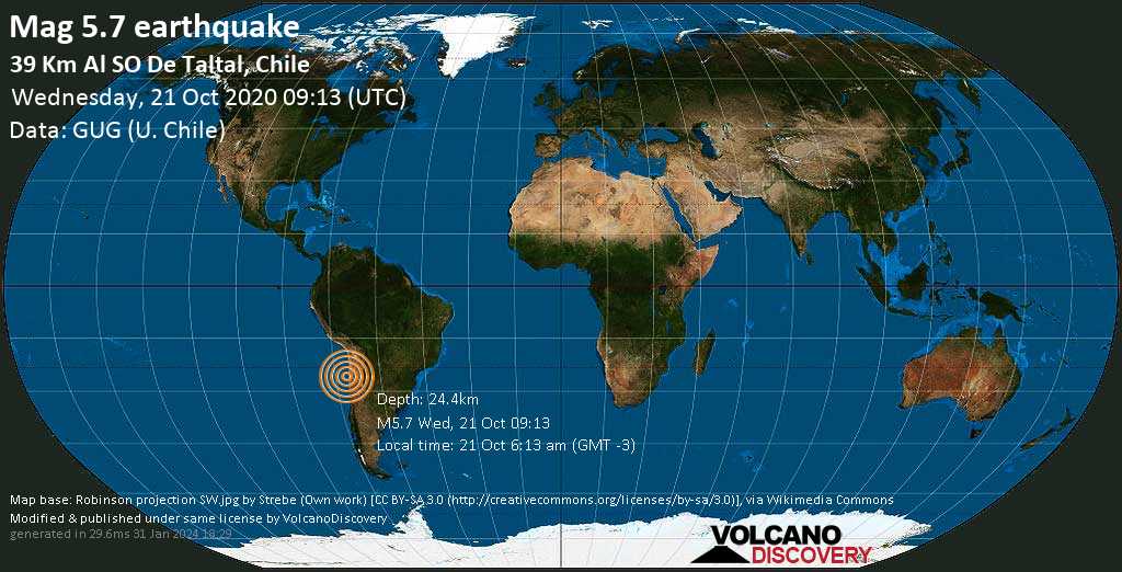
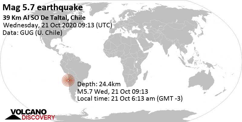
Strong mag. 5.7 Earthquake - 39 Km Al SO De Taltal, Chile, on Wednesday, Oct 21, 2020, at 06:13 am (Santiago time) Strong mag. 5.7 Earthquake - 39 Km Al SO De Taltal, Chile, on Wednesday, Oct 21, 2020, at 06:13 am (Santiago time)
Strong magnitude 5.7 earthquake at 24 km depth
21 Oct 09:16 UTC: First to report: GFZ after 3 minutes.
21 Oct 09:19: Magnitude recalculated from 6.0 to 5.4. Epicenter location corrected by 29 km (18.2 mi) towards E.
... [show all] ...
21 Oct 11:20: Hypocenter depth recalculated from 30.1 to 24.4 km (from 18.7 to 15.2 mi). Epicenter location corrected by 10.2 km (6.3 mi) towards E.
Update Wed, 21 Oct 2020, 09:28
The quake has already been downgraded to around magnitude 5.5, which is ten times weaker (and less dangerous) than a magnitude 6 event. Final calculations will still take some time.
Update Wed, 21 Oct 2020, 09:17

Significant earthquake 6.0 strikes 227 km N of Copiapó, Chile

The German Research Centre for Geosciences in Potsdam (GFZ) reported a magnitude 6.0 quake in Chile only 5 minutes ago. The earthquake happened at a shallow depth of 10 km (6.2 miles). The magnitude, exact epicenter location and depth could be revised within the next few minutes as the agency updates and refines its calculations, or as other agencies issue their report.
Based on the preliminary seismic data, the quake should have been widely felt by almost everyone in the area of the epicenter. It might have caused light to moderate damage.
Towns and cities near the epicenter that are likely to be affected include Taltal (pop. 10,000) in 72 km (45 miles) distance with moderate ground shaking expected, Diego de Almagro (pop. 18,100) in 152 km (94 miles) distance, light shaking expected, Antofagasta (pop. 309,800) in 219 km (136 miles) distance, light shaking expected, Copiapó (pop. 129,300) in 227 km (141 miles) distance, light shaking expected.
This story will be updated soon by VolcanoDiscovery. If you're in the area, please send us your experience through our reporting mechanism. This will help us provide more first-hand updates to anyone around the globe who wants to know more about this quake.
Download the Volcanoes & Earthquakes app and get one of the fastest seismic alerts online: Android | iOS

Earthquake details

Date & timeOct 21, 2020 09:13:07 UTC
Local time at epicenterWednesday, Oct 21, 2020, at 06:13 am (America/Santiago GMT -3)
StatusConfirmed
Magnitude5.7
Depth24.4 km
Epicenter latitude / longitude25.572°S / 70.833°W South Pacific Ocean, Antofagasta, Chile
Seismic antipode25.572°N / 109.167°E China
Shaking intensityV Moderate shaking near epicenter
Felt1 report
Primary data sourceCSN (National Seismological Center (Centro Sismológico Nacional))
Nearest volcanoCerro Bayo (225 km / 140 mi)
Weather at epicenter at time of quakeOvercast Clouds 14.1°C (57 F), humidity: 83%, wind: 4 m/s (9 kts) from S
Estimated seismic energy released2.2 x 1013 joules (6.22 gigawatt hours, equivalent to 5351 tons of TNT or 0.3 atomic bombs!) | about seismic energy
[smaller] [bigger]

Nearby places

The closest larger town where the quake might have been felt is Taltal, a town with 10,000 inhabitants in Chile, in 39 km (24 mi) distance northeast of the epicenter. People likely experienced moderate shaking there. In the capital of  Chile, Santiago de Chile, 877 km (545 mi) away from the epicenter, the earthquake was probably felt as very weak shaking.
The following table shows some of the places that might have been affected (or not) by the shaking.
Distance Place Max. shaking intensity(*) Region Country
39 km (24 mi)
NE of epicenter
Taltal
(pop: 10,000)
V: Moderate
Antofagasta, Antofagasta
118 km (73 mi)
SE of epicenter
Diego de Almagro
(pop: 18,100)
IV: Light
Chanaral, Atacama
206 km (128 mi)
S of epicenter
Copiapo
(pop: 129,300)
III: Weak
Copiapo, Atacama
218 km (135 mi)
N of epicenter
Antofagasta
(pop: 309,800)
III: Weak
Antofagasta
334 km (208 mi)
S of epicenter
Vallenar
(pop: 44,900)
III: Weak
Huasco, Atacama
392 km (244 mi)
N of epicenter
Tocopilla
(pop: 24,500)
III: Weak
Antofagasta
397 km (247 mi)
NE of epicenter
Calama
(pop: 143,100)
III: Weak
El Loa, Antofagasta
399 km (248 mi)
NE of epicenter
San Pedro de Atacama
(pop: 2,000)
III: Weak
El Loa, Antofagasta
518 km (322 mi)
SE of epicenter
Chilecito
(pop: 42,200)
II: Very weak
La Rioja
877 km (545 mi)
S of epicenter
Santiago de Chile
(pop: 4,837,300)
II: Very weak
Santiago, Santiago
Notes:
(*) Shaking intensity according to the Modified Mercalli Intensity Scale (MMI) and estimated using seismic models.

User-reports for this quake (2)

We received 2 reports for this quake.
User reports estimate the perceived ground shaking intensity according to the MMI (Modified Mercalli Intensity) scale.
Translate
Cleveland Mississippi / Very weak shaking (MMI II) / rattling, vibrating
Foothill Farms ,Ca.USA / not felt

What is Intensity and the Mercalli Intensity Scale?


The amount of shaking that occurs on the surface due to an earthquake is called the intensity. It is commonly measured on the so-called Modified Mercalli Intensity Scale (MMI) ranging from 1 (not felt) to 10 (extreme shaking), and given in Roman numerals as I,II,...IX, X, and often displayed with color codes ranging from light blue to dark red.
Earthquake intensity depends mainly on the magnitude and depth of the quake as well as the distance from the epicenter: The further away, the less shaking intensity occurs.
Read more about the MMI scale!

Compare Quake Data

Data for the same earthquake as reported by different agencies

The more agencies report about the same quake and post similar data, the more confidence you can have in the data. It takes normally up to a few hours until earthquake parameters are calculated with near-optimum precision.
Mag Depth Time GMT
2020-10-21
Epicenter Agency
5.7 24 km
15 mi
09:13:07 39 Km Al SO De Taltal, Chile CSN (National Seismological Center (Centro Sismológico Nacional))
5.8 19 km
12 mi
09:13:03 OCEANO PACIFICO (Argentina), Chile
29 km (18 mi) epicenter difference with GUG (U. Chile)
INPRES
5.7 9 km
5.6 mi
09:13:05 Offshore Antofagasta, Chile
18 km (11 mi) epicenter difference with GUG (U. Chile)
EMSC (European-Mediterranean Seismological Centre)
5.8 9.5 km
5.9 mi
09:13:07 Near Coast of Northern Chile
2.5 km (1.6 mi) epicenter difference with GUG (U. Chile)
GeoAu (Geoscience Australia )
5.7 20 km
12 mi
09:13:07 46 km WSW of Taltal, Chile
11 km (7.1 mi) epicenter difference with GUG (U. Chile)
USGS (United States Geological Survey)
5.3 10 km
6.2 mi
(*)
09:13:08 Near Coast of Northern Chile
48 km (30 mi) epicenter difference with GUG (U. Chile)
BMKG (Meteorological, Climatological, and Geophysical Agency of Indonesia)
5.6 21 km
13 mi
09:13:08 Near Coast of Northern Chile
14 km (8.6 mi) epicenter difference with GUG (U. Chile)
GFZ (German Research Centre for Geosciences)
Notes:
(*) A depth given as 10 km often means that the the depth of the quake could not determined with sufficient accuracy.

Seismograms

Seismic station: Las Campanas Astronomical Observatory, Chile (LCO/IU network) | Distance from quake: 383 km / 238 mi | Show on map | Station Info
Seismic station Las Campanas Astronomical Observatory, Chile: vertical movement plot around time of quake (source: IRIS/BUD)
Seismogram (vertical component) around time of quake. Thin dotted red line indicates time of quake. Seismic waves arrive some time later, depending on distance. Bandpass filter applied: 0.1-10.0 Hz. Source: IRIS Buffer of Uniform Data (BUD) webtool
Show more

15 aftershocks for this quake

For this earthquake, 15 aftershocks have been detected so far. The strongest was a magnitude 3.8 quake that hit 1 hour and 46 minutes after the mainshock in 13.4 km (8 mi) distance, in 52 km west of Taltal, Antofagasta, Chile, on Wednesday, Oct 21, 2020 on 06:58 am (- local time GMT -4).
The most recent aftershock occurred 4 years ago 49 km west of Taltal, Chile, and had a magnitude of 2.6.

What are aftershocks?


Larger earthquakes (above magnitude 5 or so) such as this one are usually followed by smaller ones known as aftershocks that occur in the same area during the days, weeks, months or even years after the main shock.
[More info]

What about this quake?


Based on its magnitude, the fault that was active during the quake likely ruptured beneath a surface of approx. 50 km2 (=19 sqare miles) as a first-order estimate. The length of the rupture zone thus was probably around 12 km (8 mi).
[More info]


Recorded aftershocks, latest first (15 quakes)

Date and Time GMTMag
Depth
DistanceRegionDetails
Nov 10, 2020 07:20 pm (GMT -4)
3 years ago
3 weeks after main shock
2.6

30 km
11 km (6.9 mi)
W of main shock
49 Km Al O De Taltal, ChileMore
Oct 23, 2020 04:32 am (GMT -4)
4 years ago
1 day 23 hours after main shock
3.7

25 km
14 km (9 mi)
W of main shock
51 Km Al O De Taltal, ChileMore
Oct 22, 2020 10:10 pm (GMT -4)
4 years ago
1 day 17 hours after main shock
4.2

15 km
8.1 km (5.1 mi)
NW of main shock
Offshore Antofagasta, ChileMore
Oct 22, 2020 03:19 am (Santiago)
4 years ago
22 hours after main shock
2.7

31 km
4.2 km (2.6 mi)
W of main shock
43 Km Al SO De Taltal, ChileMore
Oct 22, 2020 02:15 am (GMT -4)
4 years ago
21 hours after main shock
3.5

30 km
12 km (7.3 mi)
W of main shock
Offshore Antofagasta, ChileMore
Oct 21, 2020 09:51 pm (GMT -4)
4 years ago
17 hours after main shock
2.7

30 km
9.9 km (6.2 mi)
W of main shock
Offshore Antofagasta, ChileMore
Oct 21, 2020 09:05 pm (GMT -4)
4 years ago
16 hours after main shock
3.0

16 km
14 km (8.7 mi)
NW of main shock
47 Km Al O De Taltal, ChileMore
Oct 21, 2020 05:20 pm (GMT -4)
4 years ago
12 hours after main shock
2.7

37 km
14 km (8.7 mi)
SW of main shock
Offshore Antofagasta, ChileMore
Oct 21, 2020 04:23 pm (Santiago)
4 years ago
11 hours after main shock
2.6

26 km
6 km (3.7 mi)
SW of main shock
45 Km Al SO De Taltal, ChileMore
Oct 21, 2020 04:12 pm (GMT -4)
4 years ago
11 hours after main shock
3.0

24 km
12 km (7.8 mi)
W of main shock
50 Km Al O De Taltal, ChileMore
Oct 21, 2020 12:09 pm (GMT -4)
4 years ago
7 hours after main shock
3.0

28 km
5.9 km (3.7 mi)
NW of main shock
Offshore Antofagasta, ChileMore
Oct 21, 2020 07:21 am (GMT -4)
4 years ago
2 hours and 9 minutes after main shock
3.0

28 km
11 km (7 mi)
W of main shock
Offshore Antofagasta, ChileMore
Oct 21, 2020 06:58 am (GMT -4)
4 years ago
1 hour and 46 minutes after main shock
3.8

24 km
13 km (8.4 mi)
W of main shock
52 Km Al O De Taltal, ChileMore
Oct 21, 2020 06:52 am (GMT -4)
4 years ago
1 hour and 40 minutes after main shock
3.7

25 km
12 km (7.6 mi)
NW of main shock
Offshore Antofagasta, ChileMore
Oct 21, 2020 05:44 am (GMT -4)
4 years ago
31 minutes after main shock
3.4

35 km
14 km (8.6 mi)
W of main shock
Offshore Antofagasta, ChileMore
Oct 21, 2020 06:13 am (Santiago)
4 years ago - felt
5.7

24 km
0 km - This quakeSouth Pacific Ocean, 39 km SW of Taltal, Antofagasta, Chile
Main Shock (this quake)
More

Map of aftershocks

Earthquake statistics

Average number of earthquakes

Based on data from the past 54 years and our earthquake archive back to 1900, there are about 88 quakes on average per year in the area near the epicenter of this quake (within 100 km/61 mi):
  • Mag. 7 or higher: 0.03 quakes per year (or 1 quake every 31.3 years)
  • Mag. 6 or higher: 0.14 quakes per year (or 1 quake every 7 years)
  • Mag. 5 or higher: 1.52 quakes per year
  • Mag. 4 or higher: 11.7 quakes per year
  • Mag. 3 or higher: 48 quakes per year (or 4 quakes per month)
  • Mag. 2 or higher: 88 quakes per year (or 7.4 quakes per month)
The area where this quake occurred has a very high level of seismic activity. It has had at least 4 quakes above magnitude 7 since 1900, which suggests that larger earthquakes of this size occur infrequently, probably on average approximately every 30 to 35 years.

Number of quakes per year

Previous quakes in the same area of this earthquake

Map of earlier quakes in the area of this quake

[smaller] [bigger]

Map to embed or share

Try our free app!
Volcanoes & Earthquakes - new app for Android
Android | iOS version

More on VolcanoDiscovery

Why is there advertising on this site?

Support us - Help us upgrade our services!

We truly love working to bring you the latest volcano and earthquake data from around the world. Maintaining our website and our free apps does require, however, considerable time and resources.
We need financing to increase hard- and software capacity as well as support our editor team. We're aiming to achieve uninterrupted service wherever an earthquake or volcano eruption unfolds, and your donations can make it happen! Every donation will be highly appreciated. If you find the information useful and would like to support our team in integrating further features, write great content, and in upgrading our soft- and hardware, please make a donation (PayPal or Online credit card payment).

Planned features:Thanks to your past donations, these features have been added recently:
Download and Upgrade the Volcanoes & Earthquakes app to get one of the fastest seismic and volcano alerts online:
Android | IOS
Thank you!
Sources: VolcanoDiscovery / VolcanoAdventures and other sources as noted.
Use of material: Most text and images on our websites are owned by us. Re-use is generally not permitted without authorization. Contact us for licensing rights.
Volcanoes & Earthquakes
VolcanoDiscovery Home
Volcanoes | Earthquakes | Photos | Volcano News | App
Adventure & Study Travel
Tours to Volcanoes and Volcanic Areas: walking tours, photo tours, study tours
Tours & Dates | FAQ | About us
Get our newsletter!
Company info
Contact | Legal info | Terms & conditions
Follow us
Follow us on facebook Follow us on Instagram Follow us on Twitter Visit our Youtube channel
EN | DE | EL | ES | FR | IT | RU
VolcanoDiscovery GmbH, Germany, Reg. nr.: HRB 103744, EU Tax Id: DE 297 465 123 owned and created by
Dr. Tom Pfeiffer, volcanologist, volcano photographer, tour organizer member of
IAVCEI
IAVCEI
Vulkanologische Gesellschaft
Volcanological Society
Ecotourism Greece
Ecotourism Greece
RUV insurance
Insured by R+V
VolcanoDiscovery © 2004- All Rights Reserved | Privacy - Cookie Settings