SEARCH
| Latest today See all | Mag. 0.7 earthquake 2 km N of The Geysers - CA - |
| Latest felt | Mag. 2.6 earthquake 13 km S of Rancho Palos Verdes - CA - |
| Strongest today | Mag. 3.0 72 km W of Petrolia - CA - |
Date and Time | Mag Depth | Nearest Volcano | Location | Details | Map |
|---|---|---|---|---|---|
| Apr 17, 05:05 pm (GMT -7) | 0.7 0.9 km | Info | |||
| Wednesday, April 17, 2024 GMT (116 quakes) | |||||
| Apr 17, 04:54 pm (GMT -7) | 1.0 17 km | Info | |||
| Apr 17, 04:05 pm (Los Angeles) | 0.8 9.4 km | Info | |||
| Apr 17, 03:53 pm (Los Angeles) | 1.2 0.4 km | 10 km (6.2 mi) to the S | Info | ||
| Apr 17, 03:47 pm (Los Angeles) | 1.1 4.1 km | Info | |||
| Apr 17, 03:26 pm (Los Angeles) | 1.0 11 km | Info | |||
| Apr 17, 02:54 pm (Los Angeles) | 1.4 3.4 km | Info | |||
| Apr 17, 02:08 pm (Los Angeles) | 0.7 2.9 km | Info | |||
| Apr 17, 02:01 pm (Los Angeles) | 2.0 7.7 km | 51 km (32 mi) to the E | Info | ||
| Apr 17, 01:59 pm (Los Angeles) | 0.6 7.8 km | Info | |||
| Apr 17, 01:50 pm (Los Angeles) | 0.9 12 km | Info | |||
| or | ||
Look up quakes! | ||
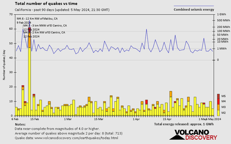
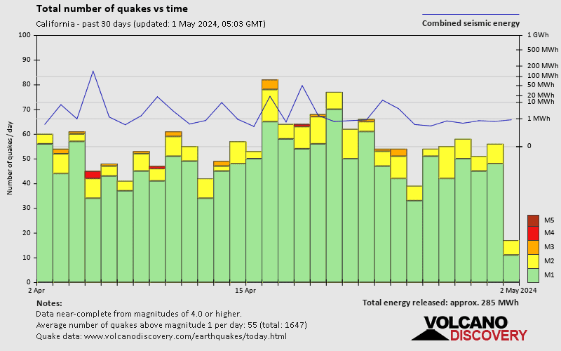
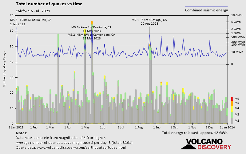
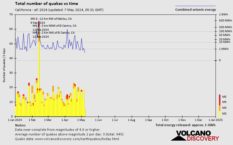
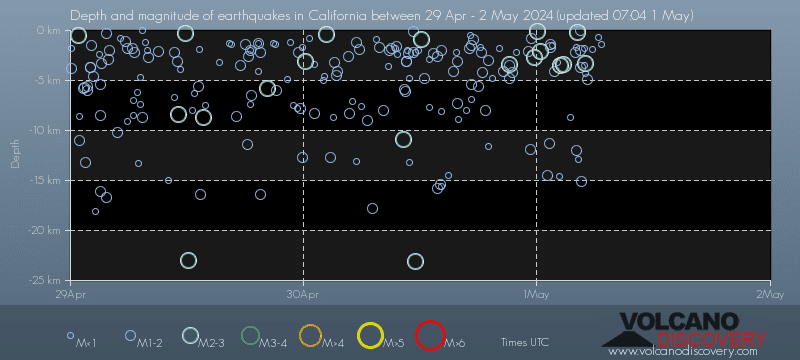
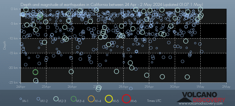
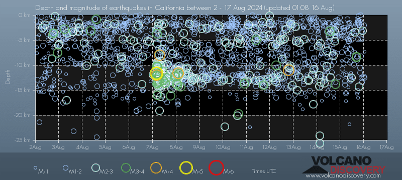
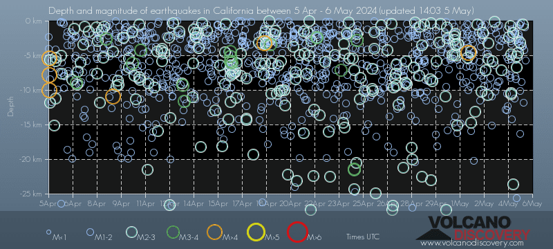
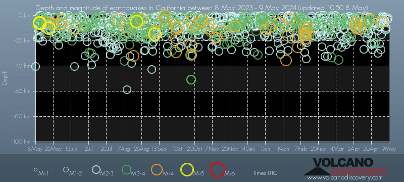
California has a high level of seismic activity. Based on data from the past 14 years and our earthquake archive back to 1900, there are about 43,000 quakes on average per year in or near California. California has had at least 33 quakes above magnitude 7 since 1900, which suggests that larger earthquakes of this size occur infrequently, probably on average approximately every 1 to 5 years.
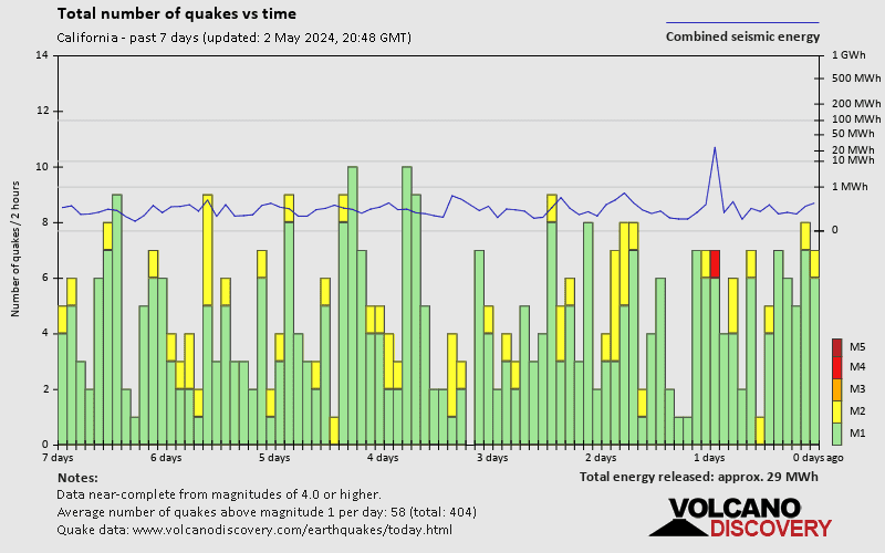
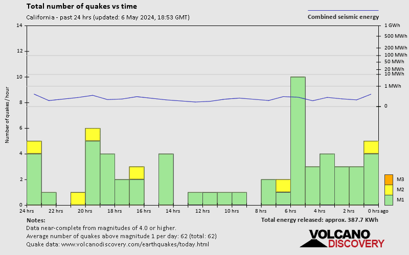
California has about 10-15 quakes every day. Most of them are too small to be felt by humans, although there is usually one or two that are.
Typically there are 1-2 quakes of magnitudes greater than 3 every day. Quakes of magnitude 4+ occur about once every 5 days on average.
Magnitude 5+ events are about once every 2 months, and strong quakes from magnitude 6+ occur on average once every 4-5 months.
California is located near the boundary between the Pacific and North American tectonic plates. In the area of California, it is called a transform boundary, because the movement of the two plates is mostly a side-wise sliding alongside each other. The Pacific Plate is moving northwest relative to the North American plate, at a rate of approx. 33-37 millimeters (1.3-1.5 in) per year on average.
This creates a complex system of very active fault systems, the most prominent being the San Andreas Fault, which runs for roughly 750 mi (1,200 km) through California. However, there are also many other faults including some found directly underneath the State's major cities including L.A. and San Francisco.
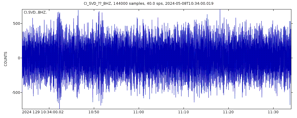
The last earthquake in or near California occurred 7 minutes ago and had a magnitude of 0.7:
A light magnitude 0.7 earthquake hit 40 km (25 mi) away from Santa Rosa, California, ![]() United States, in the afternoon of Wednesday, Apr 17, 2024 at 5.05 pm local time (GMT -7). The quake had a very shallow depth of 0.9 km (0.6 mi) and was too small to be felt by people.
United States, in the afternoon of Wednesday, Apr 17, 2024 at 5.05 pm local time (GMT -7). The quake had a very shallow depth of 0.9 km (0.6 mi) and was too small to be felt by people.
In the past 24 hours, California has had 0 quakes of magnitude 3.0 or above and 6 quakes between 2.0 and 3.0. There were also 106 quakes below magnitude 2.0 which people don't normally feel.
The strongest earthquake in or near California in the past 24 hours had a magnitude of 3.0 and occurred 7 hours ago:
A light magnitude 3.0 earthquake occurred in the North Pacific Ocean near the coast of ![]() United States in the morning of Wednesday, Apr 17, 2024 at 9.02 am local time (GMT -8). The quake had a very shallow depth of 14.4 km (9 mi) and was not felt (or at least not reported so).
United States in the morning of Wednesday, Apr 17, 2024 at 9.02 am local time (GMT -8). The quake had a very shallow depth of 14.4 km (9 mi) and was not felt (or at least not reported so).