SEARCH
| Latest See all | Mag. 2.3 earthquake 11 mi west of Mount Vernon - Illinois, United States - |
| Strongest since 1970 | Mag. 5.2 2 km ESE of Claremont - Illinois - Jun 10, 1987 - |
Date and Time | Mag Depth | Nearest Volcano | Location | Details | Map |
|---|---|---|---|---|---|
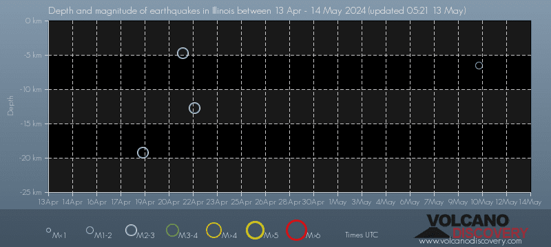
| Apr 18, 08:05 pm (Chicago) | 2.3 19 km | Info | |||
| Saturday, April 13, 2024 GMT (1 quake) | |||||
| Apr 13, 02:31 pm (Chicago) | 2.3 7.1 km | 90 km (56 mi) to the S | Info | ||
| Friday, April 12, 2024 GMT (1 quake) | |||||
| Apr 12, 03:36 am (Chicago) | 2.8 13 km | 67 km (42 mi) to the S | Info | ||
| Friday, April 5, 2024 GMT (2 quakes) | |||||
| Apr 5, 01:30 am (Chicago) | 2.4 12 km | 65 km (40 mi) to the S | Info | ||
| Apr 5, 01:17 am (Chicago) | 2.1 7.7 km | 90 km (56 mi) to the S | Info | ||
| Tuesday, April 2, 2024 GMT (1 quake) | |||||
| Apr 2, 03:53 am (GMT -5) | ? n/a | 23 km (14 mi) to the SW | Info | ||
| Friday, March 29, 2024 GMT (1 quake) | |||||
| Mar 28, 07:30 pm (GMT -5) | ? n/a | Info | |||
| Thursday, March 28, 2024 GMT (1 quake) | |||||
| Mar 28, 06:55 pm (Chicago) | 2.8 24 km | Info | |||
| Tuesday, March 5, 2024 GMT (2 quakes) | |||||
| Mar 5, 05:14 pm (GMT -6) | 2.4 8 km | 79 km (49 mi) to the S | Info | ||
| Mar 5, 10:34 am (Chicago) | 2.5 17 km | Info | |||
| Thursday, February 29, 2024 GMT (1 quake) | |||||
| Feb 29, 03:45 am (Chicago) | 2.0 5.4 km | Info | |||
| or | ||
Look up quakes! | ||
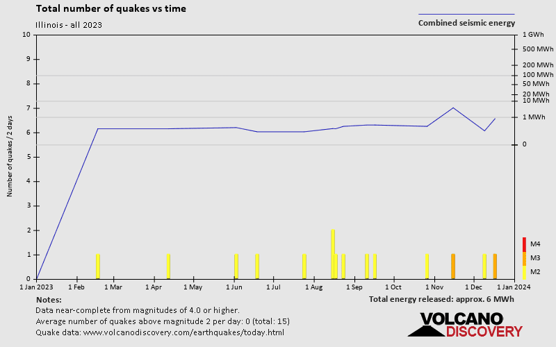
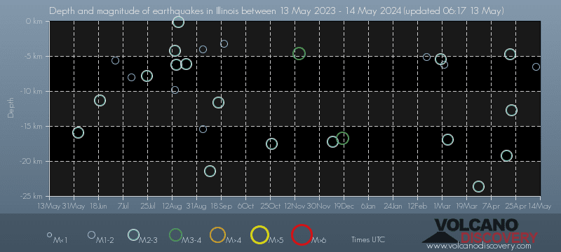
Illinois has very few earthquakes and most of them are very small (below magnitude 3). Larger quakes with magnitudes above 3 might occur from time to time. Based on data from the past 54 years and our earthquake archive back to 1900, there are about 10.8 quakes on average per year in or near Illinois, USA. However, Illinois has had at least 4 quakes above magnitude 7 since 1900, which suggests that larger earthquakes of this size occur infrequently, probably on average approximately every 30 to 35 years.
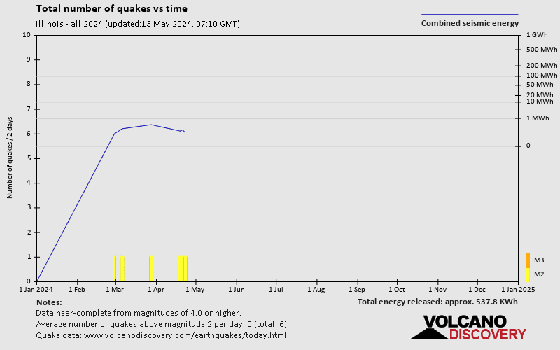
On average, Illinois has about 11.2 quakes of magnitude 2 or higher per year.
The last earthquake in Illinois occurred 1 day 9 hours ago and had a magnitude of 2.3:
A light magnitude 2.3 earthquake hit 17.9 km (11 mi) away from Mount Vernon, Illinois, ![]() United States, in the evening of Thursday, Apr 18, 2024 at 8.05 pm local time (America/Chicago GMT -5). The quake had a very shallow depth of 19.2 km (12 mi) and was not felt (or at least not reported so).
United States, in the evening of Thursday, Apr 18, 2024 at 8.05 pm local time (America/Chicago GMT -5). The quake had a very shallow depth of 19.2 km (12 mi) and was not felt (or at least not reported so).
Since 1970, Illinois has had 2 quakes of magnitude 5.0 or above, 14 quakes between 4.0 and 5.0, 85 quakes between 3.0 and 4.0, and 449 quakes between 2.0 and 3.0. There have been also 309 quakes below magnitude 2.0 which people don't normally feel.
The strongest earthquake in Illinois since 1970 had a magnitude of 5.2 and occurred 37 years ago:
A strong magnitude 5.2 earthquake hit 89 km (55 mi) away from Evansville, Indiana, ![]() United States, Wed, Jun 10, 1987 23:48 GMT. The quake had a very shallow depth of 4.6 km (2.9 mi) .
United States, Wed, Jun 10, 1987 23:48 GMT. The quake had a very shallow depth of 4.6 km (2.9 mi) .
Date and Time | Mag Depth | ###DIST_LABEL### | Location | Details | Map |
|---|