SEARCH
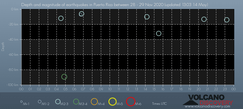
Date and Time | Mag Depth | Nearest Volcano | Location | Details | Map |
|---|---|---|---|---|---|
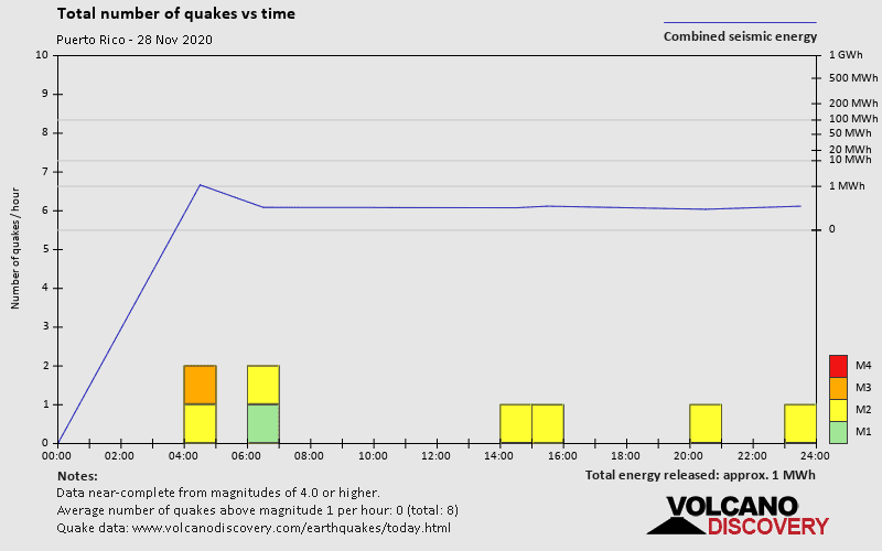
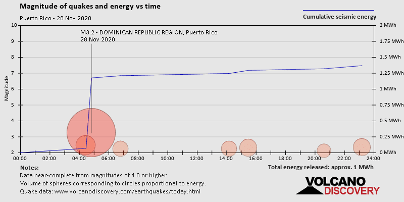
| Nov 28, 2020 07:22 pm (Santo Domingo) | 3.3 103 km | 192 km (119 mi) to the W | Info | ||
| Nov 28, 2020 07:11 pm (Puerto Rico) | 2.3 14 km | 7 km (4.3 mi) to the SW | Info | ||
| Nov 28, 2020 05:57 pm (Santo Domingo) | 3.6 137 km | 93 km (58 mi) to the W | Info | ||
| Nov 28, 2020 05:57 pm (Santo Domingo) | 2.8 141 km | 90 km (56 mi) to the W | Info | ||
| Nov 28, 2020 04:37 pm (Puerto Rico) | 2.1 13 km | 4 km (2.5 mi) to the SW | Info | ||
| Nov 28, 2020 04:19 pm (Santo Domingo) | 2.9 23 km | 299 km (186 mi) to the W | Info | ||
| Nov 28, 2020 03:20 pm (Santo Domingo) | 3.3 10 km | 131 km (81 mi) to the W | Info | ||
| Nov 28, 2020 01:49 pm (Santo Domingo) | 3.0 10 km | 231 km (144 mi) to the W | Info | ||
| Nov 28, 2020 12:55 pm (Santo Domingo) | 3.0 10 km | 288 km (179 mi) to the W | Info | ||
| Nov 28, 2020 11:28 am (Puerto Rico) | 2.3 32 km | Info | |||
| Nov 28, 2020 11:08 am (Santo Domingo) | 3.3 24 km | 287 km (178 mi) to the W | Info |
| or | ||
Look up quakes! | ||