SEARCH
Date and Time | Mag Depth | Nearest Volcano | Location | Details | Map |
|---|---|---|---|---|---|
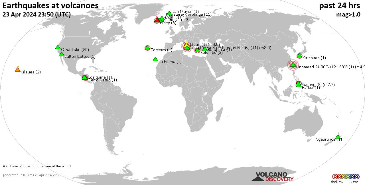
| Apr 23, 08:15 am (Los Angeles) | 0.9 6.6 km | 14 km (8.7 mi) S of | 30 km W of Olancha, CA | Info | |
| Apr 24, 12:04 am (GMT +9) | 2.7 231 km | 6 km (3.7 mi) N of | 33 km north of Muroran, Hokkaido, Japan | Info | |
| Apr 23, 10:43 pm (Manila) | 2.1 1 km | 20 km (12 mi) E of | 8.5 km north of Wao, Lanao del Sur, Mindanao Musulman, Philippines | Info | |
| Apr 23, 07:22 am (Los Angeles) | 1.3 2 km | 16 km (9.9 mi) S of | 27 mi north of Santa Rosa, Sonoma County, California, United States | Info | |
| Apr 23, 04:12 pm (Rome) | 1.1 1.5 km | 2 km (1.2 mi) W of | Italy: Campi Flegrei | Info | |
| Apr 23, 04:07 pm (Rome) | 1.5 1.4 km | 2 km (1.2 mi) W of | Italy: Campi Flegrei | Info | |
| Apr 23, 06:52 am (Los Angeles) | 1.0 21 km | 15 km (9.3 mi) S of | 5 km WNW of Cobb, CA | Info | |
| Apr 23, 06:49 am (Los Angeles) | 0.7 2.2 km | 15 km (9.3 mi) S of | Lake County, 28 mi north of Santa Rosa, Sonoma County, California, United States | Info | |
| Apr 23, 06:38 am (Los Angeles) | 0.9 2.8 km | 19 km (12 mi) S of | 6 km WNW of The Geysers, CA | Info | |
| Apr 23, 01:37 pm (Reykjavik) | 1.2 5 km | 12 km (7.5 mi) NE of | Iceland: 8.8 km WSW of Ásbyrgi | Info | |
| Apr 23, 09:34 am (Santiago) | 2.8 121 km | 20 km (12 mi) SE of | 133 km northeast of Calama, El Loa, Antofagasta, Chile | Info |
| or | ||
Look up quakes! | ||