SEARCH
| Latest today See all | Mag. 1.8 earthquake 1.9 mi northwest of Pendleton - Oregon, United States - |
| Strongest today | Mag. 1.8 1.9 mi northwest of Pendleton - Oregon, United States - |
Date and Time | Mag Depth | Nearest Volcano | Location | Details | Map |
|---|---|---|---|---|---|
| Apr 18, 03:29 pm (Los Angeles) | 1.8 0.6 km | 36 km (22 mi) to the SE | Info | ||
| Apr 18, 01:36 pm (Los Angeles) | 1.1 21 km | Info | |||
| Apr 18, 05:38 am (Los Angeles) | 0.1 1.1 km | Info | |||
| Apr 17, 11:48 pm (GMT -7) | 0.0 6.3 km | Info | |||
| Apr 17, 10:47 pm (Los Angeles) | 1.2 17 km | Info | |||
| Apr 17, 07:26 pm (Los Angeles) | 0.3 3.5 km | Info | |||
| Apr 17, 07:03 pm (Los Angeles) | 1.0 21 km | Info | |||
| Apr 17, 06:26 pm (Los Angeles) | 1.5 0.5 km | Info |

| or | ||
Look up quakes! | ||
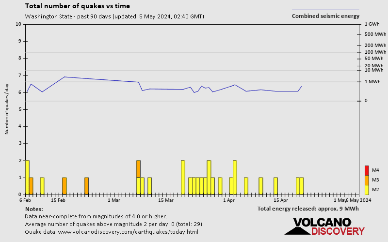
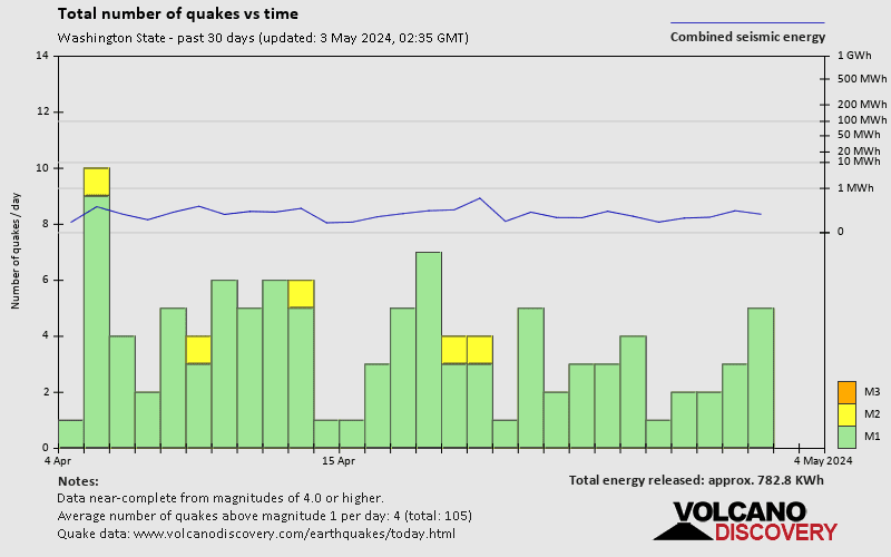
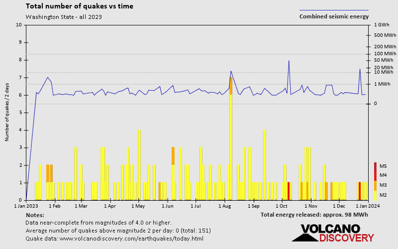

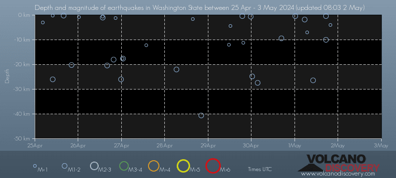
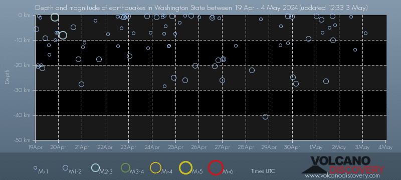
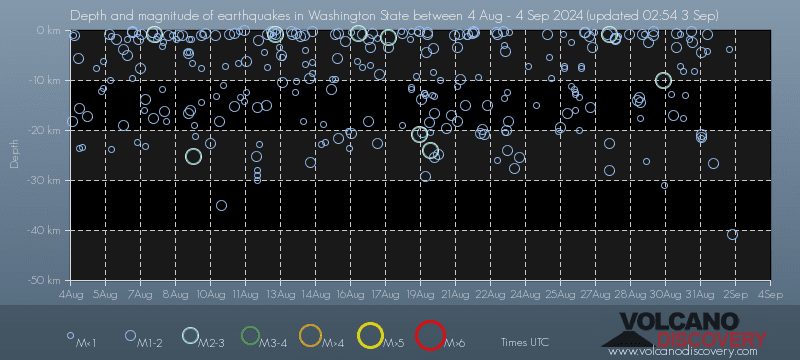
Washington State has relatively few earthquakes. Based on data from the past 54 years and our earthquake archive back to 1900, there are about 1,900 quakes on average per year in or near Washington State, USA. However, Washington State has had at least 5 quakes above magnitude 6 since 1900, which suggests that larger earthquakes of this size occur infrequently, probably on average approximately every 20 to 25 years.
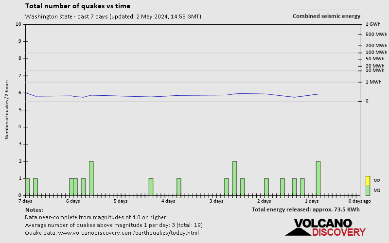
On average, Washington State has about 157 quakes of magnitude 2 or higher per year (Mag 3+: 17.8 quakes per year, Mag 4+: 7.6 quakes per year).
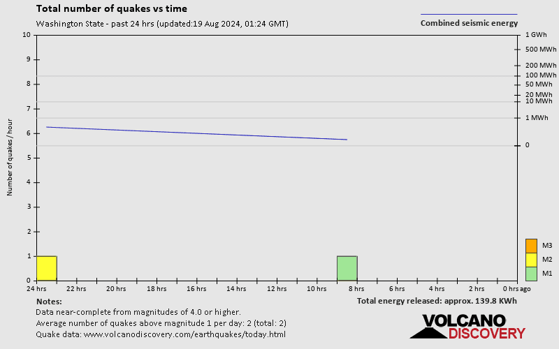
The last earthquake in Washington State occurred 2 hours and 53 minutes ago and had a magnitude of 1.8:
A light magnitude 1.8 earthquake hit 3 km (1.9 mi) away from Pendleton, Oregon, ![]() United States, in the early afternoon of Thursday, Apr 18, 2024 at 3.29 pm local time (America/Los Angeles GMT -7). The quake had a very shallow depth of 0.6 km (0.4 mi) and was too small to be felt by people.
United States, in the early afternoon of Thursday, Apr 18, 2024 at 3.29 pm local time (America/Los Angeles GMT -7). The quake had a very shallow depth of 0.6 km (0.4 mi) and was too small to be felt by people.
In the past 24 hours, Washington State has had 7 small quakes between magnitudes 1.0 and 1.8.
The strongest earthquake in Washington State today had a magnitude of 1.8 and occurred 2 hours and 53 minutes ago:
A light magnitude 1.8 earthquake hit 3 km (1.9 mi) away from Pendleton, Oregon, ![]() United States, in the early afternoon of Thursday, Apr 18, 2024 at 3.29 pm local time (America/Los Angeles GMT -7). The quake had a very shallow depth of 0.6 km (0.4 mi) and was too small to be felt by people.
United States, in the early afternoon of Thursday, Apr 18, 2024 at 3.29 pm local time (America/Los Angeles GMT -7). The quake had a very shallow depth of 0.6 km (0.4 mi) and was too small to be felt by people.
Date and Time | Mag Depth | ###DIST_LABEL### | Location | Details | Map |
|---|