Contact | RSS | EN | DE | EL | ES | FR | IT | RU

Past earthquakes near Fuego volcano: 2020 - list, stats and map

Updated: Apr 18, 2024 10:24 GMT -
In 2020, Fuego volcano has had 9 quakes of magnitudes above 2 and up to 5.3:
  • 1 quake above magnitude 5
  • 1 quake between magnitude 4 and 5
  • 6 quakes between magnitude 3 and 4
  • 1 quake between magnitude 2 and 3
Strongest: Mag. 5.3 Earthquake 37 Km Al Norte De Sipacate, Guatemala -
[smaller] [bigger]

Quakes, magnitude and depth over time

Earthquake depth plot
Depth and magnitude of quakes over time
Showing quakes magnitude 0.5 or higher, within up to 30 km (19 mi) distance (10 quakes):
Past earthquakes near Fuego volcano: 2020 - list, stats and map
Date and TimeMag
Depth
DistanceLocationDetailsMap
Nov 6, 2020 05:29 pm (Guatemala)
3.7

206 km
28 km (17 mi) to the NE 7.5 km west of Mixco, Guatemala, Guatemala
Info
Saturday, September 26, 2020 GMT (1 quake)
Sep 26, 2020 10:21 am (Guatemala)
3.3

154 km
12 km (7.4 mi) to the SE Departamento de Sacatepéquez, 9.4 km west of Palin (Palín, Escuintla), Guatemala 2 reportsInfo
Monday, September 14, 2020 GMT (1 quake)
Sep 14, 2020 08:29 am (Guatemala)
5.3

131 km
19 km (12 mi) to the W 37 Km Al Norte De Sipacate, Guatemala Info
Tuesday, August 18, 2020 GMT (1 quake)
Aug 18, 2020 04:01 am (Guatemala)
4.8

94 km
28 km (18 mi) to the SW 7 km southwest of Santa Lucía Cotzumalguapa, Santa Lucía Cotzulmalguapa, Escuintla, Guatemala
Info
Thursday, July 30, 2020 GMT (1 quake)
Jul 29, 2020 11:38 pm (Guatemala)
3.7

141 km
27 km (17 mi) to the W 69 km west of Guatemala City, Guatemala
Info
Tuesday, June 2, 2020 GMT (1 quake)
Jun 2, 2020 12:38 pm (Guatemala)
3.9

170 km
17 km (10.7 mi) to the SE 41 km southwest of Guatemala City, Guatemala
Info
Wednesday, May 20, 2020 GMT (1 quake)
May 20, 2020 02:50 am (Guatemala)
2.7

207 km
16 km (10.2 mi) to the NE 3 Km al noroeste de Antigua Guatemala, Guatema
Info
Friday, April 17, 2020 GMT (1 quake)
Apr 16, 2020 11:36 pm (Guatemala)
2.9

53 km
14 km (8.7 mi) to the SE 13 Km al norte de Escuintla, Guatemala 1 report
Info
Wednesday, April 1, 2020 GMT (1 quake)
Apr 1, 2020 06:26 am (Guatemala)
3.6

171 km
19 km (12 mi) to the E 14 km southwest of Villa Nueva, Guatemala, Guatemala
Info
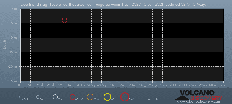
Friday, March 20, 2020 GMT (1 quake)
Mar 20, 2020 04:41 pm (Guatemala)
3.0

4 km
23 km (14 mi) to the E 8 Km al sureste de Antigua Guatemala, Guatemal 1 report
Info
About these data
Estimated combined seismic energy released: 6.7 x 10¹² joules (1.87 gigawatt hours, equivalent to 1611 tons of TNT or 0.1 atomic bombs!) | about seismic energy

Earthquake Catalog - Look up past earthquakes

Look up past earthquakes in this area by date or date range:
or
Look up quakes!
Felt a quake? Report it!
Show quakes near me!

Earthquake statistics

Number of earthquakes over time

in 2020
Number of earthquakes over time: in 2020

Magnitude and seismic energy over time

in 2020
Magnitude and seismic energy over time: in 2020

Magnitude and energy distribution

in 2020
Magnitude and energy distribution: in 2020

Embed or share standalone map

You can use the standalone version of our interactive earthquake map or embed it on your website:

Satellite image of Fuego volcano by (c) Google Earth View
Try our free app!
Volcanoes & Earthquakes - new app for Android
Android | iOS version

More on VolcanoDiscovery

Why is there advertising on this site?

Support us - Help us upgrade our services!

We truly love working to bring you the latest volcano and earthquake data from around the world. Maintaining our website and our free apps does require, however, considerable time and resources.
We need financing to increase hard- and software capacity as well as support our editor team. We're aiming to achieve uninterrupted service wherever an earthquake or volcano eruption unfolds, and your donations can make it happen! Every donation will be highly appreciated. If you find the information useful and would like to support our team in integrating further features, write great content, and in upgrading our soft- and hardware, please make a donation (PayPal or Online credit card payment).

Planned features:Thanks to your past donations, these features have been added recently:
Download and Upgrade the Volcanoes & Earthquakes app to get one of the fastest seismic and volcano alerts online:
Android | IOS
Thank you!
Sources: VolcanoDiscovery / VolcanoAdventures and other sources as noted.
Use of material: Most text and images on our websites are owned by us. Re-use is generally not permitted without authorization. Contact us for licensing rights.
Volcanoes & Earthquakes
VolcanoDiscovery Home
Volcanoes | Earthquakes | Photos | Volcano News | App
Adventure & Study Travel
Tours to Volcanoes and Volcanic Areas: walking tours, photo tours, study tours
Tours & Dates | FAQ | About us
Get our newsletter!
Company info
Contact | Legal info | Terms & conditions
Follow us
Follow us on facebook Follow us on Instagram Follow us on Twitter Visit our Youtube channel
EN | DE | EL | ES | FR | IT | RU
VolcanoDiscovery GmbH, Germany, Reg. nr.: HRB 103744, EU Tax Id: DE 297 465 123 owned and created by
Dr. Tom Pfeiffer, volcanologist, volcano photographer, tour organizer member of
IAVCEI
IAVCEI
Vulkanologische Gesellschaft
Volcanological Society
Ecotourism Greece
Ecotourism Greece
RUV insurance
Insured by R+V
VolcanoDiscovery © 2004- All Rights Reserved | Privacy - Cookie Settings