Contact | RSS | EN | DE | EL | ES | FR | IT | RU

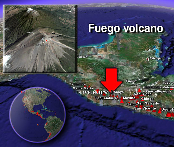
Fuego volcano (Guatemala) activity update

Sat, 27 Apr 2013, 07:31 | BY: T
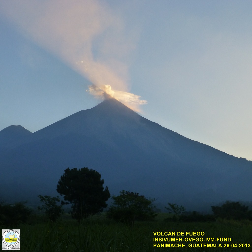
View of Fire yesterday morning
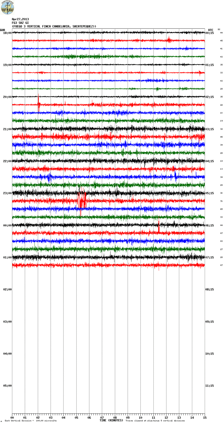
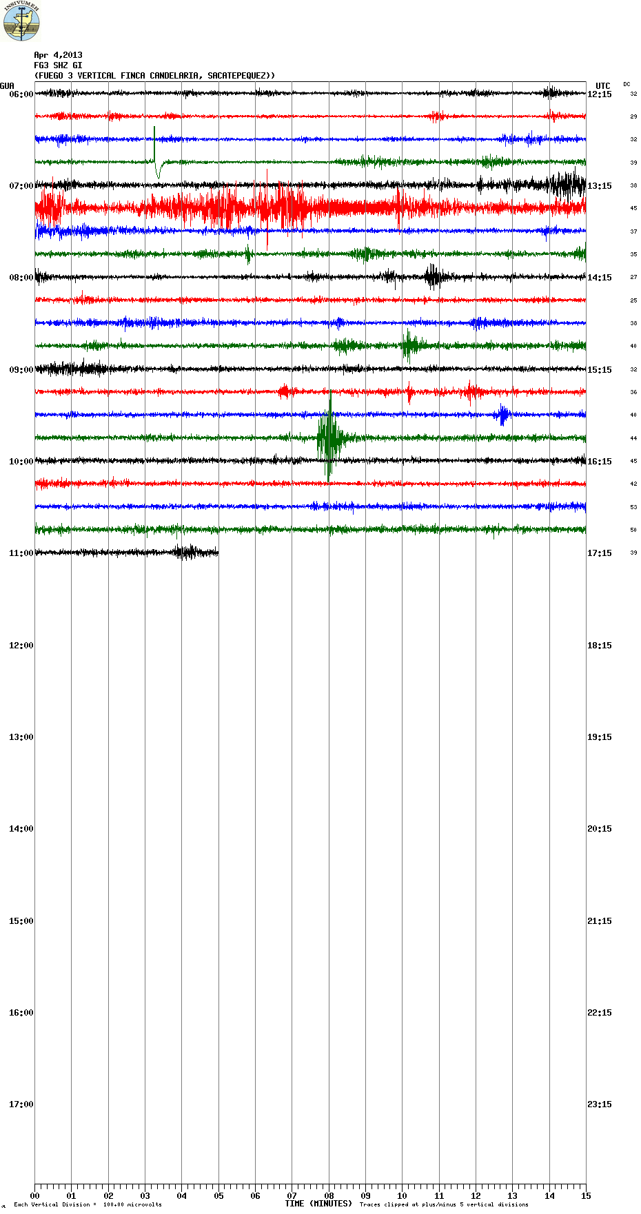
Current seismic signal from Fire (FG3 station, INSIVUMEH)
Activity has been increasing. Continuous stronger tremor today suggests an increase in effusion rate today. In INSIVUMEH's report from yesterday, the new lava flow was 400 m long and produced small avalanches towards the Ash Canyon. The number of explosions rose to 17, producing gray ash plumes rising 600 m above the crater and drifting 8-10 km to the west and SW. They were accompanied by weak rumblings and locomotive-like degassing sounds. Incandescent material was seen rising 100-200 m at night.

Previous news

Thu, 25 Apr 2013, 15:44

Fuego volcano (Guatemala): new lava flow

This morning, a new lava flow emerged from the crater and started to flow down the southern flank towards the Trinidad canyon, reaching a length of 300 meters. Explosions continue and produce ash plumes rising to 4-4.2 km altitude (300-500 m above the crater), generating weak to moderate rumbling avalanches. INSIVUMEH warns that this activity could increase towards a more intense eruptive phase in the coming days, with larger explosions, and possibly pyroclastic flows. Read all
Wed, 24 Apr 2013, 06:00

Fuego volcano (Guatemala) - Smithsonian / USGS Weekly Volcanic Activity Report for 24 April-30 April 2013 (Continuing Activity)

INSIVUMEH reported that during 23-26 April explosions from Fuego generated ash plumes that rose 250-600 m above the crater and drifted at most 10 km W, SW, S, and SE. Incandescent material was ejected 100-200 m above the crater. In a special bulletin on 25 April INSIVUMEH noted that the energy of the explosions had increased, producing rumblings and shock waves that vibrated structures in Panimaché, Morelia, and Sangre de Cristo, as far as 10 km S and SW. ... Read all
Show more
Fuego volcano
Stratovolcano 3,763 m / 12,346 ft
Guatemala, 14.47°N / -90.88°W
Current status: erupting (4 out of 5) Fuego volcano eruptions:
1581, 1585, 1586, 1587, 1614, 1617, 1620, 1623, 1629, 1679(?), 1685, 1686, 1689(?), 1699, 1702, 1705, 1706, 1709(?), 1710,1717,1730, 1732, 1737, 1751(?), 1765(?), 1773(?), 1799, 1826, 1829, 1850(?), 1852(?), 1855, 1856, 1857, 1860, 1861(?), 1867(?), 1880, 1896, 1932, 1944, 1949, 1953, 1955, 1957, 1962, 1963, 1966, 1967, 1971, 1973, 1974, 1975, 1977, 1987, 1999, 2002 - ongoing
Typical eruption style
Dominantly explosive, construction of lava domes and extrusion of viscous lava flows. In near constant activity, at least during the past centuries.
Fuego Volcano Tours
11-day volcano tour to Pacaya and Fuego, Guatemala
8-12 days - Moderate to Challenging
Price $ 3490
no scheduled dates at present
Satellite image of Fuego volcano by (c) Google Earth View
Try our free app!
Volcanoes & Earthquakes - new app for Android
Android | iOS version

More on VolcanoDiscovery

Why is there advertising on this site?

Support us - Help us upgrade our services!

We truly love working to bring you the latest volcano and earthquake data from around the world. Maintaining our website and our free apps does require, however, considerable time and resources.
We need financing to increase hard- and software capacity as well as support our editor team. We're aiming to achieve uninterrupted service wherever an earthquake or volcano eruption unfolds, and your donations can make it happen! Every donation will be highly appreciated. If you find the information useful and would like to support our team in integrating further features, write great content, and in upgrading our soft- and hardware, please make a donation (PayPal or Online credit card payment).

Planned features:Thanks to your past donations, these features have been added recently:
Download and Upgrade the Volcanoes & Earthquakes app to get one of the fastest seismic and volcano alerts online:
Android | IOS
Thank you!
Sources: VolcanoDiscovery / VolcanoAdventures and other sources as noted.
Use of material: Most text and images on our websites are owned by us. Re-use is generally not permitted without authorization. Contact us for licensing rights.
Volcanoes & Earthquakes
VolcanoDiscovery Home
Volcanoes | Earthquakes | Photos | Volcano News | App
Adventure & Study Travel
Tours to Volcanoes and Volcanic Areas: walking tours, photo tours, study tours
Tours & Dates | FAQ | About us
Get our newsletter!
Company info
Contact | Legal info | Terms & conditions
Follow us
Follow us on facebook Follow us on Instagram Follow us on Twitter Visit our Youtube channel
EN | DE | EL | ES | FR | IT | RU
VolcanoDiscovery GmbH, Germany, Reg. nr.: HRB 103744, EU Tax Id: DE 297 465 123 owned and created by
Dr. Tom Pfeiffer, volcanologist, volcano photographer, tour organizer member of
IAVCEI
IAVCEI
Vulkanologische Gesellschaft
Volcanological Society
Ecotourism Greece
Ecotourism Greece
RUV insurance
Insured by R+V
VolcanoDiscovery © 2004- All Rights Reserved | Privacy - Cookie Settings