Hunga Tonga-Hunga Ha'apai volcano (Tonga): new bathymetry map of caldera
Wed, 25 May 2022, 04:42 | BY: MARTIN
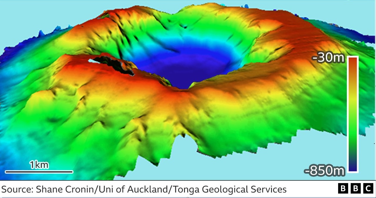
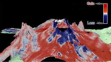
New bathymetry map of Hunga Tonga-Hunga Ha'apai volcano's caldera (image: Shane Cronin and Tonga Geological Services)
Bathymetry map of the volcano edifice itself (source: NIWA)
Professor Shane Cronin from the University of Auckland (New Zealand) in collaboration with Tonga Geological Services participated in field research to map the undersea caldera over the past two and a half months.
The volcano caldera is currently 4 km (2.5 miles) wide reaching a depth of 850 meters! The pre-eruption caldera depth was measured at a depth about 150 meters below sea level. The volcanic ejecta volume has been measured at least 6.5 km3 of pyroclastic material. "If all of Tongatapu, the main island of Tonga, was scraped to sea level, it would fill only two-thirds of the caldera", says professor Cronin.
A comparison of pre-eruption bathymetry (depth) maps from 2015 and 2016 with the current situation depicts dramatic morphological changes to the caldera. Besides general deepening, a massive area of the interior cliffs has been destroyed, mainly at the southern rim of the crater.
Along with the recent caldera map, another bathymetry map related to the area around the volcano has been released by New Zealand's National Institute for Water and Atmospheric (NIWA).
The Hunga Tonga-Hunga Ha'apai volcano is not the only threatening volcano in the southwest Pacific region, there are at least 10 undersea volcanoes to erupt at similar scale.
Source: Shane Cronin and BBC
- All news about: Hunga Tonga-Hunga Ha'apai volcano
- Information about: Hunga Tonga-Hunga Ha'apai volcano
Previous news
Wed, 23 Feb 2022, 18:46
Hunga Tonga-Hunga Ha'apai volcano (Tonga Ridge) - Smithsonian / USGS Weekly Volcanic Activity Report for 16 February-22 February 2022 (Continuing Activity)
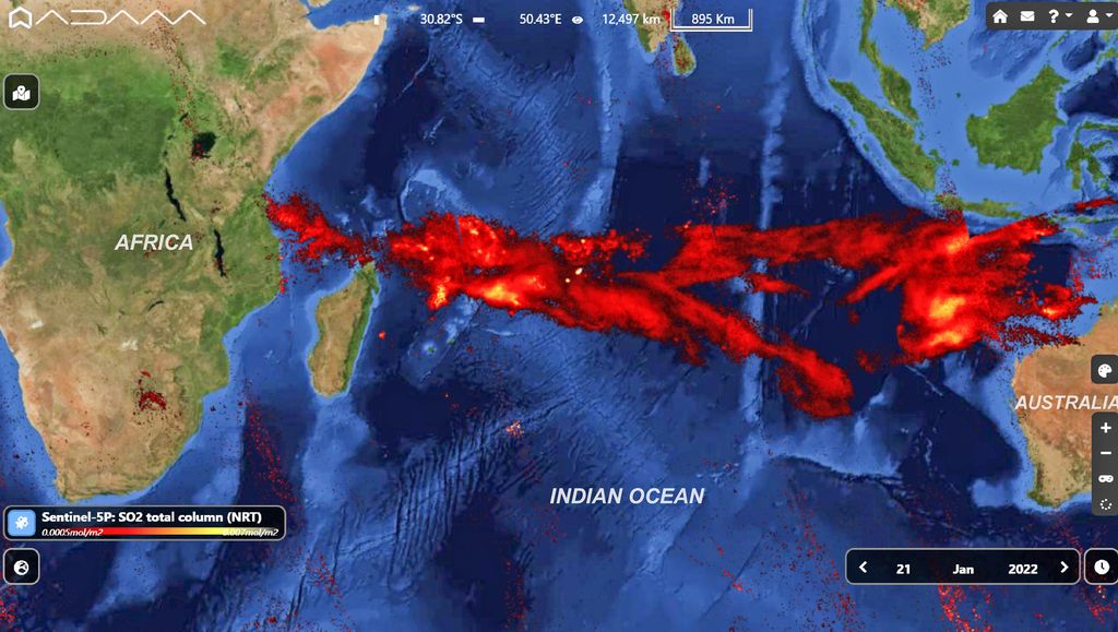
Recovery efforts from the 14-15 January eruption of Hunga Tonga-Hunga Ha'apai continued in Tonga. According to a news article, the main undersea international fiber-optic communication cable that had been severed in multiple places due to the eruption had been repaired by 21 February, and internet connectivity was restored by 22 February. Repairs had begun on 3 February to rejoin 5-6 pieces and replace a 55 km section of the cable that was missing and likely buried in sediment. ... Read all
Thu, 10 Feb 2022, 09:24
Hunga Tonga-Hunga Ha'apai volcano (Tonga Ridge) - Smithsonian / USGS Weekly Volcanic Activity Report for 2 February-8 February 2022 (New Activity / Unrest)
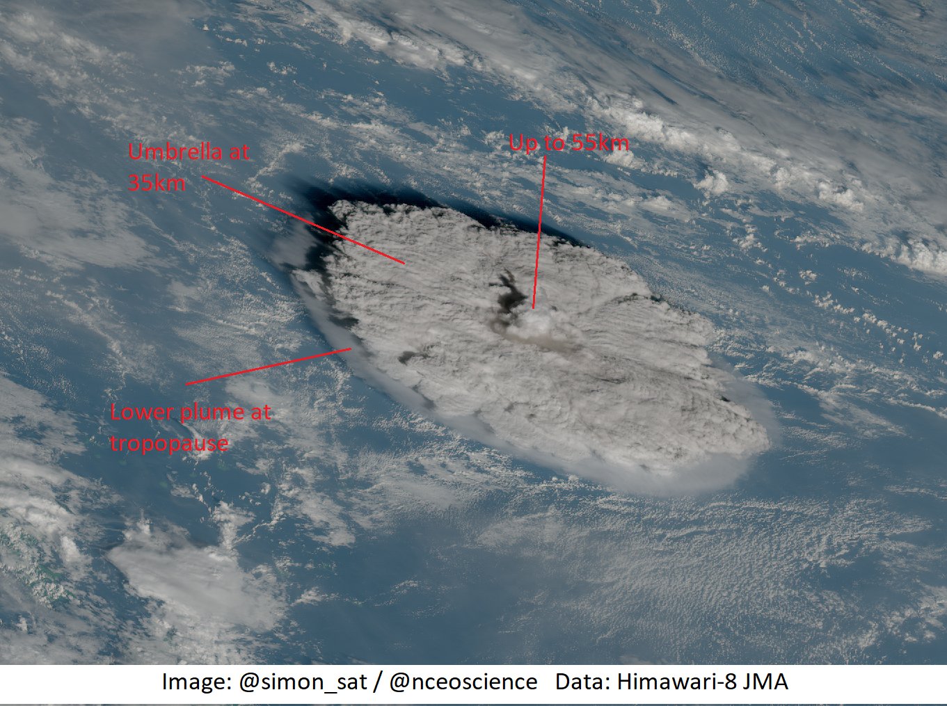
On 4 February the Tonga Geological Services (TGS) posted drone footage of the Good Samaritan Beach, located on the NE side of Tongatapu, showing that tsunamis from the 15 January Hunga Tonga-Hunga Ha'apai eruption reached areas at 15 m elevation, 200 m inland. A 6 February post provided details of what happened when tsunamis reached Mango Island (75 km ENE), stating that waves 12 m high went over the church tower, reached 500 m inland, and pushed buildings and structures against the inland wall of trees. Residents fled to an area that was 30 m elevation, 700 m from the coast, and stayed there all night as ash fell. ... Read all
Show more