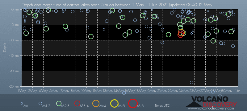
Date and Time | Mag Depth | Distance | Location | Details | Map |
|---|---|---|---|---|---|
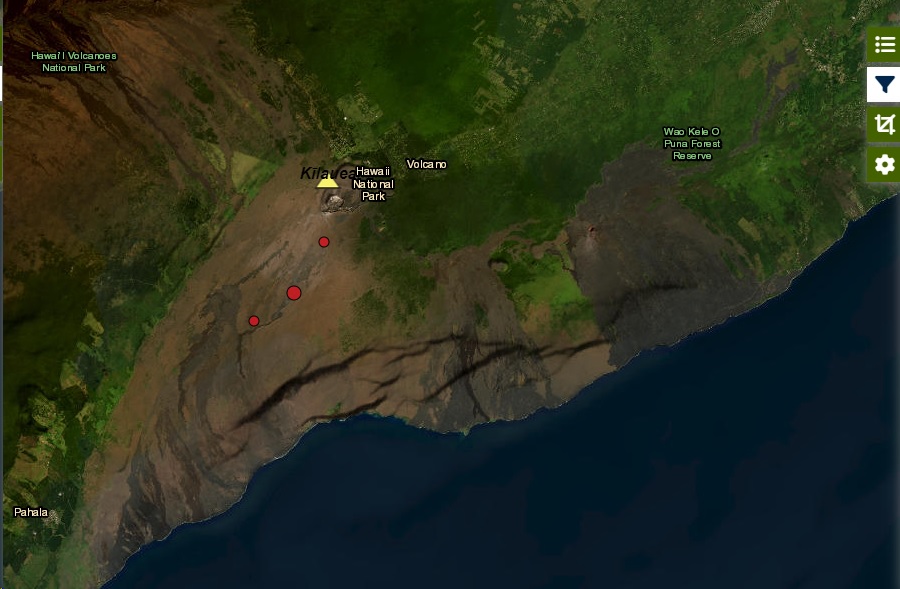
| May 31, 2021 11:37 am (Honolulu) | 2.1 32 km | 23 km (14 mi) to the SW | Info | ||
| May 31, 2021 07:32 am (Honolulu) | 2.1 33 km | 22 km (14 mi) to the SW | Info | ||
| May 31, 2021 05:59 am (Honolulu) | 3.4 32 km | 21 km (13 mi) to the SW | Info | ||
| May 31, 2021 03:31 am (Honolulu) | 2.1 33 km | 26 km (16 mi) to the SW | Info | ||
| May 30, 2021 02:16 pm (Honolulu) | 2.2 7.2 km | 29 km (18 mi) to the N | Info | ||
| Sunday, May 30, 2021 GMT (3 quakes) | |||||
| May 30, 2021 08:46 am (Honolulu) | 2.2 32 km | 26 km (16 mi) to the SW | Info | ||
| May 30, 2021 06:11 am (Honolulu) | 2.1 31 km | 22 km (14 mi) to the SW | Info | ||
| May 30, 2021 05:48 am (Honolulu) | 2.4 1.5 km | 8.5 km (5.3 mi) to the SE | Info | ||
| Saturday, May 29, 2021 GMT (4 quakes) | |||||
| May 29, 2021 12:25 pm (Honolulu) | 2.1 33 km | 25 km (15 mi) to the SW | Info | ||
| May 28, 2021 07:46 pm (Honolulu) | 2.3 29 km | 9.9 km (6.1 mi) to the SE | Info | ||
| May 28, 2021 04:50 pm (Honolulu) | 2.4 32 km | 22 km (14 mi) to the SW | Info | ||
| or | ||
Look up quakes! | ||