Date and Time | Mag Depth | Distance | Location | Details | Map |
|---|---|---|---|---|---|
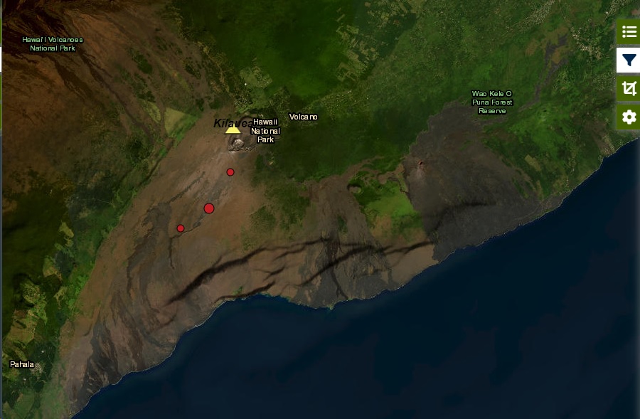
| Apr 19, 10:29 pm (Honolulu) | 1.3 1.1 km | 2.7 km (1.7 mi) to the S | Info | ||
| Apr 19, 09:55 pm (Honolulu) | 1.1 8.3 km | 24 km (15 mi) to the SW | Info | ||
| Apr 19, 09:05 pm (Honolulu) | 1.5 7.3 km | 13 km (8 mi) to the SE | Info | ||
| Apr 19, 03:38 pm (Honolulu) | 1.8 11 km | 1.3 km (0.8 mi) to the E | Info | ||
| Apr 19, 03:16 pm (Honolulu) | 1.9 11 km | 1.5 km (1 mi) to the E | Info | ||
| Apr 19, 02:30 pm (Honolulu) | 1.8 9.6 km | 7.2 km (4.4 mi) to the S | Info | ||
| Apr 19, 02:29 pm (Honolulu) | 2.2 29 km | 18 km (11 mi) to the SW | Info | ||
| Friday, April 19, 2024 GMT (29 quakes) | |||||
| Apr 19, 01:47 pm (Honolulu) | 1.4 10.8 km | 3.2 km (2 mi) to the NE | Info | ||
| Apr 19, 12:45 pm (Honolulu) | 1.9 0.4 km | 13 km (8 mi) to the SE | Info | ||
| Apr 19, 12:44 pm (Honolulu) | 1.7 1.5 km | 14 km (8.9 mi) to the SE | Info | ||
| Apr 19, 11:41 am (Honolulu) | 1.8 13 km | 2.1 km (1.3 mi) to the SE | Info | ||
| or | ||
Look up quakes! | ||