La Palma Volcano
Updated: Apr 25, 2024 07:01 GMT -
shield volcano 2426 m
Canary Islands, 28.58°N / -17.84°W
Current status: normal or dormant (1 out of 5)
Canary Islands, 28.58°N / -17.84°W
Current status: normal or dormant (1 out of 5)
Last update: 3 Jun 2022
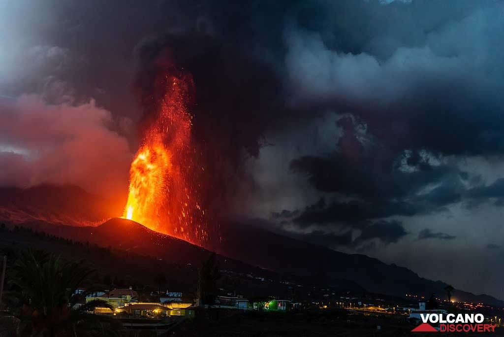
Eruption of La Palma's Cumbre Vieja in Sep 2021 (image: Tom Pfeiffer)
The 47-km-long wedge-shaped island of La Palma, the NW-most of the Canary Islands, is composed of two large volcanic centers.
[smaller] [larger]
La Palma volcano eruptions: 2021 (Sep - ongoing), 1971, 1949, 1712, 1677-1678, 1646, 1585
Latest nearby earthquakes
| Time | Mag. / Depth | Distance / Location | |||
| Apr 24, 02:24 am (Canary) | 1.4 6 km | 6.2 km (3.8 mi) to the W | Info | ||
| Tuesday, April 23, 2024 GMT (1 quake) | |||||
| Apr 23, 09:10 pm (Canary) | 1.5 0 km | 6.5 km (4.1 mi) to the NW | Info | ||
| Monday, April 15, 2024 GMT (1 quake) | |||||
| Apr 15, 04:11 am (Canary) | 1.7 5.2 km | 6.4 km (4 mi) to the NW | Info | ||
Background
The older 2426-m-high northern one is cut by the massive steep-walled Caldera Taburiente, one of several massive collapse scarps produced by edifice failure to the SW. The younger 1949-m-high Cumbre Vieja, the southern volcano, is one of the most active in the Canaries. The elongated volcano dates back to about 125,000 years ago and is oriented N-S. Eruptions during the past 7000 years have originated from the abundant cinder cones and craters along the axis of Cumbre Vieja, producing fissure-fed lava flows that descend steeply to the sea. Historical eruptions at La Palma, recorded since the 15th century, have produced mild explosive activity and lava flows that damaged populated areas. The southern tip of the island is mantled by a broad lava field produced during the 1677-1678 eruption. Lava flows also reached the sea in 1585, 1646, 1712, 1949, and 1971.La Palma Volcano Photos
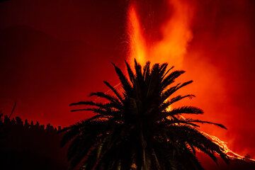
La Palma eruption Sep 2021 (Photo: Tom Pfeiffer)
Teneguia volcano, view from San Antonio v., Fuencaliente, La Palma Isl., Canaries (Photo: WNomad)

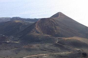
Volcanic cone of Los volcanes de Aridane, next of town Todoque, La Palma Isl. (Photo: WNomad)

Lava field and volcanic cones near Los Llanos, La Palma Isl. (Photo: WNomad)
Latest satellite images