Langila volcano Volcanic Ash Advisory: WEAK VA EMSSIONS LAST OBS TO FL070 AT 01/2210Z.
Mon, 2 Jan 2017, 16:15 |
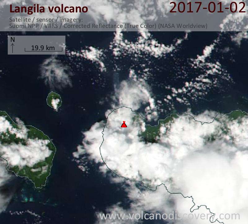
Satellite image of Langila volcano on 2 Jan 2017
FVAU0300 at 16:11 UTC, 02/01/17 from ADRM
VA ADVISORY
DTG: 20170102/1610Z
VAAC: DARWIN
VOLCANO: LANGILA 252010
PSN: S0532 E14825
AREA: PAPUA NEW GUINEA
SUMMIT ELEV: 1330M
ADVISORY NR: 2017/4
INFO SOURCE: HIMAWARI-8
AVIATION COLOUR CODE: ORANGE
ERUPTION DETAILS: WEAK VA EMSSIONS LAST OBS TO FL070 AT
01/2210Z.
OBS VA DTG: 02/1610Z
OBS VA CLD: SFC/FL070 S0529 E14840 - S0514 E14825 - S0526
E14812 - S0542 E14826 MOV N 5KT
FCST VA CLD +6 HR: 02/2210Z SFC/FL070 S0514 E14825 - S0526
E14812 - S0542 E14826 - S0529 E14840
FCST VA CLD +12 HR: 03/0410Z SFC/FL070 S0526 E14813 - S0542
E14826 - S0529 E14840 - S0514 E14825
FCST VA CLD +18 HR: 03/1010Z SFC/FL070 S0526 E14813 - S0542
E14826 - S0529 E14840 - S0514 E14825
RMK: VA CURRENTLY UNDIENTIFIABLE ON SAT IMAGERY DUE TO MET
CLOUD; HOWEVER, VA STILL EXPECTED IN AREA. WINDS LIGHT AND
VRB SO LOW CONFIDENCE IN FORECAST. VA HEIGHT AND MOVEMENT
BASED ON HIMAWARI-8 IMAGERY AND MODEL GUIDANCE.
NXT ADVISORY: NO LATER THAN 20170102/2210Z
- All news about: Langila volcano
- Information about: Langila volcano
Previous news
Sun, 1 Jan 2017, 22:15
Langila volcano Volcanic Ash Advisory: WEAK VA EMSSIONS OBS TO FL070 AT 01/2140Z.
Thu, 29 Dec 2016, 18:38
Langila volcano (New Britain Island, Papua New Guinea): new eruption
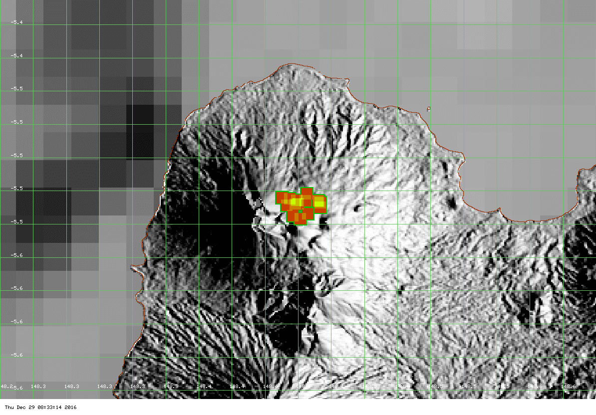
A new eruption is occurring at the volcano. Satellite data which show a strong thermal anomaly suggest lava extrusion probably on the northern summit area. Read all
Show more