Contact | RSS | EN | DE | EL | ES | FR | IT | RU

Lewotolo Volcano Volcanic Ash Advisory: DISCRETE ERUPTION TO FL070 MOV WNW OBS AT 16/2235Z to 7000 ft (2100 m)

Fri, 16 Apr 2021, 23:00 | BY: VN
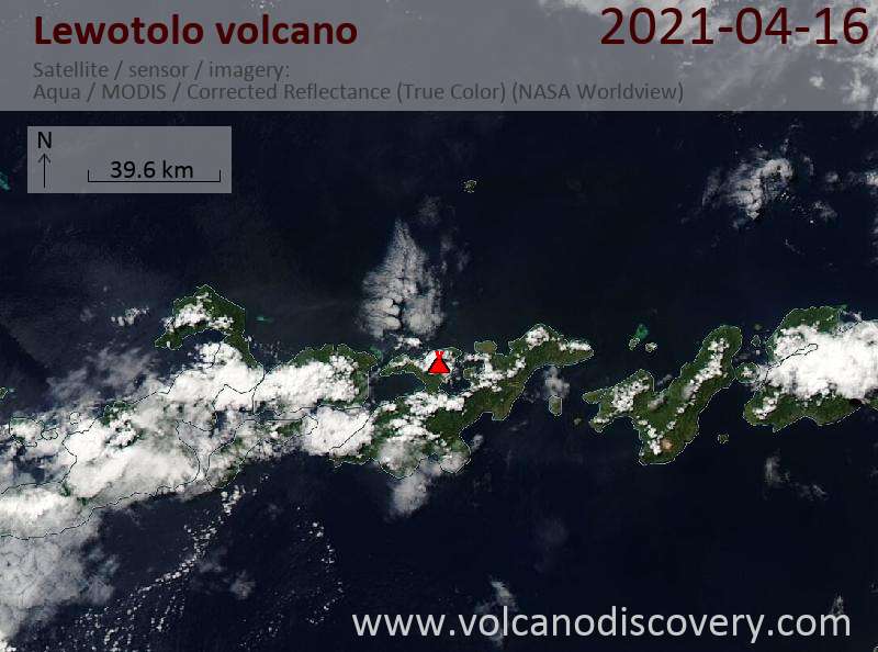
Satellite image of Lewotolo volcano on 16 Apr 2021
Explosive activity continues. Volcanic Ash Advisory Center (VAAC) Darwin warned about a volcanic ash plume that rose up to estimated 7000 ft (2100 m) altitude or flight level 070 .
The full report is as follows:

FVAU02 at 22:51 UTC, 16/04/21 from ADRM
VA ADVISORY
DTG: 20210416/2251Z
VAAC: DARWIN
VOLCANO: LEWOTOLO 264230
PSN: S0816 E12330
AREA: INDONESIA
SUMMIT ELEV: 1423M
ADVISORY NR: 2021/8
INFO SOURCE: WEBCAM, HIMIWARI-8
AVIATION COLOUR CODE: ORANGE
ERUPTION DETAILS: DISCRETE ERUPTION TO FL070 MOV WNW OBS AT
16/2235Z
OBS VA DTG: 16/2251Z
OBS VA CLD: SFC/FL070 S0815 E12331 - S0817 E12331 - S0817
E12301 - S0807 E12301 MOV W 20KT
FCST VA CLD +6 HR: 17/0451Z NO VA EXP
FCST VA CLD +12 HR: 17/1051Z NO VA EXP
FCST VA CLD +18 HR: 17/1651Z NO VA EXP
RMK: VA OBS ON WEBCAM AND VIS SAT IMG AT 16/2235Z. VA HEIGHT
AND FORECAST BASED ON WEBCAM, HIMIWARI-8 IMAGERY AND MODEL
GUIDANCE. VA IS EXPECTED TO DISSIPATE WITHIN 6 HOURS.
NXT ADVISORY: NO LATER THAN 20210417/0451Z=

Previous news

Show more
Lewotolo volcano
stratovolcano 1423 m / 4,669 ft
Lesser Sunda Islands (Indonesia), -8.27°S / 123.51°E
Current status: erupting (4 out of 5) Lewotolo volcano eruptions:
2012, 1951, 1920, 1899, 1864, 1852, 1849, 1819, 1660
Typical eruption style
Explosive
Lewotolo Volcano Tours
Flores, Indonesia
Indonesia Volcano Special
Volcano expedition to Lewotobi and Ile Lewotolok volcanoes in Feb 2024
7 days (10 days with extension) - Moderate
Price 1750 EUR (7d) / 2480 EUR (10d)
no scheduled dates at present
Try our free app!
Volcanoes & Earthquakes - new app for Android
Android | iOS version

More on VolcanoDiscovery

Why is there advertising on this site?

Support us - Help us upgrade our services!

We truly love working to bring you the latest volcano and earthquake data from around the world. Maintaining our website and our free apps does require, however, considerable time and resources.
We need financing to increase hard- and software capacity as well as support our editor team. We're aiming to achieve uninterrupted service wherever an earthquake or volcano eruption unfolds, and your donations can make it happen! Every donation will be highly appreciated. If you find the information useful and would like to support our team in integrating further features, write great content, and in upgrading our soft- and hardware, please make a donation (PayPal or Online credit card payment).

Planned features:Thanks to your past donations, these features have been added recently:
Download and Upgrade the Volcanoes & Earthquakes app to get one of the fastest seismic and volcano alerts online:
Android | IOS
Thank you!
Sources: VolcanoDiscovery / VolcanoAdventures and other sources as noted.
Use of material: Most text and images on our websites are owned by us. Re-use is generally not permitted without authorization. Contact us for licensing rights.
Volcanoes & Earthquakes
VolcanoDiscovery Home
Volcanoes | Earthquakes | Photos | Volcano News | App
Adventure & Study Travel
Tours to Volcanoes and Volcanic Areas: walking tours, photo tours, study tours
Tours & Dates | FAQ | About us
Get our newsletter!
Company info
Contact | Legal info | Terms & conditions
Follow us
Follow us on facebook Follow us on Instagram Follow us on Twitter Visit our Youtube channel
EN | DE | EL | ES | FR | IT | RU
VolcanoDiscovery GmbH, Germany, Reg. nr.: HRB 103744, EU Tax Id: DE 297 465 123 owned and created by
Dr. Tom Pfeiffer, volcanologist, volcano photographer, tour organizer member of
IAVCEI
IAVCEI
Vulkanologische Gesellschaft
Volcanological Society
Ecotourism Greece
Ecotourism Greece
RUV insurance
Insured by R+V
VolcanoDiscovery © 2004- All Rights Reserved | Privacy - Cookie Settings