Long Island Volcano
Updated: Apr 18, 2024 23:57 GMT -
complex volcano 1280 m / 4,199 ft
Northeast of New Guinea (Papua New Guinea), -5.36°S / 147.12°E
Current status: normal or dormant (1 out of 5)
Northeast of New Guinea (Papua New Guinea), -5.36°S / 147.12°E
Current status: normal or dormant (1 out of 5)
Long Island, located 136 km east of Madang in the Vitiaz Strait, consists of 2 adjacent partly collapsed steep-sided stratovolcanoes: Mount Reaumur in the north and Cerisy Peak in the south.
The central part of the complex contains a large 10x12.5 km caldera filled by a lake, Lake Wilson. The youngest eruptions have built a new cone inside the south-central part of the caldera lake, Motmot Island, which formed in 1953-54 and 1968. The historic eruptions in the 20th century occurred from vents at or near Motmot Island.
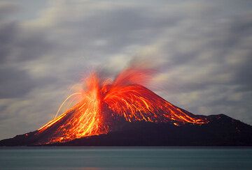
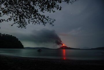
Long Island volcano's eruptions are often strombolian and sometimes submarine.
[smaller] [larger]
Long Island volcano eruptions: 1993, 1976, 1973-74, 1968, 1961(?), 1955, 1953-54, 1943, 1938, 1933, 1660
Latest nearby earthquakes
| Time | Mag. / Depth | Distance / Location | |||
| Apr 6, 10:24 pm (Port Moresby) | 4.2 198 km | 8.7 km (5.4 mi) to the S | Info | ||
Background
Collapse of the basaltic-andesitic volcanic complex produced a large 10 x 12.5 km caldera, now filled by Lake Wisdom. Caldera formation occurred during at least 3 major explosive eruptions, about 16,000, 4000, and 300 years ago. The latter was one of the largest historical eruptions in Papua New Guinea and deposited andesitic tephra across the New Guinea highlands, prompting legends of a "Time of Darkness."(Smithsonian / GVP volcano information)
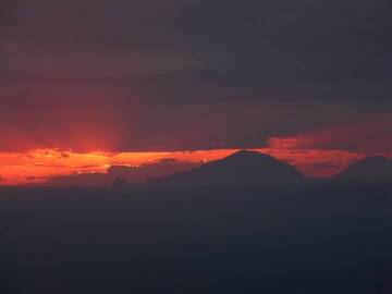
Long Island Volcano Photos
The old soil where the trees grew is visible here. Probably, it formed by deposits of collapse of the Rakata island after the 1883 eruption. The sediment platform it belo...
Another very powerful blast occurs at around 3am on 24 November. Incandescent blocks reach the lower western flanks of the island. This eruption occurs aftere an unusuall...
Sunset with the silhouette of the Eolina islands Alicudi and Filicudi, viewed from the 400m viewpoint along the Sciara del Fuocco, 13 January 2013 (Photo: Ingrid)
To the left, the NW end of Rakata, in the left background Sertung (Verlaaten) Island, Anak Krakatau in eruption, and parts of Panjang (Long) Island to the right. (Photo: ...
Eruptions of Long Island volcano
2010 earthquake
A magnitude 5.1 earthquake hit 16 km SE of Long Island on 7 February 2010.
A magnitude 5.1 earthquake hit 16 km SE of Long Island on 7 February 2010.
2007 earthquake
A magnitude 6.7 earthquake hit 54 km south of the volcano in November 2007.
A magnitude 6.7 earthquake hit 54 km south of the volcano in November 2007.
1993 eruptions
New activity started at Long Island in early November 1993. At the surface, a change in the color of the crater lake from blue-green to orange-brown was observed. The eruption were likely underwater explosions in an area north of Motmot Island, near the center of Lake Wisdom. ...more info
New activity started at Long Island in early November 1993. At the surface, a change in the color of the crater lake from blue-green to orange-brown was observed. The eruption were likely underwater explosions in an area north of Motmot Island, near the center of Lake Wisdom. ...more info
1973 eruptions
Small ash eruptions occurred in April and May 1973 from a small island in the caldera lake.
Small ash eruptions occurred in April and May 1973 from a small island in the caldera lake.
1968 eruption
Eruptions occurred at Long Island in March 1968 from vents the shore of the 1953-55 island (later Motmot Island), which by then had been eroded to a few rocks above the water. An ash cone formed in a few days and by November 1969 it had a crater with its own small pond. The island is now known as Motmot Island. ...more info
Eruptions occurred at Long Island in March 1968 from vents the shore of the 1953-55 island (later Motmot Island), which by then had been eroded to a few rocks above the water. An ash cone formed in a few days and by November 1969 it had a crater with its own small pond. The island is now known as Motmot Island. ...more info
1953-54 eruption - formation of Motmot Island
A new island, Motmot Island, appeared during submarine eruptions between May 1953 and January 1954. Surtseyan explosions (water-magma interaction) were observed 4 km from the south shore of Lake Wisdom in May 1953.
Motmot Island consisted of 2 craters joined by a ridge.
A new island, Motmot Island, appeared during submarine eruptions between May 1953 and January 1954. Surtseyan explosions (water-magma interaction) were observed 4 km from the south shore of Lake Wisdom in May 1953.
Motmot Island consisted of 2 craters joined by a ridge.
1660 Plinian eruption
A large caldera-forming Plinian eruption took place at Long Island volcano in 1660. The volume of erupted magma was estimated to be as much as 30 cubic km of material, making ranking VEI=6 and as the 3rd largest known explosive eruption on earth during the past 2000 years. It was about 3 times larger than the 1883 eruption of Krakatau, and 10 times larger than the eruption of Mt St Helens in 1980.
Large amounts of ash were deposited on New Guinea and covered 87,000 km2 of the highlands with a layer of 1.5 cm. Long Island itself was buried beneath 30 m of ash fall and ash flow deposits.
Local legends in New Guinea talk of the "Time of Darkness", due to the giant eruption plume covering the sky, plunging the region under the ash plume into a darkness.
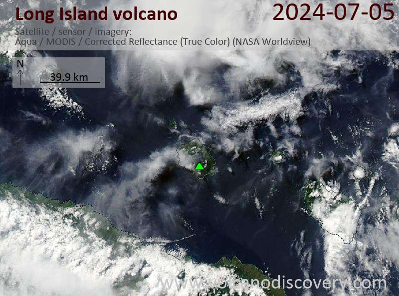
Latest satellite images