Latest Worldwide >  India > Andhra Pradesh > Pārvatipuram
SEARCH
Latest Quakes | Top 20 | Report a Quake! | Damaging Quakes | By Country/Region | Near Me | Quake Stats | FAQ | News | Volcanoes | Be Safe


SEARCH
| Latest See all | Mag. 3.4 earthquake 16 km southwest of Sālūr - Andhra Pradesh, India - Sep 27, 2023 - |
| Strongest since 1970 | Mag. 4.7 Rayagada - 33 km north of Pārvatipuram, India - Dec 23, 2022 - |
Date and Time | Mag Depth | Nearest Volcano | Location | Details | Map |
|---|---|---|---|---|---|
| Sep 27, 2023 02:12 pm (Kolkata) | 3.4 10 km | 53 km (33 mi) to the SW | Info | ||
| Thursday, March 2, 2023 GMT (1 quake) | |||||
| Mar 3, 2023 05:05 am (Kolkata) | 3.8 5 km | 23 km (14 mi) to the W | Info | ||
| Tuesday, January 10, 2023 GMT (1 quake) | |||||
| Jan 10, 2023 01:58 pm (Kolkata) | 4.5 10 km | 65 km (40 mi) to the NE | Info | ||
| Friday, December 23, 2022 GMT (1 quake) | |||||
| Dec 23, 2022 01:40 pm (Kolkata) | 4.7 200 km | 33 km (20 mi) to the N | Info | ||
| Thursday, November 24, 2022 GMT (1 quake) | |||||
| Nov 24, 2022 07:28 pm (Kolkata) | 2.7 10 km | 44 km (27 mi) to the SW | Info | ||
| Wednesday, February 16, 2022 GMT (1 quake) | |||||
| Feb 17, 2022 12:49 am (Kolkata) | 4.1 22 km | 22 km (14 mi) to the SW | Info | ||
| Monday, September 20, 2021 GMT (1 quake) | |||||
| Sep 21, 2021 02:01 am (Kolkata) | 3.2 33 km | 88 km (55 mi) to the NW | Info | ||
| Wednesday, April 14, 2021 GMT (1 quake) | |||||
| Apr 15, 2021 04:00 am (Kolkata) | 3.2 10 km | 55 km (34 mi) to the N | Info | ||
| Saturday, August 8, 2020 GMT (1 quake) | |||||
| Aug 8, 2020 07:10 am (Kolkata) | 3.8 16 km | 84 km (52 mi) to the NE | Info | ||
| Monday, June 22, 2020 GMT (1 quake) | |||||
| Jun 22, 2020 04:39 pm (Kolkata) | 3.6 5 km | 81 km (51 mi) to the NW | Info | ||
| Monday, March 23, 2020 GMT (1 quake) | |||||
| Mar 23, 2020 04:25 pm (Kolkata) | 4.7 10 km | 44 km (28 mi) to the S | Info | ||
| or | ||
Look up quakes! | ||


Pārvatipuram has relatively few earthquakes. Based on data from the past 54 years and our earthquake archive back to 1900, there are about 1.7 quakes on average per year in or near Pārvatipuram, Andhra Pradesh, India. However, Pārvatipuram has had at least 4 quakes above magnitude 4 since 2018, which suggests that larger earthquakes of this size occur infrequently, probably on average approximately every 1 to 5 years.
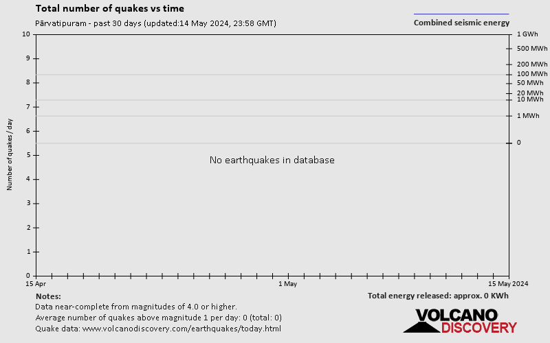
The last earthquake in Pārvatipuram occurred 30 weeks ago and had a magnitude of 3.4:
A light magnitude 3.4 earthquake hit 15.6 km (10 mi) away from Sālūr, Andhra Pradesh, ![]() India, in the early afternoon of Wednesday, Sep 27, 2023 at 2.12 pm local time (Asia/Kolkata GMT +5:30). The quake had a very shallow depth of 10 km (6 mi) and was reported felt by some people near the epicenter.
India, in the early afternoon of Wednesday, Sep 27, 2023 at 2.12 pm local time (Asia/Kolkata GMT +5:30). The quake had a very shallow depth of 10 km (6 mi) and was reported felt by some people near the epicenter.
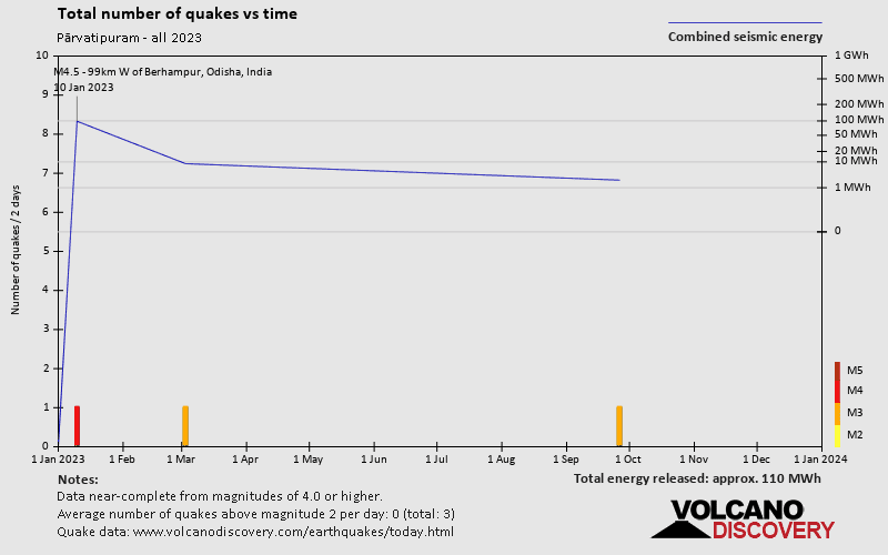
Since 1970, Pārvatipuram has had 4 quakes of magnitude 4.0 or above, 6 quakes between 3.0 and 4.0, and 1 quake of magnitude.
The strongest earthquake in Pārvatipuram since 1970 had a magnitude of 4.7 and occurred 1 year 18 weeks ago:
A strong magnitude 4.7 earthquake hit 33 km (20 mi) away from Pārvatipuram, Andhra Pradesh, ![]() India, around noon of Friday, Dec 23, 2022 at 1.40 pm local time (Asia/Kolkata GMT +5:30). The quake had a moderate depth of 200 km (124 mi) and was not felt (or at least not reported so).
India, around noon of Friday, Dec 23, 2022 at 1.40 pm local time (Asia/Kolkata GMT +5:30). The quake had a moderate depth of 200 km (124 mi) and was not felt (or at least not reported so).
Date and Time | Mag Depth | ###DIST_LABEL### | Location | Details | Map |
|---|