Latest Worldwide >  Canada > British Columbia > Port Alberni
SEARCH
Latest Quakes | Top 20 | Report a Quake! | Damaging Quakes | By Country/Region | Near Me | Quake Stats | FAQ | News | Volcanoes | Be Safe


SEARCH
| Latest See all | Mag. 1.3 earthquake 2.7 km east of Sechelt - British Columbia, Canada - |
| Strongest since 2024 | Mag. 2.7 30 km NNW of Neah Bay - Washington - Mar 21, 2024 - |
Date and Time | Mag Depth | Nearest Volcano | Location | Details | Map |
|---|---|---|---|---|---|
| Apr 17, 03:24 pm (Vancouver) | 1.3 0.3 km | 82 km (51 mi) to the E | Info | ||
| Friday, April 5, 2024 GMT (1 quake) | |||||
| Apr 4, 09:48 pm (Los Angeles) | 1.9 28 km | 81 km (50 mi) to the S | Info | ||
| Thursday, April 4, 2024 GMT (1 quake) | |||||
| Apr 4, 10:06 am (Vancouver) | 1.2 13 km | 85 km (53 mi) to the E | Info | ||
| Friday, March 22, 2024 GMT (1 quake) | |||||
| Mar 22, 01:02 am (Vancouver) | 0.7 36 km | 62 km (39 mi) to the W | Info | ||
| Thursday, March 21, 2024 GMT (1 quake) | |||||
| Mar 21, 12:04 am (Vancouver) | 2.7 33 km | 70 km (43 mi) to the S | Info | ||
| Tuesday, March 19, 2024 GMT (1 quake) | |||||
| Mar 19, 12:40 pm (Vancouver) | 1.3 33 km | 43 km (27 mi) to the S | Info | ||
| Thursday, March 14, 2024 GMT (1 quake) | |||||
| Mar 14, 12:18 pm (Vancouver) | 1.4 10 km | 90 km (56 mi) to the NW | Info | ||
| Saturday, March 9, 2024 GMT (1 quake) | |||||
| Mar 9, 04:54 pm (Vancouver) | 1.6 30 km | 71 km (44 mi) to the SE | Info | ||
| Wednesday, March 6, 2024 GMT (1 quake) | |||||
| Mar 6, 01:18 am (Vancouver) | 0.9 21 km | 80 km (49 mi) to the SE | Info | ||
| Tuesday, March 5, 2024 GMT (2 quakes) | |||||
| Mar 5, 12:22 pm (Vancouver) | 1.7 34 km | 48 km (30 mi) to the SW | Info | ||
| Mar 4, 07:48 pm (Vancouver) | 1.1 3 km | 66 km (41 mi) to the S | Info | ||
| or | ||
Look up quakes! | ||
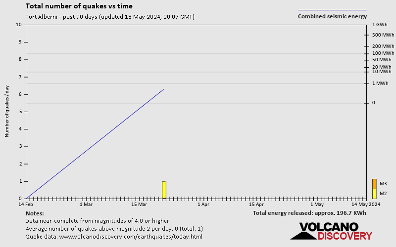
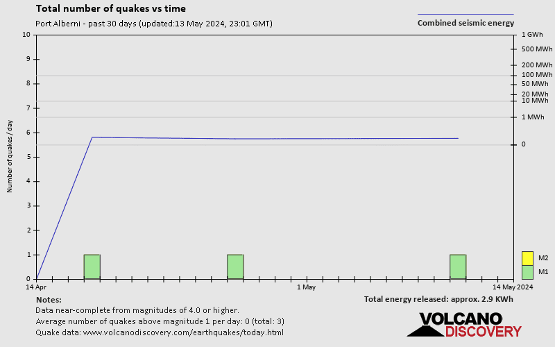
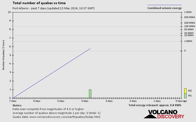
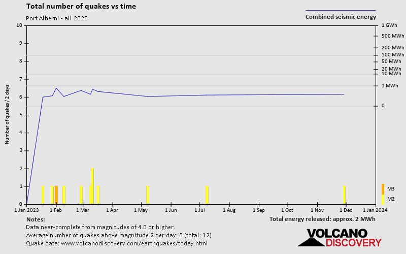

Port Alberni has a high level of seismic activity. Based on data from the past 54 years and our earthquake archive back to 1900, there are about 88 quakes on average per year in or near Port Alberni, British Columbia, Canada. Port Alberni has had at least 2 quakes above magnitude 6 since 1900, which suggests that larger earthquakes of this size occur infrequently, probably on average approximately every 60 to 65 years.
The last earthquake in Port Alberni occurred 6 days ago and had a magnitude of 1.3:
A light magnitude 1.3 earthquake hit 2.7 km (1.7 mi) away from Sechelt, British Columbia, ![]() Canada, in the early afternoon of Wednesday, Apr 17, 2024 at 3.24 pm local time (America/Vancouver GMT -7). The quake had a very shallow depth of 0.3 km (0.2 mi) and was too small to be felt by people.
Canada, in the early afternoon of Wednesday, Apr 17, 2024 at 3.24 pm local time (America/Vancouver GMT -7). The quake had a very shallow depth of 0.3 km (0.2 mi) and was too small to be felt by people.
Since 2024, Port Alberni has had 2 quakes of magnitude 2.0 or above. There have been also 19 quakes below magnitude 2.0 which people don't normally feel.
The strongest earthquake in Port Alberni since 2024 had a magnitude of 2.7 and occurred 5 weeks ago:
A light magnitude 2.7 earthquake occurred in the North Pacific Ocean near the coast of Washington, ![]() United States, shortly after midnight, on Thursday, Mar 21, 2024 at 12.04 am local time (America/Vancouver GMT -7). The quake had a very shallow depth of 33 km (21 mi) and was not felt (or at least not reported so).
United States, shortly after midnight, on Thursday, Mar 21, 2024 at 12.04 am local time (America/Vancouver GMT -7). The quake had a very shallow depth of 33 km (21 mi) and was not felt (or at least not reported so).
Date and Time | Mag Depth | ###DIST_LABEL### | Location | Details | Map |
|---|