Latest Worldwide >  British Virgin Islands > Road Town
SEARCH
Latest Quakes | Top 20 | Report a Quake! | Damaging Quakes | By Country/Region | Near Me | Quake Stats | FAQ | News | Volcanoes | Be Safe


SEARCH
| Latest See all | Mag. 3.6 earthquake 86 km NE of Cruz Bay - U.S. Virgin Islands - |
| Strongest past 30 days | Mag. 3.8 North Atlantic Ocean - 64 km northwest of Anegada Island, British Virgin Islands - Apr 15, 2024 - |
Date and Time | Mag Depth | Nearest Volcano | Location | Details | Map |
|---|---|---|---|---|---|
| Apr 22, 11:17 am (Tortola) | 3.6 24 km | 67 km (41 mi) to the NE | Info | ||
| Monday, April 15, 2024 GMT (4 quakes) | |||||
| Apr 15, 05:22 pm (GMT -4) | 3.4 21 km | 85 km (53 mi) to the N | Info | ||
| Apr 15, 04:57 pm (GMT -4) | 3.8 23 km | 88 km (55 mi) to the N | Info | ||
| Apr 15, 08:59 am (GMT -4) | 3.8 44 km | 90 km (56 mi) to the N | Info | ||
| Apr 15, 03:02 am (GMT -4) | 3.7 55 km | 60 km (37 mi) to the N | Info | ||
| Saturday, April 13, 2024 GMT (1 quake) | |||||
| Apr 13, 04:59 am (GMT -4) | 3.6 66 km | 99 km (61 mi) to the W | Info | ||
| Sunday, April 7, 2024 GMT (1 quake) | |||||
| Apr 7, 03:31 am (St Thomas) | 3.3 83 km | 55 km (34 mi) to the W | Info | ||
| Saturday, April 6, 2024 GMT (4 quakes) | |||||
| Apr 6, 08:18 am (St Thomas) | 2.9 51 km | 42 km (26 mi) to the S | Info | ||
| Apr 6, 08:13 am (GMT -4) | 3.6 126 km | 77 km (48 mi) to the E | Info | ||
| Apr 6, 02:36 am (GMT -4) | 3.3 14 km | 80 km (50 mi) to the NW | Info | ||
| Apr 6, 01:57 am (Tortola) | 3.6 9 km | 53 km (33 mi) to the NE | Info | ||
| or | ||
Look up quakes! | ||
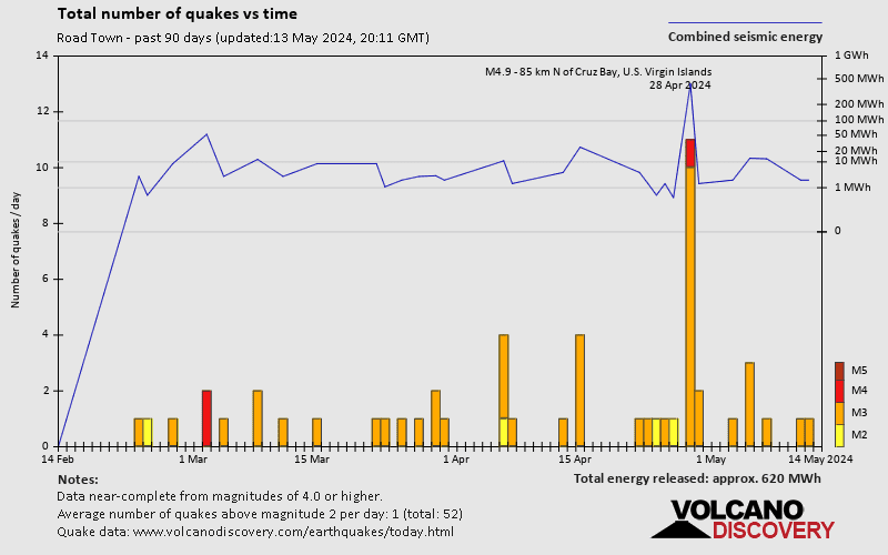
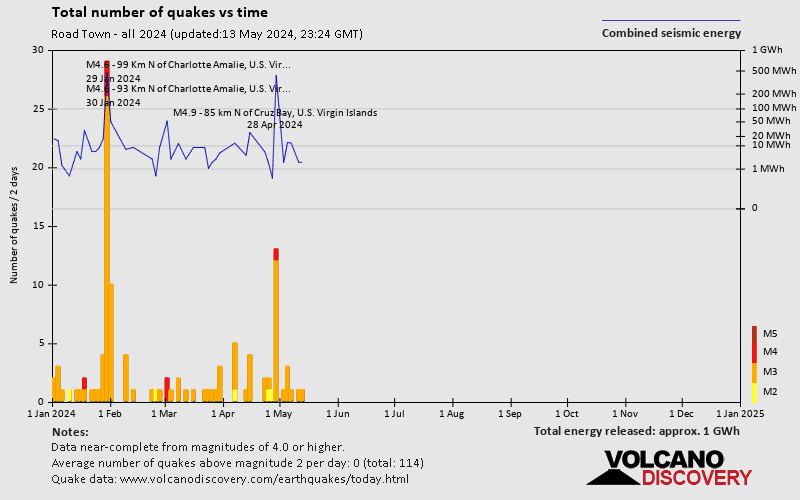
Road Town has a high level of seismic activity. Based on data from the past 54 years and our earthquake archive back to 1900, there are about 315 quakes on average per year in or near Road Town, British Virgin Islands. Road Town has had at least 2 quakes above magnitude 6 since 1900, which suggests that larger earthquakes of this size occur infrequently, probably on average approximately every 60 to 65 years.
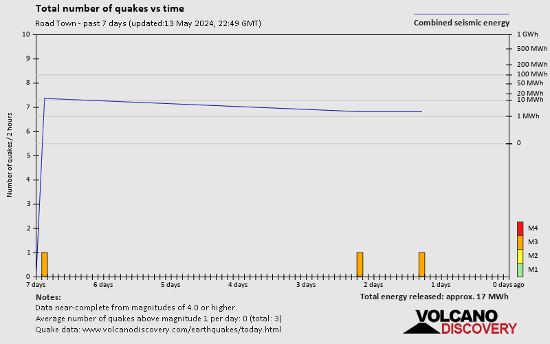
The last earthquake in Road Town occurred 21 hours ago and had a magnitude of 3.6:
A moderate magnitude 3.6 earthquake occurred in the North Atlantic Ocean near Anegada Island island, British Virgin Islands, in the morning of Monday, Apr 22, 2024 at 11.17 am local time (America/Tortola GMT -4). The quake had a very shallow depth of 24 km (15 mi) and was not felt (or at least not reported so).
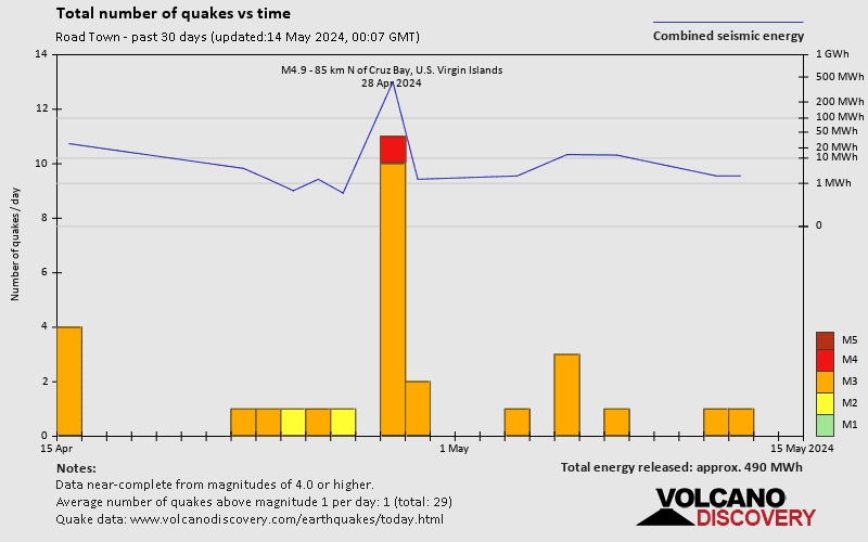
In the past 30 days, Road Town has had 15 quakes of magnitude 3.0 or above and 1 quake of magnitude.
The strongest earthquake in Road Town in the past 30 days had a magnitude of 3.8 and occurred 8 days ago:
A moderate magnitude 3.8 earthquake occurred in the North Atlantic Ocean near Anegada Island island, British Virgin Islands, in the afternoon of Monday, Apr 15, 2024 at 4.57 pm local time (GMT -4). The quake had a very shallow depth of 23 km (14 mi) and was not felt (or at least not reported so).
Date and Time | Mag Depth | ###DIST_LABEL### | Location | Details | Map |
|---|