


Latest quakes in or near Cabugan Chico Island, Eastern Visayas, Philippines - list, stats and map
| Latest See all | Mag. 2.6 earthquake 4 km northwest of Del Carmen - Surigao del Norte, Philippines - |
| Strongest past 7 days | Mag. 4.6 Philippine Sea - 41 km northwest of Homonhon Island, Philippines - |
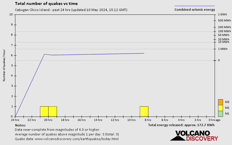
- 0 quakes above magnitude 4
- 4 quakes between magnitude 2 and 3
- 3 quakes below magnitude 2 that people normally don't feel.

Date and Time | Mag Depth | Nearest Volcano | Location | Details | Map |
|---|---|---|---|---|---|
| Jun 1, 09:43 am (Manila) | 2.6 12 km | Info | |||
| Friday, May 31, 2024 GMT (5 quakes) | |||||
| Jun 1, 04:08 am (Manila) | 3.0 30 km | Info | |||
| Jun 1, 02:22 am (GMT +8) | 1.9 11 km | Info | |||
| Jun 1, 12:56 am (GMT +8) | 1.9 6 km | Info | |||
| Jun 1, 12:16 am (GMT +8) | 1.6 28 km | Info | |||
| May 31, 08:23 pm (GMT +8) | 2.8 13 km | Info | |||
| Wednesday, May 29, 2024 GMT (2 quakes) | |||||
| May 30, 05:29 am (Manila) | 2.4 1 km | Info | |||
| May 30, 02:16 am (GMT +8) | 2.3 24 km | Info | |||
| Tuesday, May 28, 2024 GMT (5 quakes) | |||||
| May 29, 02:54 am (Manila) | 2.0 46 km | Info | |||
Cabugan Chico Island Quake-O-Meter
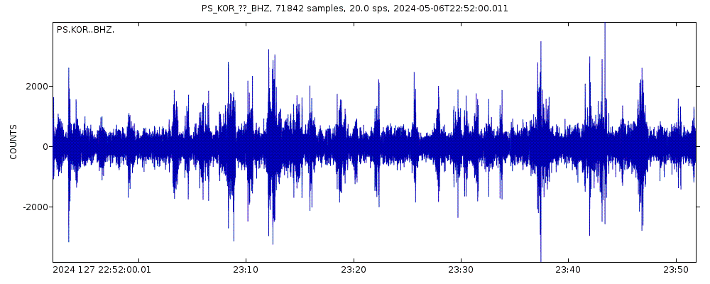
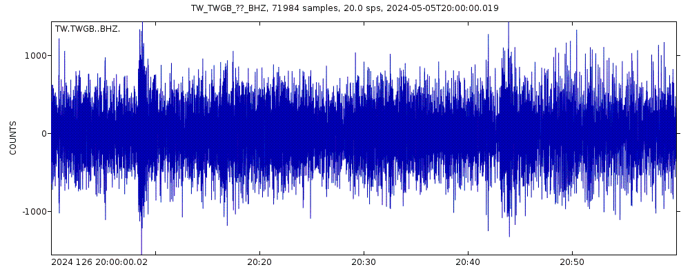
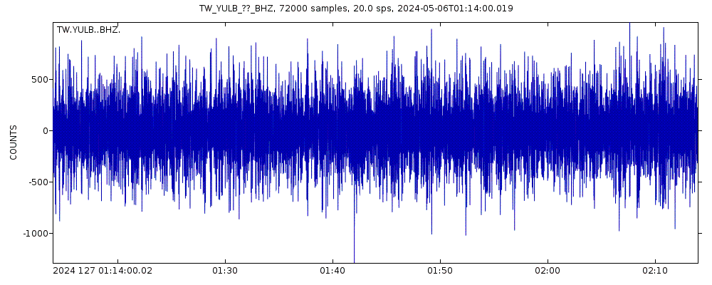
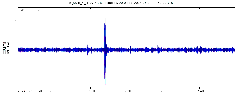
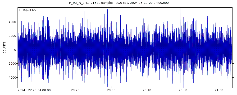
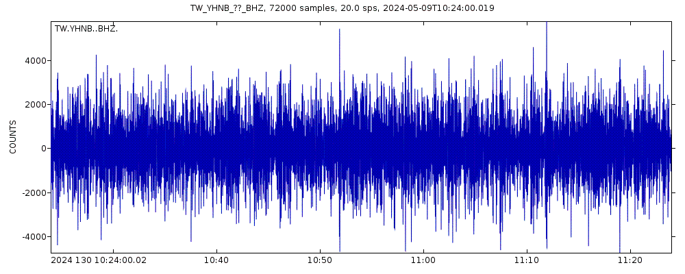
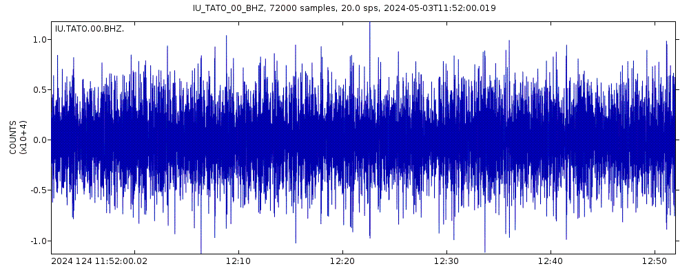
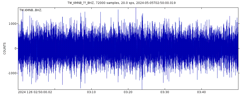
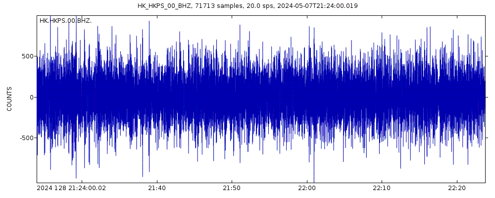
Latest seismic signals

Earthquake Catalog - Look up past earthquakes
| or | ||
Look up quakes! | ||
Earthquake statistics
Average number of earthquakes
- Mag. 6 or higher: 0.02 quakes per year (or 1 quake every 62.5 years)
- Mag. 5 or higher: 0.83 quakes per year (or 1 quake every 1.2 years)
- Mag. 4 or higher: 4.8 quakes per year
- Mag. 3 or higher: 37.5 quakes per year (or 3.1 quakes per month)
- Mag. 2 or higher: 168 quakes per year (or 14 quakes per month)
- Mag. 1 or higher: 203 quakes per year (or 16.9 quakes per month)
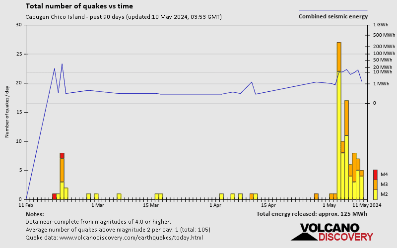
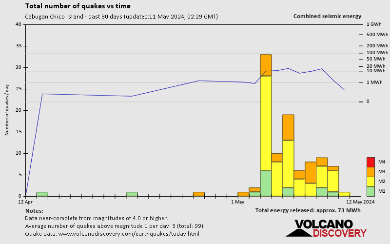
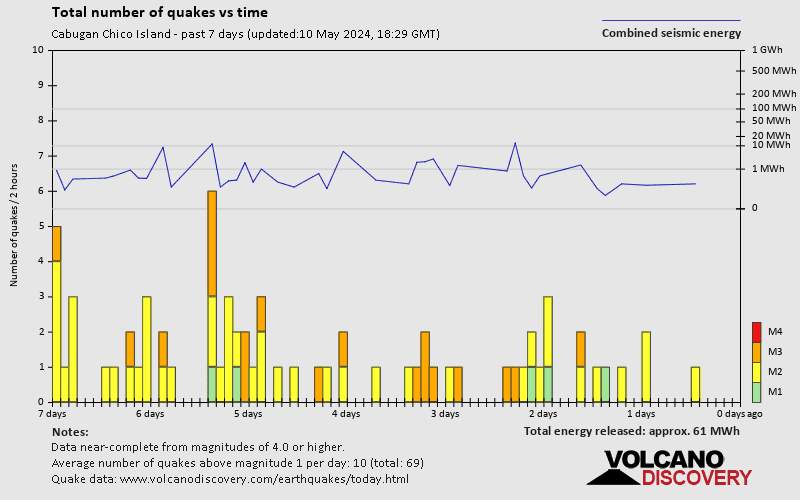
Number of earthquakes over time
Cabugan Chico Island Earthquake FAQ
+How frequent are earthquakes in or near Cabugan Chico Island, Eastern Visayas, Philippines?
Cabugan Chico Island has a high level of seismic activity. Based on data from the past 54 years and our earthquake archive back to 1900, there are about 202 quakes on average per year in or near Cabugan Chico Island, Eastern Visayas, Philippines. Cabugan Chico Island has had at least 2 quakes above magnitude 6 since 1900, which suggests that larger earthquakes of this size occur infrequently, probably on average approximately every 60 to 65 years.
+How many earthquakes occur every year in or near Cabugan Chico Island, Eastern Visayas, Philippines?
On average, Cabugan Chico Island has about 37.5 quakes of magnitude 3 or higher per year.
+When was the latest earthquake in Cabugan Chico Island?
The last earthquake in Cabugan Chico Island occurred 5 hours ago and had a magnitude of 2.6:
A light magnitude 2.6 earthquake hit 4 km (2.5 mi) away from Del Carmen, Surigao del Norte, Caraga, ![]() Philippines, in the morning of Saturday, Jun 1, 2024 at 9.43 am local time (Asia/Manila GMT +8). The quake had a very shallow depth of 12 km (7 mi) and was not felt (or at least not reported so).
Philippines, in the morning of Saturday, Jun 1, 2024 at 9.43 am local time (Asia/Manila GMT +8). The quake had a very shallow depth of 12 km (7 mi) and was not felt (or at least not reported so).
+How many quakes were there in Cabugan Chico Island in the past 7 days?
In the past 7 days, Cabugan Chico Island was shaken by 0 quakes of magnitude 4.0 or above and 4 quakes between 2.0 and 3.0. There were also 3 quakes below magnitude 2.0 which people don't normally feel.
+What was the strongest quake in Cabugan Chico Island in the past 7 days?
The strongest earthquake in Cabugan Chico Island in the past 7 days had a magnitude of 4.6 and occurred 4 days ago:
A strong magnitude 4.6 earthquake occurred in the Philippine Sea near Homonhon Island island, Philippines, shortly after midnight, on Wednesday, May 29, 2024 at 12.01 am local time (Asia/Manila GMT +8). The quake had a moderate depth of 114 km (71 mi) and was felt by many near the epicenter.
Embed or share standalone map
You can use the standalone version of our interactive earthquake map or embed it on your website:Largest Quakes in or near Cabugan Chico Island, Eastern Visayas, Philippines
Date and Time | Mag Depth | ###DIST_LABEL### | Location | Details | Map |
|---|


