


Latest quakes in or near Solomon Sea - list, stats and map
| Latest See all | Mag. 4.9 earthquake 85 km north of Lae - Morobe, Papua New Guinea - |
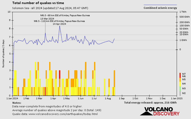
| Strongest past 30 days | Mag. 6.5 110 km ESE of Kimbe - Papua New Guinea - Apr 15, 2024 - |
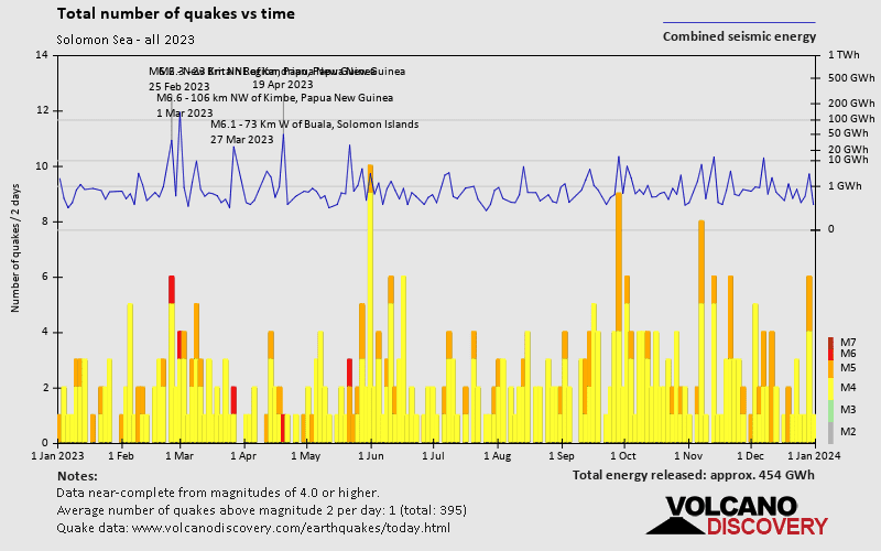
- 1 quake above magnitude 6
- 6 quakes between magnitude 5 and 6
- 13 quakes between magnitude 4 and 5
Date and Time | Mag Depth | Nearest Volcano | Location | Details | Map |
|---|---|---|---|---|---|
| Apr 23, 05:59 pm (Port Moresby) | 4.9 103 km | Info | |||
| Monday, April 22, 2024 GMT (1 quake) | |||||
| Apr 23, 03:01 am (Port Moresby) | 4.4 10 km | Info | |||
| Monday, April 15, 2024 GMT (2 quakes) | |||||
| Apr 16, 01:42 am (Port Moresby) | 4.5 10 km | Info | |||
| Apr 15, 08:43 pm (Port Moresby) | 5.4 52 km | Info | |||
| Sunday, April 14, 2024 GMT (1 quake) | |||||
| Apr 15, 06:56 am (Port Moresby) | 6.5 49 km | Info | |||
| Friday, April 12, 2024 GMT (1 quake) | |||||
| Apr 13, 02:59 am (GMT +11) | 5.8 42 km | Info | |||
| Wednesday, April 10, 2024 GMT (1 quake) | |||||
| Apr 10, 03:42 pm (Port Moresby) | 4.7 34 km | Info | |||
| Sunday, April 7, 2024 GMT (2 quakes) | |||||
| Apr 7, 05:25 pm (GMT +10) | 5.2 56 km | Info | |||
| Apr 7, 12:23 pm (GMT +10) | 4.8 10 km | Info | |||
| Saturday, April 6, 2024 GMT (1 quake) | |||||
| Apr 6, 10:24 pm (Port Moresby) | 4.1 195 km | Info | |||
| Friday, April 5, 2024 GMT (1 quake) | |||||
| Apr 6, 05:57 am (GMT +11) | 4.7 10 km | Info | |||
Solomon Sea Quake-O-Meter
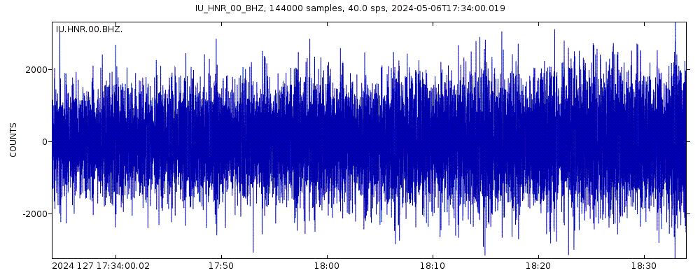
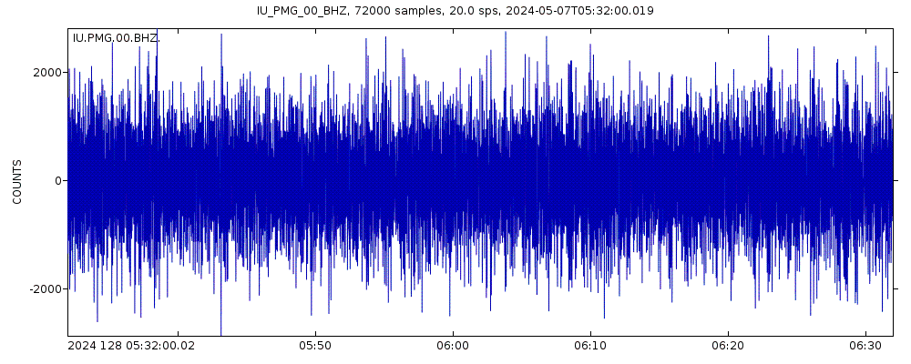
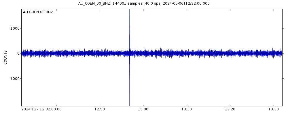
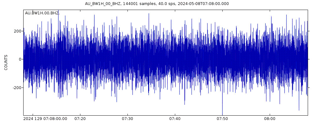
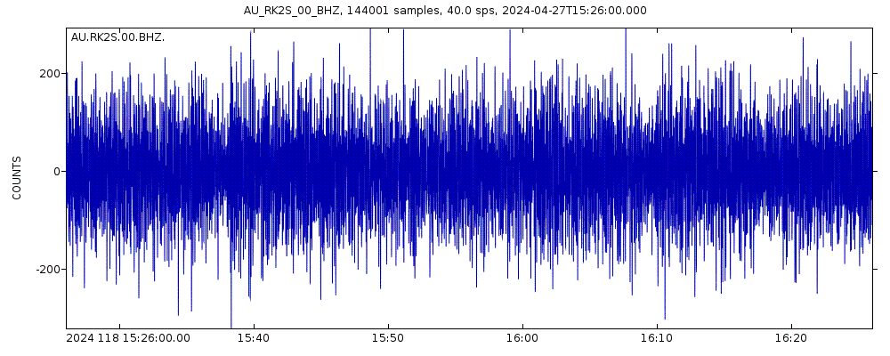
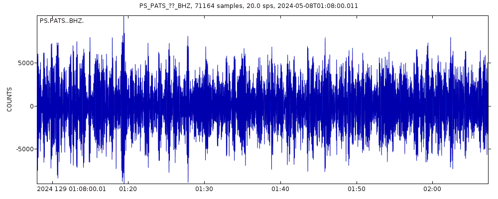
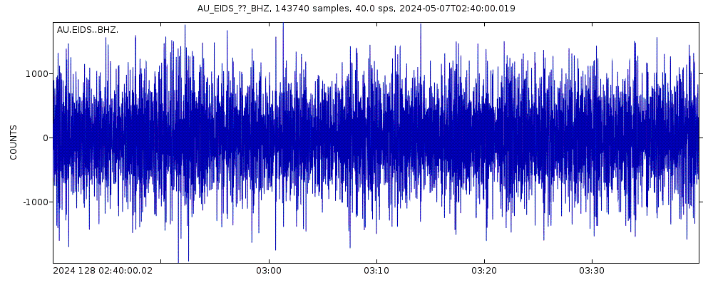
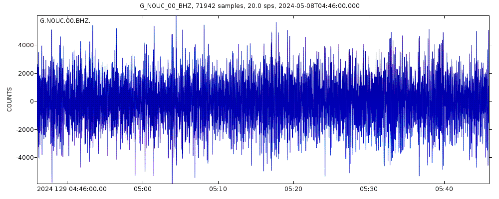
Latest seismic signals


Earthquake Catalog - Look up past earthquakes
| or | ||
Look up quakes! | ||
Earthquake statistics
Average number of earthquakes
- Mag. 8 or higher: 0.05 quakes per year (or 1 quake every 20.8 years)
- Mag. 7 or higher: 0.86 quakes per year (or 1 quake every 1.2 years)
- Mag. 6 or higher: 7.2 quakes per year
- Mag. 5 or higher: 108 quakes per year (or 9 quakes per month)
- Mag. 4 or higher: 407 quakes per year (or 33.9 quakes per month)
- Mag. 3 or higher: 432 quakes per year (or 36 quakes per month)
- Mag. 2 or higher: 432 quakes per year (or 36 quakes per month)
Number of earthquakes over time
Solomon Sea Earthquake FAQ
+How frequent are earthquakes in or near Solomon Sea?
Solomon Sea has a very high level of seismic activity. Based on data from the past 14 years and our earthquake archive back to 1900, there are about 383 quakes on average per year in or near Solomon Sea. Solomon Sea has had at least 6 quakes above magnitude 8 since 1900, which suggests that larger earthquakes of this size occur infrequently, probably on average approximately every 20 to 25 years.
+How many earthquakes occur every year in or near Solomon Sea?
On average, Solomon Sea has about 432 quakes of magnitude 3 or higher per year (Mag 4+: 407 quakes per year, Mag 5+: 108 quakes per year, Mag 6+: 7.2 quakes per year).
+When was the latest earthquake in Solomon Sea?
The last earthquake in Solomon Sea occurred 1 day 7 hours ago and had a magnitude of 4.9:
A strong magnitude 4.9 earthquake hit 85 km (53 mi) away from Lae, Morobe, ![]() Papua New Guinea, in the afternoon of Tuesday, Apr 23, 2024 at 5.59 pm local time (Pacific/Port Moresby GMT +10). The quake had a moderate depth of 103 km (64 mi) and was reported felt by some people near the epicenter.
Papua New Guinea, in the afternoon of Tuesday, Apr 23, 2024 at 5.59 pm local time (Pacific/Port Moresby GMT +10). The quake had a moderate depth of 103 km (64 mi) and was reported felt by some people near the epicenter.
+How many quakes were there in Solomon Sea in the past 30 days?
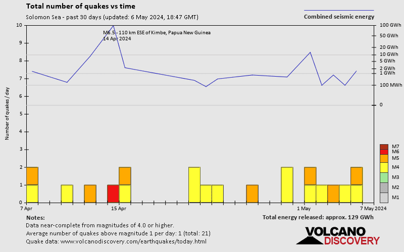
In the past 30 days, Solomon Sea has been shaken by 1 quake of magnitude 6.5, 6 quakes between 5.0 and 6.0, and 13 quakes between 4.0 and 5.0.
+What was the strongest quake in Solomon Sea in the past 30 days?
The strongest earthquake in Solomon Sea in the past 30 days had a magnitude of 6.5 and occurred 10 days ago:
A very strong magnitude 6.5 earthquake hit 209 km (130 mi) away from Kokopo, East New Britain, ![]() Papua New Guinea, in the early morning of Monday, Apr 15, 2024 at 6.56 am local time (Pacific/Port Moresby GMT +10). The quake had a shallow depth of 49 km (30 mi) and was felt by many near the epicenter.
Papua New Guinea, in the early morning of Monday, Apr 15, 2024 at 6.56 am local time (Pacific/Port Moresby GMT +10). The quake had a shallow depth of 49 km (30 mi) and was felt by many near the epicenter.
Embed or share standalone map
You can use the standalone version of our interactive earthquake map or embed it on your website:Largest Quakes in or near Solomon Sea
Date and Time | Mag Depth | ###DIST_LABEL### | Location | Details | Map |
|---|


