


Latest quakes in or near McPherson, South Dakota, USA - list, stats and map
| Latest See all | Mag. 3.2 earthquake Walworth County - South Dakota, USA - Dec 9, 2020 - |
| Strongest since 1900 | Mag. 3.3 South Dakota (USA) - Nov 26, 1989 - |
Updated: Apr 19, 2024 18:12 GMT -
Quake statistics | Past 24 hours | Yesterday | Apr | Past month | 2024 | Past year | Since 1900 | Quakes in the US | South Dakota
Find all latest earthquakes in or near McPherson, South Dakota, USA, in our list below, updated every minute! Events are often reported within minutes. If you just felt a quake in or near McPherson, find out which quakes are happening right now!
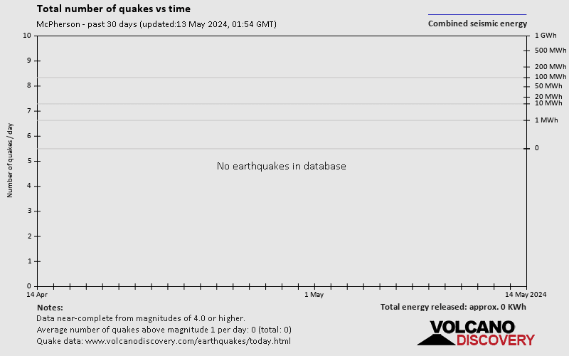
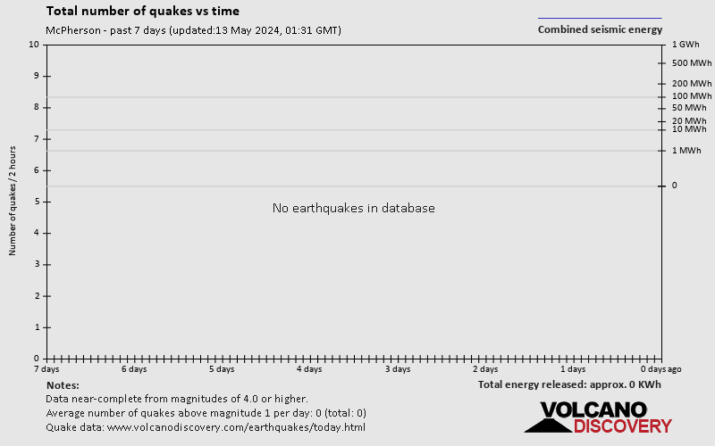
There were no significant confirmed earthquakes in or near McPherson in the past 24 hours.
There have been 2 quakes of magnitude 3.0+ in or near McPherson since 1900. Look up quakes in the past 30 days!
Number of quakes per year
Read more
[smaller] [bigger]
in sec
Showing all recent or significant quakes since 1900, magnitude 0 or higher, within up to 100 km (62 mi) distance (3 quakes):
Date and Time | Mag Depth | Nearest Volcano | Location | Details | Map |
|---|---|---|---|---|---|
| Dec 9, 2020 12:59 am (Chicago) | 3.2 5 km | 5 km (3.1 mi) to the SW | Info | ||
| Tuesday, August 15, 2017 GMT (1 quake) | |||||
| Aug 14, 2017 07:55 pm (Chicago) | 3.0 14 km | 87 km (54 mi) to the SW | Info | ||
| Sunday, November 26, 1989 GMT (1 quake) | |||||
| Nov 26, 1989 01:06 am (Universal Time) | 3.3 5 km | 35 km (22 mi) to the SW | Info | ||
About these data
Estimated combined seismic energy released: 1.2 x 10¹⁰ joules (3.22 megawatt hours, equivalent to 2.77 tons of TNT) | about seismic energy
Quake statistics | Past 24 hours | Yesterday | Apr | Past month | 2024 | Past year | Since 1900 | Quakes in the US | South Dakota
McPherson Quake-O-Meter
Has seismic activity increased or decreased?
Number of quakes: -
Number of quakes vs average
Seismic Activity: ? %
Seismic activity vs average
Below average
Normal range
Above average
Updated
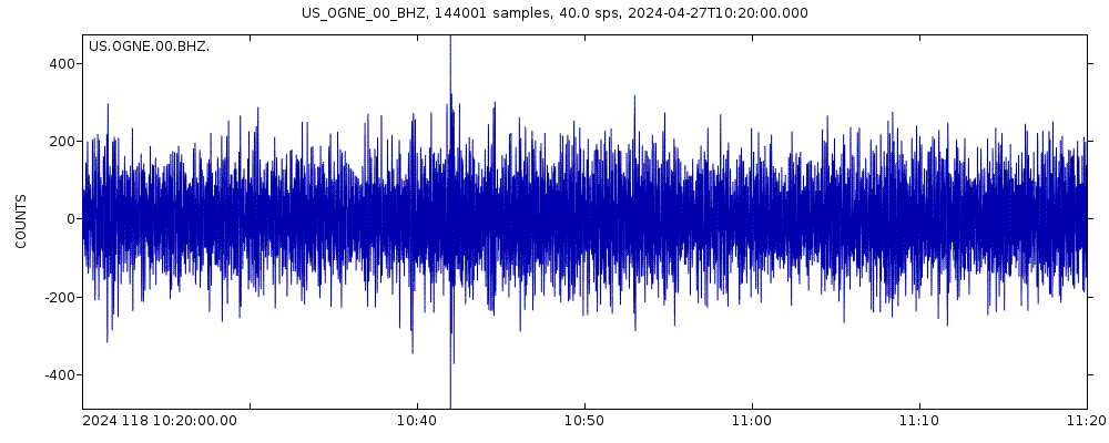
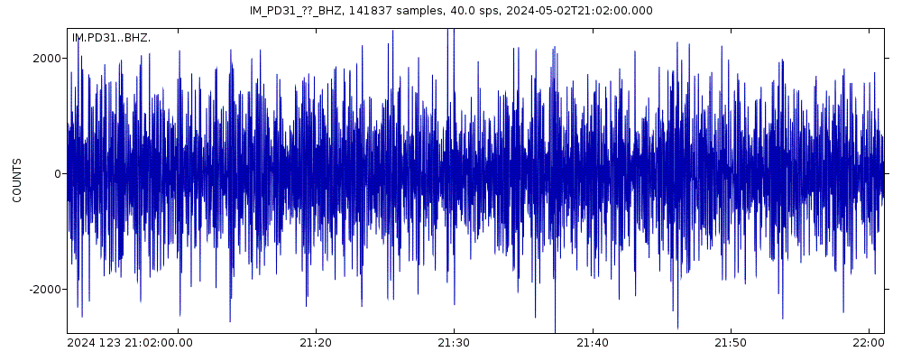
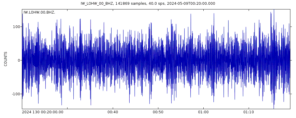
Latest seismic signals
Seismic station: EROS Data Center, Sioux Falls, South Dakota, USA (ECSD/US network) | Show on map | Station Info
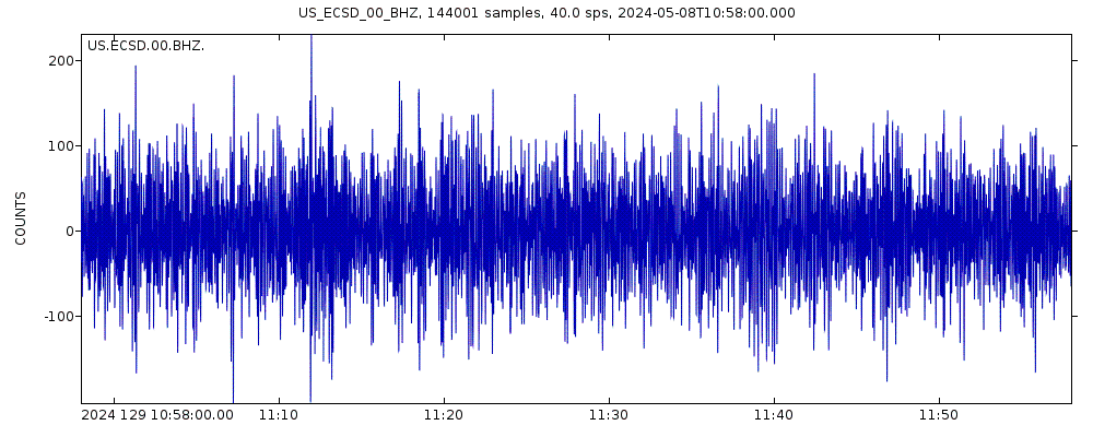
Seismogram (vertical component) last 60 minutes. Source: IRIS query builder webtool
Show more
Earthquake Catalog - Look up past earthquakes
Look up past earthquakes in this area by date or date range:
| or | ||
Look up quakes! | ||
Felt a quake? Report it!
Show quakes near me!
Earthquake statistics
Average number of earthquakes
Number of earthquakes over time
Past 90 days
30 days
7 days
24 hours
2023
2024 so far


McPherson Earthquake FAQ
+When was the latest earthquake in McPherson?
The last earthquake in McPherson occurred 3 years ago and had a magnitude of 3.2:
Mag. 3.2 earthquake Walworth County - South Dakota, USA - Dec 9, 2020 -
A light magnitude 3.2 earthquake hit 25 km (16 mi) away from Eureka, South Dakota, ![]() United States, in the early morning of Wednesday, Dec 9, 2020 at 12.59 am local time (America/Chicago GMT -5). The quake had a very shallow depth of 5 km (3.1 mi) and was not felt (or at least not reported so).
United States, in the early morning of Wednesday, Dec 9, 2020 at 12.59 am local time (America/Chicago GMT -5). The quake had a very shallow depth of 5 km (3.1 mi) and was not felt (or at least not reported so).
+How many quakes were there in McPherson since 1900?
There have been 2 quakes of magnitude 3.0+ in or near McPherson since 1900.
+What was the strongest quake in McPherson since 1900?
The strongest earthquake in McPherson since 1900 had a magnitude of 3.3 and occurred 34 years ago:
Mag. 3.3 earthquake South Dakota (USA) - Nov 26, 1989 -
A light magnitude 3.3 earthquake hit 34 km (21 mi) away from Gettysburg, South Dakota, ![]() United States, Sun, Nov 26, 1989 01:06 GMT. The quake had a very shallow depth of 5 km (3.1 mi) .
United States, Sun, Nov 26, 1989 01:06 GMT. The quake had a very shallow depth of 5 km (3.1 mi) .
Embed or share standalone map
You can use the standalone version of our interactive earthquake map or embed it on your website:Largest Quakes in or near McPherson, South Dakota, USA
Date and Time | Mag Depth | ###DIST_LABEL### | Location | Details | Map |
|---|
Map of largest quakes in or near McPherson, South Dakota, USA
[smaller] [bigger]


