Contact | RSS | EN | DE | EL | ES | FR | IT | RU

Sabancaya Volcano Volcanic Ash Advisory: CONTINUOUS VA EMISSION to 26000 ft (7900 m)

Fri, 22 Jan 2021, 18:15 | BY: VN
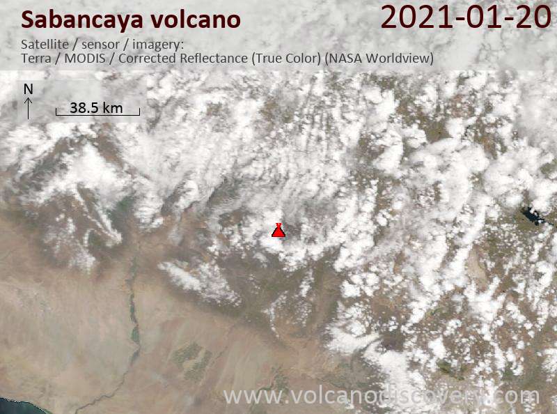
Satellite image of Sabancaya volcano on 22 Jan 2021
Explosive activity continues. Volcanic Ash Advisory Center (VAAC) Buenos Aires warned about a volcanic ash plume that rose up to estimated 26000 ft (7900 m) altitude or flight level 260 .
The full report is as follows:

FVAG01 at 17:59 UTC, 22/01/21 from SABM
VA ADVISORY
DTG: 20210122/1800Z

VAAC: BUENOS AIRES

VOLCANO: SABANCAYA 354006
PSN: S1547 W07150

AREA: PERU

SUMMIT ELEV: 19576 FT [5967 M]

ADVISORY NR: 2021/089

INFO SOURCE: GOES-E. GFS. WEBCAM.

AVIATION COLOUR CODE: NOT GIVEN

ERUPTION DETAILS: CONTINUOUS VA EMISSION

OBS VA DTG: 22/1740Z

OBS VA CLD: SFC/FL260 S1547 W07150 - S1601 W07140
- S1604 W07149 - S1556 W07201 - S1547 W07150 MOV
S 5KT

FCST VA CLD +6 HR: 22/2330Z SFC/FL260 S1546 W07151
- S1605 W07128 - S1618 W07136 - S1558 W07157 -
S1546 W07151

FCST VA CLD +12 HR: 23/0530Z SFC/FL260 S1547
W07151 - S1612 W07129 - S1620 W07145 - S1559
W07153 - S1547 W07151

FCST VA CLD +18 HR: 23/1130Z SFC/FL260 S1547
W07151 - S1608 W07122 - S1620 W07138 - S1602
W07153 - S1547 W07151

RMK: VA PLUME MOV S IS HARDLY DETECTED ON STLT
IMAGERY DUE TO WX CLD COVER. THERE IS INDICATION
OF CONTINUOUS VA EMISSION ON WEBCAM IMAGES,
PARTIALLY HINDERED BY WX CLDS. ...SMN

NXT ADVISORY: WILL BE ISSUED BY 20210123/0000Z=

Previous news

Show more
Sabancaya volcano
stratovolcano 5967 m / 19,577 ft
Peru, -15.78°S / -71.85°W
Current status: erupting (4 out of 5) Sabancaya volcano eruptions:
2016, 2015, 2014, 2003, 2000, 1998, 1997, 1990-95, 1988, 1986, 1784, 1750, <1595(?)
Typical eruption style
explosive and effusive
Try our free app!
Volcanoes & Earthquakes - new app for Android
Android | iOS version

More on VolcanoDiscovery

Why is there advertising on this site?

Support us - Help us upgrade our services!

We truly love working to bring you the latest volcano and earthquake data from around the world. Maintaining our website and our free apps does require, however, considerable time and resources.
We need financing to increase hard- and software capacity as well as support our editor team. We're aiming to achieve uninterrupted service wherever an earthquake or volcano eruption unfolds, and your donations can make it happen! Every donation will be highly appreciated. If you find the information useful and would like to support our team in integrating further features, write great content, and in upgrading our soft- and hardware, please make a donation (PayPal or Online credit card payment).

Planned features:Thanks to your past donations, these features have been added recently:
Download and Upgrade the Volcanoes & Earthquakes app to get one of the fastest seismic and volcano alerts online:
Android | IOS
Thank you!
Sources: VolcanoDiscovery / VolcanoAdventures and other sources as noted.
Use of material: Most text and images on our websites are owned by us. Re-use is generally not permitted without authorization. Contact us for licensing rights.
Volcanoes & Earthquakes
VolcanoDiscovery Home
Volcanoes | Earthquakes | Photos | Volcano News | App
Adventure & Study Travel
Tours to Volcanoes and Volcanic Areas: walking tours, photo tours, study tours
Tours & Dates | FAQ | About us
Get our newsletter!
Company info
Contact | Legal info | Terms & conditions
Follow us
Follow us on facebook Follow us on Instagram Follow us on Twitter Visit our Youtube channel
EN | DE | EL | ES | FR | IT | RU
VolcanoDiscovery GmbH, Germany, Reg. nr.: HRB 103744, EU Tax Id: DE 297 465 123 owned and created by
Dr. Tom Pfeiffer, volcanologist, volcano photographer, tour organizer member of
IAVCEI
IAVCEI
Vulkanologische Gesellschaft
Volcanological Society
Ecotourism Greece
Ecotourism Greece
RUV insurance
Insured by R+V
VolcanoDiscovery © 2004- All Rights Reserved | Privacy - Cookie Settings