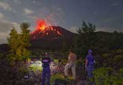
Sabancaya volcano (Peru): seismic unrest and ground deformation
Tue, 14 May 2013, 15:17 | BY: T

Ground deformation (deflation) at Sabancaya volcano measured by InSAR (IGP)
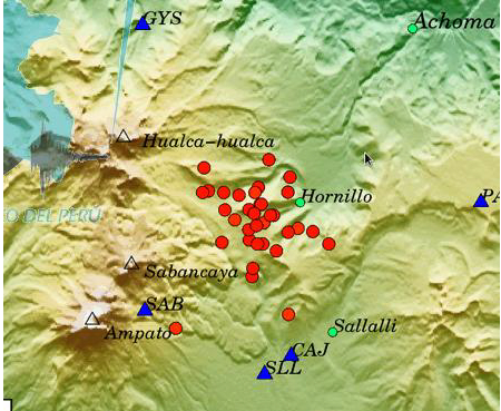
Location of recent earthquakes (IGP)
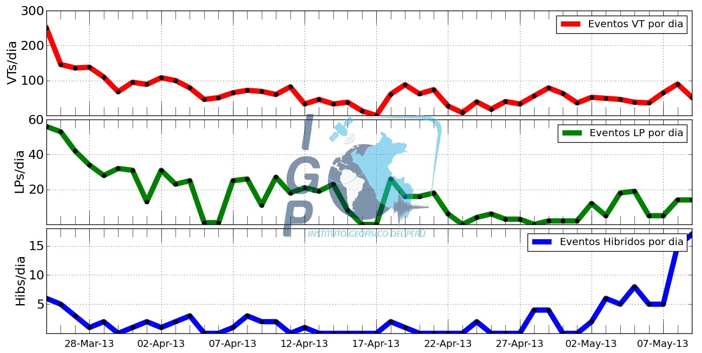
Seismic activity during the past weeks (IGP)
So-called "hybrid" earthquakes (related to both the fracturing of rock and fluid movements) have increased since 2 May, while purely volcanic-tectonic quakes have remained stable.
Satellite-born InSAR radar measurements showed that the area of the current seismicity (north-east of the volcano, just above the village of Hornillo), has shown subsidence of about 7 cm, which is possibly related to magma draining from there into different reservoirs.
- All news about: Sabancaya volcano
- Information about: Sabancaya volcano
---
Links / Sources:
Links / Sources:
Previous news
Sun, 12 May 2013, 16:35
Sabancaya volcano (Peru): possible ash emissions
Possible eruptions have started at the volcano. Pilots reported several volcanic ash plumes from the volcano in the past days although VAAC Buenos Aires could not identify ash on satellite imagery. ... Read all
Wed, 8 May 2013, 06:00
Sabancaya volcano (Peru) - Smithsonian / USGS Weekly Volcanic Activity Report for 8 May-14 May 2013 (Continuing Activity)
On 10 May Instituto Geofísico de Perú (IGP) reported that results of an interferogram of Sabancaya provided by a collaborator at Cornell University showed that an area of deformation (subsidence of 7 cm centered at 6 km NE of the crater) was coincident with the main area of seismicity. Volcano-tectonic (VT) earthquakes continued to dominate the seismic signals, although long-period (LP) events continued to be detected. There was also an increase of hybrid events. ... Read all
Show more