Contact | RSS | EN | DE | EL | ES | FR | IT | RU

Sabancaya Volcano Volcanic Ash Advisory: INTERMITTENT EMISSIONS to 26000 ft (7900 m)

Tue, 16 Jul 2019, 19:45 | BY: VN
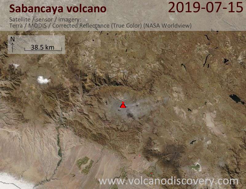
Satellite image of Sabancaya volcano on 16 Jul 2019
Explosive activity continues. Volcanic Ash Advisory Center (VAAC) Buenos Aires warned about a volcanic ash plume that rose up to estimated 26000 ft (7900 m) altitude or flight level 260 .
The full report is as follows:

FVAG01 at 19:39 UTC, 16/07/19 from SABM
VA ADVISORY
DTG: 20190716/1940Z

VAAC: BUENOS AIRES

VOLCANO: SABANCAYA 354006
PSN: S1547 W07150

AREA: PERU

SUMMIT ELEV: 19576 FT [5967 M]

ADVISORY NR: 2019/802

INFO SOURCE: GOES-E. VOLCANO WEB CAMERA.

AVIATION COLOR CODE: NOT GIVEN

ERUPTION DETAILS: INTERMITTENT EMISSIONS

OBS VA DTG: 16/1900Z

OBS VA CLD: SFC/FL260 S1546 W07155 - S1546 W07148
- S1614 W07117 - S1617 W07152 - S1546 W07155 MOV
S 20KT

FCST VA CLD +6HR: 17/0100Z SFC/FL260 S1548 W07147
- S1619 W07113 - S1624 W07153 - S1553 W07156 -
S1548 W07147

FCST VA CLD +12HR: 17/0700Z SFC/FL260 S1547
W07148 - S1618 W07101 - S1632 W07139 - S1547
W07155 - S1547 W07148

FCST VA CLD +18HR: 17/1300Z SFC/FL260 S1547
W07148 - S1628 W07053 - S1641 W07138 - S1549
W07155 - S1547 W07148

RMK: VA PULSES MVG SE ARE DETECTED IN SATELLITE
IMAGERY. WEBCAM REVEALS INTEMITTENT EMISSIONS OF
VA ...SMN

NXT ADVISORY: WILL BE ISSUED BY 20190717/0140Z=

Previous news

Show more
Sabancaya volcano
stratovolcano 5967 m / 19,577 ft
Peru, -15.78°S / -71.85°W
Current status: erupting (4 out of 5) Sabancaya volcano eruptions:
2016, 2015, 2014, 2003, 2000, 1998, 1997, 1990-95, 1988, 1986, 1784, 1750, <1595(?)
Typical eruption style
explosive and effusive
Try our free app!
Volcanoes & Earthquakes - new app for Android
Android | iOS version

More on VolcanoDiscovery

Why is there advertising on this site?

Support us - Help us upgrade our services!

We truly love working to bring you the latest volcano and earthquake data from around the world. Maintaining our website and our free apps does require, however, considerable time and resources.
We need financing to increase hard- and software capacity as well as support our editor team. We're aiming to achieve uninterrupted service wherever an earthquake or volcano eruption unfolds, and your donations can make it happen! Every donation will be highly appreciated. If you find the information useful and would like to support our team in integrating further features, write great content, and in upgrading our soft- and hardware, please make a donation (PayPal or Online credit card payment).

Planned features:Thanks to your past donations, these features have been added recently:
Download and Upgrade the Volcanoes & Earthquakes app to get one of the fastest seismic and volcano alerts online:
Android | IOS
Thank you!
Sources: VolcanoDiscovery / VolcanoAdventures and other sources as noted.
Use of material: Most text and images on our websites are owned by us. Re-use is generally not permitted without authorization. Contact us for licensing rights.
Volcanoes & Earthquakes
VolcanoDiscovery Home
Volcanoes | Earthquakes | Photos | Volcano News | App
Adventure & Study Travel
Tours to Volcanoes and Volcanic Areas: walking tours, photo tours, study tours
Tours & Dates | FAQ | About us
Get our newsletter!
Company info
Contact | Legal info | Terms & conditions
Follow us
Follow us on facebook Follow us on Instagram Follow us on Twitter Visit our Youtube channel
EN | DE | EL | ES | FR | IT | RU
VolcanoDiscovery GmbH, Germany, Reg. nr.: HRB 103744, EU Tax Id: DE 297 465 123 owned and created by
Dr. Tom Pfeiffer, volcanologist, volcano photographer, tour organizer member of
IAVCEI
IAVCEI
Vulkanologische Gesellschaft
Volcanological Society
Ecotourism Greece
Ecotourism Greece
RUV insurance
Insured by R+V
VolcanoDiscovery © 2004- All Rights Reserved | Privacy - Cookie Settings