Sirung Volcano
Updated: Apr 20, 2024 05:05 GMT -
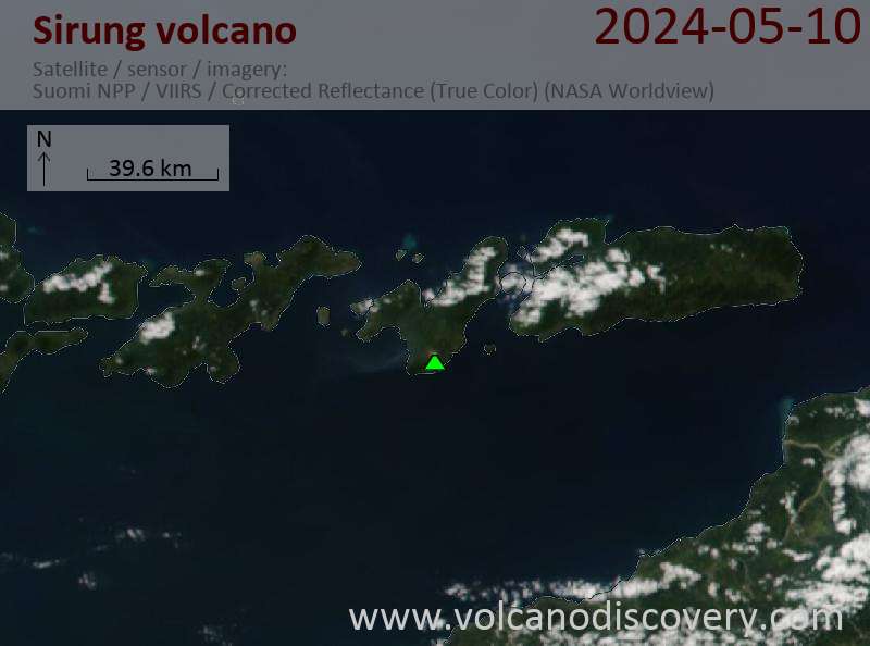
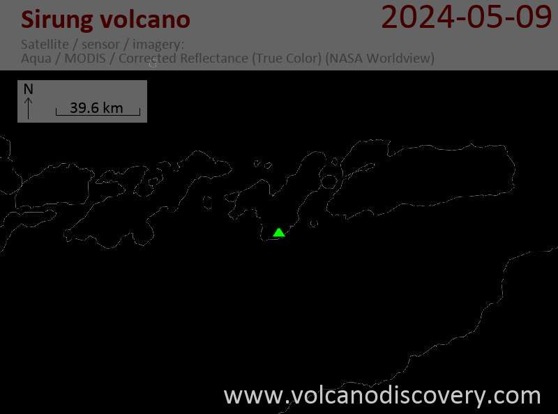
stratovolcano 862 m / 2,828 ft
Pantar Island, Indonesia , -8.51°S / 124.13°E
Current status: normal or dormant (1 out of 5)
Pantar Island, Indonesia , -8.51°S / 124.13°E
Current status: normal or dormant (1 out of 5)
Last update: 6 Apr 2022 (Smithsonian / USGS Weekly Volcanic Activity Report)
Sirung is a frequently active volcano on Pantar Island, 77 km north of the island of Timor. Sirung has a 2 km wide caldera which usually contains an acid crater lakes in the rain season. Gunung Sirung is a lava dome located on the caldera's western rim.
[smaller] [larger]
Sirung volcano eruptions: 2012, 2004 (?), 1970, 1965, 1965, 1964, 1960, 1953, 1947, 1934, 1927 (?), 1899 (?), 1852 (?)
Latest nearby earthquakes
| Time | Mag. / Depth | Distance / Location | |||
Background
Sirung volcano is located at the NE end of a 14-km-long line of volcanic centers that form a peninsula at the southern end of Pantar Island. The low, 862-m-high volcano is truncated by a 2-km-wide caldera whose floor often contains one or more small lakes. Much of the volcano is constructed of basaltic lava flows, and the Gunung Sirung lava dome forms the high point on the caldera's western rim. A number of phreatic eruptions have occurred from vents within the caldera during the 20th century. Forested Gunung Topaki, the 1390-m high point of the volcanic chain, lies at the SW end and contains a symmetrical summit crater.---
Source: GVP
Eruptions of Sirung volcano
Sirung hot springs & crater lake
Strong fumaroles and boiling springs are found in Sirung's large crater. The crater contains often a highly acid (pH = 0.75), warm (40 deg C), grey-coloured crater lake where volcanic gasses escape in bubbles. The gasses are unusually rich in chlorine. The lake is similar to Kawah lien crater lake in East Java. ...more info
Strong fumaroles and boiling springs are found in Sirung's large crater. The crater contains often a highly acid (pH = 0.75), warm (40 deg C), grey-coloured crater lake where volcanic gasses escape in bubbles. The gasses are unusually rich in chlorine. The lake is similar to Kawah lien crater lake in East Java. ...more info
Beangabang Bay hot springs
A second area of hot springs is found on the beach of Beangabang Bay east of Sirung's crater. Water from these springs mixes with seawater.
A second area of hot springs is found on the beach of Beangabang Bay east of Sirung's crater. Water from these springs mixes with seawater.
2004 uncertain eruption
Eruptions of "smoke and dust" were reported by press around 13 May 2004, but according to the Indonesian Volcanological Survey, these reports were false.
Eruptions of "smoke and dust" were reported by press around 13 May 2004, but according to the Indonesian Volcanological Survey, these reports were false.
1987 earthquake
A volcanologist from the Indonesian Volcanological Survey visited the volcano on 12 December, following an earthquake of M6.5 on 26 November. Fumaroles and the crater lake were normal and showed no evidence of increased activity. The only notable change in the crater was a fresh landslide scar that perhaps had resulted from the earthquake.
A volcanologist from the Indonesian Volcanological Survey visited the volcano on 12 December, following an earthquake of M6.5 on 26 November. Fumaroles and the crater lake were normal and showed no evidence of increased activity. The only notable change in the crater was a fresh landslide scar that perhaps had resulted from the earthquake.
1934 eruption
Sirung volcano erupted on 14-15 June 1934. Detonations were heard in Ilakalau village and the following morning the crater rim was observed to be covered by white fresh ash deposits. On 16 June lapilli fell in Ilakalau village. On 17 June dense ash clouds were erupted 5-10 minutes. On 26 June, 30 m high lava fountains or strombolian activity were observed at the crater.
Sirung volcano erupted on 14-15 June 1934. Detonations were heard in Ilakalau village and the following morning the crater rim was observed to be covered by white fresh ash deposits. On 16 June lapilli fell in Ilakalau village. On 17 June dense ash clouds were erupted 5-10 minutes. On 26 June, 30 m high lava fountains or strombolian activity were observed at the crater.
Latest satellite images