QWA: a new tool for analysing climate response to volcanism
Tue, 16 Feb 2021, 09:37 09:37 AM | BY: ELEANOR WRIGHT
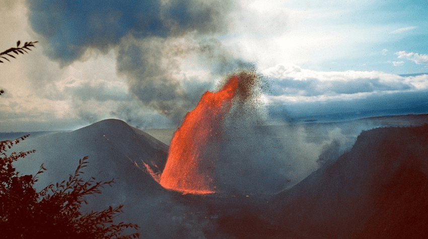
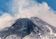
Laki, Iceland – The 1783-1784 fissure eruption produced a haze that engulfed most of Europe. Large quantities of aerosols emitted during the effusive fissure eruption resulted in a significant global volcanic-induced cooling episode, with climate impacts felt thousands of miles away in locations such as China and Japan. It is suggested that this eruption and the resulting crop failures/ famine triggered the French Revolution (1789-1799) (Image: A.Robock on EOS).

Example of Alaskan May–August temperature reconstruction using MXD method, a pronounced cold anomaly is clear following the eruption of Laki, Iceland in 1783. Lower left inset shows annual ring width increments in white spruce from Alaska with dates highlighted. MXD measures the peak density value in the latewood of each year. Note very low density in 1783 in this wood section (Image: D’Arrigo et al. 2013).
Volcanic eruptions are the most significant natural radiative forcing on Earth's climate system. During large explosive eruptions, huge quantities of sulphur aerosols are injected into the atmosphere, encircling the planet. This reduces incoming solar radiation and alters the energy balance, consequently causing an overall decrease in global mean surface temperature. It produces, what is commonly termed, a 'volcanic cooling episode'. Large tropical eruptions, such as Tambora 1815, Krakatoa 1883 and Pinatubo 1991, typically produce the greatest climatic impacts due to their equatorial location. However, high-latitude eruptions such as Laki, Iceland 1783 should not be overlooked as these can still have significant impact on global climate.
Dendrochronology – the study of tree rings – has successfully been used to reconstruct past climate. It also provides an important proxy for understanding the timing and environmental impacts of volcanic eruptions. Tree rings can be precisely dated and provide an annual resolution of the conditions and climate that prevailed at the time the tree ring developed. Ring width and density reconstructions provide quantitative information for inferring the variability and sensitivity of the Earth's climate system on local to hemispheric scales and can be combined with other proxy archives to analyse the widespread impacts of large volcanic eruptions, particularly volcanic cooling episodes.
There are several dendrochronological methods used to analyse climate response to volcanic events and identify volcanic cooling episodes. Ring Width (RW) analyses the annual increments of the growth rings in trees – typically, a tree will respond to poor environmental conditions by producing narrow ring widths (often known as 'frost rings'whereby the tree ring contains visible cellular damage most likely due to sudden and adverse cold events). However, studies suggest this method can underestimate the volcanic cooling effect and often shows a lagged response.
Maximum Latewood Density (MXD) has been considered the best tree-ring metric for accurately reconstructing interannual high-latitude temperature variability and used for many years as the better proxy for quantifying volcanic climate signals. Although it is a more appropriate method than RW, it has been suggested that additional factors may potentially lead to overestimation of the duration and magnitude of volcanic cooling episodes.
A new study published in the Journal of Geophysical Research by Edwards et al. has used an alternative fine-scale dendrochronology technique, known as Quantitative Wood Anatomy (QWA) combined with climate model simulations, to investigate climatic anomalies and cooling episodes following the Laki 1783-1784 eruption. The study used tree samples from Alaska. Tree rings were very thinly sliced and stained. Computer software was used to calculate the thickness of each of the stained cells – in warm years, the walls of these cells are thickened, and the wood appears darker. In cold years, the cell walls are thin, and the wood appears light and less dense.
Edwards et al. concluded that investigating cell characteristics by QWA measurements can provide novel information, beyond that available from MXD or RW methods. The high-resolution QWA data can identify the precise timing of cooling within the trees growing season and can likely be used to quantify temperature anomalies during narrower periods of the growing season, differentiating between overall growing season cooling and transient cold events following eruptions. It can provide a week-to-week perspective on an individual climate anomaly caused by a volcanic eruption.
A better understanding of the climate impacts following volcanic eruptions will help society prepare for the consequences of future eruptions and to evaluate the ability of climate models to simulate the Earth system response to changes in radiative forcing. Studies such as this highlight how QWA can provide a valuable new tool for more precisely quantifying and pin-pointing the timing and magnitude of climatic response to volcanism.
---
Links / Sources:
Links / Sources:
Previous news
Tue, 2 Feb 2021, 18:03
Shiveluch – World’s most explosive volcano hosts unique superhydrous magma
Water is a key ingredient for fuelling explosive volcanic eruptions. Water-rich magma contains higher proportions of volatiles (gases), increasing buoyancy and therefore driving the upward movement of the magma to the surface. The increase in gases within the magma also increases the pressure, causing the explosive nature of eruptions with this magmatic composition. ... Read all
Wed, 13 Jan 2021, 09:34
The grandest canyon in the Solar System – a product of ancient Martian volcanism
Volcanism is not confined to planet Earth and thanks to decades of revolutionary work by planetary scientists, we now have abundant evidence that volcanism exists on every terrestrial planet, on many of the moons and even some asteroid belts! ... Read all
Show more