Volcanic activity worldwide 7 Jul 2016: Kliuchevskoi volcano, Alaid, Kilauea
Thu, 7 Jul 2016, 21:00 21:00 PM |

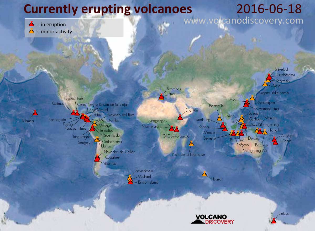
Map of today's active volcanoes
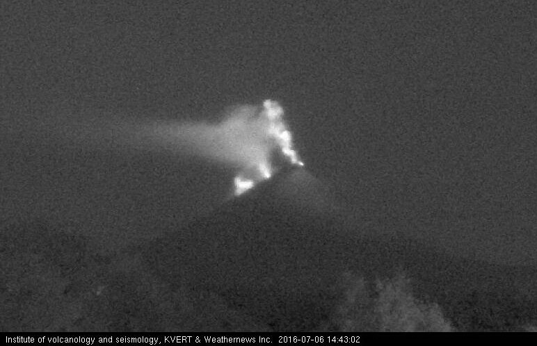
Lava flow and glow from strombolian explosions at Klyuchevskoy volcano on 6 July 2016 (KVERT)
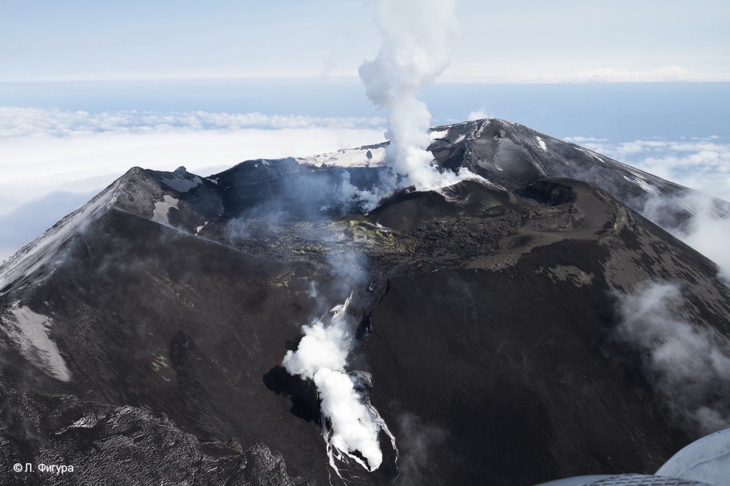
Aerial view of Alaid volcano (Image: L. Fugura / KVERT)
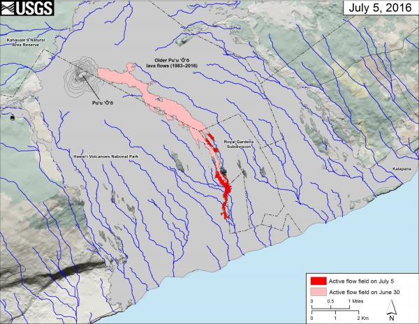
Map of Kilauea's new lava flow headed towards the ocean (map: HVO)
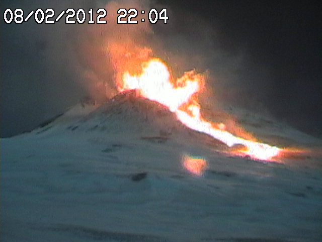
During end of June, a series of collapses occurred from the lava flow on the eastern slope, generating small glowing avalanches.
The rhythmic explosive activity at the summit crater also generates occasional "smoke rings" (or better: gas rings, ring vortexes created by rapid degassing through circular vents) such as the one shown in the second picture attached.
Alaid (Northern Kuriles): The activity at the volcano has again picked up. An intense thermal anomaly is visible on recent satellite data and is stronger than during the preceding eruptive phase in March-May this year.
A (rare) aerial image taken on 28 April shows the volcano's summit occupied by fresh lava, a new cinder cone and a breach in the southwestern crater wall with a lava flow tongue present on its slope beneath (visible by the steaming front).
The current thermal anomaly is almost certainly due to another phase of intense lava effusion, likely in the same location (although recent photographs would be need to confirm this).
Kilauea (Hawai'i): The new lava flow southeast of Puʻu ʻŌʻō continued to be active and made some rapid advance through the coastal plain: when HVO last mapped it Tuesday afternoon, the nearest lava front was only about 1.7 km (1.1 miles) away from the coast, after having advanced nearly 1 km alone since the morning of Monday (i.e. little more than 24 hours).
If the current rapid advance continues, lava might begin to flow into the ocean - and construct new land on Hawai'i - very soon (few days?).
Previous news
Mon, 4 Jul 2016, 21:00
Volcanic activity worldwide 4 Jul 2016: Sinabung volcano, Kilauea

Sinabung (Sumatra, Indonesia): Explosions of small to moderate size continue to be relatively frequent lately. This morning, an explosion produced an ash plume that rose 1500 meters above he volcano's summit. ... Read all
Sat, 2 Jul 2016, 21:00
Volcanic activity worldwide 2 Jul 2016: Pavlof volcano, Sinabung, Kilauea

Sinabung (Sumatra, Indonesia): The volcano continues to erupt with little changes overall during the past months. An explosion at the lava dome today at 13:35 local time produced an ash plume that rose approx. 1100 m above the summit. ... Read all
Show more