West Eifel Volcanic Field Volcano
Updated: Apr 18, 2024 14:22 GMT -
Volcanic field, maars, cinder cones 600 m / 1,969 ft
Germany, 50.17°N / 6.85°E
Current status: (probably) extinct (0 out of 5)
Germany, 50.17°N / 6.85°E
Current status: (probably) extinct (0 out of 5)
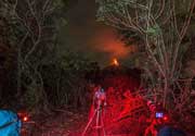
The West Eifel Volcanic Field of western Germany is located SW of the city of Bonn and covers an area of approx. 600 sq km. It contains approx. 240 cinder cones and explosion craters, often lake-filled, known as maars, as well as small stratovolcanoes.
Most of the volcanic activity in this area took place mostly in past 730,000 years, with the most recent eruption dating back little more than 10,000 years at the Ulmener, Pulvermaar, and Strohn maars.
[smaller] [larger]
West Eifel Volcanic Field volcano eruptions: 10,300 years ago
Latest nearby earthquakes
| Time | Mag. / Depth | Distance / Location | |||
Background
The smaller, but better known, East Eifel Volcanic Field is about 40 km NE. Individual vents spread across a broad NW-SE-trending area extending about 50 km from the towns of Ormont on the NW to Bad Bertrich on the SE. Eruptions originated from a mantle plume through Devonian sedimentary and metamorphic rocks.Two-thirds of the volcanic centers in the field are scoria cones; lava flows have been produced from about half of them. About 30% of the centers are maars or tuff rings, many of which are occupied by lakes.
About 230 eruptions have occurred during the past 730,000 years. The latest eruptions formed the Ulmener, Pulvermaar, and Strohn maars around the end of the Pleistocene and the beginning of the Holocene.
The West Eifel volcanic field is part of the Vulkaneifel, a UNESCO Global Geopark property.
West Eifel Volcanic Field Volcano Photos
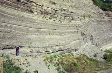
The famous Wingertsbergwand, an excellent exposure of proximal pyroclastic fall and surge deposits form the Plinian Laacher See volcano eruption 10,700 years ago (East Ei...
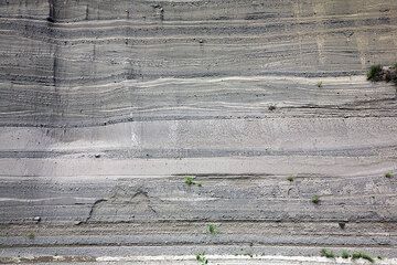
Pyroclastic deposits fro the Laacher See volcano eruption 10,700 years ago (East Eifel volcanic field, Western Germany) (Photo: Tobias Schorr)
Latest satellite images