Contact | RSS | EN | DE | EL | ES | FR | IT | RU

Agung volcano (Bali, Indonesia): Volcanic Alert Level lowered to Green

Sat, 18 Sep 2021, 00:29 | BY: MARTIN
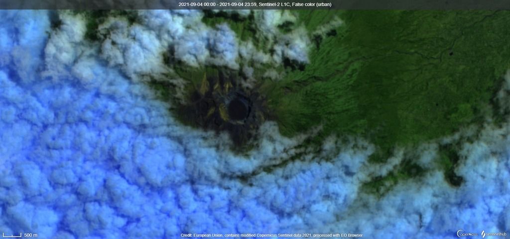
Satellite image of Agung volcano on 4 September (image: Sentinel 2)
Based on volcano monitoring data and visual observations during 1 Jan-13 Sept, the volcano observatory PVMBG reported that the activity at the volcano decreased significantly.
Its currently stable condition suggests that there is a delicate equilibrium. Therefore, the alert level for the volcano was lowered to "green".
A continuous degassing activity continues at the summit vent characterized by "only" venting of emissions of steam and gases.
The seismic network recorded approx. 500 volcano-tectonic earthquakes during this period. This is likely reflecting continued magma flux within the volcano edifice at low intensity.
Surface temperatures continue at reduced levels, detected by Modis satellite, that indicates a decreased batch of magma inside the volcano's conduits.
The warning bulletin states to avoid activities in the crater area of the volcano for climbers and tourists.
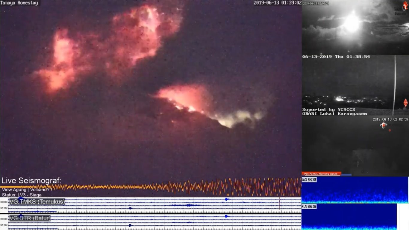
The last explosive eruption at the volcano occurred on 13 June 2019.
Source: Pusat Vulkanologi dan Mitigasi Bencana Geologi volcano activity update 17 September 2021

Previous news

Wed, 15 Sep 2021, 06:00

Agung volcano (Bali, Indonesia) - Smithsonian / USGS Weekly Volcanic Activity Report for 15 September-21 September 2021 (Continuing Activity)

PVMBG reported that activity at Agung was last observed on 13 June 2019 and a thermal anomaly over the crater was last identified in satellite images in October 2019. During the previous year deformation data indicated no changes at the volcano and seismicity decreased. During 1 Janaury-13 September white gas-and-steam plumes rose 20-50 m above the summit. ... Read all
Wed, 15 Jul 2020, 06:00

Agung volcano (Bali, Indonesia) - Smithsonian / USGS Weekly Volcanic Activity Report for 15 July-21 July 2020 (Continuing Activity)

PVMBG reported that the last eruption at Agung was recorded at 0138 on 13 June 2019. Over the past year seismicity had generally decreased; volcanic earthquakes continued to be recorded but at a low occurrence rate. Deformation data indicated a deflationary pattern which had stabilized in recent months. ... Read all
Show more
Hazard map of Agung volcano (Sep 2017)
Hazard map of Agung volcano (PVMBG)
Agung volcano
Stratovolcano 3142 m (10,308 ft)
Bali (Indonesia), -8.34°S / 115.51°E
Current status: normal or dormant (1 out of 5) Agung volcano eruptions:
1808, 1821(?), 1843, 1963-64 (large Plinian eruption on March 16, 1963), 2017-ongoing
Typical eruption style
Highly explosive.
Try our free app!
Volcanoes & Earthquakes - new app for Android
Android | iOS version

More on VolcanoDiscovery

Why is there advertising on this site?

Support us - Help us upgrade our services!

We truly love working to bring you the latest volcano and earthquake data from around the world. Maintaining our website and our free apps does require, however, considerable time and resources.
We need financing to increase hard- and software capacity as well as support our editor team. We're aiming to achieve uninterrupted service wherever an earthquake or volcano eruption unfolds, and your donations can make it happen! Every donation will be highly appreciated. If you find the information useful and would like to support our team in integrating further features, write great content, and in upgrading our soft- and hardware, please make a donation (PayPal or Online credit card payment).

Planned features:Thanks to your past donations, these features have been added recently:
Download and Upgrade the Volcanoes & Earthquakes app to get one of the fastest seismic and volcano alerts online:
Android | IOS
Thank you!
Sources: VolcanoDiscovery / VolcanoAdventures and other sources as noted.
Use of material: Most text and images on our websites are owned by us. Re-use is generally not permitted without authorization. Contact us for licensing rights.
Volcanoes & Earthquakes
VolcanoDiscovery Home
Volcanoes | Earthquakes | Photos | Volcano News | App
Adventure & Study Travel
Tours to Volcanoes and Volcanic Areas: walking tours, photo tours, study tours
Tours & Dates | FAQ | About us
Get our newsletter!
Company info
Contact | Legal info | Terms & conditions
Follow us
Follow us on facebook Follow us on Instagram Follow us on Twitter Visit our Youtube channel
EN | DE | EL | ES | FR | IT | RU
VolcanoDiscovery GmbH, Germany, Reg. nr.: HRB 103744, EU Tax Id: DE 297 465 123 owned and created by
Dr. Tom Pfeiffer, volcanologist, volcano photographer, tour organizer member of
IAVCEI
IAVCEI
Vulkanologische Gesellschaft
Volcanological Society
Ecotourism Greece
Ecotourism Greece
RUV insurance
Insured by R+V
VolcanoDiscovery © 2004- All Rights Reserved | Privacy - Cookie Settings