Contact | RSS | EN | DE | EL | ES | FR | IT | RU

Cotopaxi volcano (Ecuador) - Smithsonian / USGS Weekly Volcanic Activity Report for 26 August-1 September 2015 (New Activity / Unrest)

Wed, 26 Aug 2015, 06:00 | BY: VN
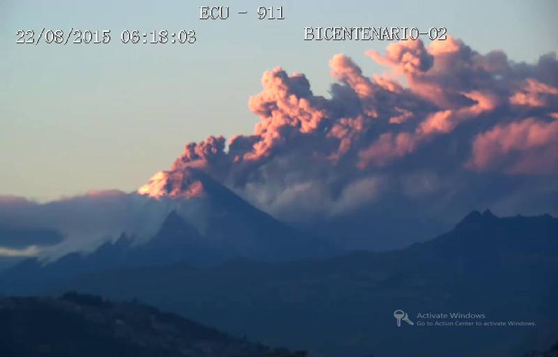
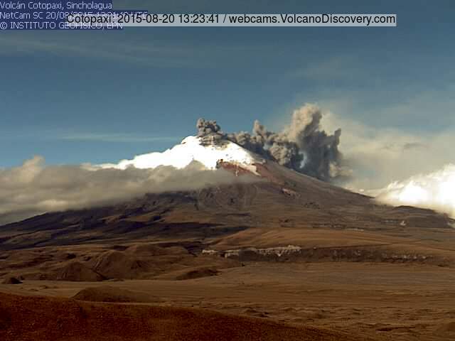
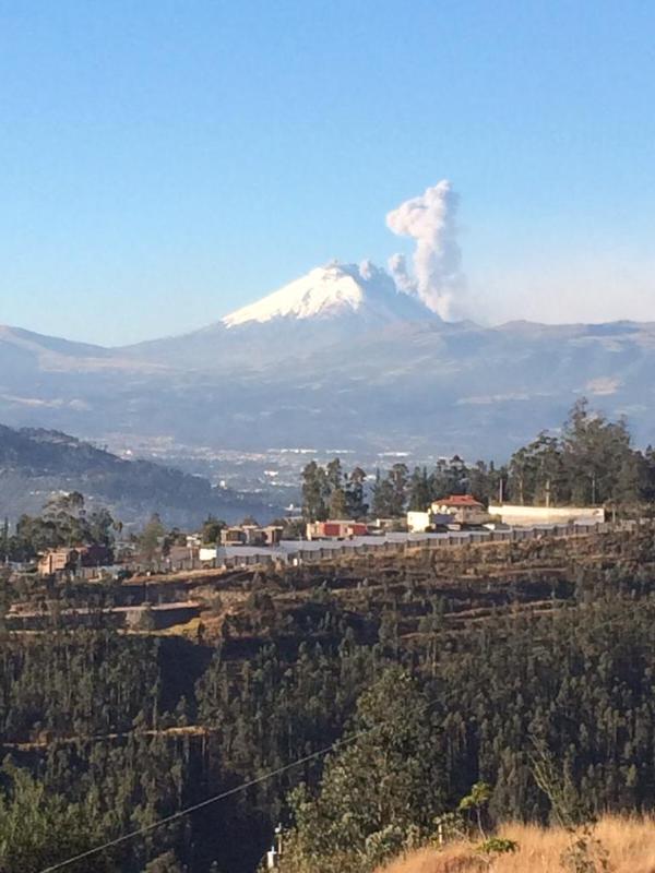
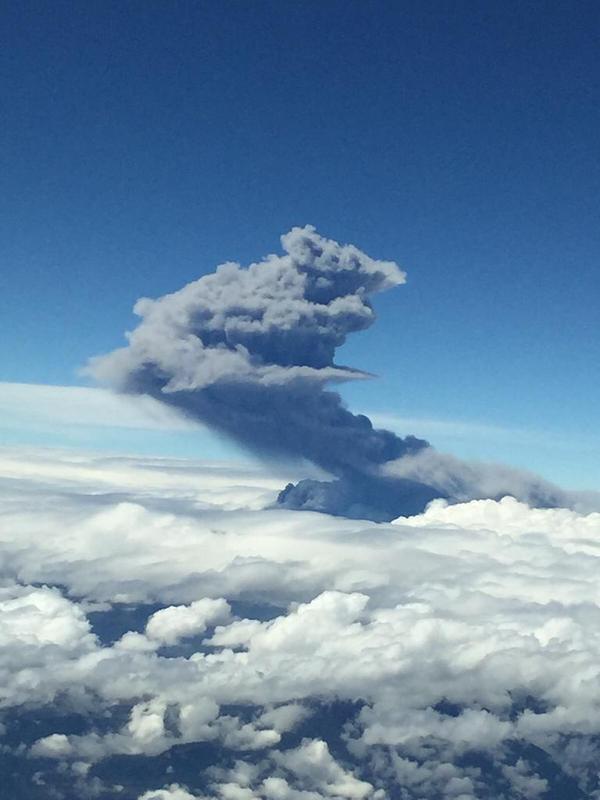
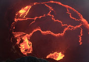
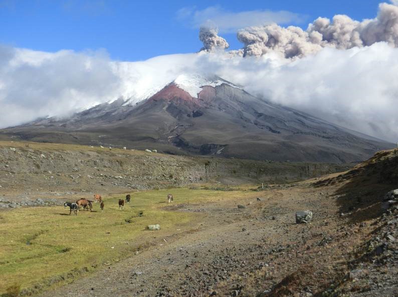
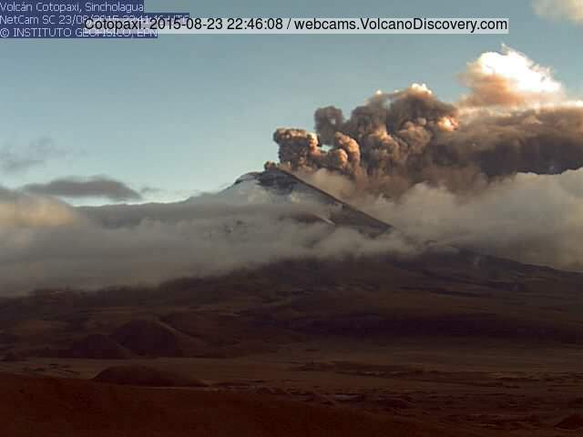
According to IG, fieldwork revealed that the volume of material ejected since the onset of the eruption at Cotopaxi was an estimated 56,000 cubic meters on 14 August and 19,500 cubic meters during 15-21 August. Thermal images obtained during overflights on 18 and 26 August revealed a significant increase in the temperatures of emissions (150 degrees Celsius on 26 August) and at different areas in the crater.


Since the onset of continuous tremor on the evening of 22 August there had been very few breaks in ash-and-gas emissions. During 25-31 August ash-and-steam emissions were observed rising at most 2 km above the crater and drifting NW, W, and SW. Based on Washington VAAC reports, IG noted on 26 August that the plume rose as high as 9 km (29,500 ft) a.s.l.
Ashfall was reported in a wide area to the WSW, millimeters thick in some areas. During 25-26, 28, and 30-31 August areas reporting ashfall included Manabi (El Carmen, 165 km W), Santo Domingo de los Tsáchilas (95 km NW), Pastocalle, Santa Ana, Cerro Azul, Azachul, Leonidas Plaza (40 km N), Bahia de Caraquez (220 WNW), Charapotó (230 W), Pichincha, Rocafuerte (225 WSW), Machachi (25 km NW), Tambillo (33 km NNW), Aloag (28 km NNW), and Chaupi. The mayor of Sigchos, in the Province of Cotopaxi, noted impacts on livestock, crops, and greenhouses.
A small lahar descended the W flank on 28 August. Emissions later in the day on 31 August were mostly water vapor and gas, with low amounts of ash.

Source: Instituto Geofísico-Escuela Politécnica Nacional (IG)
---
From: Global Volcanism Program, 2015. Report on Cotopaxi. In: Mayberry, G (ed.), Weekly Volcanic Activity Report 26 August-1 September 2015. Smithsonian Institution and US Geological Survey.

Previous news

Tue, 25 Aug 2015, 15:55

Cotopaxi volcano update: Continuous ash emissions, volcanic tremor

Ash emissions from Cotopaxi yesterday (photo: Patricia Mothes / IGEPN)
The eruption continues with similar activity as during the past days, with a gradually increasing trend. Accompanied by near-continuous tremor, the volcano now produces almost constant, dense ash plumes rising up to 2 km and drifting into westerly directions, reaching the Pacific Ocean. ... Read all
Mon, 24 Aug 2015, 08:07

Cotopaxi volcano update: Continuing ash emissions 2 km high

Ash plume from Cotopaxi last evening
Activity at the volcano remains more or less similar with moderately strong, near continuous ash emissions producing a plume rising approx. 2 km and drifting into westerly directions. ... Read all
Show more
Cotopaxi volcano
stratovolcano 5911 m / 19,393 ft
Ecuador, -0.68°S / -78.44°W
Current status: minor activity or eruption warning (3 out of 5) Cotopaxi volcano eruptions:
2015-16, 1942(?), 1940, 1939(?), 1931(?), 1928-30(?), 1905-08, 1903, 1895, 1886, 1885, 1883?, 1883, 1882, 1880, 1879, 1878, 1877, 1870-76, 1870, 1869, 1868, 1867, 1866, 1863, 1860-62, 1859, 1858, 1857, 1856, 1856, 1855, 1854, 1853, 1852, 1851, 1850, 1845, 1844, 1803, 1768, 1766, 1750, 1747-49, 1746, 1744, 1743, 1743, 1742, 1742, 1740-41, 1738, 1698, 1534, 1533, 1532, 1400, 1260, 1130, 950, 770, 760, 740, 550, 370, 180, 140, 110, 70, 80 BC, 230 BC, 1510 BC, 2220 BC, 2640 BC
Typical eruption style
explosive
Try our free app!
Volcanoes & Earthquakes - new app for Android
Android | iOS version

More on VolcanoDiscovery

Why is there advertising on this site?

Support us - Help us upgrade our services!

We truly love working to bring you the latest volcano and earthquake data from around the world. Maintaining our website and our free apps does require, however, considerable time and resources.
We need financing to increase hard- and software capacity as well as support our editor team. We're aiming to achieve uninterrupted service wherever an earthquake or volcano eruption unfolds, and your donations can make it happen! Every donation will be highly appreciated. If you find the information useful and would like to support our team in integrating further features, write great content, and in upgrading our soft- and hardware, please make a donation (PayPal or Online credit card payment).

Planned features:Thanks to your past donations, these features have been added recently:
Download and Upgrade the Volcanoes & Earthquakes app to get one of the fastest seismic and volcano alerts online:
Android | IOS
Thank you!
Sources: VolcanoDiscovery / VolcanoAdventures and other sources as noted.
Use of material: Most text and images on our websites are owned by us. Re-use is generally not permitted without authorization. Contact us for licensing rights.
Volcanoes & Earthquakes
VolcanoDiscovery Home
Volcanoes | Earthquakes | Photos | Volcano News | App
Adventure & Study Travel
Tours to Volcanoes and Volcanic Areas: walking tours, photo tours, study tours
Tours & Dates | FAQ | About us
Get our newsletter!
Company info
Contact | Legal info | Terms & conditions
Follow us
Follow us on facebook Follow us on Instagram Follow us on Twitter Visit our Youtube channel
EN | DE | EL | ES | FR | IT | RU
VolcanoDiscovery GmbH, Germany, Reg. nr.: HRB 103744, EU Tax Id: DE 297 465 123 owned and created by
Dr. Tom Pfeiffer, volcanologist, volcano photographer, tour organizer member of
IAVCEI
IAVCEI
Vulkanologische Gesellschaft
Volcanological Society
Ecotourism Greece
Ecotourism Greece
RUV insurance
Insured by R+V
VolcanoDiscovery © 2004- All Rights Reserved | Privacy - Cookie Settings