La Palma volcano eruption update: lava flows destroy houses, might reach the sea
Mon, 20 Sep 2021, 10:18 | BY: T
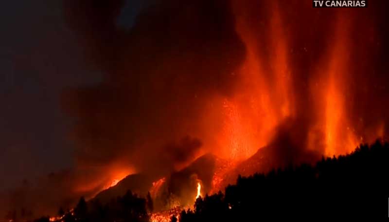
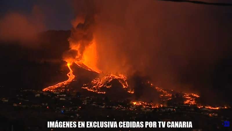
Lava fountains from the main vents early this morning (image: Canaria TV)
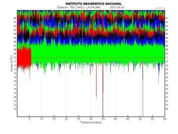
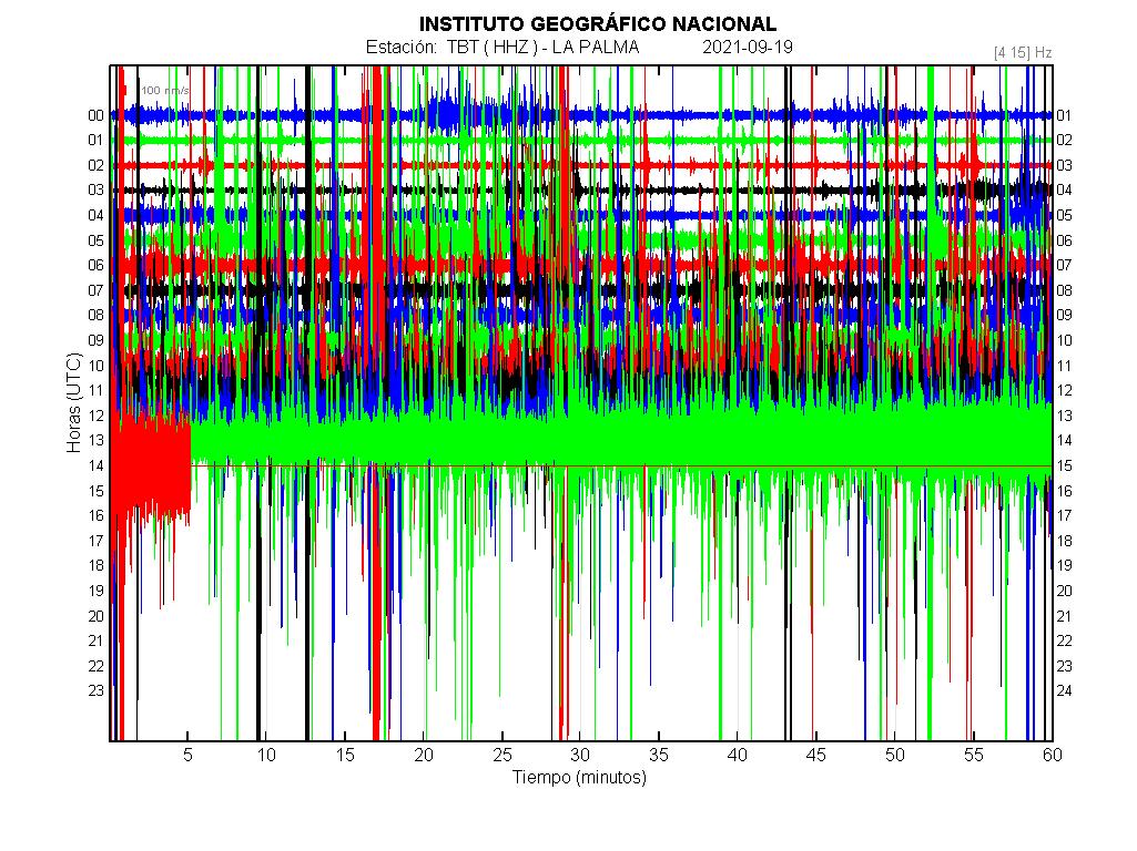
Seismic signal from TBT station showing strong continuous tremor
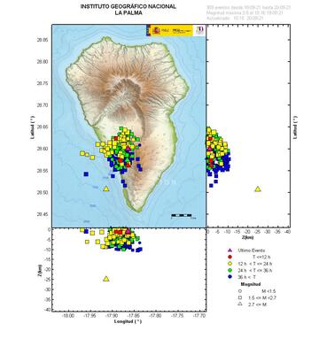
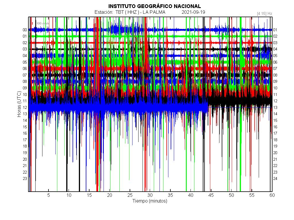
Earthquakes under La Palma during the past 3 days (image: IGN)
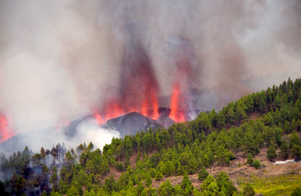
A sizeable new cinder cone, typically described as “new volcano”, has already formed around the main vent. Lava fountains continue to shoot many tens of meters into the air from the most active vents.
Lava flows continued to advance, at an average speed of 700 m per hour, towards the west coast. The flows have already destroyed around a hundred homes in the municipality of El Paso, according to the first calculations of the Civil Protection. Fortunately, there has only been damage to property but not to people as the advance of the lava is slow enough to allow a managed evacuation and escape.
Some 5,000 people have been evacuated from the municipalities of El Paso, Los Llanos de Aridane and Tazacorte so far. An exclusion zone of 2 km radius around the eruption site has been emplaced, in order to protect people from gasses and projectiles.
There is a possibility that the lava reaches the sea, as has happened during other eruptions on La Palma, but it will depend on the available magma to erupt and the duration of the eruption. Scientists believe that they will be able to give some first estimates on these after about 48 hours of eruption, when the trend of the effusion rate can be estimated.
Ángel Víctor Torres, president of the Canary Islands, explained in an interview the "in 48 hours, a little earlier, they will be able to predict how long the eruption will last" of the La Palma volcano. He also confirmed that for the moment no more evacuations are foreseen since as long as the lava follows the projected paths downslope and the eruption doesn't change significantly.
Scientists estimate that the available magma volume is between 17 and 20 million cubic meters of magma, according to the President of the Government of the Canary Islands, Ángel Víctor Torres. This amount far exceeds the 11 million cubic meters initially estimated by modelling the deformation observed prior to the eruption. For comparison, this represents less than half of the lava erupted during the 1971 Teneguía eruption, which was 43 million cubic meters.
The first estimate of the amount of sulfur dioxide (SO2) emitted into the atmosphere by the volcanic eruption is of the order of 6,000 —9,000 tons per day.
Lava has already destroyed isolated houses:
Y así ha llegado la lava a las casas pic.twitter.com/LXkjoVhcZ3
— Enrique Rodríguez (@rodriguezcoello) September 19, 2021
We would like to show you embedded content from X/Twitter. If you like to see such content, please make sure you agree with the privacy policy of X/Twitter and click the button:
View embedded content from X/Twitter
View embedded content from X/Twitter
#InformativosCR
— Canarias Radio (@laautonomica) September 19, 2021
#Vídeo | Las coladas de lava, en su trayectoria hacia el mar, ya han afectado a varias viviendas de La Palma.#VigilanciaLaPalma pic.twitter.com/EXd8P5TXYt
Live streaming of the eruption:
WATCH: A volcano has erupted on the Spanish Canary Island of La Palma after a week of building seismic activity. pic.twitter.com/k2LgFVmaqW
— DW News (@dwnews) September 19, 2021
Seismic activity
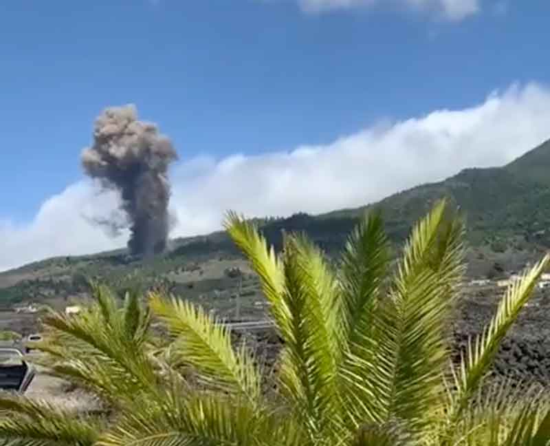
The seismic activity on the island of La Palma continues although at lesser intensity and rate than during the buildup prior to the eruption. Since midnight, only 5 quakes above magnitude 2 and have been recorded so far, the largest a magnitude 3.0 event at 7.34 a.m. local time. However, the quakes are significant: The eruption could still evolve and new fissures could open up if the current pathways become blocked or other easier ways open up.
This scenario might not be very likely, but the quakes in the area suggest that underground, magma flow has not stabilized yet, and magma pressure is still breaking rocks to intrude into new dikes. If these propagate to the surface, a new fissure would open and lava could travel in different areas. In addition to a constant, strong volcanic tremor signal reflecting the flow of magma dominates the seismic recordings.
- All news about: La Palma volcano
- Information about: La Palma volcano