Contact | RSS | EN | DE | EL | ES | FR | IT | RU

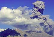
Pacaya Volcano Volcanic Ash Advisory: VA EMS OBS IN SUMMIT WEB CAM to 10000 ft (3000 m)

Thu, 7 Jan 2021, 19:30 | BY: VN
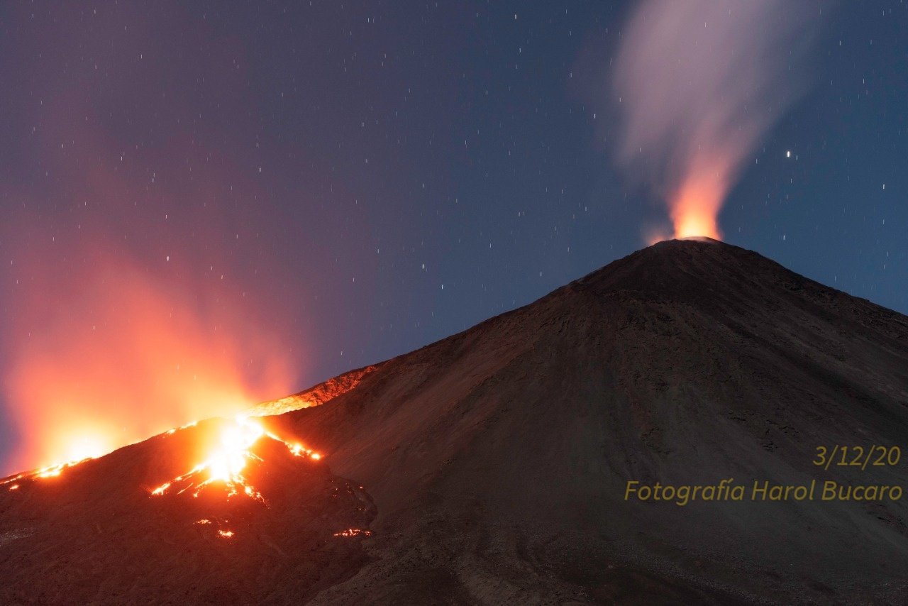
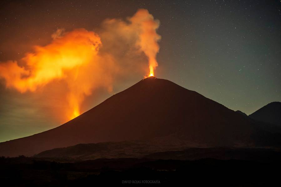
Explosive activity continues. Volcanic Ash Advisory Center (VAAC) Washington warned about a volcanic ash plume that rose up to estimated 10000 ft (3000 m) altitude or flight level 100 .
The full report is as follows:

FVXX24 at 19:23 UTC, 07/01/21 from KNES
VA ADVISORY
DTG: 20210107/1920Z

VAAC: WASHINGTON

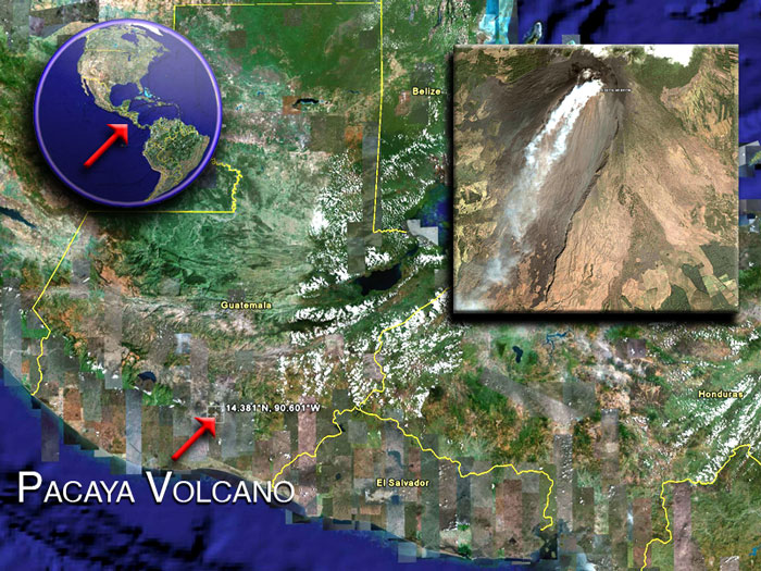
VOLCANO: PACAYA 342110
PSN: N1422 W09035

AREA: GUATEMALA

SUMMIT ELEV: 8373 FT [2552 M]

ADVISORY NR: 2021/001

INFO SOURCE: GOES-16. WEBCAM. NWP MODELS.
INSIVUMEH.

ERUPTION DETAILS: VA EMS OBS IN SUMMIT WEB CAM

OBS VA DTG: 07/1900Z

OBS VA CLD: SFC/FL100 N1423 W09036 - N1422 W09035
- N1418 W09038 - N1422 W09041 - N1423 W09036 MOV
SW 10KT

FCST VA CLD +6HR: 08/0100Z SFC/FL100 N1424 W09036
- N1422 W09035 - N1416 W09038 - N1422 W09043 -
N1424 W09036

FCST VA CLD +12HR: 08/0700Z NO VA EXP

FCST VA CLD +18HR: 08/1300Z NO VA EXP

RMK: VA EMS OBS IN SUMMIT WEB CAM. LOW CONF IN
VAA DUE TO WX CLDS OVER SUMMIT REGION. VA HGT FM
VA RPRT FM INSIVUMEH. VA DIR FM NWP MDLS SHOWS
CONT SW-LY MOVMT THRU T+6. ...SAMBUCCI

NXT ADVISORY: WILL BE ISSUED BY 20210108/0115Z

Previous news

Wed, 6 Jan 2021, 06:00

Pacaya volcano (Guatemala) - Smithsonian / USGS Weekly Volcanic Activity Report for 6 January-12 January 2021 (Continuing Activity)

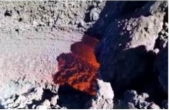
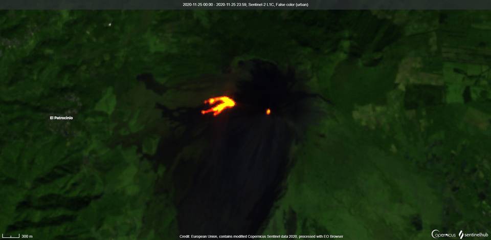
INSIVUMEH reported that the lava flow that began on 2 January from a vent on the SW flank, 200 m below Pacaya's Mackenney Crater, formed 3-4 branches and was 400 m long by 6 January. Avalanches of material descended the W, SW, and S flanks. Strombolian explosions produced ash plumes that rose 100-150 m above the cone and drifted 10 km S and SW. ... Read all
Wed, 30 Dec 2020, 06:00

Pacaya volcano (Guatemala) - Smithsonian / USGS Weekly Volcanic Activity Report for 30 December-5 January 2021 (Continuing Activity)

INSIVUMEH reported that Strombolian activity and lava effusion continued at Pacaya during 29 December-5 January. Explosions from the cone in Mackenney Crater ejected material as high as 300 m above the vent and away from the crater. Lava flows on the SW and W flanks were active and varied in length between 400 and 650 m; the lava flow on the SW flank had numerous branches. ... Read all
Show more
Pacaya volcano satellite image by (c) Google Earth View
Pacaya volcano
Complex volcano 2552 m (8,373 ft)
Guatemala, 14.38°N / -90.6°W
Current status: normal or dormant (1 out of 5) Pacaya volcano eruptions:
1360, 1565, 1623(?), 1651, 1655, 1664, 1668, 1671, 1674, 1677(?), 1678, 1690, 1693, 1699, 1717(?), 1760(?), 1775, 1805, 1830(?), 1846, 1885, 1961, 1965, 1970, 1972, 1973, 1976, 1977, 1978, 1980 - May 1998 (intense period of summit activity), 1999-2003, 2004-2010, 2012, 2013, 2014
Typical eruption style
Mildly explosive and effusive (Strombolian activity, lava fountaining, lava flows from the summit crater). Near continuously active the least during the past centuries.
Pacaya Volcano Tours
11-day volcano tour to Pacaya and Fuego, Guatemala
8-12 days - Moderate to Challenging
Price $ 3490
no scheduled dates at present
Try our free app!
Volcanoes & Earthquakes - new app for Android
Android | iOS version

More on VolcanoDiscovery

Why is there advertising on this site?

Support us - Help us upgrade our services!

We truly love working to bring you the latest volcano and earthquake data from around the world. Maintaining our website and our free apps does require, however, considerable time and resources.
We need financing to increase hard- and software capacity as well as support our editor team. We're aiming to achieve uninterrupted service wherever an earthquake or volcano eruption unfolds, and your donations can make it happen! Every donation will be highly appreciated. If you find the information useful and would like to support our team in integrating further features, write great content, and in upgrading our soft- and hardware, please make a donation (PayPal or Online credit card payment).

Planned features:Thanks to your past donations, these features have been added recently:
Download and Upgrade the Volcanoes & Earthquakes app to get one of the fastest seismic and volcano alerts online:
Android | IOS
Thank you!
Sources: VolcanoDiscovery / VolcanoAdventures and other sources as noted.
Use of material: Most text and images on our websites are owned by us. Re-use is generally not permitted without authorization. Contact us for licensing rights.
Volcanoes & Earthquakes
VolcanoDiscovery Home
Volcanoes | Earthquakes | Photos | Volcano News | App
Adventure & Study Travel
Tours to Volcanoes and Volcanic Areas: walking tours, photo tours, study tours
Tours & Dates | FAQ | About us
Get our newsletter!
Company info
Contact | Legal info | Terms & conditions
Follow us
Follow us on facebook Follow us on Instagram Follow us on Twitter Visit our Youtube channel
EN | DE | EL | ES | FR | IT | RU
VolcanoDiscovery GmbH, Germany, Reg. nr.: HRB 103744, EU Tax Id: DE 297 465 123 owned and created by
Dr. Tom Pfeiffer, volcanologist, volcano photographer, tour organizer member of
IAVCEI
IAVCEI
Vulkanologische Gesellschaft
Volcanological Society
Ecotourism Greece
Ecotourism Greece
RUV insurance
Insured by R+V
VolcanoDiscovery © 2004- All Rights Reserved | Privacy - Cookie Settings