Contact | RSS | EN | DE | EL | ES | FR | IT | RU

Turrialba volcano Volcanic Ash Advisory: EMS AT 11/2245Z

Tue, 11 Jul 2017, 22:15 |
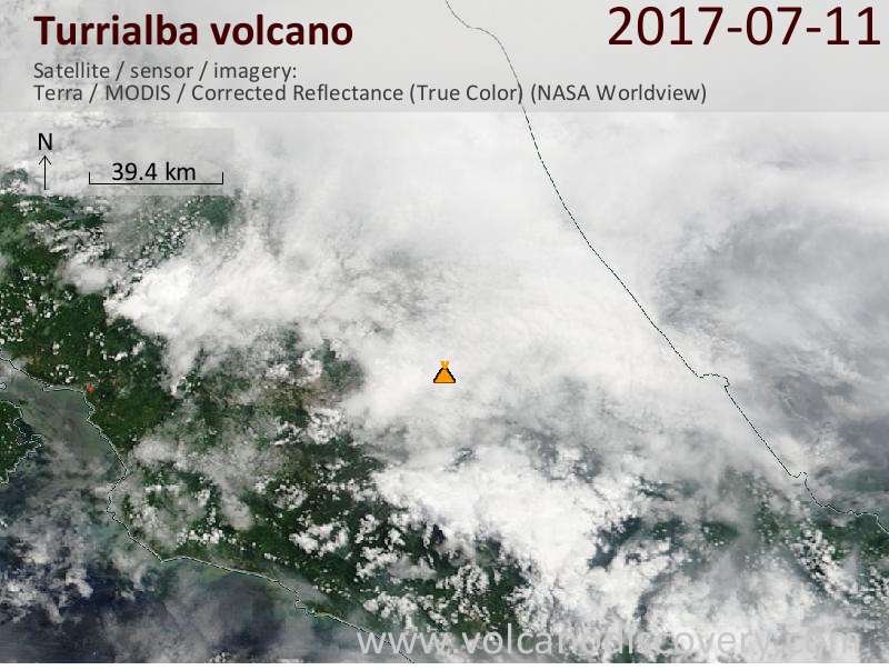
Satellite image of Turrialba volcano on 11 Jul 2017
Volcanic Ash Advisory Center Washington (VAAC) issued the following report:

FVXX21 at 22:07 UTC, 11/07/17 from KNES
VA ADVISORY
DTG: 20170711/2205Z

VAAC: WASHINGTON

VOLCANO: TURRIALBA
345070
PSN: N1001 W08346

AREA: COSTA RICA

SUMMIT ELEV: 10958 FT [3340
M]

ADVISORY NR: 2017/181

INFO SOURCE: GOES-EAST. NWP MODELS. VOLCANO
WEB
CAMERA. OVSICORI-UNA.

ERUPTION DETAILS: EMS AT 11/2245Z

OBS VA DTG:
11/2245Z

OBS VA CLD: VA NOT IDENTIFIABLE FROM SATELLITE
DATA WINDS
SFC/FL125 090/5-10KT

FCST VA CLD +6HR: 12/0500Z

FCST VA CLD +12HR:
12/1100Z

FCST VA CLD +18HR: 12/1700Z

RMK: NO VA IS OBSERVED IN WEBCAM
OR IMAGERY
ALTHOUGH THERE ARE THICK WX CLOUDS PRESENT.
OVSICORI-UNA
REPORTS VA TO 500M ABOVE CRATER.
...SCHWARTZ

NXT ADVISORY: WILL BE
ISSUED BY 20170712/0400Z

Previous news

Wed, 5 Jul 2017, 06:00

Turrialba volcano (Costa Rica) - Smithsonian / USGS Weekly Volcanic Activity Report for 5 July-11 July 2017 (Continuing Activity)

OVSICORI-UNA reported that during 4-11 July plumes of water vapor, aerosols, and magmatic gases rose as high as 500 m above Turrialba's crater rim, and on most nights incandescence emanated from Cráter Oeste. The emissions sporadically contained moderate amounts of ash during 5-7 July. Minor ashfall was reported in Coronado (San José), and in San Rafael and Barva (Heredia). ... Read all
Show more
Turrialba volcano
Stratovolcano 3340 m (10,958 ft)
Costa Rica, 10.03°N / -83.77°W
Current status: normal or dormant (1 out of 5) Turrialba volcano eruptions:
1723(?), 1847(?), 1853, 1855, 1861(?), 1864-65, 1866, 2010 (Jan 4) - ongoing
Typical eruption style
Explosive.
Try our free app!
Volcanoes & Earthquakes - new app for Android
Android | iOS version

More on VolcanoDiscovery

Why is there advertising on this site?

Support us - Help us upgrade our services!

We truly love working to bring you the latest volcano and earthquake data from around the world. Maintaining our website and our free apps does require, however, considerable time and resources.
We need financing to increase hard- and software capacity as well as support our editor team. We're aiming to achieve uninterrupted service wherever an earthquake or volcano eruption unfolds, and your donations can make it happen! Every donation will be highly appreciated. If you find the information useful and would like to support our team in integrating further features, write great content, and in upgrading our soft- and hardware, please make a donation (PayPal or Online credit card payment).

Planned features:Thanks to your past donations, these features have been added recently:
Download and Upgrade the Volcanoes & Earthquakes app to get one of the fastest seismic and volcano alerts online:
Android | IOS
Thank you!
Sources: VolcanoDiscovery / VolcanoAdventures and other sources as noted.
Use of material: Most text and images on our websites are owned by us. Re-use is generally not permitted without authorization. Contact us for licensing rights.
Volcanoes & Earthquakes
VolcanoDiscovery Home
Volcanoes | Earthquakes | Photos | Volcano News | App
Adventure & Study Travel
Tours to Volcanoes and Volcanic Areas: walking tours, photo tours, study tours
Tours & Dates | FAQ | About us
Get our newsletter!
Company info
Contact | Legal info | Terms & conditions
Follow us
Follow us on facebook Follow us on Instagram Follow us on Twitter Visit our Youtube channel
EN | DE | EL | ES | FR | IT | RU
VolcanoDiscovery GmbH, Germany, Reg. nr.: HRB 103744, EU Tax Id: DE 297 465 123 owned and created by
Dr. Tom Pfeiffer, volcanologist, volcano photographer, tour organizer member of
IAVCEI
IAVCEI
Vulkanologische Gesellschaft
Volcanological Society
Ecotourism Greece
Ecotourism Greece
RUV insurance
Insured by R+V
VolcanoDiscovery © 2004- All Rights Reserved | Privacy - Cookie Settings