Kontakt | RSS | EN | DE | EL | ES | FR | IT | RU

Loihi Volcano

Updated: 26. Apr. 2024 13:39 GMT -
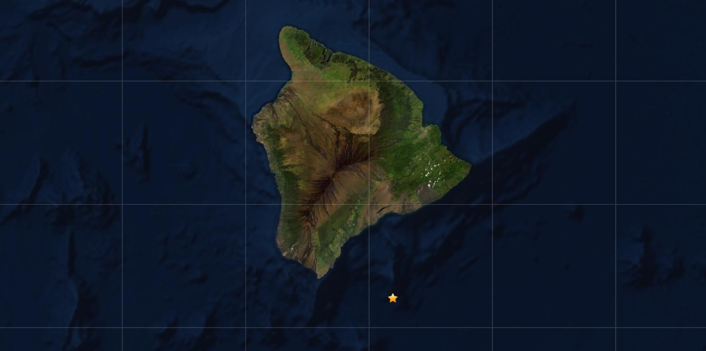
Submarine volcano -975 m / - 3,199 ft
United States, Hawaiian Islands, 18.92°N / -155.27°W
Aktueller Status: normal / ruhend (1 von 5)
Last update: 20 Jul 2022 (Smithsonian / USGS Weekly Volcanic Activity Report)

[smaller] [larger]
Typische Aktivität: unspecified
Ausbrüche des Loihi: 1996 

Letzte Erdbeben in der Nähe

UhrzeitMag. / TiefeEntfernung / Ort
22. Apr. 16:55 (GMT +0)
2.2

36 km
19 km SSE of Pāhala, Hawaii
Info
22. Apr. 15:41 (GMT +0)
2.4

33 km
20 km E of Naalehu, Hawaii
Info
Mittwoch, 17. April 2024 GMT (2 Beben)
17. Apr. 21:57 (GMT +0)
2.4

36 km
18 km ESE of Naalehu, Hawaii
Info
17. Apr. 20:08 (GMT +0)
2.4

37 km
17 km ESE of Naalehu, Hawaii
Info
Dienstag, 16. April 2024 GMT (1 Beben)
16. Apr. 12:49 (Honolulu)
2.4

28 km
15 km SE of Pāhala, Hawaii
Info
Sonntag, 14. April 2024 GMT (1 Beben)
13. Apr. 18:49 (Honolulu)
2.4

29 km
13 km ESE of Pāhala, Hawaii
Info

Beschreibung

Loihi seamount, the youngest volcano of the Hawaiian chain, lies about 35 km off the SE coast of the island of Hawaii. Loihi (which is the Hawaiian word for "long") has an elongated morphology dominated by two curving rift zones extending north and south of the summit. The summit region contains a caldera about 3 x 4 km wide and is dotted with numerous lava cones, the highest of which is about 975 m below the sea surface. The summit platform includes two well-defined pit craters, sediment-free glassy lava, and low-temperature hydrothermal venting. An arcuate chain of small cones on the western edge of the summit extends north and south of the pit craters and merges into the crests of Loihi's prominent rift zones. Deep and shallow seismicity indicate a magmatic plumbing system distinct from that of Kilauea volcano. During 1996, a new pit crater was formed at the summit of the volcano, and lava flows were erupted. Continued volcanism is expected to eventually build a new island at Loihi; time estimates for the summit to reach the sea surface range from roughly 10,000 to 100,000 years.
---
Smithsonian / GVP volcano information

Latest satellite images

loihi satellite image sat1loihi satellite image sat2
Mi, 20. Jul 2022, 14:00

Kama'ehuakanaloa volcano (Hawaiian Islands, USA) - Smithsonian / USGS Weekly Volcanic Activity Report for 13 July-19 July 2022 (Continuing Activity)

An earthquake swarm began at Kama'ehuakanaloa at about 0200 on 16 July and was characterized by seismic tremor accompanied by pulses of seismic energy every 15-20 seconds. The pattern of elevated seismicity continued through at least 1453 on 17 July, the posting time of the HVO's information statement. The report also noted that around 24 earthquakes in the M 1.8-3 range were recorded during 0130-0600 on 17 July. ... Read all
Mo, 18. Jul 2022, 18:37

Kama’ehuakanaloa submarine volcano (Hawai'i): seismic swarm

Swarm distribution under Kama’ehuakanaloa submarine volcano (image: HVO)
An elevated seismic activity has been registered beneath the submarine volcano by the Hawaiian Volcano Observatory (HVO) instruments starting about 02:00 local time on 16 July. ... Read all

Auf dieser Seite:

App herunterladen
Volcanoes & Earthquakes - new app for Android
Android | iOS-Version

Mehr auf VolcanoDiscovery

Warum gibt es Werbung auf dieser Seite?

Unterstützen Sie unsere Arbeit!

Diese Webseite und die dazugehörigen Apps und Tools instandzuhalten und kostenlos Nachrichten zu Vulkanen, Erdbeben und anderen Themen bereitzustellen, verschlingt enorm viel Zeit und auch Geld.
Wenn Sie die Infos mögen und uns in der Arbeit dazu unterstützen wollen, würden wir uns über eine Spende (über PayPal oder mit Kreditkarte) sehr freuen.
Online Zahlung (Kreditkarte)
Damit können wir Ihnen auch in Zukunft neue Features entwickeln und Bestehende laufend verbessern.Vielen Dank!
Sources: VolcanoDiscovery / VolcanoAdventures and other sources as noted.
Use of material: Most text and images on our websites are owned by us. Re-use is generally not permitted without authorization. Contact us for licensing rights.
Volcanoes & Earthquakes
VolcanoDiscovery Home
Vulkane | Erdbeben | Fotos | News | App
Adventure & Study Travel
Reisen zu Vulkanen und Vulkangebieten: Wanderreisen, Studienreisen, Fotoreisen
Tours & Dates | FAQ | About us
Get our newsletter!
Company info
Kontakt | Impressum | AGB
Follow us
Follow us on facebook Follow us on Instagram Follow us on Twitter Visit our Youtube channel
EN | DE | EL | ES | FR | IT | RU
VolcanoDiscovery GmbH, Germany, Reg. nr.: HRB 103744, EU Tax Id: DE 297 465 123 owned and created by
Dr. Tom Pfeiffer, volcanologist, volcano photographer, tour organizer member of
IAVCEI
IAVCEI
Vulkanologische Gesellschaft
Volcanological Society
Ecotourism Greece
Ecotourism Greece
RUV insurance
Insured by R+V
VolcanoDiscovery © 2004- All Rights Reserved | Datenschutz - Cookie Einstellungen