Volcano earthquake report for Tuesday, 6 Apr 2021
Tue, 6 Apr 2021, 23:50 | BY: EARTHQUAKEMONITOR
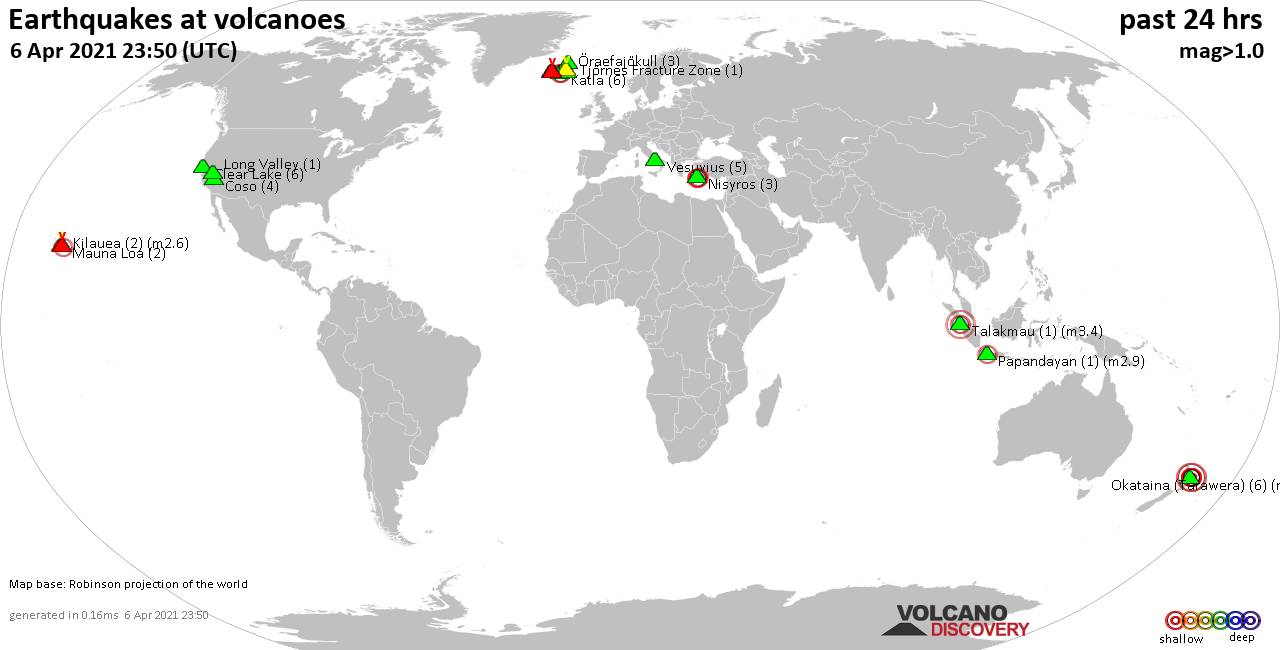
World map showing volcanoes with shallow (less than 20 km) earthquakes within 20 km radius during the past 24 hours on 6 Apr 2021 Number in brackets indicate nr of quakes.
Krísuvík (26 quakes between mag 0.1-1.6), Long Valley (1 quake mag 1.1), Mauna Loa (2 quakes between mag 0.8-1.8), Nisyros (3 quakes between mag 2.1-2.2), Okataina (Tarawera) (6 quakes between mag 1.4-3.4), Papandayan (1 quake mag 2.9), Reykjanes (15 quakes between mag 0.1-1.7), Talakmau (1 quake mag 3.4), Tjörnes Fracture Zone (1 quake mag 1.1), Vesuvius (5 quakes between mag 0.1-1.2), Öraefajökull (3 quakes between mag 0.1-1.1) (updated 23h50)
Note: Earthquakes within 20 km from and at depths less than 20 km under active volcanoes are reported. The list is not complete because many volcanoes are not monitored and/or seismic data in high resolution is not available publicly.
Volcanoes with recent earthquakes above magnitude 2 or more than 10 quakes are listed below:
Fagradalsfjall volcano (Reykjanes Peninsula, Iceland): 27 earthquakes up to magnitude 1.7
Possible earthquake swarm: 27 earthquakes occurred near (under) the volcano during 20 hours, the last being recorded quake 1 hour 41 minutes ago. Hypocenter depths ranged between 8.8 and 0.3 km.Earthquake details: (only 5 largest)
1.7 quake 3.5 Km NE of Grindavík, Iceland, 6 April 2021 02:26 GMT (7 km SW)
1.3 quake 2.6 Km ESE of Fagradalsfjall, Iceland, 6 Apr 2021 10:08 pm (GMT +0) (2 km E)
1.3 quake 2.7 Km S of Fagradalsfjall, Iceland, 6 April 2021 05:27 GMT (2 km S)
1.2 quake 3.4 Km SSW of Keilir, Iceland, 6 Apr 2021 7:18 am (GMT +0) (4 km NE)
1.0 quake 3.1 Km S of Fagradalsfjall, Iceland, 6 Apr 2021 3:07 pm (GMT +0) (2 km S)
All earthquakes at Fagradalsfjall
Katla volcano (Iceland): 6 earthquakes up to magnitude 2.2
6 earthquakes occurred near (under) the volcano during 21 hours, the last being recorded quake 30 minutes ago. Hypocenter depths ranged between 3.2 and 0.1 km.Earthquake details: (only 5 largest)
2.2 quake 2.1 Km NW of Hábunga, Iceland, 6 Apr 2021 10:12 pm (GMT +0) (5 km SW)
2.0 quake 8.0 Km N of Hábunga, Iceland, 6 Apr 2021 10:46 am (GMT +0) (2 km NW)
1.3 quake 6.6 Km N of Hábunga, Iceland, 6 Apr 2021 10:46 am (GMT +0) (1 km NW)
1.0 quake 7.5 Km NNE of Goðabunga, Iceland, 6 April 2021 01:59 GMT (11 km NW)
1.0 quake 6.5 Km NNE of Goðabunga, Iceland, 6 Apr 2021 1:59 am (GMT +0) (9 km NW)
All earthquakes at Katla
Kilauea volcano (Hawai'i (Big Island)): 2 earthquakes up to magnitude 2.6
2 earthquakes occurred near (under) the volcano during 6 hours, the last being recorded quake 17 hours ago. Hypocenter depths ranged between 7.6 and 5.2 km.Earthquake details:
2.6 quake 26 mi south of Hilo, Hawaii County, USA, 5 Apr 2021 9:07 pm (GMT -10) (16 km ESE)
1.6 quake 16 Km S of Volcano, Hawaii, USA, 5 Apr 2021 2:53 pm (GMT -10) (13 km SSE)
All earthquakes at Kilauea
Krísuvík volcano (Reykjanes Peninsula, Iceland): 26 earthquakes up to magnitude 1.6
Possible earthquake swarm: 26 earthquakes occurred near (under) the volcano during 17 hours, the last being recorded quake 6 hours ago. Hypocenter depths ranged between 9.2 and 0.3 km.Earthquake details: (only 5 largest)
1.6 quake 2.1 Km SSW of Keilir, Iceland, 6 April 2021 09:41 GMT (5 km W)
1.5 quake 1.8 Km SW of Keilir, Iceland, 6 Apr 2021 3:31 pm (GMT +0) (5 km W)
0.9 quake 2.9 Km SSW of Keilir, Iceland, 6 April 2021 01:52 GMT (5 km WSW)
0.9 quake 3.6 Km N of Krýsuvík, Iceland, 6 April 2021 01:10 GMT (2 km ESE)
0.9 quake 2.2 Km SSW of Keilir, Iceland, 6 April 2021 10:32 GMT (5 km W)
All earthquakes at Krísuvík
Nisyros volcano (Greece): 3 earthquakes up to magnitude 2.2
3 earthquakes occurred near (under) the volcano during 18 hours, the last being recorded quake 5 hours ago. Hypocenter depths ranged between 6.5 and 4.0 km.Earthquake details:
2.2 quake Aegean Sea, 17 km west of Tilos Island, Dodecanese, South Aegean, Greece, 6 Apr 2021 10:00 pm (GMT +3) (16 km S)
2.2 quake Aegean Sea, 24 km west of Tilos Island, Dodecanese, South Aegean, Greece, 6 Apr 2021 9:54 pm (GMT +3) (13 km SSW)
2.1 quake Aegean Sea, 16 km northwest of Tilos Island, Dodecanese, South Aegean, Greece, 6 Apr 2021 4:04 am (GMT +3) (8 km SE)
All earthquakes at Nisyros
Okataina (Tarawera) volcano (New Zealand): 6 earthquakes up to magnitude 3.4
6 earthquakes occurred near (under) the volcano during 18 hours, the last being recorded quake 6 hours ago. Hypocenter depths ranged between 5.0 and 3.9 km.Earthquake details: (only 5 largest)
3.4 quake 32 km northeast of Rotorua, Bay of Plenty, New Zealand, 6 Apr 2021 12:36 pm (GMT +12) (19 km N)
3.3 quake Whakatane District, 32 km northeast of Rotorua, Bay of Plenty, New Zealand, 6 Apr 2021 8:50 pm (GMT +12) (19 km N)
2.8 quake Whakatane District, 32 km northeast of Rotorua, Bay of Plenty, New Zealand, 7 Apr 2021 5:55 am (GMT +12) (19 km N)
2.4 quake 32 km northeast of Rotorua, Bay of Plenty, New Zealand, 6 Apr 2021 12:34 pm (GMT +12) (19 km N)
2.2 quake 32 km northeast of Rotorua, Bay of Plenty, New Zealand, 7 Apr 2021 6:16 am (GMT +12) (19 km N)
All earthquakes at Okataina (Tarawera)
Papandayan volcano (West Java): magnitude 2.9 earthquake
A magnitude 2.9 earthquake occurred at the volcano 1 hour 22 minutes ago. The quake, which might be volcanic in origin, was located at a depth of 10.0 km depth at 3 km distance N from the volcano.Earthquake details:
2.9 quake 21 km south of Paseh, West Java, Indonesia, 7 Apr 2021 5:27 am (GMT +7) (3 km N)
All earthquakes at Papandayan
Reykjanes volcano (Reykjanes Peninsula, Iceland): 15 earthquakes up to magnitude 1.7
Possible earthquake swarm: 15 earthquakes occurred near (under) the volcano during 23 hours, the last being recorded quake 35 minutes ago. Hypocenter depths ranged between 6.4 and 0.1 km.Earthquake details: (only 5 largest)
1.7 quake 1.9 Km ENE of Grindavík, Iceland, 6 Apr 2021 3:57 pm (GMT +0) (7 km SE)
1.4 quake 3.5 Km NNE of Grindavík, Iceland, 6 April 2021 04:59 GMT (6 km ESE)
0.9 quake 2.4 Km NW of Reykjanestá, Iceland, 6 Apr 2021 3:57 am (GMT +0) (13 km SW)
0.6 quake 5.2 Km NNE of Reykjanestá, Iceland, 6 April 2021 05:34 GMT (9 km SW)
0.6 quake 1.6 Km NE of Grindavík, Iceland, 6 April 2021 02:10 GMT (7 km SE)
All earthquakes at Reykjanes
Talakmau volcano (Sumatra): magnitude 3.4 earthquake
A magnitude 3.4 earthquake occurred at the volcano 7 hours ago. The quake, which might be volcanic in origin, was located at a depth of 10.0 km depth at 11 km distance ENE from the volcano.Earthquake details:
3.4 quake 58 km northwest of Bukittinggi, Sumatera Barat, Indonesia, 7 Apr 2021 12:05 am (GMT +7) (11 km ENE)
All earthquakes at Talakmau
Previous news
Mon, 5 Apr 2021, 23:50
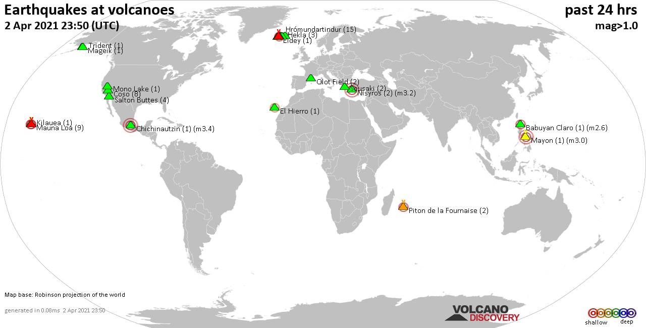
Volcano earthquake report for Monday, 5 Apr 2021
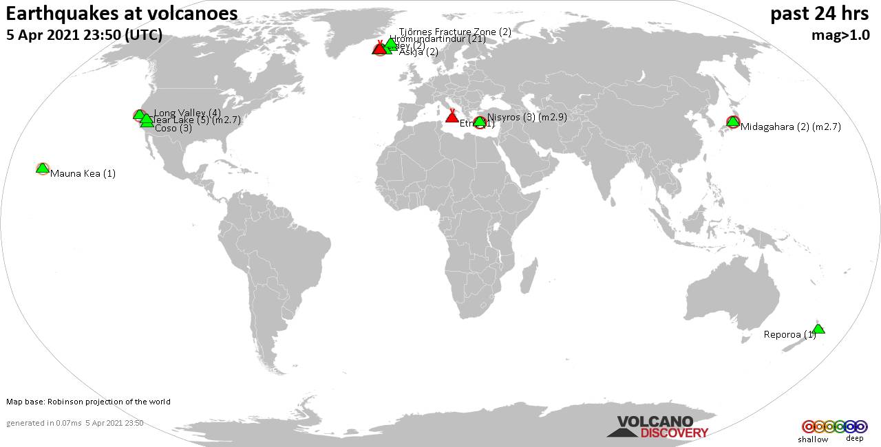
Quakes detected near: Askja (2 quakes between mag 1.3-1.6), Clear Lake (5 quakes between mag 0.9-2.7), Coso (3 quakes between mag 0.7-1.7), Eldey (2 quakes between mag 1.0-1.4), Etna (1 quake mag 1.2), Fagradalsfjall (58 quakes between mag 0.1-2.4) ... Read all
Sun, 4 Apr 2021, 23:50
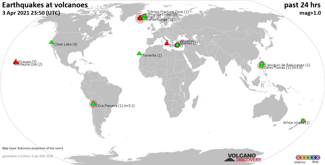
Volcano earthquake report for Sunday, 4 Apr 2021
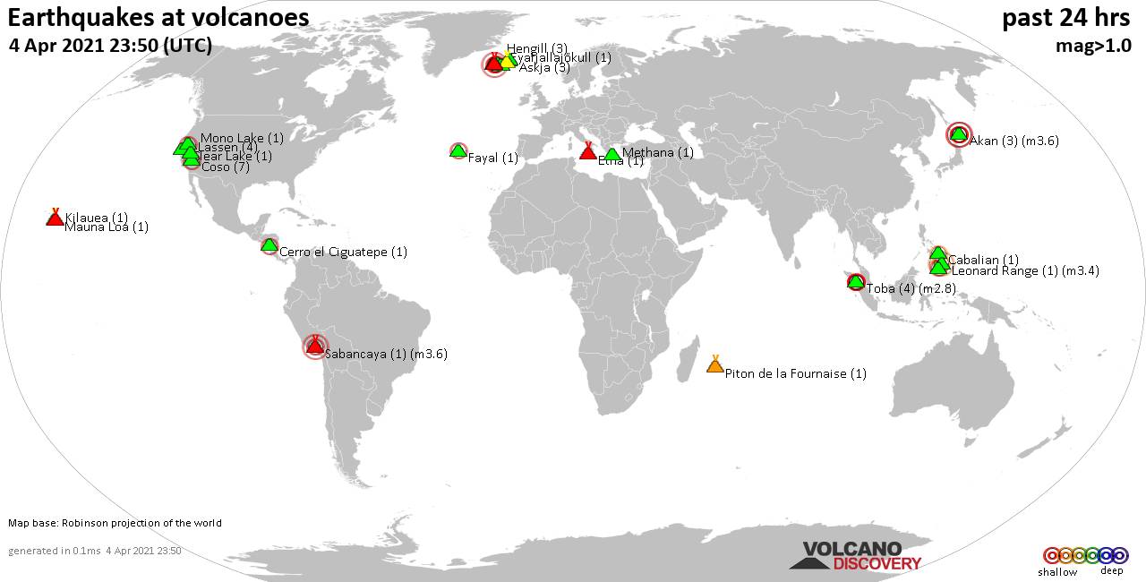
Quakes detected near: Akan (3 quakes between mag 2.7-3.6), Askja (3 quakes between mag 1.1-1.9), Cabalian (1 quake mag 2.5), Cerro el Ciguatepe (1 quake mag 2.3), Clear Lake (1 quake mag 1.4), Coso (7 quakes between mag 0.3-2.0) ... Read all
Show more