Volcano earthquake report for Friday, 16 Apr 2021
Fri, 16 Apr 2021, 23:50 | BY: EARTHQUAKEMONITOR
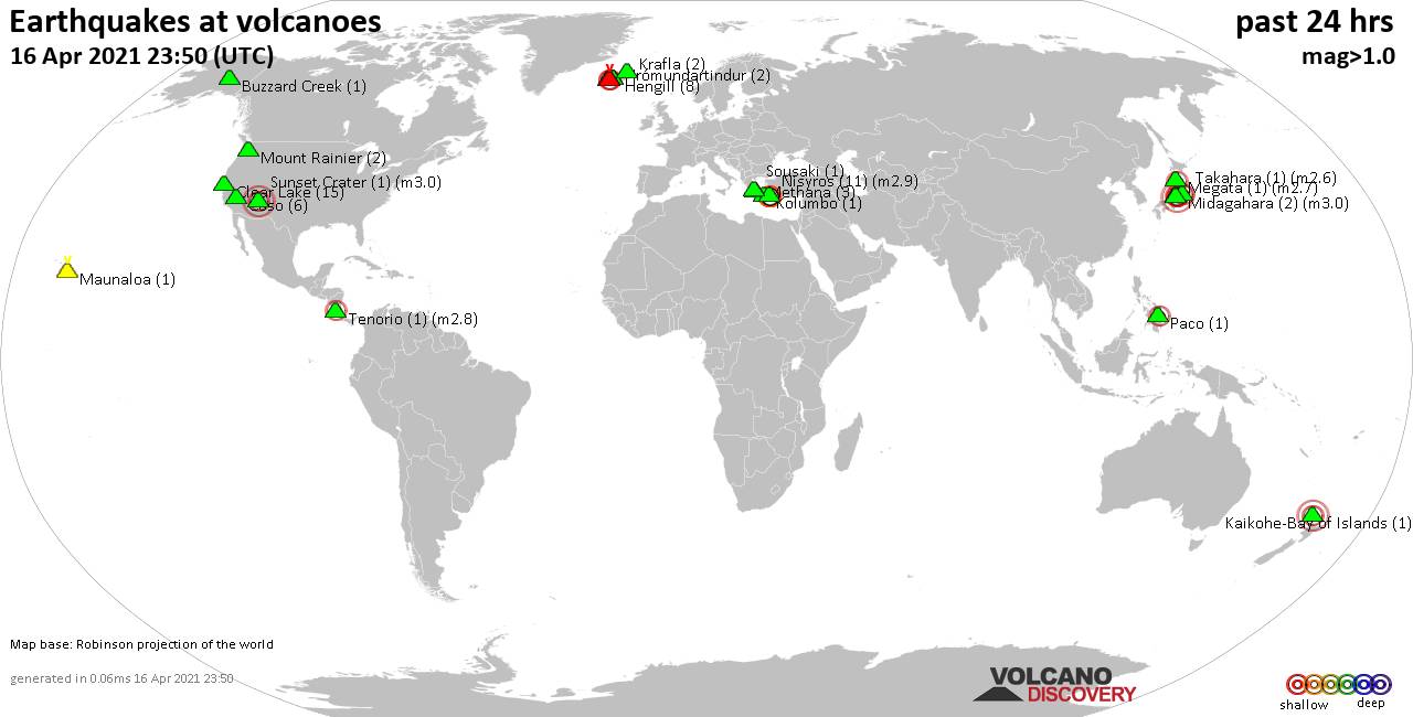
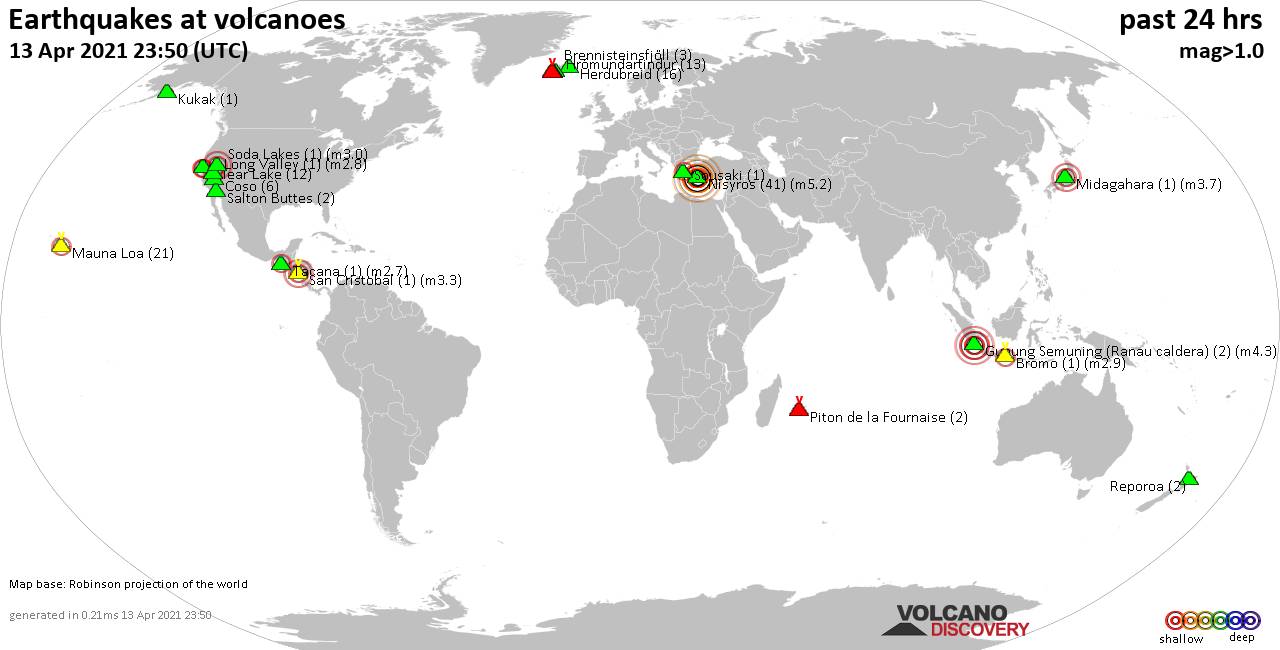
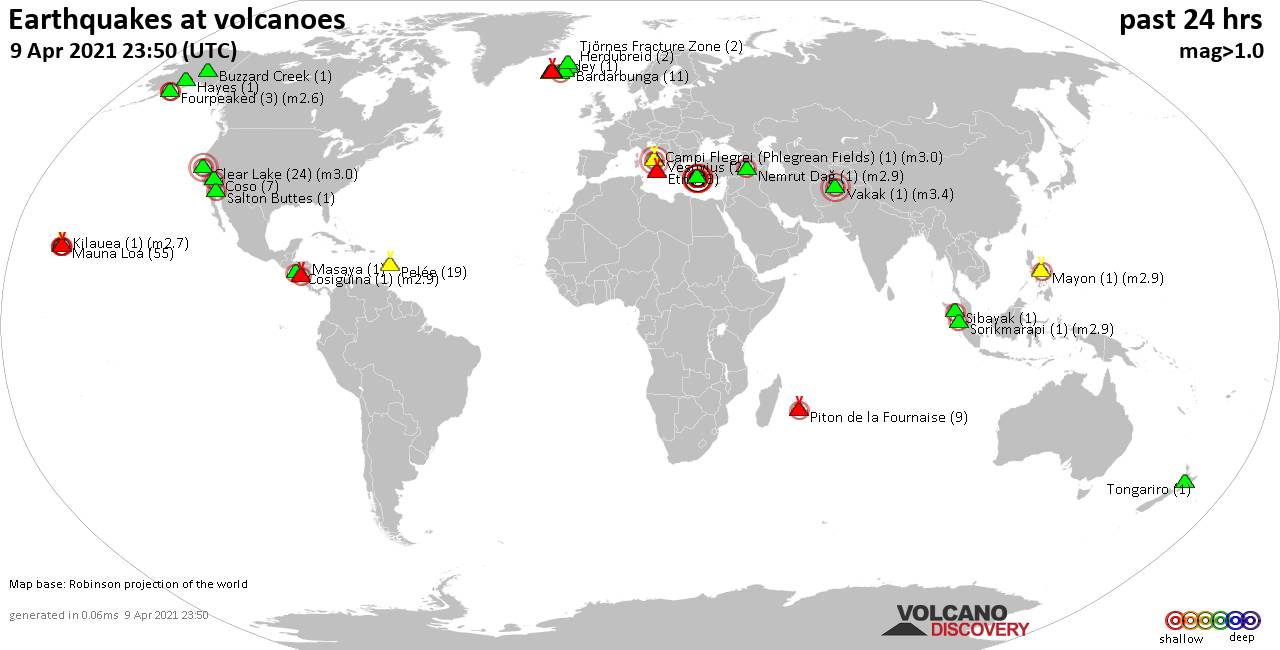
World map showing volcanoes with shallow (less than 20 km) earthquakes within 20 km radius during the past 24 hours on 16 Apr 2021 Number in brackets indicate nr of quakes.
Kaikohe-Bay of Islands (1 quake mag 3.0), Kolumbo (1 quake mag 1.0), Krafla (2 quakes between mag 0.8-1.1), Krísuvík (14 quakes between mag 0.4-1.6), Maunaloa (1 quake mag 1.0), Megata (1 quake mag 2.7), Methana (3 quakes between mag 1.2-1.5), Midagahara (2 quakes between mag 2.6-3.0), Mount Rainier (2 quakes between mag 0.7-1.3), Nisyros (11 quakes between mag 1.4-2.9), Paco (1 quake mag 2.4), Reykjanes (5 quakes between mag 0.4-1.3), Sousaki (1 quake mag 1.8), Sunset Crater (1 quake mag 3.0), Takahara (1 quake mag 2.6), Tenorio (1 quake mag 2.8), Washiba-Kumonotaira (1 quake mag 2.6) (updated 23h50)
Note: Earthquakes within 20 km from and at depths less than 20 km under active volcanoes are reported. The list is not complete because many volcanoes are not monitored and/or seismic data in high resolution is not available publicly.
Volcanoes with recent earthquakes above magnitude 2 or more than 10 quakes are listed below:
Clear Lake volcano (California): 15 earthquakes up to magnitude 1.8
Possible earthquake swarm: 15 earthquakes occurred near (under) the volcano during 21 hours, the last being recorded quake 2 hours ago. Hypocenter depths ranged between 2.6 and 0.3 km.Earthquake details: (only 5 largest)
1.8 quake 6km NNW of The Geysers, CA, USA, 16 April 2021 03:15 GMT (16 km S)
1.7 quake 4km NW of The Geysers, CA, USA, 16 April 2021 03:24 GMT (19 km S)
0.9 quake 9km WNW of The Geysers, CA, USA, 16 April 2021 10:37 GMT (18 km SSW)
0.9 quake 8km W of Cobb, CA, USA, 16 April 2021 14:05 GMT (15 km SSW)
0.9 quake 6km WNW of The Geysers, CA, USA, 16 April 2021 05:53 GMT (19 km SSW)
All earthquakes at Clear Lake
Fagradalsfjall volcano (Reykjanes Peninsula, Iceland): 30 earthquakes up to magnitude 2.8
Possible earthquake swarm: 30 earthquakes occurred near (under) the volcano during 9 hours, the last being recorded quake 15 hours ago. Hypocenter depths ranged between 6.5 and 0.5 km.Earthquake details: (only 5 largest)
2.8 quake 3.3 Km WSW of Keilir, Iceland, 16 April 2021 06:00 GMT (4 km NE)
2.7 quake 3.1 Km NE of Fagradalsfjall, Iceland, 16 April 2021 05:58 GMT (4 km NE)
1.7 quake 2.8 Km ENE of Fagradalsfjall, Iceland, 16 April 2021 05:59 GMT (3 km NE)
1.7 quake 2.8 Km ENE of Fagradalsfjall, Iceland, 16 April 2021 05:56 GMT (3 km NE)
1.6 quake 2.8 Km ENE of Fagradalsfjall, Iceland, 16 April 2021 05:44 GMT (3 km NE)
All earthquakes at Fagradalsfjall
Kaikohe-Bay of Islands volcano (North Island): magnitude 3.0 earthquake
A magnitude 3.0 earthquake occurred at the volcano 11 hours ago. The quake, which might be volcanic in origin, was located at a depth of 10.0 km depth at 19 km distance E from the volcano.Earthquake details:
Unconfirmed quake reported: Near Kerikeri, Northland, New Zealand, 16 April 2021 13:02 GMT (19 km E)
All earthquakes at Kaikohe-Bay of Islands
Krísuvík volcano (Reykjanes Peninsula, Iceland): 14 earthquakes up to magnitude 1.6
Possible earthquake swarm: 14 earthquakes occurred near (under) the volcano during 14 hours, the last being recorded quake 10 hours ago. Hypocenter depths ranged between 5.9 and 0.5 km.Earthquake details: (only 5 largest)
1.6 quake 2.2 Km SSW of Keilir, Iceland, 16 April 2021 14:10 GMT (5 km W)
1.5 quake 3.6 Km N of Krýsuvík, Iceland, 16 April 2021 01:16 GMT (2 km ESE)
1.4 quake 2.2 Km SSW of Keilir, Iceland, 16 April 2021 02:46 GMT (5 km W)
1.2 quake 2.6 Km SSW of Keilir, Iceland, 16 April 2021 00:16 GMT (5 km WSW)
1.0 quake 2.3 Km SSW of Keilir, Iceland, 16 April 2021 02:07 GMT (5 km W)
All earthquakes at Krísuvík
Megata volcano (Honshu): magnitude 2.7 earthquake
A magnitude 2.7 earthquake occurred at the volcano 13 hours ago. The quake, which might be volcanic in origin, was located at a depth of 10.2 km depth at 11 km distance S from the volcano.Earthquake details:
2.7 quake Japan Sea, 19 km west of Tennō, Katagami, Akita, Japan, Apr 16, 2021 19:30:28.77 (11 km S)
All earthquakes at Megata
Midagahara volcano (Honshu): 2 earthquakes up to magnitude 3.0
2 earthquakes occurred near (under) the volcano during 8 minutes, the last being recorded quake 11 hours ago. Hypocenter depths ranged between 3.1 and 3.1 km.Earthquake details:
3.0 quake Ōmachi-shi, 9.9 km west of Ōmachi, Omachi, Nagano, Japan, Apr 16, 2021 21:32:35.16 (16 km ESE)
2.6 quake Ōmachi-shi, 10.2 km west of Ōmachi, Omachi, Nagano, Japan, Apr 16, 2021 21:40:55.56 (16 km ESE)
All earthquakes at Midagahara
Nisyros volcano (Greece): 11 earthquakes up to magnitude 2.9
Possible earthquake swarm: 11 earthquakes occurred near (under) the volcano during 23 hours, the last being recorded quake 48 minutes ago. Hypocenter depths ranged between 17.8 and 5.0 km.Earthquake details: (only 5 largest)
2.9 quake Aegean Sea, 49 km south of Kos Town, Dodecanese, South Aegean, Greece, 16 April 2021 23:01 GMT (12 km S)
2.9 quake Aegean Sea, 45 km south of Kos Town, Dodecanese, South Aegean, Greece, 16 April 2021 16:26 GMT (14 km SSE)
2.9 quake Aegean Sea, 55 km south of Kos Town, Dodecanese, South Aegean, Greece, 16 April 2021 00:22 GMT (15 km SSW)
2.8 quake Aegean Sea, 54 km south of Kos Town, Dodecanese, South Aegean, Greece, 16 April 2021 04:58 GMT (17 km SSW)
2.7 quake Aegean Sea, 48 km south of Kos Town, Dodecanese, South Aegean, Greece, 16 April 2021 21:26 GMT (11 km SSE)
All earthquakes at Nisyros
Paco volcano (Mindanao): magnitude 2.4 earthquake
A magnitude 2.4 earthquake occurred at the volcano 6 hours ago. The quake, which might be volcanic in origin, was located at a depth of 8.0 km depth at 19 km distance SE from the volcano.Earthquake details:
2.4 quake 39 km southeast of Surigao City, Philippines, 17 April 2021 - 01:42 AM (PST) (19 km SE)
All earthquakes at Paco
Sunset Crater volcano (Arizona): magnitude 3.0 earthquake
A magnitude 3.0 earthquake occurred at the volcano 17 hours ago. The quake, which might be volcanic in origin, was located at a depth of 10.0 km depth at 4 km distance SSE from the volcano.Earthquake details:
Unconfirmed quake reported: Near Flagstaff, Arizona, USA, 16 April 2021 06:53 GMT (4 km SSE)
All earthquakes at Sunset Crater
Takahara volcano (Honshu): magnitude 2.6 earthquake
A magnitude 2.6 earthquake occurred at the volcano 21 hours ago. The quake, which might be volcanic in origin, was located at a depth of 9.6 km depth at 2 km distance E from the volcano.Earthquake details:
2.6 quake Nikko-shi, 20 km west of Ōtawara, Tochigi, Japan, Apr 16, 2021 11:49:04.74 (2 km E)
All earthquakes at Takahara
Tenorio volcano (Costa Rica): magnitude 2.8 earthquake
A magnitude 2.8 earthquake occurred at the volcano 17 hours ago. The quake, which might be volcanic in origin, was located at a depth of 5.0 km depth at 7 km distance NNW from the volcano.Earthquake details:
2.8 quake 27 km southeast of San Jose, Upala, Provincia de Alajuela, Costa Rica, 16 de abril del 2021 1:15 am (7 km NNW)
All earthquakes at Tenorio
Washiba-Kumonotaira volcano (Honshu): magnitude 2.6 earthquake
A magnitude 2.6 earthquake occurred at the volcano 7 hours ago. The quake, which might be volcanic in origin, was located at a depth of 2.8 km depth at 17 km distance NE from the volcano.Earthquake details:
2.6 quake Ōmachi-shi, 9.9 km west of Ōmachi, Omachi, Nagano, Japan, Apr 17, 2021 01:31:51.21 (17 km NE)
All earthquakes at Washiba-Kumonotaira
Previous news
Thu, 15 Apr 2021, 23:50
Volcano earthquake report for Thursday, 15 Apr 2021
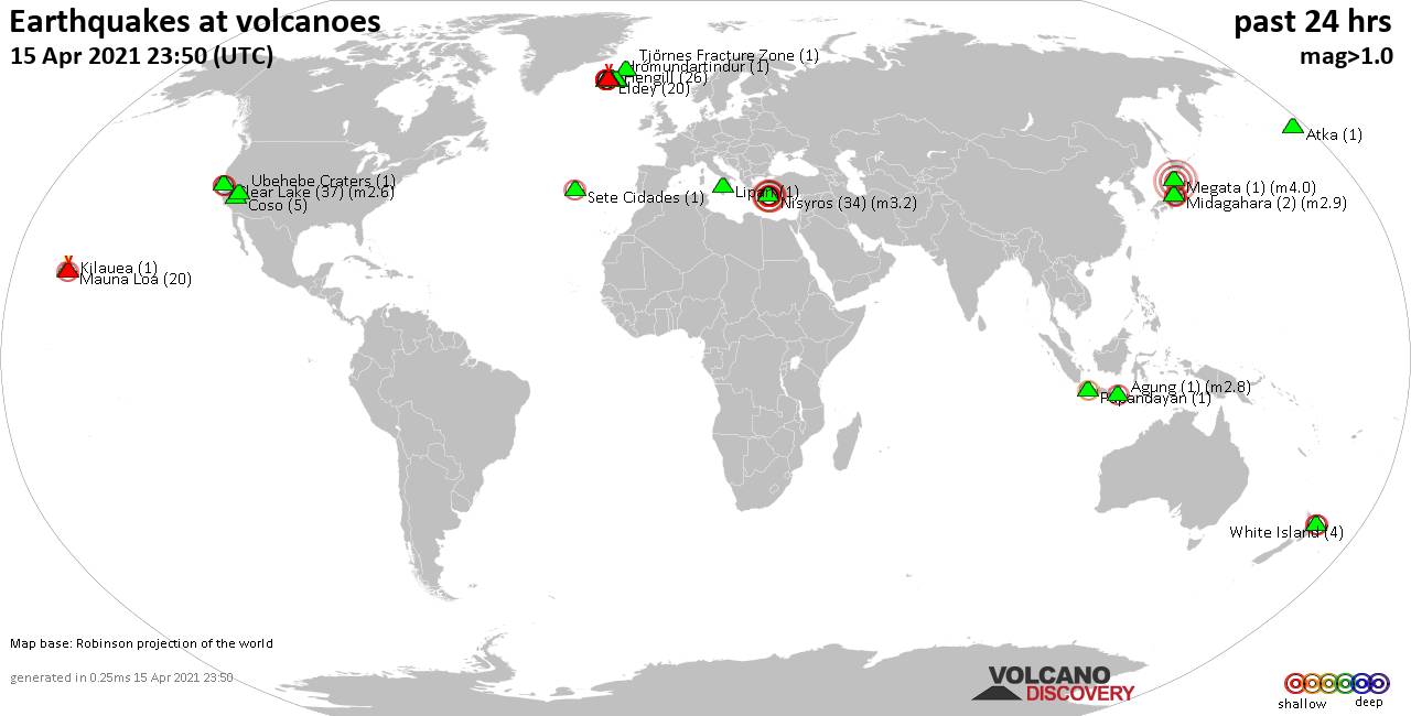
Quakes detected near: Agung (1 quake mag 2.8), Atka (1 quake mag 1.0), Brennisteinsfjöll (1 quake mag 1.9), Clear Lake (37 quakes between mag 0.2-2.6), Coso (5 quakes between mag 0.7-1.9), Eldey (20 quakes between mag 0.9-2.5) ... Read all
Wed, 14 Apr 2021, 23:50
Volcano earthquake report for Wednesday, 14 Apr 2021
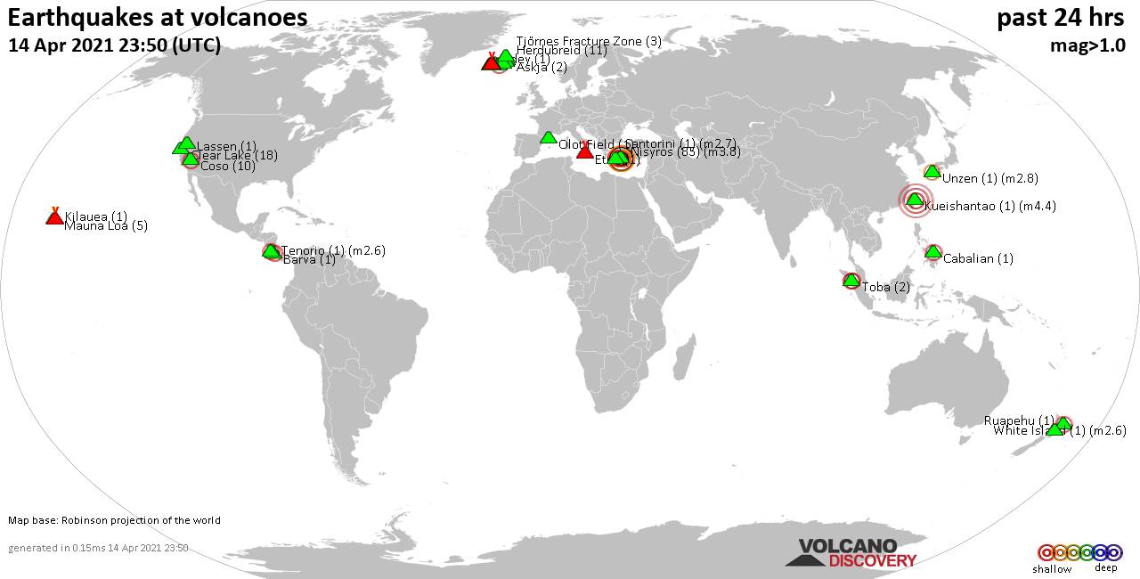
Quakes detected near: Askja (2 quakes between mag 0.6-1.4), Barva (1 quake mag 2.5), Brennisteinsfjöll (11 quakes between mag 0.4-1.5), Cabalian (1 quake mag 2.4), Clear Lake (18 quakes between mag 0.2-1.4), Coso (10 quakes between mag 0.9-2.2) ... Read all
Show more