Volcano earthquake report for Sunday, 12 Sep 2021
Sun, 12 Sep 2021, 23:50 | BY: EARTHQUAKEMONITOR
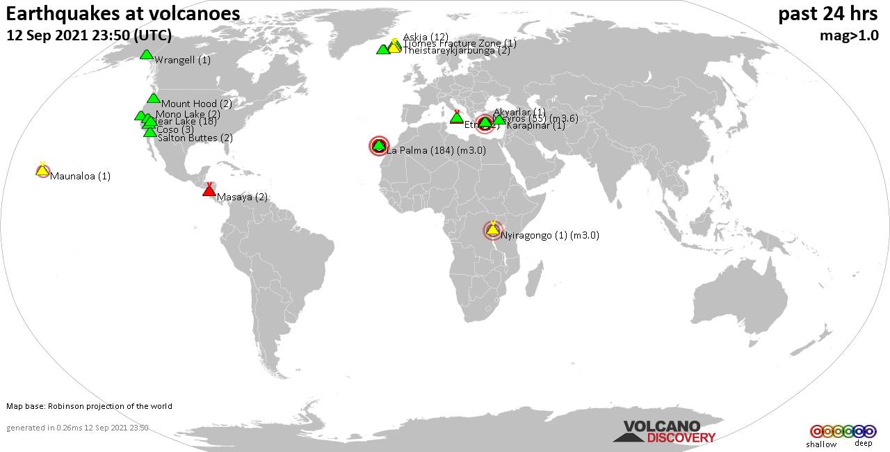
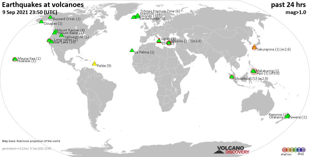
World map showing volcanoes with shallow (less than 20 km) earthquakes within 20 km radius during the past 24 hours on 12 Sep 2021 Number in brackets indicate nr of quakes.
Karapinar (1 quake mag 1.6), Krísuvík (8 quakes between mag 0.6-1.1), La Palma (184 quakes between mag 0.9-3.0), Masaya (2 quakes between mag 1.6-1.9), Maunaloa (1 quake mag 2.2), Mono Lake (2 quakes between mag 1.1-1.2), Mount Hood (2 quakes between mag 0.5-1.3), Nisyros (55 quakes between mag 1.2-3.6), Nyiragongo (1 quake mag 3.0), Reykjanes (5 quakes between mag 0.1-1.5), Salton Buttes (2 quakes between mag 1.3-1.3), Theistareykjarbunga (2 quakes between mag 0.6-1.0), Tjörnes Fracture Zone (1 quake mag 1.5), Ubehebe Craters (1 quake mag 1.4), Vulcano (1 quake mag 1.2), Wrangell (1 quake mag 1.6) (updated 23h50)
Note: Earthquakes within 20 km from and at depths less than 20 km under active volcanoes are reported. The list is not complete because many volcanoes are not monitored and/or seismic data in high resolution is not available publicly.
Volcanoes with recent earthquakes above magnitude 2 or more than 10 quakes are listed below:
Askja volcano (Iceland): 12 earthquakes up to magnitude 1.1
Possible earthquake swarm: 12 earthquakes occurred near (under) the volcano during 15 hours, the last being recorded quake 6 hours ago. Hypocenter depths ranged between 7.0 and 3.0 km.Earthquake details: (only 5 largest)
1.1 quake Iceland: 5.2 Km WSW of Dreki Sep 12, 2021 5:37 pm (GMT +0) (3 km ESE)
1.1 quake Iceland: 4.0 Km W of Dreki Sep 12, 2021 3:26 pm (GMT +0) (3 km ENE)
0.8 quake Iceland: 8.6 Km WNW of Dreki Sep 12, 2021 2:33 am (GMT +0) (4 km NNW)
0.6 quake Iceland: 5.3 Km WSW of Dreki Sep 12, 2021 5:17 am (GMT +0) (2 km ESE)
0.4 quake Iceland: 6.5 Km SSE of Lokatindur Sep 12, 2021 1:42 pm (GMT +0) (7 km NNW)
All earthquakes at Askja
Clear Lake volcano (California): 18 earthquakes up to magnitude 1.4
Possible earthquake swarm: 18 earthquakes occurred near (under) the volcano during 23 hours, the last being recorded quake 32 minutes ago. Hypocenter depths ranged between 13.2 and 0.4 km.Earthquake details: (only 5 largest)
1.4 quake 3km W of Cobb, CA, Sep 12, 2021 12:11 pm (GMT -7) (16 km S)
1.2 quake 10km NW of The Geysers, CA, Sep 12, 2021 4:00 am (GMT -7) (16 km SSW)
1.2 quake 7km NW of The Geysers, CA, Sep 11, 2021 10:05 pm (GMT -7) (17 km SSW)
1.1 quake 6km W of Cobb, CA, Sep 11, 2021 8:08 pm (GMT -7) (16 km S)
1.0 quake 4km NW of The Geysers, CA, Sep 12, 2021 7:31 am (GMT -7) (19 km S)
All earthquakes at Clear Lake
La Palma volcano (Canary Islands): 184 earthquakes up to magnitude 3.0
Possible earthquake swarm: 184 earthquakes occurred near (under) the volcano during 23 hours, the last being recorded quake 13 minutes ago. Hypocenter depths ranged between 19.0 and 2.0 km.Earthquake details: (only 5 largest)
3.0 quake 10.3 km south of Los Llanos de Aridane, Tenerife, Canary Islands, Spain, Sep 13, 2021 12:36 am (GMT +1) (4 km WSW)
3.0 quake 12 km southeast of Los Llanos de Aridane, Tenerife, Canary Islands, Spain, Sep 13, 2021 12:09 am (GMT +1) (4 km SSW)
2.9 quake 12 km southeast of Los Llanos de Aridane, Tenerife, Canary Islands, Spain, Sep 13, 2021 12:07 am (GMT +1) (2 km SW)
2.9 quake 12 km southeast of Los Llanos de Aridane, Tenerife, Canary Islands, Spain, Sep 13, 2021 12:12 am (GMT +1) (2 km SSW)
2.8 quake 13 km southeast of Los Llanos de Aridane, Tenerife, Canary Islands, Spain, Sep 12, 2021 4:26 pm (GMT +1) (2 km SE)
All earthquakes at La Palma
Maunaloa volcano (Hawai'i (Big Island)): magnitude 2.2 earthquake
A magnitude 2.2 earthquake occurred at the volcano 6 hours ago. The quake, which might be volcanic in origin, was located at a depth of 2.9 km depth at 11 km distance E from the volcano.Earthquake details:
2.2 quake 28 Km W of Volcano, Hawaii, Sep 12, 2021 8:18 am (GMT -10) (11 km E)
All earthquakes at Maunaloa
Nisyros volcano (Greece): 55 earthquakes up to magnitude 3.6
Possible earthquake swarm: 55 earthquakes occurred near (under) the volcano during 22 hours, the last being recorded quake 25 minutes ago. Hypocenter depths ranged between 19.5 and 1.0 km.Earthquake details: (only 5 largest)
3.6 quake Aegean Sea, 55 km south of Kos, Dodecanese, South Aegean, Greece, Sep 13, 2021 1:06 am (GMT +3) (18 km S)
2.9 quake Aegean Sea, 47 km south of Kos, Dodecanese, South Aegean, Greece, Sep 12, 2021 8:56 am (GMT +3) (11 km SSW)
2.5 quake Aegean Sea, 46 km south of Kos, Dodecanese, South Aegean, Greece, Sep 12, 2021 8:27 am (GMT +3) (12 km S)
2.3 quake Aegean Sea, 49 km south of Kos, Dodecanese, South Aegean, Greece, Sep 12, 2021 6:46 pm (GMT +3) (13 km S)
2.3 quake Aegean Sea, 48 km south of Kos, Dodecanese, South Aegean, Greece, Sep 12, 2021 9:57 am (GMT +3) (10 km SSW)
All earthquakes at Nisyros
Nyiragongo volcano (Democratic Republic of Congo (DRC)): magnitude 3.0 earthquake
A magnitude 3.0 earthquake occurred at the volcano 5 hours ago. The quake, which might be volcanic in origin, was located at a depth of 10.0 km depth at 19 km distance S from the volcano.Earthquake details:
Reported seismic-like event (likely no quake): Near Gisenyi, Western Province, Rwanda, Sep 12, 2021 9:02 pm (GMT +2) (19 km S)
All earthquakes at Nyiragongo
Previous news
Sat, 11 Sep 2021, 23:50
Volcano earthquake report for Saturday, 11 Sep 2021
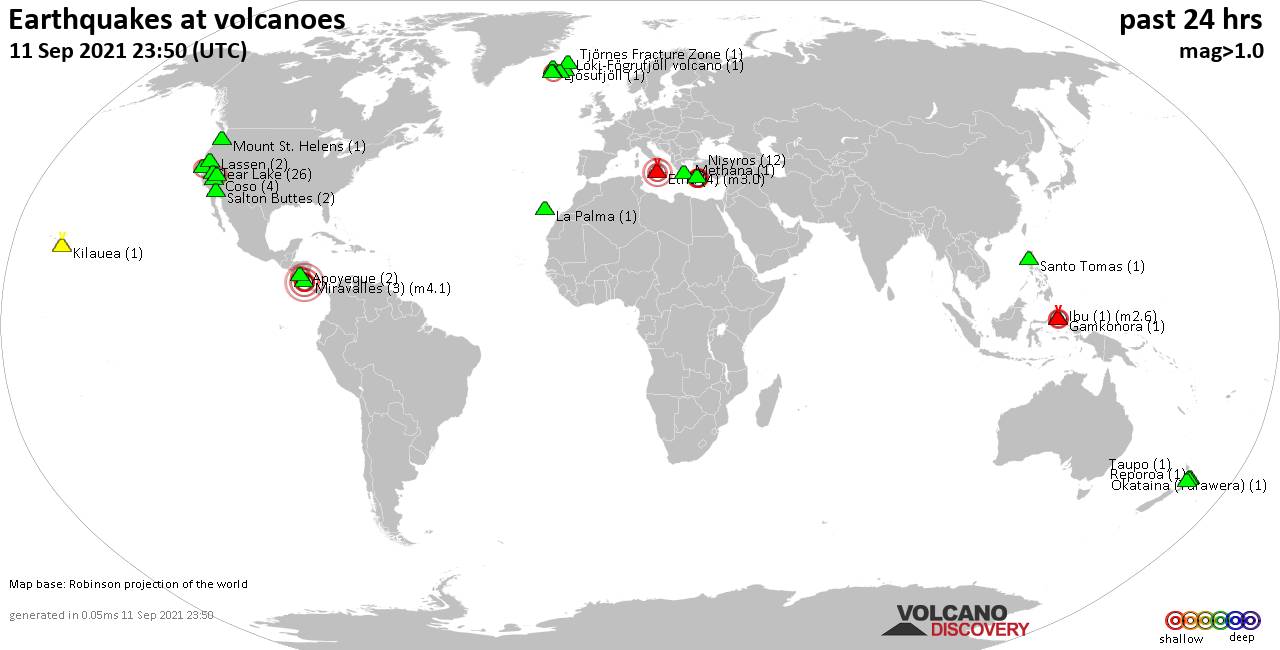
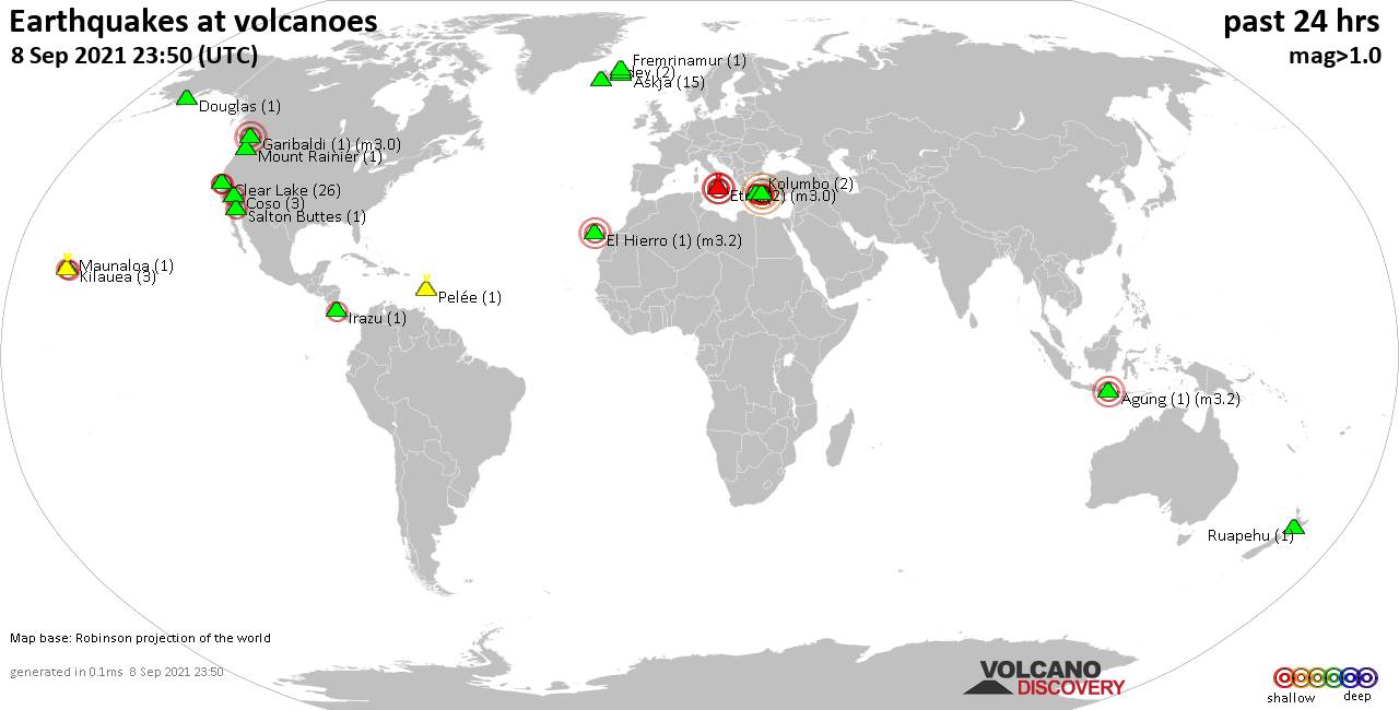
Quakes detected near: Apoyeque (2 quakes between mag 1.4-2.2), Brennisteinsfjöll (2 quakes between mag 0.7-1.2), Clear Lake (26 quakes between mag 0.3-2.5), Coso (4 quakes between mag 0.9-1.1), Etna (4 quakes between mag 1.2-3.0), Gamkonora (1 quake mag 2.5) ... Read all
Fri, 10 Sep 2021, 23:50
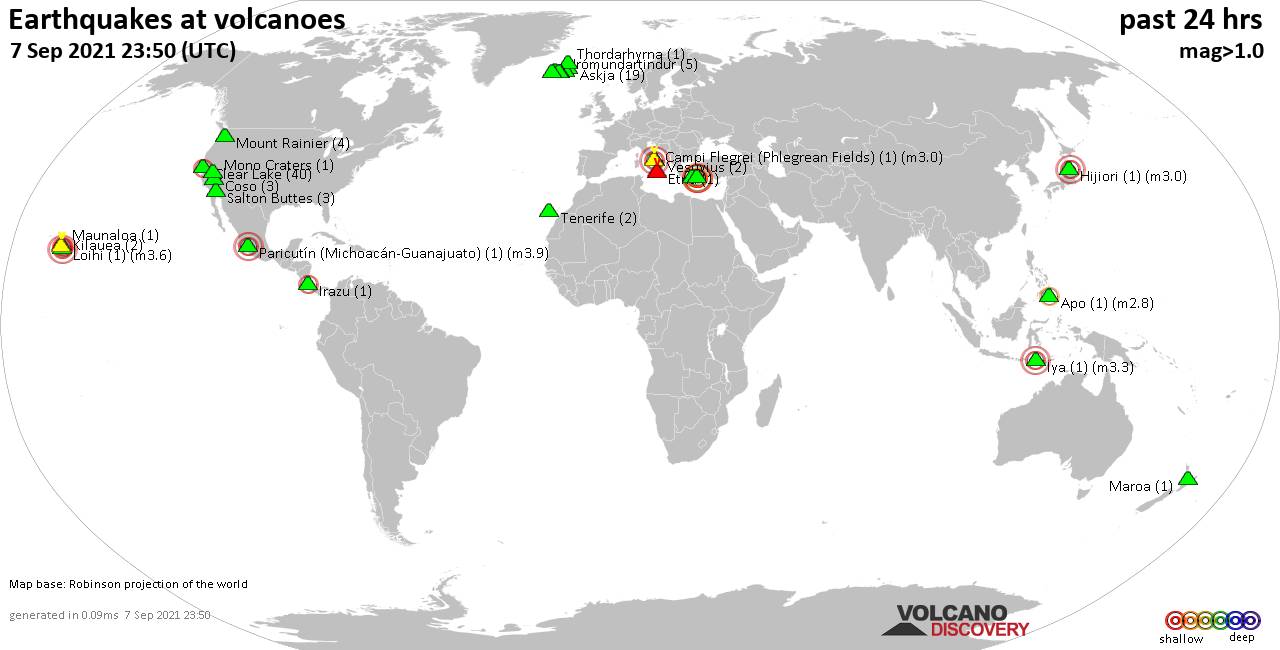
Volcano earthquake report for Friday, 10 Sep 2021

Quakes detected near: Askja (8 quakes between mag 0.1-1.1), Clear Lake (32 quakes between mag 0.4-1.7), Etna (5 quakes between mag 1.1-3.0), Eyafjallajökull (1 quake mag 2.1), Kilauea (1 quake mag 1.8), Lewotolo (1 quake mag 3.1) ... Read all
Show more