Volcano earthquake report for Monday, 10 May 2021
Mon, 10 May 2021, 23:50 | BY: EARTHQUAKEMONITOR

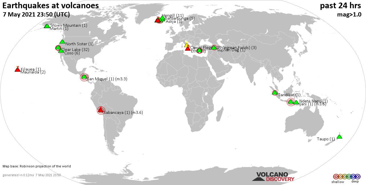
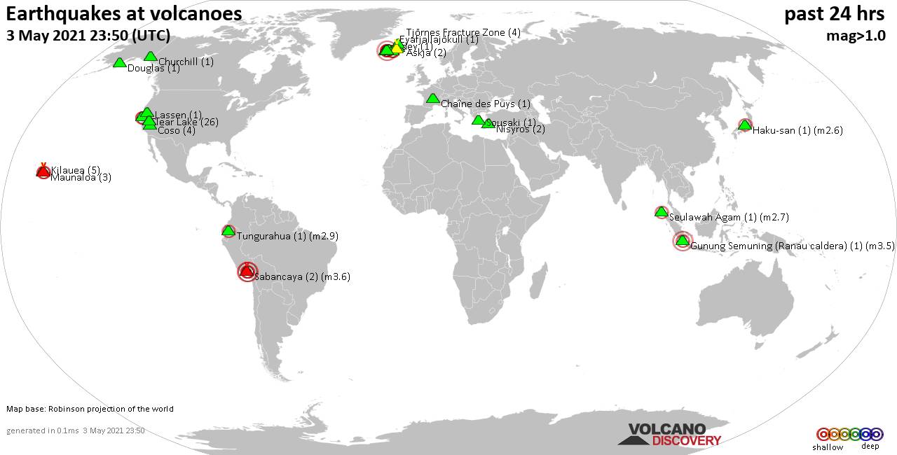
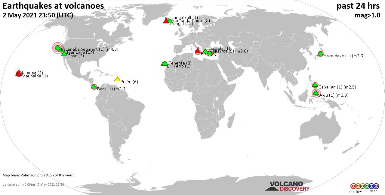
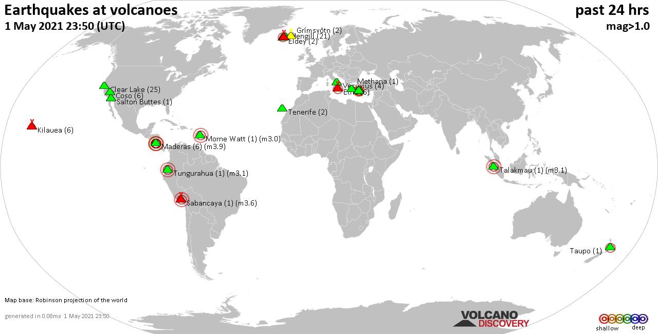
World map showing volcanoes with shallow (less than 20 km) earthquakes within 20 km radius during the past 24 hours on 10 May 2021 Number in brackets indicate nr of quakes.
Grímsvötn (1 quake mag 1.9), Irazu (2 quakes between mag 2.5-3.5), Kaguyak (1 quake mag 1.3), Kilauea (3 quakes between mag 0.7-2.4), Krísuvík (10 quakes between mag 0.1-1.2), Long Valley (10 quakes between mag 0.1-1.8), Mahagnao (3 quakes between mag 2.4-3.2), Nevados Casiri (1 quake mag 4.2), Nisyros (5 quakes between mag 1.8-2.6), Penguin Island (1 quake mag 2.7), Redoubt (2 quakes between mag 1.0-1.1), Sandal (1 quake mag 1.2), Tjörnes Fracture Zone (2 quakes between mag 0.5-1.2), Toba (3 quakes between mag 2.0-2.3) (updated 23h50)
Note: Earthquakes within 20 km from and at depths less than 20 km under active volcanoes are reported. The list is not complete because many volcanoes are not monitored and/or seismic data in high resolution is not available publicly.
Volcanoes with recent earthquakes above magnitude 2 or more than 10 quakes are listed below:
Cabalian volcano (Central Philippines): 2 earthquakes up to magnitude 2.5
2 earthquakes occurred near (under) the volcano during 18 hours, the last being recorded quake 6 hours ago. Hypocenter depths ranged between 13.0 and 1.0 km.Earthquake details:
2.5 quake Philippines Sea, 8.9 km northeast of Liloan, Philippines, 11 May 2021 - 02:03 AM (PST) (9 km SW)
2.1 quake 15 km east of Sogod, Southern Leyte, Eastern Visayas, Philippines, 10 May 2021 - 07:57 AM (PST) (19 km NW)
All earthquakes at Cabalian
Clear Lake volcano (California): 31 earthquakes up to magnitude 2.1
Possible earthquake swarm: 31 earthquakes occurred near (under) the volcano during 22 hours, the last being recorded quake 19 minutes ago. Hypocenter depths ranged between 11.8 and 1.5 km.Earthquake details: (only 5 largest)
2.1 quake 7km NW of The Geysers, CA, USA, 10 May 2021 23:20 GMT (18 km SSW)
1.3 quake 8km W of Cobb, CA, USA, 10 May 2021 19:45 GMT (16 km SSW)
1.2 quake 7km NW of The Geysers, CA, USA, 10 May 2021 05:11 GMT (18 km SSW)
1.2 quake 7km NW of The Geysers, CA, USA, 10 May 2021 16:40 GMT (16 km SSW)
1.2 quake 8km NW of The Geysers, CA, USA, 10 May 2021 16:59 GMT (16 km SSW)
All earthquakes at Clear Lake
Irazu volcano (Costa Rica): 2 earthquakes up to magnitude 3.5
2 earthquakes occurred near (under) the volcano during 43 seconds, the last being recorded quake 22 hours ago. Hypocenter depths ranged between 6.0 and 5.0 km.Earthquake details:
3.5 quake Moravia, 23 km northeast of San Jose, San José, Costa Rica, 09 de mayo del 2021 7:25 pm (15 km NW)
2.5 quake Moravia, 22 km northeast of San Jose, San José, Costa Rica, 2021-05-09 19:25:43 (13 km NW)
All earthquakes at Irazu
Kilauea volcano (Hawai'i (Big Island)): 3 earthquakes up to magnitude 2.4
3 earthquakes occurred near (under) the volcano during 12 hours, the last being recorded quake 2 hours ago. Hypocenter depths ranged between 8.8 and 0.1 km.Earthquake details:
2.4 quake 16 Km W of Volcano, Hawaii, USA, 10 May 2021 21:45 GMT (11 km WNW)
1.5 quake 9 Km NW of Volcano, Hawaii, USA, 10 May 2021 10:52 GMT (12 km N)
0.7 quake 5 Km SW of Volcano, Hawaii, USA, 10 May 2021 09:42 GMT (1 km ENE)
All earthquakes at Kilauea
Mahagnao volcano (Central Philippines): 3 earthquakes up to magnitude 3.2
3 earthquakes occurred near (under) the volcano during 20 minutes, the last being recorded quake 23 hours ago. Hypocenter depths ranged between 8.0 and 1.0 km.Earthquake details:
3.2 quake 23 km east of Ormoc City, Province of Leyte, Eastern Visayas, Philippines, 10 May 2021 00:15 GMT (14 km NNW)
3.2 quake 22 km east of Ormoc City, Province of Leyte, Eastern Visayas, Philippines, 10 May 2021 - 08:27 AM (PST) (12 km NW)
2.4 quake 24 km east of Ormoc City, Province of Leyte, Eastern Visayas, Philippines, 10 May 2021 - 08:35 AM (PST) (13 km NW)
All earthquakes at Mahagnao
Nevados Casiri volcano (Peru): magnitude 4.2 earthquake
A magnitude 4.2 earthquake occurred at the volcano 16 hours ago. The quake, which might be volcanic in origin, was located at a depth of 10.0 km depth at 10 km distance N from the volcano.Earthquake details:
4.2 quake Provincia de Tarata, 84 km northeast of Tacna, Peru, 10 May 2:34 am (GMT -5) (10 km N)
All earthquakes at Nevados Casiri
Nisyros volcano (Greece): 5 earthquakes up to magnitude 2.6
5 earthquakes occurred near (under) the volcano during 14 hours, the last being recorded quake 9 hours ago. Hypocenter depths ranged between 16.5 and 2.1 km.Earthquake details:
2.6 quake Aegean Sea, 52 km south of Kos Town, Dodecanese, South Aegean, Greece, 10 May 2021 02:34 GMT (14 km SSW)
2.2 quake Aegean Sea, 40 km south of Kos Town, Dodecanese, South Aegean, Greece, 10 May 2021 09:41 GMT (6 km SE)
1.8 quake Aegean Sea, 95 km west of Rhodes, Dodecanese, South Aegean, Greece, 10 May 2021 15:17 GMT (16 km S)
1.8 quake Aegean Sea, 94 km west of Rhodes, Dodecanese, South Aegean, Greece, 10 May 2021 06:39 GMT (16 km S)
1.8 quake Aegean Sea, 48 km south of Kos Town, Dodecanese, South Aegean, Greece, 10 May 2021 01:33 GMT (12 km S)
All earthquakes at Nisyros
Penguin Island volcano (Antarctica): magnitude 2.7 earthquake
A magnitude 2.7 earthquake occurred at the volcano 15 hours ago. The quake, which might be volcanic in origin, was located at a depth of 8.0 km depth at 17 km distance WSW from the volcano.Earthquake details:
2.7 quake 39 Km Al E De Base Frei, Antártica, Antarctica, 10 May 2021 09:02 GMT (17 km WSW)
All earthquakes at Penguin Island
Toba volcano (Sumatra): 3 earthquakes up to magnitude 2.3
3 earthquakes occurred near (under) the volcano during 19 minutes, the last being recorded quake 1 hour 38 minutes ago. Hypocenter depths ranged between 10.0 and 10.0 km.Earthquake details:
2.3 quake 20 km south of Tomok Bolon, Kabupaten Samosir, North Sumatra, Indonesia, 10 May 2021 21:53 GMT (15 km N)
2.0 quake 17 km south of Tomok Bolon, Kabupaten Samosir, North Sumatra, Indonesia, 10 May 2021 22:11 GMT (18 km N)
2.0 quake 16 km south of Tomok Bolon, Kabupaten Samosir, North Sumatra, Indonesia, 10 May 2021 21:55 GMT (19 km N)
All earthquakes at Toba
Previous news
Sun, 9 May 2021, 23:50
Volcano earthquake report for Sunday, 9 May 2021

Quakes detected near: Brennisteinsfjöll (2 quakes between mag 0.5-1.3), Clear Lake (31 quakes between mag 0.4-2.2), Coso (4 quakes between mag 0.8-2.1), Etna (8 quakes between mag 1.0-1.5), Eyafjallajökull (3 quakes between mag 0.2-1.4), Fagradalsfjall (7 quakes between mag 0.5-1.4) ... Read all
Sat, 8 May 2021, 23:50
Volcano earthquake report for Saturday, 8 May 2021

Quakes detected near: Auckland Field (1 quake mag 3.0), Bardarbunga (12 quakes between mag 0.1-1.3), Brennisteinsfjöll (3 quakes between mag 0.9-2.7), Cerro Nicholson (1 quake mag 3.7), Clear Lake (20 quakes between mag 0.4-1.5), Coso (1 quake mag 1.2) ... Read all
Show more